The Lower Mississippi River Water Trail

68.5 LBD Blue Heron Point

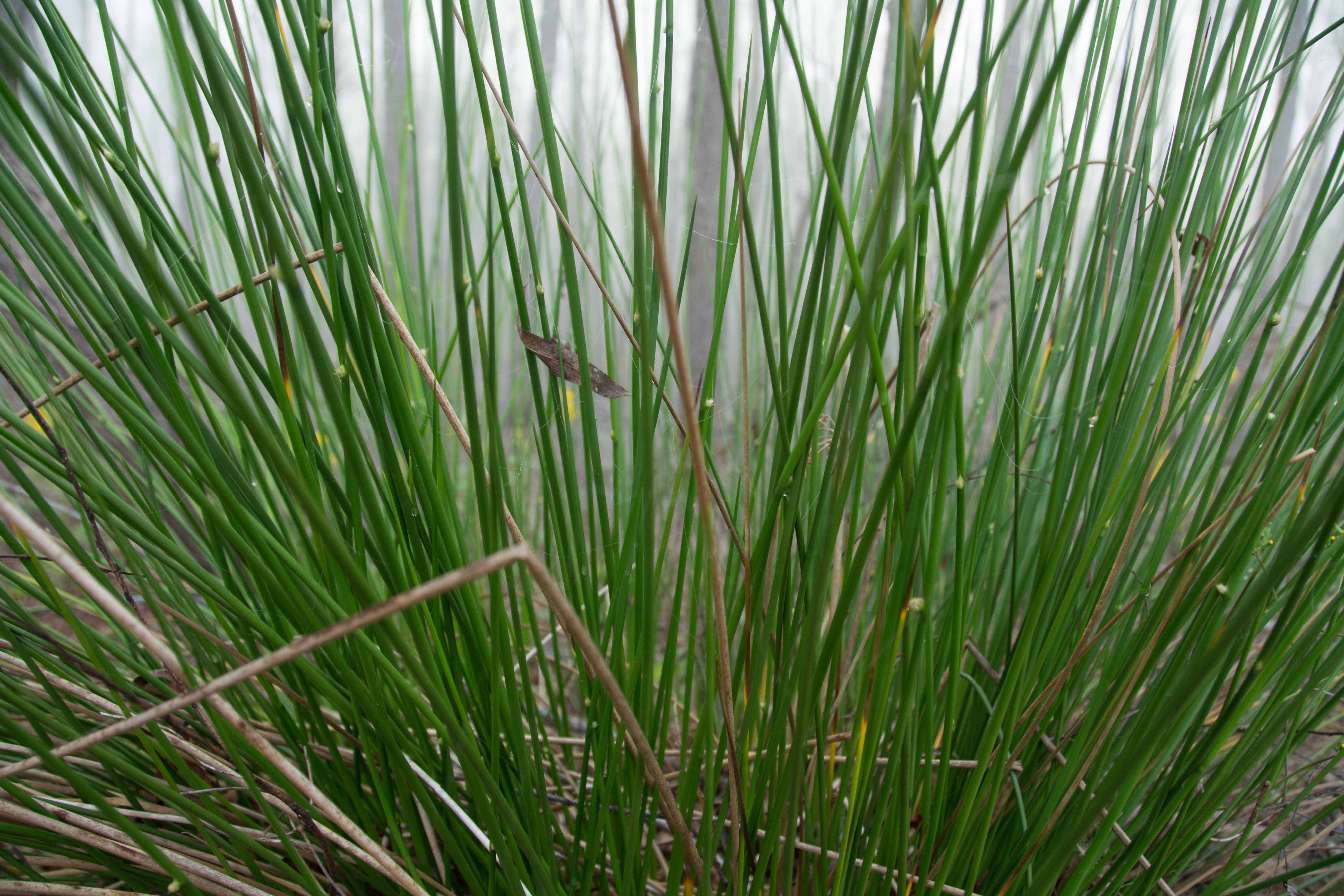
There is a beautiful cubbyhole of a landing as you paddle over the top of Blue Heron Point, but its posted “No Tresspassing.”  Keep paddling a little further downstream and you will discover a modest ridge of willows with dry ground up to bank full around 24 KG.  This willow wetlands is exploding with tons of wildlife, especially amphibians and birds behind ridge.  Good picnicking and camping up to 24 KG.  Blue Heron Point is a thin sliver of willow-topped sandy ridge with some alders, some sumac and poison ivy, also purple vetch; but no cockleburrs.  In the springtime the frogs make a raucous roar well into the night, until after midnight.  Some of the creatures we saw at camp in March 2015: Amphibians seen include peepers, leopard toads, and bright green lizards; We heard some barred and great horned owls on the opposite shore towards Butte La Rose; beaver slide by in the mist, softly grunting to each other in throaty gutterals; two herons pass overhead while fish tails sploshings are heard in the backwaters; mosquito hawks hovering overhead along with Caddis flies.  Other birds we have been seeing: anhingas, bald eagles, tufted and pileated woodpeckers, crows, egrets, ducks and cardinals.  The vegetation seems to have changed slightly below the I-10 bridge.  THere are more cypress trees along the main channel, and more scrub oaks, saw grass, bull rush, and something that looks like pampas grass.


From the Mark River Journals: “I wake on a tiny peninsula along Whiskey Bay navigational channel next to a tiny swamp full of yellow rockets and driftwood. The evening before, Driftwood Johnny took a swim in the debris infested swamp and noticed the temperature was quite warmer than the main channel. That let me know the spawn is upon us. Large gar and black bass splash in the swamp throughout the night preparing for the most exciting time for animals of all kinds- the spawn.  The spawn is the time of plenty for most animals. The flooding and warming of these waters triggers reptiles and amphibians of the arrival of spring, the time to reproduce and celebrate the welcoming of new generations.”

69.7 LBD Linder Oil Dock

70.9 LBD Upper Grand River

Good camping or picnicking can be found at the mouth of the Upper Grand River at mile 70.9, best choice would be the north side in a slice of woods growing on top of a ridge along the bank.  This north side would be dry up to around 24KG.  An even higher bank is found on the southside of the Upper Grand River mouth, but only with difficult landings in a tortured forest, rough woods, very overgrown with scrubby undergrowth and vines.


Upper Grand River is the first major cross basin distributary.  Water that enters here crosses the Atchafalaya Basin west to east and slams into the East Protection Levee at Grand River Landing (Public Boat Ramp).  It is approximately eight miles to cross the Basin here.  The water flows along good at all water levels except during drought, but will be especially strong during the Spring pulse.  Upper Grand River feeds many wetlands through Bayou Pigeon and its many forks, and eventually reaches Bayou Sorrel and joins its waters on the swamp journey to the Gulf.

73.4 LBD Little Tensas Bayou

Perennial Little Tensas Bayou flows north when the Atchafalaya is 20KG or above and joins the Upper Grand River, but is often choked close by hyacinth.  Nearby Cowpen Lake also choked over.  Slim Island starts below the bayou.

75.2 Equilon Pipeline two 6” pipes

75.3 LBD Texaco Resources Dock

The forests in the vicinity of this dock are carved by several oil exploration and extraction canals.  This area is a popular oil pipeline crossing, with seven major pipelines in the next four miles.

75.5 RBD Splice Island (Bottom End)

The two major channels of the Atchafalaya reunite at the bottom end of Splice Island, the Whiskey Bay Pilot Channel, and the Old Atchafalaya Channel.  If you have ventured down the Old Atchafalaya Channel through Butte La Rose here is where you will probably return to the Main Channel, although you could have wandered elsewhere down other West Basin splinter bayous.


Splice Island comes to a fine point at 75.5.  The two channels flow almost parallel to each other for about 10 miles, in places separated by a half mile of woods or wetlands, and then at long last they come to a vary fine point and re-join their waters.  A small homestead is located half mile from the tip on the Main Channel side.


There is good camping and picnicking at the end of Splice Island, but only in low or medium waters.  The bottom end goes under around 20KG.

75.7 Louisiana Resources Pipeline

Primitive Camping in the Marshes & Swamps

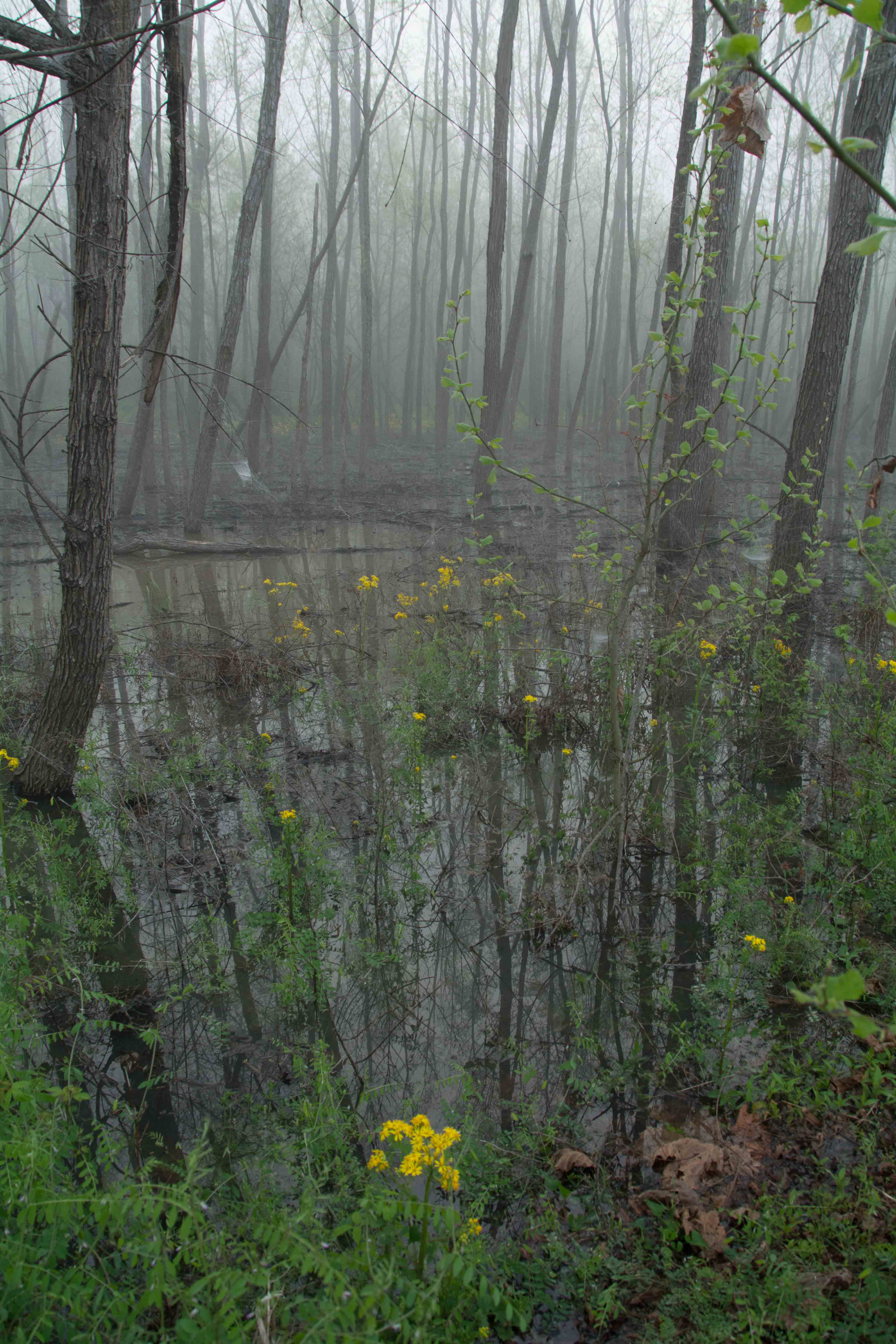
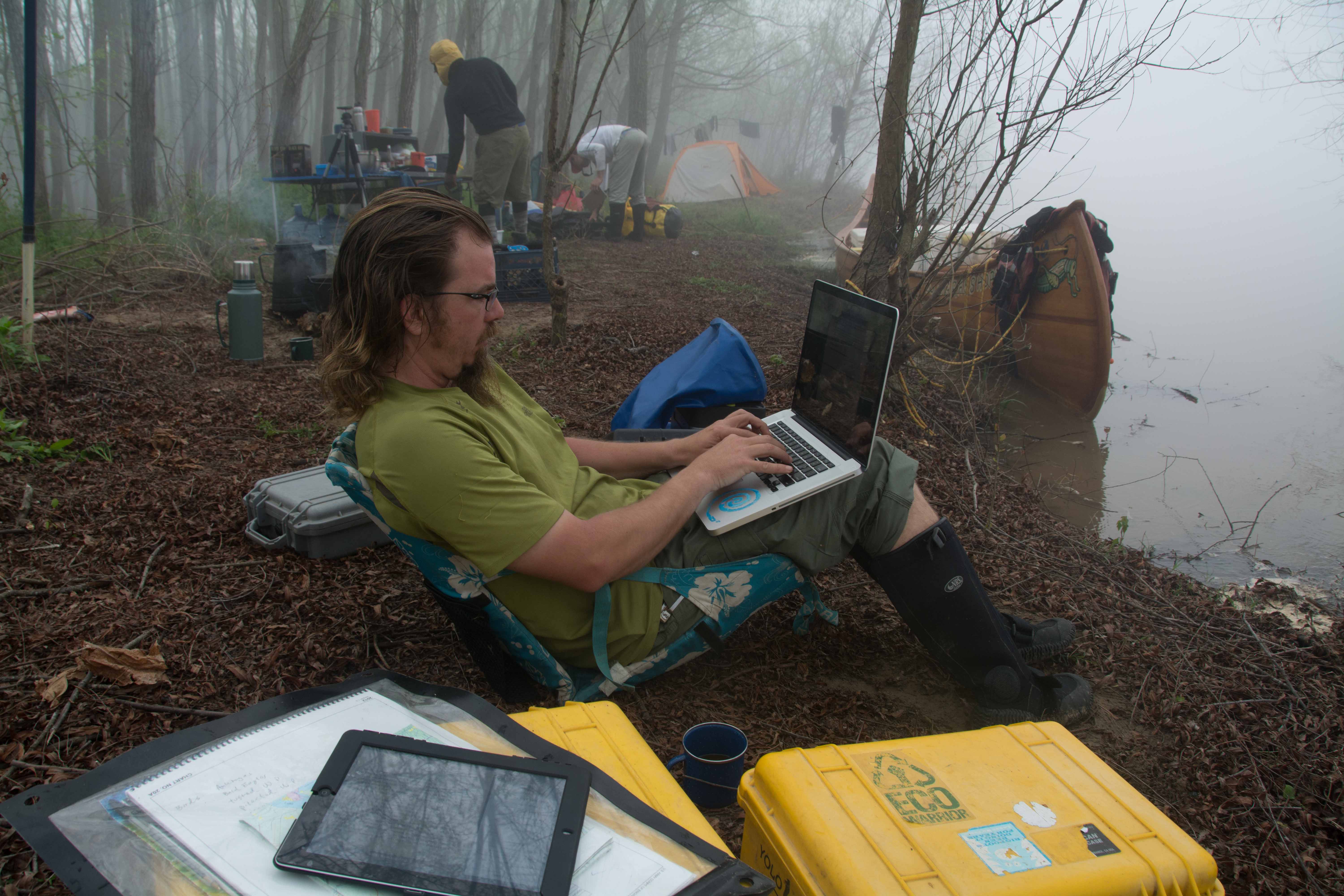
Camping (and picnicking) in the half-submerged Cypress-Tupelo Gum Swamps and Coastal Marshes of the Atchafalaya River Basin can be very challenging.  You might end up on spongy ground with half your camp in water, half on nothing but masses of vegetation held together by interlacing and interlocking roots, tubers and mud. It would be wise to pack a hammock.  This could be considered a semi-tropical jungle, after all. It would also be wise to pack an extra tarp or two for extra protection on wet spots.  Be sure to set your tent on a tarp for extra protection from below.  Other useful items to pack specific to the Atchafalaya include: machete, water filter, small camp stove, mosquito netting, GPS, and as already mentioned: hammock and extra tarp.  But like all challenging situations, there are many possible great rewards that accompany life in extreme situations, and the sometimes painful experiences.  Below is an excerpt from a wetlands camp in the Wax Lake Delta, which could be similar to camping in the wetlands anywhere below Krotz Spring:


We camped at the junction of an oil pipeline canal and a curvy waterway we have been following which connects the Wax Lake Delta with the Atchafalaya.  We are maybe two-thirds of the way back across the coastal wetlands to Morgan City.  Swampy marshes surround us as far as the eye can see.  There is no dry land to be found, even the solid mass where we are camped is a wet composition of tangled roots, mud and grasses just solid enough to support our weight, erect our tents, and even build a fire.  Dry land is a thing of the past.  Terra cognita is nowhere to be found.  The marsh is a rich mixture of roots, leaves, and sulfurous soil, half of this world, half of another.  Like peat moss, it exists somewhere between life and decay.  As you move around your footsteps are accompanied by lots of sucking sounds, squishing, gollumping, gollashing sounds.  And in the stillness of the pre-morning darkness those wet rubbery sounds seem to be emulated by the frogs, and are punctuated in the sighs and moans of the nutria.  The sonic atmosphere rings with wetness of the place.  Later after sunrise the swampy symphony comes to a crescendo when the squeaks, whistles and shrieks of various birds, rodents and insects add their voices.  And us… what does the guttural bubbling monotone clunking of man’s tongue-speak sound like to the natives of the swampland?  Crickets join the morning chorus of grunts, squeaks and squishing noises, like rubber rubbing against rubber.  The plaintive cries of the nutria and Mark River adding in his own grunts and moans from his tent to the choir.  A lone songbird, a cardinal, makes a burst of song and then falls silent.  More sounds resound off the muddy channel: bankside thrashings, something crackling through the bullrushes, some violent splashing, then silence.  That was ominous.  A gator thrashing a nutria?  Frogs make all kinds of sounds, some coughing, some re-running short drum beats of jumbled snatches of snoggles, some grinding their gums and making that squishing rubber sound, a bullfrog bellow, a repeated chirping staccato like a giggling lamb, and then another cardinal.  David’s light flashes on in his tent.  And then Mark River’s.  Mark River can be heard stomping through the crackly bankside mattress of bullrushes, ferns and dried greens.  The far-off moan of a boat engine adds an accent.  One frog can be heard hiccuping like an amused old man clucking his tongue.  The whining of mosquitoes and at least two different kinds of crickets can be heard intertwining their rhythms, clicks, rasps and squeaks, maybe male and female?  And then a clan of coyotes far away cries and cries. (John Ruskey)


  I step outside my tent and to my surprise the water has risen to a point just below my tent tarp. The night was full of sounds of nature. The swamp filled with yellow rockets came alive as we laid our heads after a long day of paddling. Crawfish fishermen checked their traps deep into the night, as bullfrogs bellowed sounds that resembled yapping dogs. Raccoons fought in the trees, eventually falling to the depth of the swamp, sounding like an unplanned belly flop. A beaver downed a tree in the distance. Various owls hooted in a-cappella as if to be competing for originality. The acoustic campsite entertained throughout the evening. A few raindrops teased me to the point were I left my cozy tent to reassure my fly. The fog clears and the sky opens, as we prepare to pack the canoe for our journey to the gulf.  We leave our campsite, which is sliver of land between Bayou Butte and the American Pass. We enter Bayou Big Joe headed to Flat Lake. The cypress trees spanish moss is getting thicker and darker in color. Entering Flat Lake, we noticed a large eagle high in the trees. This is a good sign. Our morality rose to a high level as we start to synchronize our paddle strokes and attack the flat freshwater lake. As we glide across the lake, I notice more bald eagles lining the channel, as if to direct us back to the Atchafalaya River.  (Mark River)

Leave A Comment

SECTION MILE ACCESS CITY
Middle Mississippi & Bluegrass Hills / Bootheel 195-0, 954-850 ST. LOUIS TO CARUTHERSVILLE
Chickasaw Bluffs 850 – 737 CARUTHERSVILLE TO MEMPHIS
Upper Delta 737 – 663 MEMPHIS TO HELENA
Middle Delta 663 – 537 HELENA TO GREENVILLE
Lower Delta 537 – 437 GREENVILLE TO VICKSBURG
Loess Bluffs 437 – 225 VICKSBURG TO BATON ROUGE
Atchafalaya River 159 – 0 SIMMESPORT TO MORGAN CITY
Atchafalaya Upper
Consider The Atchafalaya  
The Atchafalaya  
Alternate Route To The Gulf Of Mexico: The Atchafalaya River  
Big Geography Geography  
Atchafalaya Exit  
Intro: Atchafalaya River  
The Atchafalaya River: Best Route To The Gulf  
Best Water Levels To Paddle To The Gulf  
Traffic And Industry On The Atchafalaya  
NOTE TO PADDLERS:  
Who Is The Rivergator Written For?  
Reading The Rivergator:  
Panel Of Experts:  
Wild Miles:  
Warning: Stay Away From Intake Canals!  
What Are The Wild Miles?  
Big Trees And Floodplain:  
Important Note To Paddlers:  
Your Route: Main Channel Vs. Back Channel  
The Atchafalaya Split  
Maps And Mileage  
USACE 2012 Atchafalaya River And Outlets To Gulf Of Mexico  
Louisiana Geological Survey Atchafalaya Basin Map  
Maps Of The Atchafalaya Delta  
River Speed and Trip Duration  
Dangers Of Paddling Through Morgan City  
Expert Paddlers Only!  
Wind Direction And Speed  
Atchafalaya Delta Tides  
Tidal Influence:  
Estimate Your Camp Height  
Tidal Coefficient  
Tides In Rivers  
Tidal Bore  
Water Speed In The Passes  
Which Pass?  
Wax Lake Outlet: Alternate Route To The Gulf  
Shell Island Pass  
Location Island Pass  
Amerada Pass  
Main Channel: Melanie Island  
The Joy Of Reaching The Gulf  
Camping On The Gulf At The End Of The River  
The Best Gulf Beaches  
Open Water Of The Gulf?  
Some Helpful Hints:  
Getting Back To Land  
Getting Back  
Upstream Paddling  
What Do You Do Now With Your Vessel?  
LiNKS = Leave No Kid On Shore  
Atchafalaya Basinkeeper  
Bayou Teche Experience  
Bayou Sara kayak Rental  
Pack & Paddle  
Services For Lower Mississippi River Paddlers  
Lower Mississippi And Ohio River Forecast  
Reading Google Maps  
Lower Mississippi River Mileage  
Rivergator  
Towboat Protocol  
What To Pack:  
Atchafalaya Swamp Pack List:  
Primitive Camping In The Marshes & Swamps  
Biting Bugs  
Poison Ivy  
Can You Drink The Water?  
Where Do You Go? (To The Bathroom?)  
Water Quality  
The Atchafalaya Basinkeeper  
The Lower Mississippi Riverkeeper  
Environmental Reporting Phone Numbers:  
Maps And Mileage  
Louisiana Geological Survey Atchafalaya Basin Map  
Atchafalaya River Boat Ramps (Functional Jan 2016)  
River Gages  
Best Water Levels To Paddle To The Gulf  
What Do You Do Now With Your Vessel?  
LiNKS = Leave No Kid On Shore  
Left Bank And Right Bank  
Towboats And Buoys  
VHF Marine Radio  
Resources  
Cajun Culture And The Atchafalaya Wilderness  
SOLA Coffee Companies  
How To Brew A Great-Tasting Pot Of River-Rat Coffee  
The Atchafalaya  
A Note On Mileage  
A Note On Pronunciation  
Where To Start Your Atchafalaya River Expedition  
Leaving The Mississippi River  
Mississippi River Maps And Mileage  
NATCHEZ GAGE (NG)  
WATER LEVELS AND DIKES  
USING THE NATCHEZ GAGE:  
Three Inflow Openings At Old River  
Warning  
Old River Control Structure: 3 Inflow Channels  
316.3 RBD Hydro Inflow Channel
313.7 RBD Knox Landing
311.7 RBD Auxiliary Intake — Old River Control Structure
316.3 RBD Hydro Intake — Old River Control Structure
Short History Of The Old River Control Structure  
314.6 RBD Main Intake — Old River Control Structure
313 LBD Buffalo River
Clark Creek Natural Area  
311.7 LBD Clark Creek
311.7 – 310 LBD Tunica Hills Below Clark Creek (Mississippi Loess Bluffs ##6)
311 – 309 RBD Point Breeze
310.2 LBD Wilkinson Creek
306 LBD Welcome To Louisiana!
306 – 294 LBD Angola State Penitentiary
306 LBD Angola Ferry
304.5 – 303 LBD Shreve’s Bar
306 – 302 Back Channel Of Shreve’s Bar
306 – 302 Main Channel Of Shreve’s Bar
303.8 Old River Lock And Dam: Entrance To The Atchafalaya River
Leaving The Mississippi Towards Lock & Dam  
The Atchafalaya River: Best Route To The Gulf  
How Does A Lock & Dam Work?  
Contact Lockmaster  
Safe Paddling Through A Lock & Dam  
Lock Signals  
Inside The Lock Chamber  
Order Of Locking Through  
Mileage Down Lower Old River Channel  
6.9 RBD Three Rivers Junction
Red River  
Three Rivers WMA And Red River NWR  
Atchafalaya – A Modern History  
Atchafalaya Lower
Atchafalaya River Basin Biotas  
A Lived-In Landscape  
Atchafalaya Mileage  
RBD = Right Bank Descending, LBD = Left Bank Descending  
Gas Pipelines  
Simmesport Gage (SG)  
Water Levels According To The Simmesport Gage  
Maps And Mileage  
USACE 2012 Atchafalaya River And Outlets To Gulf Of Mexico  
Louisiana Geological Survey Atchafalaya Basin Map  
0.1 LBD Three Rivers Landing
1.4 LBD Small Dune
1.9 RBD Coville Bayou
3.4 LBD Bayou Coteau
4.5 Simmesport KCS Railroad Bridge
4.6 LBD Simmesport Sand Dune
4.8 LBD Kuhlman Bayou
5.5 Simmesport River Park
Simmesport, Louisiana  
Canadaville, Louisana  
9 – 11 RBD Odenburg Island Dikes
12.5 LBD Marine Bayou
13 – 20 Atchafalaya Squiggles
13.2 RBD Porcupine Point
14.5 LBD Cypress Point
14.5 RBD  
14.7 RBD Small Dunes
15.5 Primitive Boat Ramp (Private)
16 RBD Eddy Dune
16.5 RBD Trash Site
17 – 18 RBD Hick’s Landing/Gordon Point
18 – 20 LBD Bayou Point
Borrow Pits And Blue Holes  
20.5 LBD Small Sandy Shelves
20 – 25 Bayou Current To Elba Landing
22 RBD Cell Tower
22.2 LBD Small Hump Of Sand
23.4 RBD Barberton Landing
25.1 RBD Elba Landing
26.1 RBD Small Bluff Of Sand
26.2 LBD Broad Sandy Shelf
26.3 RBD Old Channel Of Bayou Rouge
27.1 LBD Point Coupee/Bayou Latenache Pumping Station
27.1 Morganza Floodway – North End
28.1 Underwater Pipeline Crossings
28.2 Aerial Pipeline Crossing
29.6 Melville Union Pacific Railroad Bridge
29.7 RBD Melville Boat Ramp (Primitive)
29.8 LBD Melville Ferry Barge East Bank Landing
30 – 40 Melville To Krotz Springs
31 LBD Broad Bay
31.5 LBD Cross Bayou
31.7 LBD Open Field Cow Pasture
32.5 LBD Cross Bayou Point (Owl Hoot)
35.6 LBD Small Sandbar
36 – 37 RBD Sandy Landings
37.1 RBD Cell Tower
39.7 LBD Bayou Sherman Point
Atchafalaya Basin Pack List For Swampy/Marshy Camp Sites  
Switching To The KROTZ SPRINGS GAGE (KG)  
Water Levels According To The Krotz Springs Gage  
38.5 – 42.7 Krotz Springs Utility Crossings
39.3 Water Drainage Structure: Origins Of The Teche River
39.5 RBD Cell Tower
39.6 LBD High Sand Dune
40.3 RBD Gravel Landing
40.3 Wire Suspension Bridge For Pipeline
41 Krotz Springs US Hwy 190 And 71 (2 Bridges)
41.5 Krotz Springs Union Pacific Railroad Bridge
42.3 RBD Krotz Springs Boat Ramp
Krotz Springs History  
42.5 RBD Port Of Krotz Springs
Krotz Springs To The Split  
Atchafalaya National Wildlife Refuge  
44 Sherburne Bend
44.5 RBD Frank Diesl Point
44.9 LBD Small Sand Dune
46.1 RBD Bayou Big Graw Boat Ramp
49.3 RBD Bayou Courtableau
49.7 LBD Coswell Point
51 RBD Courtableau Point
54.2 LBD End Of The East Bank Levee
55 LBD Atchafalaya NWR Boat Ramp
55.1 Two Blue Holes
55.4 LBD Alabama Point
56.4 RBD Old Atchafalaya Point
56.4 The Atchafalaya Split
Whiskey Bay Pilot Channel  
59.8 I-10 The Atchafalaya Basin Bridge
60 RBD Sand Dune
60.5 Union Texas Petrochemical Aerial Crossing
61.7 LBD Bayou Des Glaises Boat Ramp (Primitive)
62.3 LBD Bayou Des Glaises
66.4 RBD Splice Lake
66.7 LBD Pat’s Throat
68 RBD Willow Point
68.5 LBD Blue Heron Point
70.9 LBD Upper Grand River
73.4 LBD Little Tensas Bayou
75.3 LBD Texaco Resources Dock
75.5 RBD Splice Island (Bottom End)
Primitive Camping In The Marshes & Swamps  
75.7 LBD Jake’s Bayou
75.8 Three Major Pipelines
76.4 LBD Lake Mongoulois Point
77.2 RBD Bayou Chene
79.9 Tarleton Bayou
81.2 LBD Bayou Sorrel
81.2 LBD Bayou Sorrell: Alternate Route Down The Atchafalaya
3 Days On Dean’s Route  
East Grand Lake  
82.4 LBD Bee Bayou
82 – 99 Chicot Pass
83 Pipeline Tailings
83.2 Philip’s Canal
85.7 RBD Danbury Management Corp Dock
86.2 RBD Canal Entrance
86.8 RBD Canal Entrance
88.1 RBD Canal Entrance
89.7 RBD Pipeline Canal
91.2 Texas Gas Transmission Co. 12″ Gas Pipeline
Attakapas Island Wildlife Management Area  
95.4 LBD Blue Hole
96.1 Texas Gas Transmission Co. 12″ Gas Pipeline
96.7 Old Pipeline Canal
97.3 Louisiana Intrastate Gas Corp 4″ Gas Pipeline
98.2 RBD Myette Point
MORGAN CITY GAGE (MCG)  
Water Levels According To The Morgan City Gage  
Tidal Influence  
Estimate Your Camp Height  
100.2 LBD Blue Hole Landing
102 RBD Sixmile Lake: Access To Wax Lake Outlet
Wax Lake Outlet: Alternate Route To The Gulf  
Paradise Regained: The Wax Lake Delta  
103.8 LBD Narrow Bayou Leading To East Grand Lake
105 LBD Blue Point Chute: Shortcut To Cypress Wonderland
107.9 Exxon Gas Transmission Company 20″ Gas Pipeline
108.3 RBD Shortcut To Sixmile Lake
109 RBD Cypress Pass Back Channel
109.5 Duck Lake Channel
Duck Lake  
Many Rivers To Follow  
111.7 RBD Lower Atchafalaya River
111.7 RBD Riverside Pass
112.5 RBD Three Island Pass
113 RBD Little Island Pass
Main Channel Atchafalaya River  
115.1 American Pass
115.8 LBD Pipeline Canal To Dog Island Pass And Flat Lake
Flat Lake  
115.8 – 119.8 LBD Drew’s Island
117 RBD Stouts Point
119 Drew’s Pass
Dangers Of Paddling Through Morgan City  
Waves  
Small Tows In Harbors  
Towboats Vs. Tugboats  
Stay Off The River In Fog  
Fleeted Barges  
Buoys And Other Hazardous Stationary Objects  
119 LBD Swiftships Boat Yard
119.5 RBD Bayou Teche (Berwick) Lock & Dam
119.5 RBD Bayou Teche Water Trail
121 Morgan City US Hwy 90 Bridge
121.2 LBD Morgan City Downtown Landing
Morgan City  
121.3 Morgan City Texas And New Orleans Railroad Bridge
121.4 RBD Berwick Public Boat Ramp
121.4 LBD Mr. Charlie: The International Petroleum Museum
Intro: Morgan City To The Gulf Of Mexico  
Maps Of The Atchafalaya Delta  
Best Water Levels To Paddle To The Gulf  
Morgan City Gage (MCG)  
Water Levels According To The Morgan City Gage  
Flood Stage Warning:  
Weather And Tides  
Check The Winds And Weather  
Tidal Influence:  
Estimate Your Camp Height  
121.5 LBD Gulf Intracoastal Waterway (East)
121.7 – 130.3 Bateman Island
Pipelines And Electrical Lines  
124.2 RBD Berwick Intracoastal Waterway Boat Launch
124.2 RBD Gulf Intracoastal Waterway (West)
124.5 RBD Gulf Intracoastal Waterway Point (South Side)
Atchafalaya Delta Navigation Channel Buoys  
126-127 LBD Outside Bend Highground
127.4 Bateman Island Point And Bend
127.5 – 128 RBD Cypress Forests
128 – 131 LBD Sweetbay Lake
131 LBD Access To Bayou Shaffer Via Sweetbay Lake
131 RBD Glass Island
Night-Time Sky In The Atchafalaya Delta  
131.8 – 132 LBD Stands Of Young Cypress Trees
134 RBD Sandy Willow Spit
134 LBD Avoca Island Cutoff
135-136 LBD New Dike Wall
135-138 LBD New Navigation Channel Around He Avoca Island Bend
136 – 137 Sandy Marsh Island
137.8 RBD Shell Island Pass
Gulf Route: Crossing Over To The Wax Lake Delta  
Atchafalaya Delta Wildlife Management Area  
138.5 LBD Low Lying Muddy/Sandy Beach With Willows
139.1 LBD Small Shell Beach
140 LBD Deer Island
140.5 RBD Breaux’s Pass
140.2 LBD Location Island Pass
142.2 LBD East Pass
144.2 RBD Amerada Pass
144.2 RBD Willow Island
144.3 LBD God’s Island
144.8 RBD Log Island Pass
145.4 RBD Yvette Island
146 RBD Melanie Island
148.5 RBD Donna Island
150.5 RBD Eugene Island
151.5 LBD Bird Island East
Pount Au Fer/Raqet Pass  
Getting Back To Land  
Atchafalaya Delta WMA Campground  
Wax Lake Delta Passes  
Getting Back  
Upstream Paddling  
What Do You Do Now With Your Vessel?  
LiNKS = Leave No Kid On Shore  
Louisiana Delta 229 – 10 BATON ROUGE TO VENICE
Birdsfoot Delta 10 – 0 VENICE TO GULF OF MEXICO