The Lower Mississippi River Water Trail

Atchafalaya River:

Introduction

 
© 2015 John Ruskey
For the Rivergator: Lower Mississippi River Water Trail


Intro: Atchafalaya River

Welcome to the 2015 update to the Rivergator: Paddlers Guide to the Lower Mississippi River.  In this section we will be describing the Atchafalaya River to help paddlers in the exploration and enjoyment of this unique waterway.  The Atchafalaya: the River of Trees.

The Atchafalaya River: Best Route to the Gulf

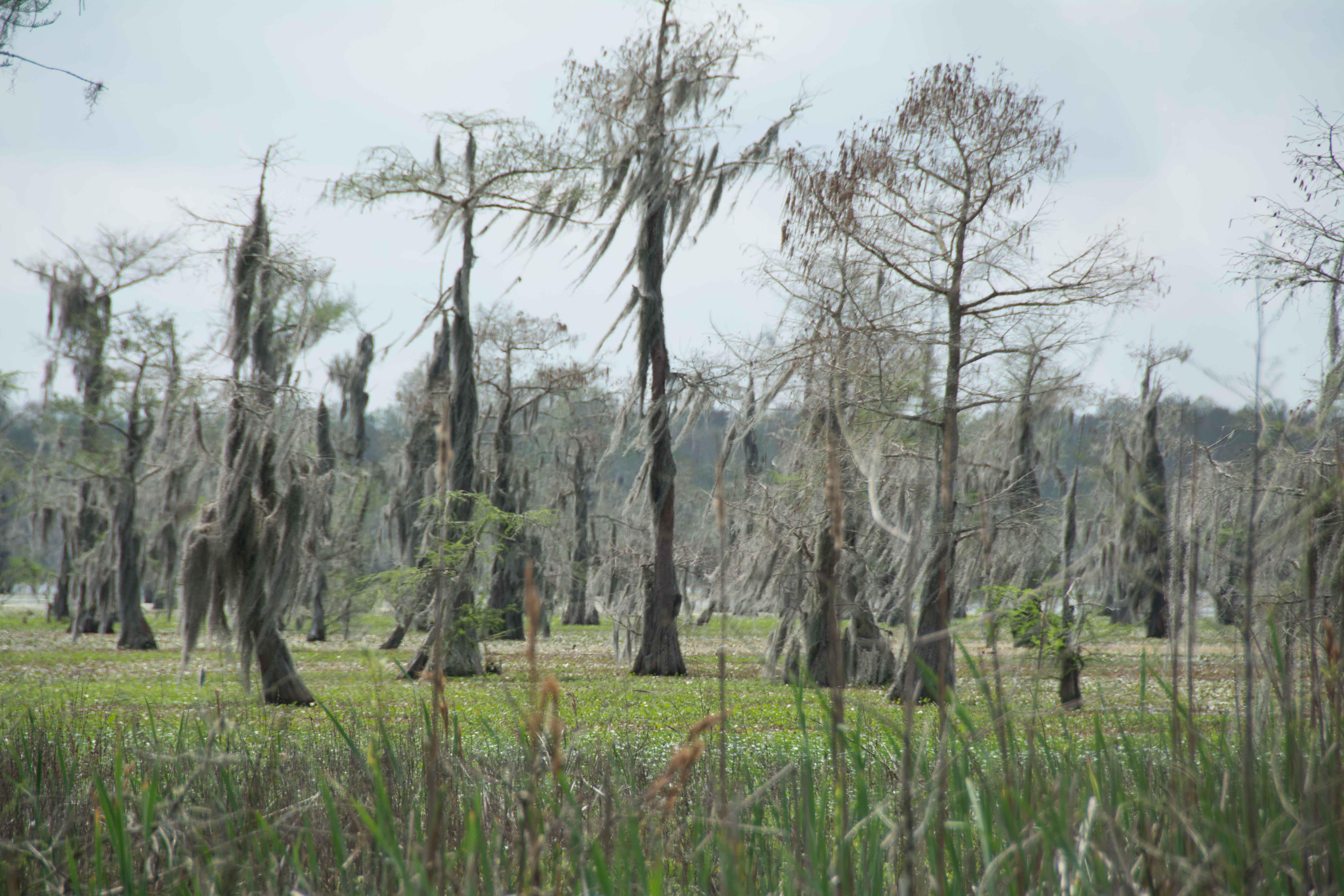
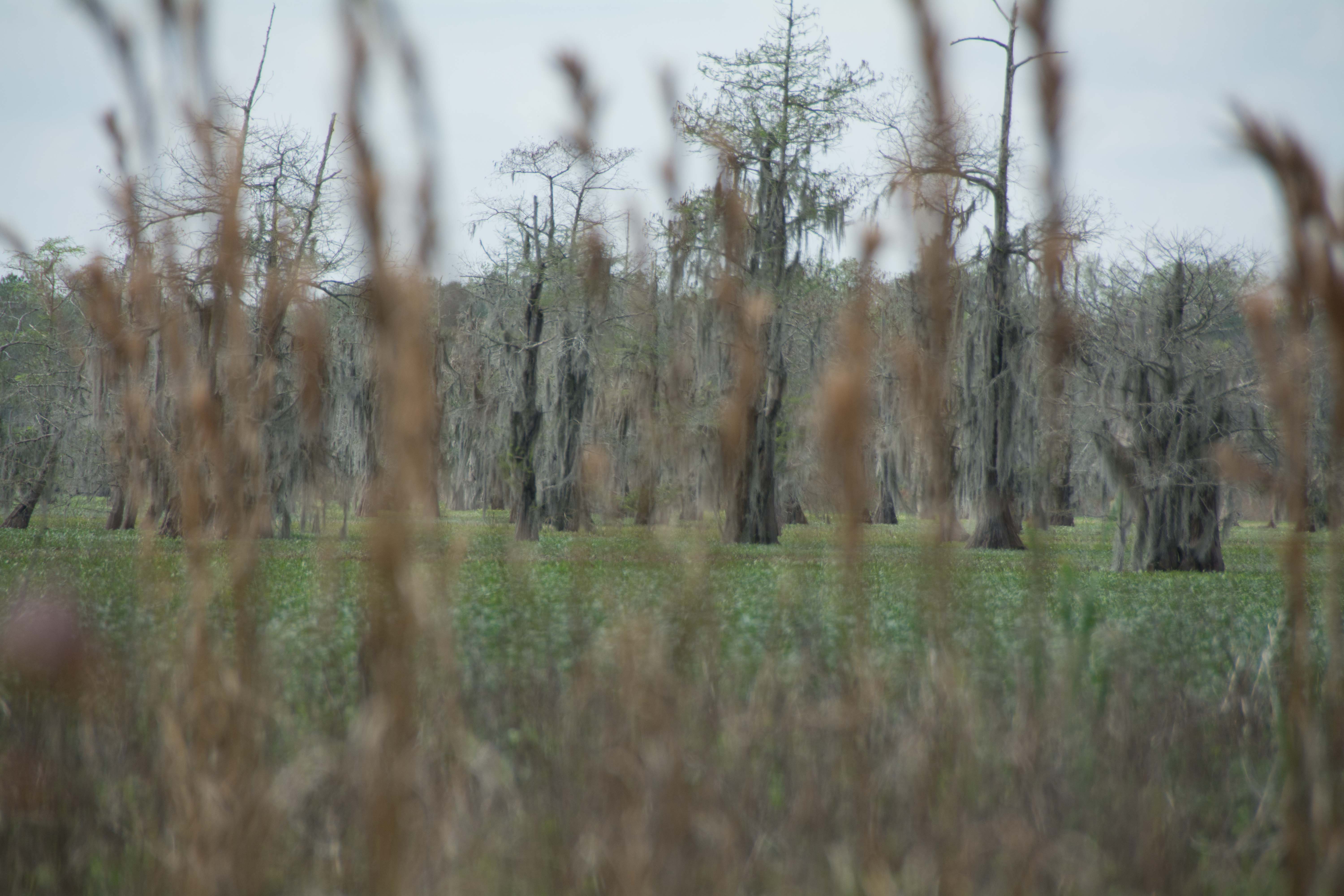
The 150 mile long Atchafalaya River makes for an enticing alternative for paddlers who want to avoid the heavy industry awaiting them below Baton Rouge.  Imagine paddling down the richest and largest river swamp in North America as opposed to paddling down the busiest and largest inland port in the world!   Unless you are dead-set committed to the traditional Mississippi route, most paddlers would do best to take the Atchafalaya route.  Paddlers can enter the Atchafalaya Canal right bank descending above Shreve’s Bar at mile 304 through the Old River Lock and Dam.  The Atchafalaya is a distributary of the Mississippi and Red Rivers.  One third of the average daily flow of the Mississippi passes down the Atchafalaya, which makes it the shortest big river in America.  At nearly one-million acres, the Atchafalaya Basin is North America’s largest riverine swamp. It contains monstrous ecosystems of marshland, bottomland forests, lakes, bayous, and estuaries. The Atchafalaya (Native American for Long River) offers a baseline for big river health and ecosystem vitality.  The Atchafalaya Basin is a key estuary for nesting, breeding, and migration of 250 bird species, 60 species of reptiles & amphibians, and it is also the life-support system for close to 100 species of fish. One of the most profound aspects of the Atchafalaya River is its ability to improve water quality as the river runs its course to the Gulf.  (Its muddy deltas are examples of how the Mississippi River should be working below New Orleans, but isn’t because the Mississippi River water is not allowed to filter through the brackish wetlands, having been cut off by levees and canals) The disappearing coast of Louisiana is being saved along one of the Atchafalaya distributaries, called Wax Lake.  The Wax Lake channel is creating a totally new delta as the sediments of a nation fall out of the muddy flow and congeal to form fresh land.

Best Water Levels to Paddle to the Gulf

The best time to paddle to the Gulf is during low or medium water levels (around 0 on the Morgan City Gage), which usually occurs in the late summer and fall.  This is excellent timing for long-distance paddlers, most of whom begin in Minnesota or Montana in May or June, and 3-5 months later are approaching the Gulf of Mexico.   Annually the water levels at Morgan City typically peak during the spring flood season (April-July) and trough in the fall/winter (Sept-February), with intermediate changes in between.  The lowest recorded water level was -5.4 on August 25, 1926, and the record high peaked during the 1973 flood at 10.53 (The same flood that almost dislodged the Old River Control Structure).  The waters almost came that high during the Great Flood of 2011 when they crested at 10.35 in Morgan City.

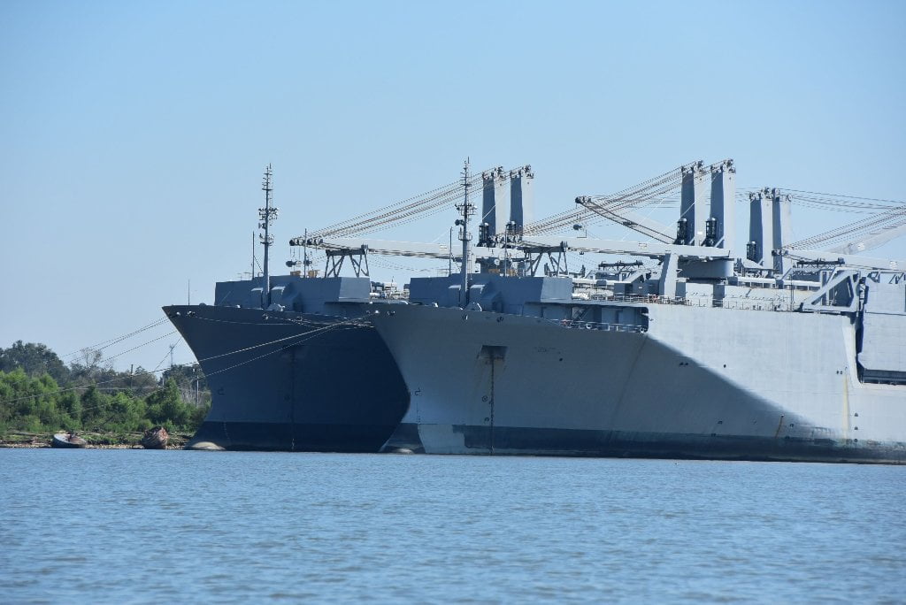
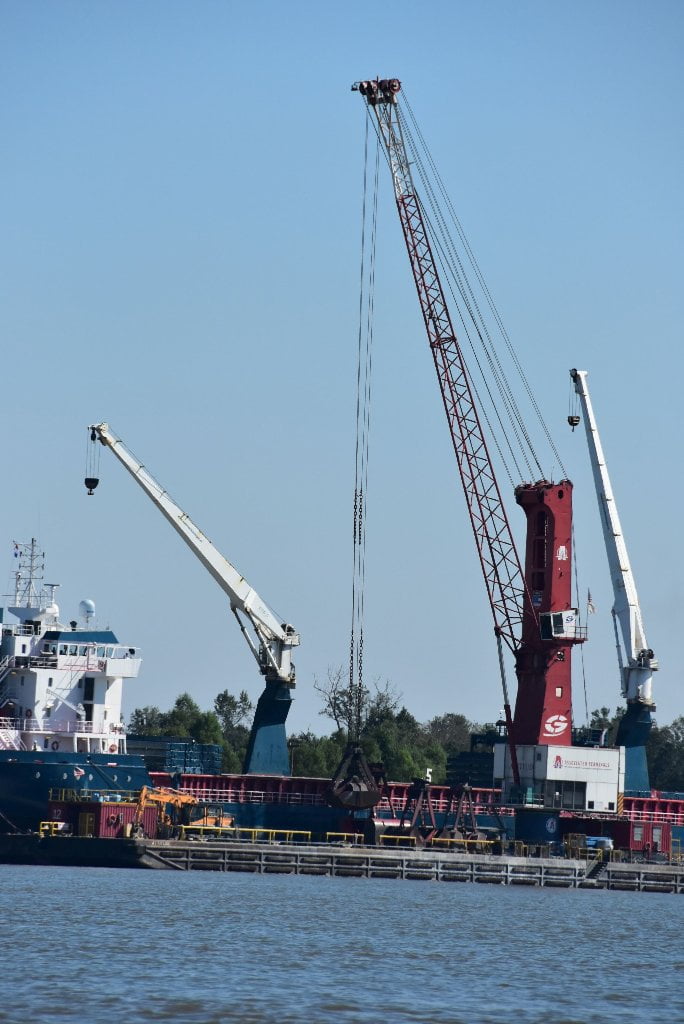
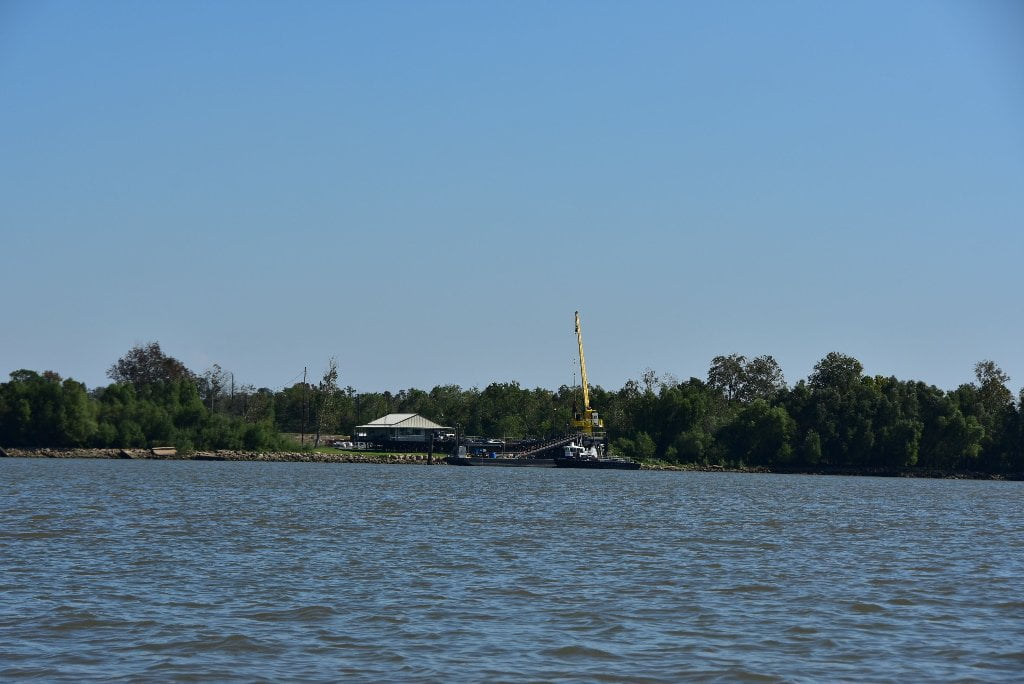
Traffic and Industry on the Atchafalaya

Industry and commercial traffic is much quieter on the Atchafalaya than the Mississippi.  You will be able to enjoy long stretches of paddling without having to negotiate turns with big tows bearing down on you and causing big waves behind them.  Your campsites will be much more peaceful.  You will almost never be awoken by the bright lights of passing tows, or rumbled in your sleep by their throbbing engines.  However, there is one place you will encounter heavy traffic, and will need to be especially cautious and alert, and that is paddling through the Port of Morgan City.   The good news is that it’s short.  iIn fact, you will only have to paddle through heavy traffic and industry for five miles, from 119 to 124.

NOTE TO PADDLERS:

The Rivergator is for your free use!  Please print or access from your smart phone.  (Presented here in roughly 100 miles sections from St. Louis to the Gulf of Mexico). 


Best case scenario: 1) print up section of Rivergator that you will be canoeing or kayaking.  2) Print up accompanying USACE river maps.  3) Print up NOAA River Stage Forecasts the day before you embark on your adventure for latest readings and forecast.  4) Lastly, listen to and print the latest weather forecast. 


Secure the above by inserting pages into 8.5×11 page protectors and bundle into a 3-ring notebook or waterproof map casing which are available at most water outfitters such as The BackPacker or Massey’s Professional Outfitters (Baton Rouge), Pack & Paddle Outfitters (Lafayette) or online at REI or NRS.


If using smart phone protect with water-proof casing!  The river is hungry for electronic devices and equipment that doesn’t float!  (I have personally left several marine radios, a half dozen knives and one camera with the sturgeon and catfish at the bottom of the river!)


The Rivergator is a public service brought to you compliments of the Lower Mississippi River Foundation with support from dozens of river experts and partner organizations

Who is the Rivergator written for?

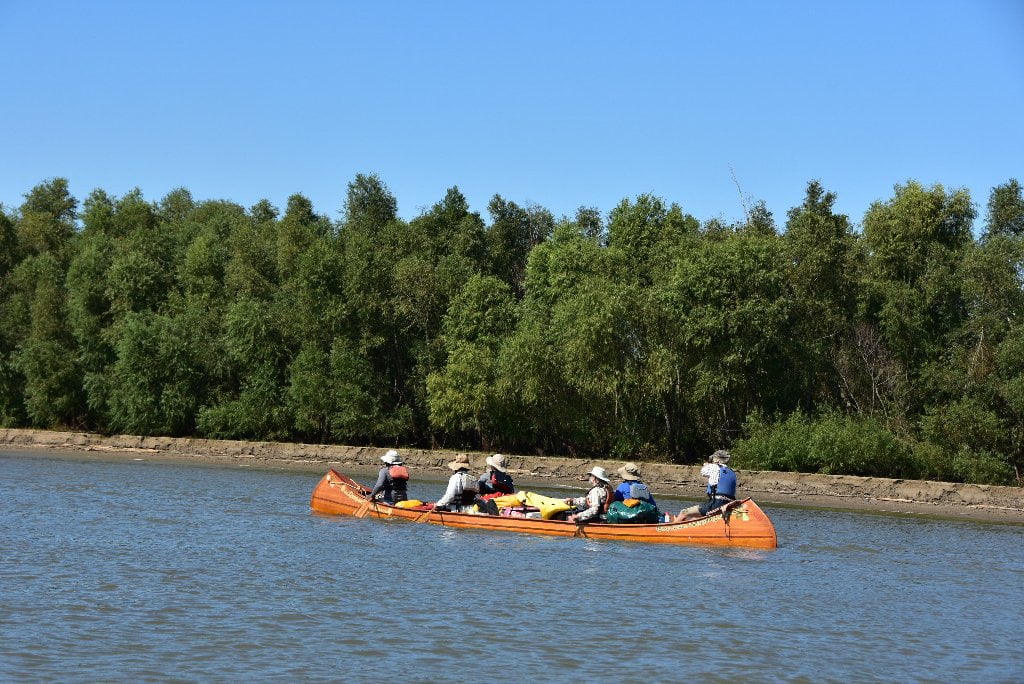
The Rivergator is written by paddlers for paddlers. It will open the river for local experienced canoeists who have always wanted to paddle the Mississippi but didn’t know how or when or where to start.  Canoe clubs, kayak clubs and outdoor clubs.  Outdoor leadership schools.  Friends and families.  Church groups and youth groups.  It could be used by the Girl Scouts for a week-long summer expedition to Tunica, or a group of Boy Scouts working on their canoe badge in the Memphis area — or a group of KIPP middle schoolers from Helena who want to get on the river at the mouth of the St. Francis for an easy daytrip.  Paddlers seek out new places to explore.  You could read the Rivergator during the winter months from your home and by spring snowmelt you could be making your first paddle strokes on a life-changing adventure down the Mississippi!   Rivergator will help you get there if you’re a long-distance canoeist who started at Lake Itasca, or a kayaker who is coming through south after paddling the length of the Missouri River from Montana’s Bitterroot Mountains.  You could be a stand-up-paddleboarder who put in at the Great River Confluence of the Upper Mississippi and Big Muddy Missouri in St. Louis.


Us paddlers are all the same: canoeists, kayakers, stand-up-paddleboarders, rafters.  We look for the same kinds of currents on the river, and enjoy the same kinds of remote islands.  We are slow, but efficient.  We know the river better than any other river pilots, at least the pieces of river we have paddled on.  We have more in common with towboats than motorboats.  Regardless of what you paddle, the Rivergator will you help you find the essential landings and the obscure back channels that you would otherwise miss.  It will help you safely paddle around towboats, and choose the best line of travel to follow around the head-turning bends and intimidating dikes, wing dams, and other rock structures.  It will identify which islands to camp and which to avoid, and where the best picnic spots are found and where blue holes form.  It will lead you to places of prolific wildlife and mind-blowing beauty. It will help explain some of the mysterious motions of the biggest river in North America.  It’s written for canoeists and kayakers, but is readable enough to be enjoyed by any arm-chair adventurers including landowners, hunters, fishermen, communities along the route, historians, biologists, geologists, and other river-lovers.  The river is the key to understanding the history, the geography and the culture of the Mid-South.  It’s the first high speed “router.”  It connected our ancestors much like internet does today.   It’s the original American highway, migration route, freight route, newspaper route, and trade route.  But it’s also a church, a sanctuary, a playground, a classroom.  The river is the rock star, The Rivergator is merely a guide to help you interpret and enjoy the songs of the river!

Reading the Rivergator:

The Rivergator reads like a big river expedition, starting above St. Louis at the confluence of the Missouri and following the Middle and then Lower Mississippi downstream mile-by-mile.  The descriptions are factual and the information is the most up-to-date available, but I have tried to enliven the writing with “the feel” whenever possible.  Each piece is titled with headings in bold that include 1) the name of the important features along the way, 2) which side of the river it’s on, and 3) its mileage.   For example, “LBD Mile 736 Memphis, Tennessee, Mud Island Harbor.”  736 is the mileage above the head of passes near the Gulf of Mexico.  RBD=right bank descending and LBD=left bank descending.  Paddlers are offered many route choices beyond the main channel in the plethora of sluices, back channels, secret passages, and tributaries along the way, using Google maps for illustration.  On your laptop or home computer you could open two pages, one for the text and one for Google maps.  On the river you can switch back and forth on your smart phone.  Or you can print the text and use the US Army Corps Lower Mississippi Maps hard copy or online.  The Rivergator is three guides wrapped up into one, because every island, landing and riverbank has to be described in three different water levels, low, medium and high.  It provides paddling routes, as well as history, geography and culture.  The Mississippi fluctuates 40-50 vertical feet in any given year, with enormous changes as result, whole islands disappear in high water, while some good landings become fields of mud at low water.

Leave A Comment

SECTION MILE ACCESS CITY
Middle Mississippi & Bluegrass Hills / Bootheel 195-0, 954-850 ST. LOUIS TO CARUTHERSVILLE
Chickasaw Bluffs 850 – 737 CARUTHERSVILLE TO MEMPHIS
Upper Delta 737 – 663 MEMPHIS TO HELENA
Middle Delta 663 – 537 HELENA TO GREENVILLE
Lower Delta 537 – 437 GREENVILLE TO VICKSBURG
Loess Bluffs 437 – 225 VICKSBURG TO BATON ROUGE
Atchafalaya River 159 – 0 SIMMESPORT TO MORGAN CITY
Atchafalaya Upper
Consider The Atchafalaya  
The Atchafalaya  
Alternate Route To The Gulf Of Mexico: The Atchafalaya River  
Big Geography Geography  
Atchafalaya Exit  
Intro: Atchafalaya River  
The Atchafalaya River: Best Route To The Gulf  
Best Water Levels To Paddle To The Gulf  
Traffic And Industry On The Atchafalaya  
NOTE TO PADDLERS:  
Who Is The Rivergator Written For?  
Reading The Rivergator:  
Panel Of Experts:  
Wild Miles:  
Warning: Stay Away From Intake Canals!  
What Are The Wild Miles?  
Big Trees And Floodplain:  
Important Note To Paddlers:  
Your Route: Main Channel Vs. Back Channel  
The Atchafalaya Split  
Maps And Mileage  
USACE 2012 Atchafalaya River And Outlets To Gulf Of Mexico  
Louisiana Geological Survey Atchafalaya Basin Map  
Maps Of The Atchafalaya Delta  
River Speed and Trip Duration  
Dangers Of Paddling Through Morgan City  
Expert Paddlers Only!  
Wind Direction And Speed  
Atchafalaya Delta Tides  
Tidal Influence:  
Estimate Your Camp Height  
Tidal Coefficient  
Tides In Rivers  
Tidal Bore  
Water Speed In The Passes  
Which Pass?  
Wax Lake Outlet: Alternate Route To The Gulf  
Shell Island Pass  
Location Island Pass  
Amerada Pass  
Main Channel: Melanie Island  
The Joy Of Reaching The Gulf  
Camping On The Gulf At The End Of The River  
The Best Gulf Beaches  
Open Water Of The Gulf?  
Some Helpful Hints:  
Getting Back To Land  
Getting Back  
Upstream Paddling  
What Do You Do Now With Your Vessel?  
LiNKS = Leave No Kid On Shore  
Atchafalaya Basinkeeper  
Bayou Teche Experience  
Bayou Sara kayak Rental  
Pack & Paddle  
Services For Lower Mississippi River Paddlers  
Lower Mississippi And Ohio River Forecast  
Reading Google Maps  
Lower Mississippi River Mileage  
Rivergator  
Towboat Protocol  
What To Pack:  
Atchafalaya Swamp Pack List:  
Primitive Camping In The Marshes & Swamps  
Biting Bugs  
Poison Ivy  
Can You Drink The Water?  
Where Do You Go? (To The Bathroom?)  
Water Quality  
The Atchafalaya Basinkeeper  
The Lower Mississippi Riverkeeper  
Environmental Reporting Phone Numbers:  
Maps And Mileage  
Louisiana Geological Survey Atchafalaya Basin Map  
Atchafalaya River Boat Ramps (Functional Jan 2016)  
River Gages  
Best Water Levels To Paddle To The Gulf  
What Do You Do Now With Your Vessel?  
LiNKS = Leave No Kid On Shore  
Left Bank And Right Bank  
Towboats And Buoys  
VHF Marine Radio  
Resources  
Cajun Culture And The Atchafalaya Wilderness  
SOLA Coffee Companies  
How To Brew A Great-Tasting Pot Of River-Rat Coffee  
The Atchafalaya  
A Note On Mileage  
A Note On Pronunciation  
Where To Start Your Atchafalaya River Expedition  
Leaving The Mississippi River  
Mississippi River Maps And Mileage  
NATCHEZ GAGE (NG)  
WATER LEVELS AND DIKES  
USING THE NATCHEZ GAGE:  
Three Inflow Openings At Old River  
Warning  
Old River Control Structure: 3 Inflow Channels  
316.3 RBD Hydro Inflow Channel
313.7 RBD Knox Landing
311.7 RBD Auxiliary Intake — Old River Control Structure
316.3 RBD Hydro Intake — Old River Control Structure
Short History Of The Old River Control Structure  
314.6 RBD Main Intake — Old River Control Structure
313 LBD Buffalo River
Clark Creek Natural Area  
311.7 LBD Clark Creek
311.7 – 310 LBD Tunica Hills Below Clark Creek (Mississippi Loess Bluffs ##6)
311 – 309 RBD Point Breeze
310.2 LBD Wilkinson Creek
306 LBD Welcome To Louisiana!
306 – 294 LBD Angola State Penitentiary
306 LBD Angola Ferry
304.5 – 303 LBD Shreve’s Bar
306 – 302 Back Channel Of Shreve’s Bar
306 – 302 Main Channel Of Shreve’s Bar
303.8 Old River Lock And Dam: Entrance To The Atchafalaya River
Leaving The Mississippi Towards Lock & Dam  
The Atchafalaya River: Best Route To The Gulf  
How Does A Lock & Dam Work?  
Contact Lockmaster  
Safe Paddling Through A Lock & Dam  
Lock Signals  
Inside The Lock Chamber  
Order Of Locking Through  
Mileage Down Lower Old River Channel  
6.9 RBD Three Rivers Junction
Red River  
Three Rivers WMA And Red River NWR  
Atchafalaya – A Modern History  
Atchafalaya Lower
Atchafalaya River Basin Biotas  
A Lived-In Landscape  
Atchafalaya Mileage  
RBD = Right Bank Descending, LBD = Left Bank Descending  
Gas Pipelines  
Simmesport Gage (SG)  
Water Levels According To The Simmesport Gage  
Maps And Mileage  
USACE 2012 Atchafalaya River And Outlets To Gulf Of Mexico  
Louisiana Geological Survey Atchafalaya Basin Map  
0.1 LBD Three Rivers Landing
1.4 LBD Small Dune
1.9 RBD Coville Bayou
3.4 LBD Bayou Coteau
4.5 Simmesport KCS Railroad Bridge
4.6 LBD Simmesport Sand Dune
4.8 LBD Kuhlman Bayou
5.5 Simmesport River Park
Simmesport, Louisiana  
Canadaville, Louisana  
9 – 11 RBD Odenburg Island Dikes
12.5 LBD Marine Bayou
13 – 20 Atchafalaya Squiggles
13.2 RBD Porcupine Point
14.5 LBD Cypress Point
14.5 RBD  
14.7 RBD Small Dunes
15.5 Primitive Boat Ramp (Private)
16 RBD Eddy Dune
16.5 RBD Trash Site
17 – 18 RBD Hick’s Landing/Gordon Point
18 – 20 LBD Bayou Point
Borrow Pits And Blue Holes  
20.5 LBD Small Sandy Shelves
20 – 25 Bayou Current To Elba Landing
22 RBD Cell Tower
22.2 LBD Small Hump Of Sand
23.4 RBD Barberton Landing
25.1 RBD Elba Landing
26.1 RBD Small Bluff Of Sand
26.2 LBD Broad Sandy Shelf
26.3 RBD Old Channel Of Bayou Rouge
27.1 LBD Point Coupee/Bayou Latenache Pumping Station
27.1 Morganza Floodway – North End
28.1 Underwater Pipeline Crossings
28.2 Aerial Pipeline Crossing
29.6 Melville Union Pacific Railroad Bridge
29.7 RBD Melville Boat Ramp (Primitive)
29.8 LBD Melville Ferry Barge East Bank Landing
30 – 40 Melville To Krotz Springs
31 LBD Broad Bay
31.5 LBD Cross Bayou
31.7 LBD Open Field Cow Pasture
32.5 LBD Cross Bayou Point (Owl Hoot)
35.6 LBD Small Sandbar
36 – 37 RBD Sandy Landings
37.1 RBD Cell Tower
39.7 LBD Bayou Sherman Point
Atchafalaya Basin Pack List For Swampy/Marshy Camp Sites  
Switching To The KROTZ SPRINGS GAGE (KG)  
Water Levels According To The Krotz Springs Gage  
38.5 – 42.7 Krotz Springs Utility Crossings
39.3 Water Drainage Structure: Origins Of The Teche River
39.5 RBD Cell Tower
39.6 LBD High Sand Dune
40.3 RBD Gravel Landing
40.3 Wire Suspension Bridge For Pipeline
41 Krotz Springs US Hwy 190 And 71 (2 Bridges)
41.5 Krotz Springs Union Pacific Railroad Bridge
42.3 RBD Krotz Springs Boat Ramp
Krotz Springs History  
42.5 RBD Port Of Krotz Springs
Krotz Springs To The Split  
Atchafalaya National Wildlife Refuge  
44 Sherburne Bend
44.5 RBD Frank Diesl Point
44.9 LBD Small Sand Dune
46.1 RBD Bayou Big Graw Boat Ramp
49.3 RBD Bayou Courtableau
49.7 LBD Coswell Point
51 RBD Courtableau Point
54.2 LBD End Of The East Bank Levee
55 LBD Atchafalaya NWR Boat Ramp
55.1 Two Blue Holes
55.4 LBD Alabama Point
56.4 RBD Old Atchafalaya Point
56.4 The Atchafalaya Split
Whiskey Bay Pilot Channel  
59.8 I-10 The Atchafalaya Basin Bridge
60 RBD Sand Dune
60.5 Union Texas Petrochemical Aerial Crossing
61.7 LBD Bayou Des Glaises Boat Ramp (Primitive)
62.3 LBD Bayou Des Glaises
66.4 RBD Splice Lake
66.7 LBD Pat’s Throat
68 RBD Willow Point
68.5 LBD Blue Heron Point
70.9 LBD Upper Grand River
73.4 LBD Little Tensas Bayou
75.3 LBD Texaco Resources Dock
75.5 RBD Splice Island (Bottom End)
Primitive Camping In The Marshes & Swamps  
75.7 LBD Jake’s Bayou
75.8 Three Major Pipelines
76.4 LBD Lake Mongoulois Point
77.2 RBD Bayou Chene
79.9 Tarleton Bayou
81.2 LBD Bayou Sorrel
81.2 LBD Bayou Sorrell: Alternate Route Down The Atchafalaya
3 Days On Dean’s Route  
East Grand Lake  
82.4 LBD Bee Bayou
82 – 99 Chicot Pass
83 Pipeline Tailings
83.2 Philip’s Canal
85.7 RBD Danbury Management Corp Dock
86.2 RBD Canal Entrance
86.8 RBD Canal Entrance
88.1 RBD Canal Entrance
89.7 RBD Pipeline Canal
91.2 Texas Gas Transmission Co. 12″ Gas Pipeline
Attakapas Island Wildlife Management Area  
95.4 LBD Blue Hole
96.1 Texas Gas Transmission Co. 12″ Gas Pipeline
96.7 Old Pipeline Canal
97.3 Louisiana Intrastate Gas Corp 4″ Gas Pipeline
98.2 RBD Myette Point
MORGAN CITY GAGE (MCG)  
Water Levels According To The Morgan City Gage  
Tidal Influence  
Estimate Your Camp Height  
100.2 LBD Blue Hole Landing
102 RBD Sixmile Lake: Access To Wax Lake Outlet
Wax Lake Outlet: Alternate Route To The Gulf  
Paradise Regained: The Wax Lake Delta  
103.8 LBD Narrow Bayou Leading To East Grand Lake
105 LBD Blue Point Chute: Shortcut To Cypress Wonderland
107.9 Exxon Gas Transmission Company 20″ Gas Pipeline
108.3 RBD Shortcut To Sixmile Lake
109 RBD Cypress Pass Back Channel
109.5 Duck Lake Channel
Duck Lake  
Many Rivers To Follow  
111.7 RBD Lower Atchafalaya River
111.7 RBD Riverside Pass
112.5 RBD Three Island Pass
113 RBD Little Island Pass
Main Channel Atchafalaya River  
115.1 American Pass
115.8 LBD Pipeline Canal To Dog Island Pass And Flat Lake
Flat Lake  
115.8 – 119.8 LBD Drew’s Island
117 RBD Stouts Point
119 Drew’s Pass
Dangers Of Paddling Through Morgan City  
Waves  
Small Tows In Harbors  
Towboats Vs. Tugboats  
Stay Off The River In Fog  
Fleeted Barges  
Buoys And Other Hazardous Stationary Objects  
119 LBD Swiftships Boat Yard
119.5 RBD Bayou Teche (Berwick) Lock & Dam
119.5 RBD Bayou Teche Water Trail
121 Morgan City US Hwy 90 Bridge
121.2 LBD Morgan City Downtown Landing
Morgan City  
121.3 Morgan City Texas And New Orleans Railroad Bridge
121.4 RBD Berwick Public Boat Ramp
121.4 LBD Mr. Charlie: The International Petroleum Museum
Intro: Morgan City To The Gulf Of Mexico  
Maps Of The Atchafalaya Delta  
Best Water Levels To Paddle To The Gulf  
Morgan City Gage (MCG)  
Water Levels According To The Morgan City Gage  
Flood Stage Warning:  
Weather And Tides  
Check The Winds And Weather  
Tidal Influence:  
Estimate Your Camp Height  
121.5 LBD Gulf Intracoastal Waterway (East)
121.7 – 130.3 Bateman Island
Pipelines And Electrical Lines  
124.2 RBD Berwick Intracoastal Waterway Boat Launch
124.2 RBD Gulf Intracoastal Waterway (West)
124.5 RBD Gulf Intracoastal Waterway Point (South Side)
Atchafalaya Delta Navigation Channel Buoys  
126-127 LBD Outside Bend Highground
127.4 Bateman Island Point And Bend
127.5 – 128 RBD Cypress Forests
128 – 131 LBD Sweetbay Lake
131 LBD Access To Bayou Shaffer Via Sweetbay Lake
131 RBD Glass Island
Night-Time Sky In The Atchafalaya Delta  
131.8 – 132 LBD Stands Of Young Cypress Trees
134 RBD Sandy Willow Spit
134 LBD Avoca Island Cutoff
135-136 LBD New Dike Wall
135-138 LBD New Navigation Channel Around He Avoca Island Bend
136 – 137 Sandy Marsh Island
137.8 RBD Shell Island Pass
Gulf Route: Crossing Over To The Wax Lake Delta  
Atchafalaya Delta Wildlife Management Area  
138.5 LBD Low Lying Muddy/Sandy Beach With Willows
139.1 LBD Small Shell Beach
140 LBD Deer Island
140.5 RBD Breaux’s Pass
140.2 LBD Location Island Pass
142.2 LBD East Pass
144.2 RBD Amerada Pass
144.2 RBD Willow Island
144.3 LBD God’s Island
144.8 RBD Log Island Pass
145.4 RBD Yvette Island
146 RBD Melanie Island
148.5 RBD Donna Island
150.5 RBD Eugene Island
151.5 LBD Bird Island East
Pount Au Fer/Raqet Pass  
Getting Back To Land  
Atchafalaya Delta WMA Campground  
Wax Lake Delta Passes  
Getting Back  
Upstream Paddling  
What Do You Do Now With Your Vessel?  
LiNKS = Leave No Kid On Shore  
Louisiana Delta 229 – 10 BATON ROUGE TO VENICE
Birdsfoot Delta 10 – 0 VENICE TO GULF OF MEXICO