The Lower Mississippi River Water Trail

lbd 838-835 Island 18 Towhead

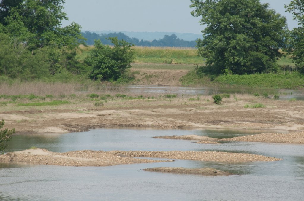
After sliding under the bridge and past the Boothspoint Bunge Grain elevator continue on downstream westward and the southwestward around Island 18 where possible sandy high water campsites (up to 30 CuG) are found a high hump mid-channel near 836, at higher water levels keep going for higher sites.  At low water a giant sandbar forms with unlimited camping and picnicking possibilities.


The low water road and land bridge of Island 18 was blown out in the 2011 flood.  Expert paddlers only through the opening which is full of snags, strainers and turbulent waters!  If the river is above 30 CuG the expert paddler could possibly find a tree-choked opening with ample flow diving straight through the woods at 838 which continue through a convoluted gravel & forest landscape and eventually open up into the expansive Robert E. Everett Lake.  Re-enter main channel at bottom of lake, which closes off around 7 on the Caruthersville Gauge.  Everett Lake Boat Launch: Crude concrete ramp best at medium level, muddy at low water, disappears at high water.  Inquire locally for parking.


rbd 829-832 Island 20 Dikes & Towhead

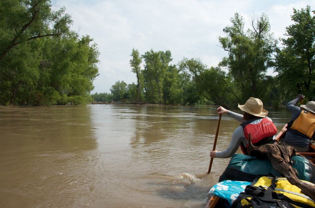
Archipelago of Islands accumulating along the dikes of Island 20.  Canoeists and kayakers in higher water levels can stay RBD below Cottonwood Point (RBD 832.5) and float behind a series of three prominent clumpy islands which have grown up along the wing dams of island 20 and go completely under at flood stage 32 CuG.  At low water Island 20 transforms into a 5-mile long sandbar full of turtles, terns and swim holes.  Watch for nesting least terns during their May-July season, and try not to disturb their sandy nests which they form as small shallow bowls right on the surface of the sandbar.


LBD 823-829 Island 21

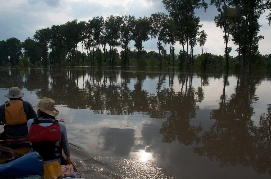
During low water you will make a five-mile semi circle to get around the sprawling sandbars of Island 21, and you will want to be alert around the industrious hubbub surrounding Nucor Arkansas Steel & Power Plant found RBD near 824 where coal and iron ore barges dock and smaller tows hustle barges back and forth.  Back channel opens up in medium water through large opening below fifth big dike (near LBD 828.5) During higher water levels you can duck into any one of many back channels disappearing into the main body of this island and find yourself in a watery wilderness of islands and sloughs.  The primary inflow is the 2nd opening above the wing dam at LBD 828.  Paddle quietly and you might enjoy close encounters with beavers, river otters, deer, coyotes and bald eagles.  There is a primitive landing LBD just off Chic Road near the top of the back channel (36.189635,-89.651018).  Island 21 has five miles of back channel north to south, and a solid cross-channel dike near the bottom end that could produce sizable waves and turbulence at medium water levels.  If the water seems to drop a level and you hear the commotion of a waterfall proceed cautiously.  Stop and scout if uncertain.  A hidden sandbar with beautiful blue holes forms at lower water levels LBD at the bottom of the back channel.


Best camping in the entire area could be found along the multilayered Island 21, one of the biggest islands in this stretch of river.  Island 21 is lacerated by numerous channels interwoven with deep forests, wetlands, blue holes and extensive sandbars.  There is a high sandy bluff found along the outside edge which could offer safe respite in all water stages.


Unfortunately any main channel travel, picnicking or camping will be spoiled by the monstrous Nucor Arkansas with its tiresome bells and sirens, and the endless roar of its power plant and giant coal trucks.  After dark the night sky is ruined by its lights and the intrusive sounds seem to get louder.  If industry doesn’t bother you, no problem.  Find your place and endure.  But if your seeking peace and quiet, you won’t find it here.  Keep heading downstream to Wright’s Point or below.

Leave A Comment

SECTION MILE ACCESS CITY
Middle Mississippi & Bluegrass Hills / Bootheel 195-0, 954-850 ST. LOUIS TO CARUTHERSVILLE
Chickasaw Bluffs 850 – 737 CARUTHERSVILLE TO MEMPHIS
Introduction  
Caruthersville to Osceola
850 – 737 LBD Options for Paddlers in the Caruthersville Stretch
Above Caruthersville  
Below Caruthersville  
850 RBD Caruthersville Harbor Boat Ramp (1/2 Mile Up Harbor)
849 RBD Mouth of the Carutherville Harbor
849 RBD Trinity Barge Fabrication Plant
847 RBD Blaker Towhead
846.5 Caruthersville
846 RBD Isle of Capri/Lady Luck Casino and Casino Inn Suites
845 – 840 LBD Caruthersville – Linwood Bend
850 RBD – 840 LBD Day Trip: Caruthersville to Booth’s Point
840 LBD Linwood Bend Boat Ramp
839 Caruthersville Bridge
Bridges and Mud: How Deep is the Mississippi Mud  
Several Routes Around Islands 18, 20 and 21  
838 – 835 LBD Island 18 Towhead
829 – 832 RBD Island 20 Dikes and Towhead
823 – 829 LBD Island 21
Routes for the Paddler Around Tamm/Barfield Bends  
820 – 815 RBD Wright’s Point – Tamm Bend
819.3 LBD Mouth of the Obion River
Moss Island WMA  
817.7 LBD Tamm’s Landing and Ed Jones Boat Ramp
817.7 – 801.8 LBD Chickasaw National Wildlife Refuge
No Levee?  
814 LBD Nebraska Landing
815 – 805 LBD Barfield Bend
809.3 RBD Barfield Boat Ramp
806 RBD Tomato Arkansas
805 – 801 RBD Island 25
Paddler’s Options in the Island 30 – Osceola Area  
800 – 796.5 RBD Island 26 and Forked Deer Island 27
803 – 787 RBD Ashport-Keyes Gold Dust
796 – 791 RBD Ashport Gold Dust Dikes
797 LBD Shoaf Landing
797 LBD Lower Forked Deer River
796 LBD Ashport-Keyes Boat Ramp
793 – 785 RBD Island 30
796 LBD Ashport-Keyes Boat Ramp
Neark (Jacksonville) Landing  
786.5 LBD Back Channel Island 30
785 RBD Osceola Arkansas
783.5 RBD Sans Souci Boat Ramp
Osceola to Shelby Forest
785 RBD Osceola Arkansas
783.5 RBD Sans Souci Boat Ramp
782 LBD Driver Island
779.8 LBD Old Mouth of the Forked Deer
779 – 778 LBD First Chickasaw Bluff
Alternate Paddler’s Route Around Hatchie River & 2nd Chickasaw Bluff  
778 – 773 RBD Sunrise Towhead – Island 34
777 – 773.5 LBD Hatchie Towhead
773.5 LBD Mouth of the Hatchie River
773.5 LBD Lower Hatchie National Wildlife Refugee
771 – 772 LBD Angelo Towhead
771 LBD Randolph Landing
771 – 769 LBD The Second Chickasaw Bluff (Richardson Bluff)
768.9 LBD Richardson’s Landing
768 LBD Randolph’s Landing/Duvall’s Boat Ramp
766 – 763 LBD Below Richardson’s Landing Dikes and Bar
Dyess Arkansas, Birthplace of Johnny Cash’s Five Feet High and Rising  
Five Feet High and Rising  
767.6 – 761.5 RBD Island 35
767 RBD Island 35 Boat Ramp
Back Channels of Island 35  
767.6 RBD Entrance
761.5 RBD Exit Behind Dean Isand
Memphis Gage  
Dikes and Water Levels  
Reading Google Maps  
761.5 – 757 RBD Dean Isand
761.5 – 757 RBD Back Channel of Dean Isand
Third Chickasaw Bluff  
758 – 754 LBD Denseford Bar and Dikes/Hen and Chicks
752.7 LBD Shelby Forest Boat Ramp
Shelby Forest to Memphis
Memphis Gage  
Dikes and Water Levels  
752.7 LBD Shelby Forest Boat Ramp
Hen & Chicks Round Trip  
754 – 745 LBD Meeman Shelby Forest State Park
754 – 747.5 RBD Back Channel of Brandywine Island
Buoys and Dikes  
Paddling Into Memphis: Three Distinct Routes  
749 – 742 LBD Hickman Bar
Picknicking and Camping on Hickman  
746 LBD Upper Hickman
745 LBD Middle Hickman
744 LBD Lower Hickman
743 LBD Below Lower Hickman
740.6 LBD Loosahatchie River
743.5 – 740 LBD Redman Point Bar
Memphis Upper Waswater Treatment Plant  
M.C. Stiles Waterwater Treatment Facility  
739 LBD Conoco Lucy-Woodstock Memphis Chemical Terminal Dock
740.6 LBD Wolf River
738.4 LBD Mud Island Upper Boat Ramp
740 – 737.5 Loosahatchie Bar
737.5 Ferry Crossing to Memphis From the Bottom of Loosahatchie Bar
737 Memphis “M” Bridge (Hernando De Soto Bridge)
736 LBD 4th Chickasaw Bluff: Memphis
736 LBD Memphis Mud Island Harbor
Mud Island Riverpark & Museum  
Memphis Yatch Club Marina & Boat Ramp  
Coast Guard Boat Ramp  
Memphis Conveniences Useful to Paddlers  
Several Challenging Round-trips From Memphis  
The Lossahatchie Redman Figure-Eight  
The Loosahatchie Roundtrip  
Hickman Bar Roundtrip  
Upper Delta 737 – 663 MEMPHIS TO HELENA
Middle Delta 663 – 537 HELENA TO GREENVILLE
Lower Delta 537 – 437 GREENVILLE TO VICKSBURG
Loess Bluffs 437 – 225 VICKSBURG TO BATON ROUGE
Atchafalaya River 159 – 0 SIMMESPORT TO MORGAN CITY
Louisiana Delta 229 – 10 BATON ROUGE TO VENICE
Birdsfoot Delta 10 – 0 VENICE TO GULF OF MEXICO