The Lower Mississippi River Water Trail

Willow Island, Chotard Lake and Eagle Lake: Paddler’s Routes

https://maps.google.com/maps/ms?msid=217859314001592865582.0004e6d829fd264811d35&msa=0


http://goo.gl/maps/RJ5Go


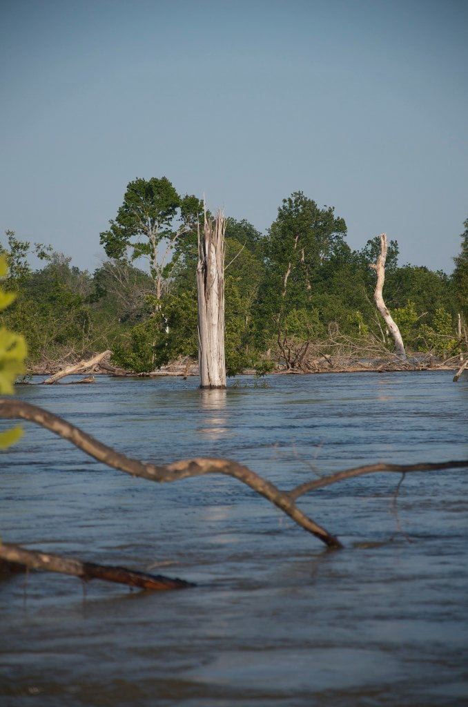
Canoeists and kayakers can stay Main Channel to find the fastest route, or if the water is high enough jump behind Willow Island and Tara Island for back channel paddling (above 25VG).  Opportunities for deep woods exploring by canoe or kayak is found paddling into the wonderland of Chotard Lake/Terrapin Neck Cutoff.  You can paddle up the Eagle Lake Pass only when the river is bankful 35VG.


Main Channel

The fastest water in the Main channel follows predictable lines around Willow Island.  Approach left bank past the mouths of Chotard and Eagle Lake Pass, past Tara Landing and then ease back across mid channel and slide towards the left bank past the Madison Parish Port and Tara Island, and stay right bank all the way down to Paw Paw.


Willow Island Back Channel

Willow Island back channel opens through in low water, around 15 Vicksburg Gauge, with good flow in medium water 25VG.  By 35VG the back channel is flowing as fast as the main channel and long-distance paddlers might want to use it and shave off a few precious miles.


Chotard Lake/Terrapin Neck Cutoff 461 LBD

The Mouth of Chotard Lake/Terrapin Neck Cutoff opens up to paddlers in low water around 16 VG, maybe a little lower, maybe a little higher, changes from year to year.  Two mile narrow chute opens up into a giant oxbow lake.  Two miles across lake to Laney’s Landing, or continue beyond for exploring, birding and fishing.

Chotard Lake: Laney’s Landing

Well-designed concrete ramp at the edge of Chotard Lake north of Eagle Lake.  Ample parking, and safe place to leave your vehicle for overnights.  Check in at store.  Formerly private ramp now made public through 2011 acquisition by the Miss Dept of Wildlife, Fisheries and Parks.


Eagle Lake Pass LBD 458.8

At low water this is nothing more than a ditch through the scraggly tornado ravaged woods.  At medium water you can paddle in a short ways but might have to portage over fallen trees and a beaver dam.  At high water you can work your way a little over two miles through this wildlife-filled chute to where it opens up into a small lake at the base of the levee.


Tara Landing LBD 458

Leave A Comment

SECTION MILE ACCESS CITY
Middle Mississippi & Bluegrass Hills / Bootheel 195-0, 954-850 ST. LOUIS TO CARUTHERSVILLE
Chickasaw Bluffs 850 – 737 CARUTHERSVILLE TO MEMPHIS
Upper Delta 737 – 663 MEMPHIS TO HELENA
Middle Delta 663 – 537 HELENA TO GREENVILLE
Lower Delta 537 – 437 GREENVILLE TO VICKSBURG
Introduction  
Greenville to Lake Providence
Greenville, Mississippi  
Greenville Accomodations and Restaurants  
Greenville Blues Festivals  
Greenville Boat Ramp  
Greenville Harbor  
537 LBD Warfield Point Park
537 LBD Old Warfield Point Boat Ramp
537 LBD New Warfield Point Boat Ramp
534 LBD Vaucluse Landing
531.5 RBD Sunny Side Landing
530.7 LBD Greenville Bridge
529 – 525.5 LBD Lakeport Towhead / American Bar
525 LBD American Cut-Off / Lake Lee
Lake Lee Public Boat Ramp  
Options for Paddlers Below Greenville Bridge Near American Bar and Lake Lee  
Lake Washington  
523 – 520 RBD Island 68
519 – 515 RBD Kentucky Bend
515 – 512 LBD Leota Bar / Cracraft Chute
514 – 512 RBD Worthington Cutoff, Matthews Bend, Grand Lake, Island 88
512 RBD (And Up Back Channel) Grand Lake Landing Boat Ramp
510 – 506 RBD Cracraft Bar
Paddler’s Choices Through Cracraft Chute & Sarah’s Cutoff  
Entering Louisiana  
503.5 RBD Bunch’s Cutoff
503 RBD Chute of Old River Lake
505 – 502 LBD Corregidor Bar
500 – 495 RBD Wilson Point Bar
496 LBD Tennis Court Landing
Vicksburg Gage  
Water Levels and Dikes  
494 – 487 LBD Baleshead / Stack Island / Ben Lamond
Two Stack Islands?  
Lake Providence  
Lake Providence Landings  
Paddler’s Choices in the Mayersville – Lake Providence Area  
487 – 481 LBD Shipland Wildlife Management Area
Lake Providence to Vicksburg
Vicksburg Gage  
Water Levels and Dikes  
Lake Providence  
Lake Providence Landing  
Paddler’s Choices in the Mayersville – Lake Providence Area  
487 – 481 LBD Shipland Wildlife Management Area
480 – 474 Fitler Bend
471 – 465 Arcadia Point Bar / Cottonwood Bar
Paddler’s Routes Arcadia Point Bar / Cottonwood Bar  
462 – 459 RBD Willow Island
461 LBD Chotard Lake Terrapin Neck Cutoff
Laney’s Landing  
459 LBD 2010 F-4 Tallulah – Yazoo Tornado
458.8 LBD Eagle Lake Pass
458 LBD Tara Landing
457 RBD Madison Parish Port and Public Boat Launch
Bluz Cruz Kayak and Canoe Race  
Willow Island, Chotard Lake, and Eagle Lake: Paddler’s Routes  
458 – 449 Milliken Bend
449 – 445 RBD Sparta Island
449 – 445 RBD Marshall Cutoff
446.5 LBD Paw Paw Chute
The “Heart of the Darkness” Tour  
Around Paw Paw to Forest Home Chute  
Paw Paw to Vicksburg Via the Yazoo  
Steele Bayou Control Structure  
What Are the Paw Paws  
Paw Paw Chute / Sparta / Brown’s Point: Paddler’s Routes  
445 – 442 Brown’s Point
444 Brown’s Point Fault Line
441 – 438.5 RBD Delta Point Bar
Habitat Restoration on the Lower Miss  
438 RBD King’s Point / Secret Entrance Into Lake Centennia
437.7 LBD Mouth of the Yazoo River
Vicksburg  
Vicksburg Services and Accommodations  
Vicksburg Services, Accommodations, and Restaurants  
Looking Downstream  
Loess Bluffs 437 – 225 VICKSBURG TO BATON ROUGE
Atchafalaya River 159 – 0 SIMMESPORT TO MORGAN CITY
Louisiana Delta 229 – 10 BATON ROUGE TO VENICE
Birdsfoot Delta 10 – 0 VENICE TO GULF OF MEXICO