The Lower Mississippi River Water Trail

behind as close as possible (maintaining a healthy 300 yards buffer).  This way you will know for sure no upstream traffic will be in motion, and the downstreamer will flatten any waves for you.  Remember: the safest place around any tow is behind the tow!


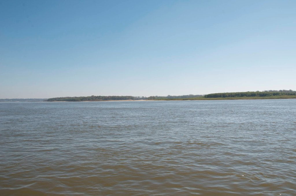
RBD 441-438.5 Delta Point Bar


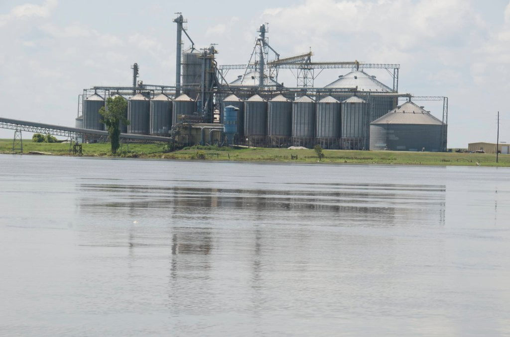
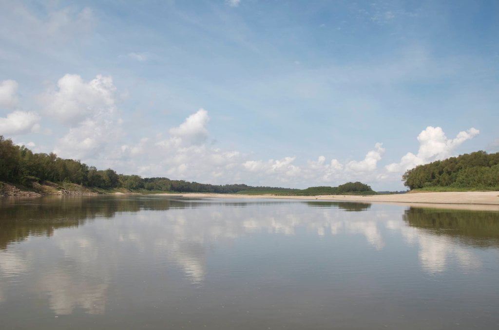
After paddling past the vast collection of grain elevators and connecting conveyor belts at Farmer’s Grain Terminal RBD 442.1 the canoeist or kayaker will see a three-mile long island, the last island above Vicksburg.  This is the Delta Point Bar.  You can find possible campsites here if the river is below 30 on the Vicksburg Gauge, and extensive camping below 25.  At low water below 20VG beautiful sand beaches become exposed, particularly around and above the top of the island near RBD440, with a sparkling channel of water rounding the top and diving into a back channel.  If you’re a strong paddler go ahead and ride the back channel.  But be prepared for making a very strong ferry crossing for entrance into the mouth of the Yazoo River to reach downtown Vicksburg.


Delta Point Bar Back Channel was once closed off by a series of rock dikes.  Fortunately for fish (and kayakers) the same engineers who built the dikes have returned and opened them back up with a series of notches on each one.  The notching project is overseen by the Vicksburg-based Lower Mississippi River Conservation Committee.  Its founding director Ron Nasser envisioned endangered pallid sturgeon and other species reconnecting their life-cycles with free flowing back channels, and through decades of hard work Ron made them happen.  Delta Point Bar is one of the many islands that have benefitted from Ron’s vision.  As result of the notching project biologists like Paul Hartfield and his Pallid Sturgeon Posse have uncovered Pallid Sturgeon spawning grounds and secrets of their migrations and life cycles that had heretofore not been understood.  In fact, the Lower Mississippi was considered a dead river (for sturgeon) until Paul and other river specialists demonstrated otherwise.   Two other mysterious Lower Mississippi migrations are the freshwater shrimp and the American eel.  See Rivergator Appendix for more information about these.


Habitat Restoration on the Lower Miss


The Lower Mississippi River Conservation Committee partners have identified more than 200 projects to restore aquatic habitat and provide greater public access to the river.  Water flows have been restored to nearly 40 miles of side channel habitat. More projects are planned based on how they improve habitat quality and whether they are cost-effective.  The LMRCC, the U.S. Army Corps of Engineers and other partners are monitoring habitat changes at restoration sites.


Pallid Sturgeon: Studies in the last decade have confirmed that the Pallid Sturgeon, an endangered species, occurs throughout the Lower Mississippi River. Restoration of side channels, among other actions, is improving habitat for young sturgeon to survive. Biologists with the U.S. Fish and Wildlife Service and the U.S. Army Corps of Engineers 

Leave A Comment

SECTION MILE ACCESS CITY
Middle Mississippi & Bluegrass Hills / Bootheel 195-0, 954-850 ST. LOUIS TO CARUTHERSVILLE
Chickasaw Bluffs 850 – 737 CARUTHERSVILLE TO MEMPHIS
Upper Delta 737 – 663 MEMPHIS TO HELENA
Middle Delta 663 – 537 HELENA TO GREENVILLE
Lower Delta 537 – 437 GREENVILLE TO VICKSBURG
Introduction  
Greenville to Lake Providence
Greenville, Mississippi  
Greenville Accomodations and Restaurants  
Greenville Blues Festivals  
Greenville Boat Ramp  
Greenville Harbor  
537 LBD Warfield Point Park
537 LBD Old Warfield Point Boat Ramp
537 LBD New Warfield Point Boat Ramp
534 LBD Vaucluse Landing
531.5 RBD Sunny Side Landing
530.7 LBD Greenville Bridge
529 – 525.5 LBD Lakeport Towhead / American Bar
525 LBD American Cut-Off / Lake Lee
Lake Lee Public Boat Ramp  
Options for Paddlers Below Greenville Bridge Near American Bar and Lake Lee  
Lake Washington  
523 – 520 RBD Island 68
519 – 515 RBD Kentucky Bend
515 – 512 LBD Leota Bar / Cracraft Chute
514 – 512 RBD Worthington Cutoff, Matthews Bend, Grand Lake, Island 88
512 RBD (And Up Back Channel) Grand Lake Landing Boat Ramp
510 – 506 RBD Cracraft Bar
Paddler’s Choices Through Cracraft Chute & Sarah’s Cutoff  
Entering Louisiana  
503.5 RBD Bunch’s Cutoff
503 RBD Chute of Old River Lake
505 – 502 LBD Corregidor Bar
500 – 495 RBD Wilson Point Bar
496 LBD Tennis Court Landing
Vicksburg Gage  
Water Levels and Dikes  
494 – 487 LBD Baleshead / Stack Island / Ben Lamond
Two Stack Islands?  
Lake Providence  
Lake Providence Landings  
Paddler’s Choices in the Mayersville – Lake Providence Area  
487 – 481 LBD Shipland Wildlife Management Area
Lake Providence to Vicksburg
Vicksburg Gage  
Water Levels and Dikes  
Lake Providence  
Lake Providence Landing  
Paddler’s Choices in the Mayersville – Lake Providence Area  
487 – 481 LBD Shipland Wildlife Management Area
480 – 474 Fitler Bend
471 – 465 Arcadia Point Bar / Cottonwood Bar
Paddler’s Routes Arcadia Point Bar / Cottonwood Bar  
462 – 459 RBD Willow Island
461 LBD Chotard Lake Terrapin Neck Cutoff
Laney’s Landing  
459 LBD 2010 F-4 Tallulah – Yazoo Tornado
458.8 LBD Eagle Lake Pass
458 LBD Tara Landing
457 RBD Madison Parish Port and Public Boat Launch
Bluz Cruz Kayak and Canoe Race  
Willow Island, Chotard Lake, and Eagle Lake: Paddler’s Routes  
458 – 449 Milliken Bend
449 – 445 RBD Sparta Island
449 – 445 RBD Marshall Cutoff
446.5 LBD Paw Paw Chute
The “Heart of the Darkness” Tour  
Around Paw Paw to Forest Home Chute  
Paw Paw to Vicksburg Via the Yazoo  
Steele Bayou Control Structure  
What Are the Paw Paws  
Paw Paw Chute / Sparta / Brown’s Point: Paddler’s Routes  
445 – 442 Brown’s Point
444 Brown’s Point Fault Line
441 – 438.5 RBD Delta Point Bar
Habitat Restoration on the Lower Miss  
438 RBD King’s Point / Secret Entrance Into Lake Centennia
437.7 LBD Mouth of the Yazoo River
Vicksburg  
Vicksburg Services and Accommodations  
Vicksburg Services, Accommodations, and Restaurants  
Looking Downstream  
Loess Bluffs 437 – 225 VICKSBURG TO BATON ROUGE
Atchafalaya River 159 – 0 SIMMESPORT TO MORGAN CITY
Louisiana Delta 229 – 10 BATON ROUGE TO VENICE
Birdsfoot Delta 10 – 0 VENICE TO GULF OF MEXICO