The Lower Mississippi River Water Trail

Clarksdale 

[CLICK HERE: Map of Quapaw Canoe Company — Clarksdale]

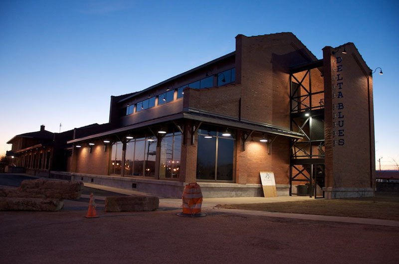
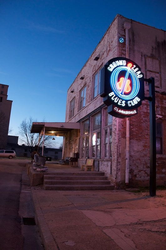
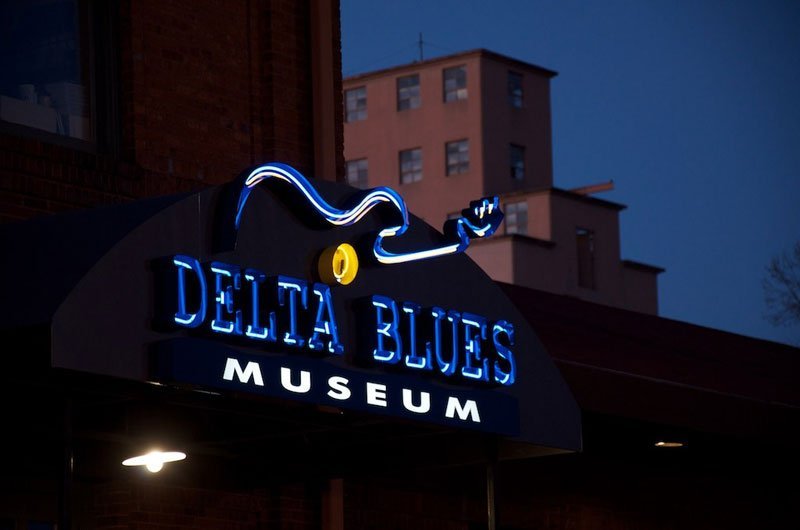
Quapaw is the closest landing to Clarksdale, Mississippi, the unrivaled blues capital of the mid- south.  Every night Tuesday through Sunday live blues music can be heard at one of many different venues including sho-‘nuf authentic down-home juke joints like Red’s as well as larger club venues like Ground Zero Blues Club (which is partially-owned by actor Morgan Freeman).  Clarksdale thrives with an incredible variety of eateries and superb overnight accommodations drenched with zealous Delta character.  Many paddlers choose the renovated shotgun shacks at the Shack Up Inn.  Clarksdale is the home of the world-famous Delta Blues Museum which should be the top-of-the-list for anyone making a visit.  Clarksdale is also the home base of the Lower Mississippi River experts at Quapaw Canoe Company (offering full-spectrum support for any paddler’s needs from guiding & outfitting to shuttling to rentals).  Owl’s Roost Tree House is reserved for paddlers.  Best Bet for high quality overnights: Clark House B&B.  Tell them we sent you for the paddler’s 10% discount!  www.clarkhouse.com  Wifi can be found at the Library, Miss Dell’s or Yazoo Pass Cafe.  Miss Dell’s sells good cheeses, hard sausages, and artisian French bread and multi-grain breads.  The Carnegie Public Library has an excellent exhibit of the Native American populations of the area with pottery, artifacts, maps and paintings depicting the pre-Columbian region.  Upstairs in the Children’s room is a cottonwood dugout canoe that kids pile into with books for the afternoon.   The library card logo is two voyageurs paddling a canoe, maybe Joliett & Marquette?  Needless to say this library is paddler friendly!


Blues Festivals: If your timing is right, you can paddle into Quapaw Landing and make a weekend furlough into Clarksdale for one or two of the best blues festivals in land where the blues was born:


1) The Sunflower River Blues & Gospel Festival is the purest blues festival in the nation, bringing in the artists who live & work in the Mississippi/Arkansas Delta areas and in many ways are simultaneously living the blues and also keeping the blues alive.  2nd full weekend in August.  Free and family friendly.  www.sunflowerfest.org


2) Juke Joint Festival turns downtown Clarksdale into a free-for-all music & arts & food extravaganza, every corner bursting with the sound of street musicians, at night the jukes open their doors and in some places it turns into an all night party.  Lots of activities for kids like a petting zoo and Monkey’s Riding Pigs, a climbing wall, and face painting.  Juke Joint is always the first weekend after Easter, which means it is tied into to the Full Willow Moon (you may recall Easter falls on the first Sunday after the first full moon after the spring equinox unless the full moon is on the equinox in which case it is after the following full moon).  www.jukejointfestival.com


Directions to Clarksdale from Quapaw Landing:

[CLICK HERE: Map of Clarksdale to Quapaw Landing]


Drive over old levee and go left on old levee road (gravel)

Head east on Old Levee Road (Burke’s Point Road)

Continue straight over big levee onto Farrell Rd (paved)

Continue straight over Mississippi Hwy 1 and follow short dog leg

Turn left onto Farrell to Stovall Rd

Turn right onto Stovall Rd

Continue straight onto Oakhurst Ave

Oakhurst becomes Riverside Ave

Take the 1st left onto 1st Street

Go over Sunflower River Bridge

Take the 1st right onto Sunflower Ave

You are now in downtown Clarksdale

2 blocks south on Sunflower to 3rd & Sunflower

Quapaw Canoe Company is located at 279 Sunflower


Total: 12.4 mi – about 34 mins


Directions to Quapaw from Clarksdale

[CLICK HERE: Map of Clarksdale to Quapaw Landing]


If you are already in Clarksdale and need directions to Quapaw here are the directions in reverse: The shortest and best route route to Quapaw Landing from Downtown Clarksdale is through Farrell. 12.4 miles total via 1st Street Bridge, right on Riverside Drive which becomes Oakhurst, follow that straight out of Clarksdale onto the Stovall Road and then take a left on Farrell Road through Farrell. From there drive straight out and over the levee, onto gravel surface Old Levee Road (Burke’s Point Road) and follow to the 2nd gravel road on the right over old levee, Quapaw Landing is marked with large brown sign.


Additional Topics to be added later to Clarksdale: Cat Head Music & Arts, Sunflower River, Restaurants & Accommodations, other festivals.


[CLICK HERE: for shuttling contacts in Clarksdale].

[CLICK HERE: Safe Paddling on the Big River].

CLICK HERE for the next section

Leave A Comment

SECTION MILE ACCESS CITY
Middle Mississippi & Bluegrass Hills / Bootheel 195-0, 954-850 ST. LOUIS TO CARUTHERSVILLE
Chickasaw Bluffs 850 – 737 CARUTHERSVILLE TO MEMPHIS
Upper Delta 737 – 663 MEMPHIS TO HELENA
Middle Delta 663 – 537 HELENA TO GREENVILLE
St. Francis to Helena
652.5 LBD Friars Point Landing (Unimproved)
652 – 650 LBD Friars Point Island
671 – 673 LBD St. Francis Bar
670 LBD St. Francis Dikes
669 LBD Flower Lake Dikes
668 RBD (A View Of) Crowley’s Ridge
668 – 663 RBD Buck Island (Prairie Point Towhead)
665.5 LBD Trotter’s Pass
663 RBD Helena Harbor
Helena Boat Ramps  
663 RBD Helena-West Helena
Quapaw Canoe Company – Helena Outpost  
661 Helena Bridge (Hernando De Soto Bridge – US HWY 49)
657 Yazoo Pass
Helena to Island 63
663 LBD Leaving Helena Harbor
Fleeted Barges  
Small Towns in Harbors  
Buoys and Other Stationary Objects  
Highlights of Civilizations  
Wild Miles  
Pollution Within the Helena Industrial Reach  
661.6 Helena Bridge (Hernando De Soto Bridge – US HWY 49)
657 LBD Yazoo Pass
How to Get Into the Old Entrance of the Yazoo Pass  
LBD Alternate Route to Vicksburg: Yazoo Pass
Yazoo Pass Mileage  
Rivers & Robert Johnson  
656 LBD East Motezuma Bar
657 – 654 RBD Montezuma Towhead
654.7 LBD Montezuma Landing
Shuttle Route Montezuma to Clarksdale  
652 LBD Friars Point
652.5 LBD Friars Point Landing (Unimproved)
652 – 650 LBD Friars Point Island
Beavers on the Lower Mississippi River  
652.2 RBD Kangaroo Point
648 LBD Horseshoe
646 – 649 RBD Dewberry Island 61
646 – 642 Old Town Bend
641 – 635 LBD Island 62
640.5 – 637 LBD Island 63
640.5 LBD Entrance to Top End of Island 63 Chute
637.5 LBD Entrance Into Bottom End of Island 63 Chute
637 LBD Back Channel Island 63
Quapaw Landing  
Clarksdale  
Island 63 to Hurricane
Muddy Waters Wilderness  
637 LBD Back Channel Island 63
Quapaw Landing  
Old Levee at Quapaw  
Levee Break Below Quapaw Landing  
Great Flood of 2011  
637.5 LBD Island 63 Chute
636 LBD Burke’s Point
The Flanking Maneuver  
634 RBD Modoc Old River Lake
632 LBD Robson Towhead
632.5 RBD Fair Landing
Jackson Cutoff  
Sunflower Cutoff  
625.6 RBD Mouth of the Mellwood Lake
624 – 627 LBD Sunflower Dikes
Diving Duck  
624.5 LBD Mouth of De Soto Lake
621 – 624 LBD Jug Harris Towhead
620.8 RBD Mouth of the Chute of Island 68
619 – 621 LBD Island 68
619 – 621 LBD Island 67
619.6 BD Wood Cottage
620 – 617 RBD Old Levee at Knowlton
616 LBD Knowlton Crevasse
619 – 609 RBD Island 69
615.5 RBD Island 69 Old Back Channel
616 – 614 LBD Cession’s Towhead
610 LBD Hurricane Pint (Dennis Landing)
Hurricane to Rosedale
605 – 610 LBD Island 70
The River Mirage Effect  
604 – 601 LBD Henrico Sandbar
603 – 597 Scrubgrass Bend
601.5 – 598 LBD Smith Point Sandbar
600.5 LBD Entrance
598 LBD Exit
Secret Channel Behind Smith Point Sandbar  
599 RBD Mouth of the White River
The White River  
Montgomery Point Lock & Dam  
At the Mouth of the White River  
How Does a Lock Work?  
Arkansas River: Little Rock, Fort Smith, Tulsa  
White River National Wildlife Refuge  
597.5 – 580 RBD Big Island
596 – 594 Victoria Bend
592.1 LBD Terrence Landing
597.5 RBD Entrance
591 LBD Exit
RBD Near Mile 3 of the Old Channel of the White  
Wreck of the Victor?  
Old Channel of the White  
Arkansas City Gage (AG)  
591 – 587 LBD Great River Road State Park
587 – 584.5 LBD Malone Field (Barge Fleeting Area)
594.5 LBD Mouth of the Rosedale Harbor
Rosedale Harbor  
Rosedale, Mississippi  
Rosedale to Arkansas City
Arkansas City Gage  
585 – 580 RBD Arkansas Bar
580 RBD Arkansas River
Paddling Past the Mouth of the Arkansas  
A Detour Up & Down the Arkansas  
Island Hopping  
The Floating Sensation  
Circumnavigation of the Big Island (52 Miles; 5-7 Days)  
Below the Arkansas Confluence  
581 – 576 LBD Prentiss Sandbar
578.4 RBD Napoleon Light
574.5 LBD Mouth of Lake Whittington
575.8 RBD Caulk Eddy
575 – 572.5 RBD Caulk Neck Bar
576 – 572 Caulk Neck Cutoff
572 – 567 Cypress Bend
Cypress Bend – Pallid Sturgeon  
571 – 567 Catfish Point Bar
568 RBD Chicot Landing
Reading Google Maps  
Approaching Choctaw Island  
Choctaw Island Geomorphology  
564 – 558 Chocktaw Bar Island
Note on Low-Water Camping  
Arkansas City Boat Ramp  
561.7 LBD Easton Landing – Mounds Boat Ramp
560.5 LBD Mounds Landing
Addendum: Take-Out in Greenville or Lake Village  
Best Campsites Along the Lower Mississippi Water Trail  
End of Trail  
Lower Delta 537 – 437 GREENVILLE TO VICKSBURG
Loess Bluffs 437 – 225 VICKSBURG TO BATON ROUGE
Atchafalaya River 159 – 0 SIMMESPORT TO MORGAN CITY
Louisiana Delta 229 – 10 BATON ROUGE TO VENICE
Birdsfoot Delta 10 – 0 VENICE TO GULF OF MEXICO