The Lower Mississippi River Water Trail
663 RBD HELENA-WEST HELENA
[CLICK HERE: Map of the Helena]
Mark Twain said that Helena occupies the prettiest situations on the Mississippi River… Twain should have also added: and the driest… Thanks to Crowley’s Ridge Helena has the distinction of being the only remaining population of any size to be found directly on the main channel in between Memphis & Vicksburg, some 300 miles of river. This fact in of itself deserves special attention. Other locales such as Rosedale, Greenville and Arkansas City that used to be sure-nuf river towns sitting right on the banks of the main channel and serviced by water vessels have been abandoned by the unstoppable shifting nature of the big river. Crowley’s Ridge provides Helena high ground and squeezes the river enough that you can still walk over the levee from downtown Cherry Street and watch towboats go sailing by, stick your toes in the water, and board your canoe. The American Queen Steamboat will resume passage in Spring 2012 with stops here.
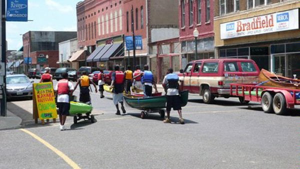
As such, Helena is the most logical place for a stop-over and resupply for the long distance paddler, and the best choice in the region as a one-stop push off location to base your Lower Mississippi Water Trail adventure from. (see below for second choice Clarksdale, Mississippi, which is located 10 miles inland from the river). Conveniences like the Post Office, Groceries, Book Store and the Library can all be found within walking distance, but be sure to hide or secure your canoe when you leave to walk into town. If you’re traveling in a team leave someone as guard. For wifi visit the library or the Delta Cultural Center. If you’re staying overnight in one of the many B&Bs, or need transportation anywhere, call Quapaw Canoe Company (870) 228-2266 for assistance. Recommended high quality overnight: Edwardian Inn. www.edwardianinn.com Tell them we sent you for a special paddler’s 10% discount.
You will want to visit the Delta Cultural Center in downtown Helena, just over the levee from the Harbor. There are two annexes, both dedicated to the history & culture of the Delta, and both definitely worth the extra hour or two for a visit. If you arrive mid-day, you can sit in on one of Sunshine Sonny Payne’s legendary King Biscuit Time Radio Program on AM1360, which broadcasts live from the Delta Cultural Center every day Monday-Friday from 12:15 – 12:45pm. www.deltaculturalcenter.com
[CLICK HERE: Helena Accommodations]
[CLICK HERE: Helena Services]
Quapaw Canoe Company — Helena Outpost
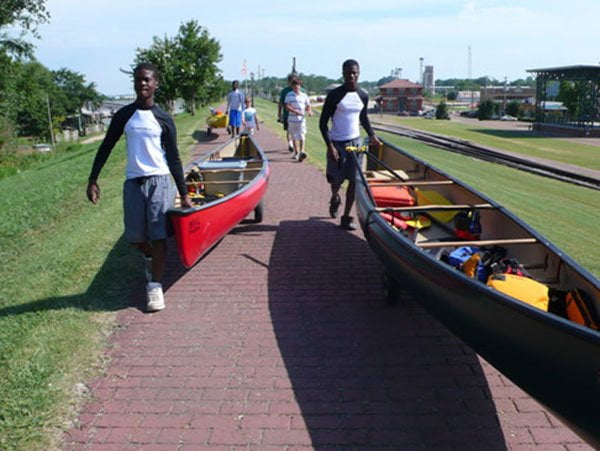
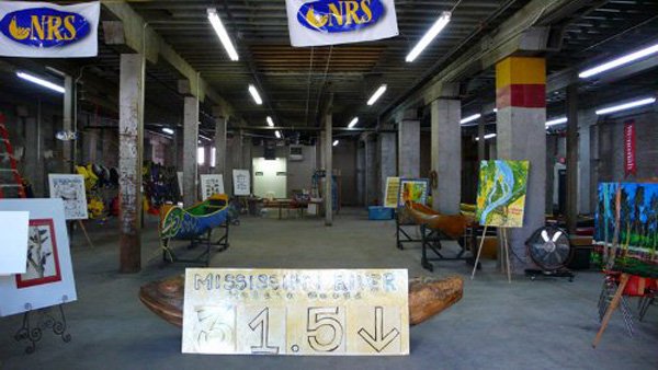
Quapaw Canoe Company is located just over the levee from the River Park at 411 Ohio Street with a 7,000 square foot warehouse full of canoes, kayaks and stand up paddleboards. QCC keeps river maps, county maps and state maps, and also books, magazines and other literature of interest to the big river paddler. Paddler’s support equipment such as paddles, life jackets, ropes, bailers, sponges, and etc. QCC offers workshops on Big River Canoe & Kayak Safety, as well as self-rescue and canoe building. Shuttles, storage and any other services for the paddler can be found here. (870) 228-2266. www.island63.com
King Biscuit Blues Festival
(2nd weekend of October)
Every Fall, during the second full weekend of October, one of the world’s greatest blues festivals takes place on the banks of the Mississippi River in downtown Helena. As you paddle down the main channel of the river the sounds of towboats and cicadas in the river valley is replaced with the scintillating vibrations of the purest music tradition that was born out of the cottonfields of the deep south — the music that broke down the barriers of segregation and led to the birth of rock & roll — the downhome Delta Blues!
Imagine listening to world-class blues artists from where you sit on the levee, incredible blues performances in front of you, the Mississippi River flowing behind! Traditionally the music starts Thursday at noon and runs through Saturday night. Music is presented at five different stages in the downtown, and historic Cherry Street becomes a pedestrian mall lined with food vendors, arts & crafts booths and street musicians. You can camp directly on the banks of the river in the Helena River Park, or you could camp on Buck Island and paddle in for the music. For your own safety please don’t drink & paddle, and exercise special caution when paddling at dusk, or after dark. Use running lights in case of close encounters with yachts, party boats and other motorized craft that frequent the harbor during festival time.
For more information about the King Biscuit Blues Festival, visit their website: www.kingbiscuitfestival.com
Leave A Comment
You must be logged in to post a comment.