The Lower Mississippi River Water Trail

Floating Underneath a Bridge

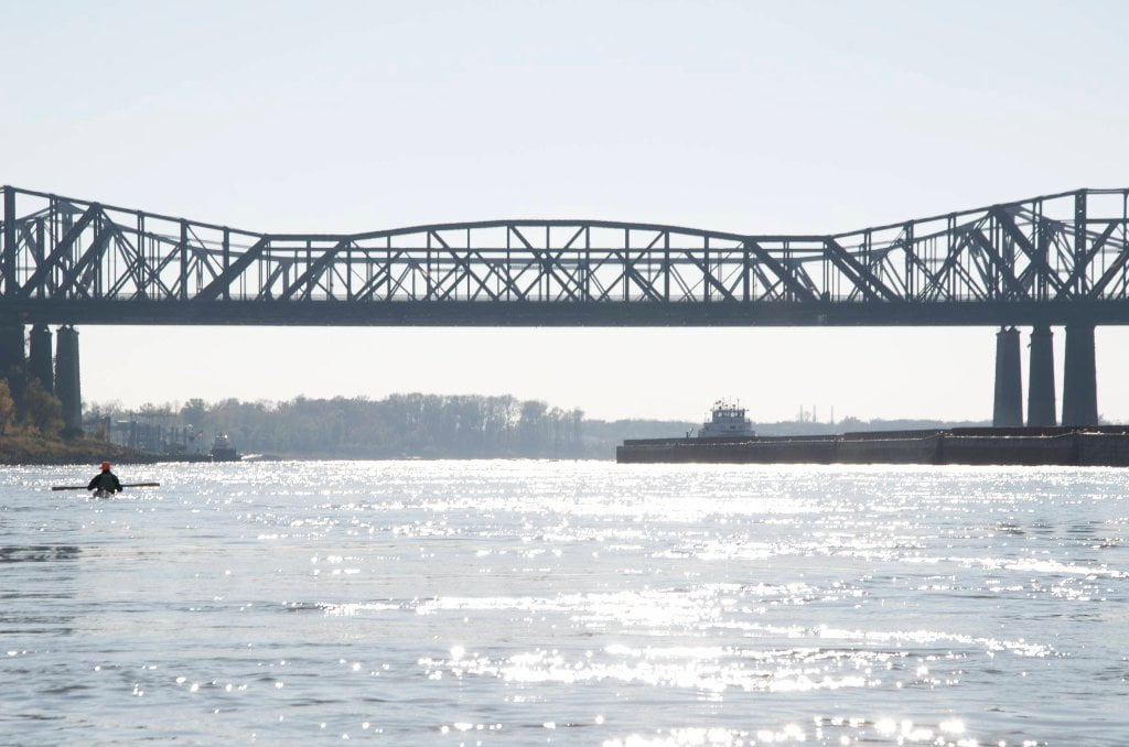
Floating underneath a bridge is one of the most sensational of Mississippi River experiences. For the paddler on the wide open Mississippi River it’s difficult to get a sense of motion, speed, and the river current. Sometimes it feels like you are sitting in a lake not a river, even though you are indeed floating within the throes of the biggest and most powerful river in North America! That is until you pass underneath a bridge. As you scoot downstream the water piles up high against the bridge pylons and then swirls around the backside with violent convulsions and contortions of water, and you will enjoy the distinct sensation of river motion as the bridge abutments mysteriously slide by and the geometric truss work and solid concrete road bed swing overhead with surprising speed, the higher the water the faster the speed. At high water this experience can be slightly disconcerting so fast the bridge slides by with sickening sucking sounds and explosions of agitated water. If you entertained any previous doubt about the power of the big river it will now be forever dashed away!


734.7 Lower Bridges/Engineer’s Bar

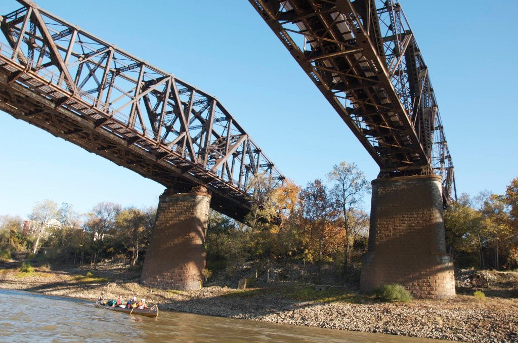
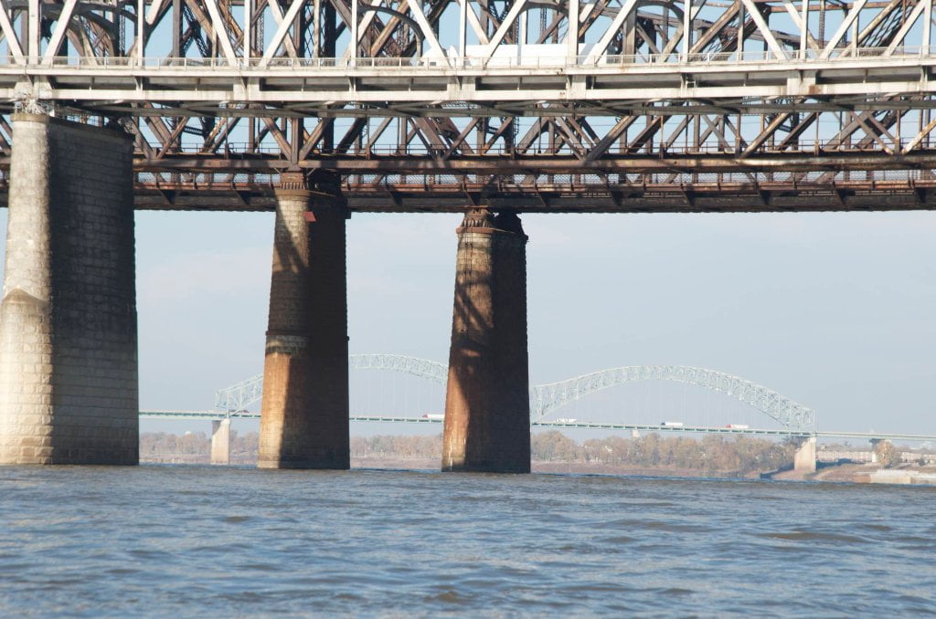
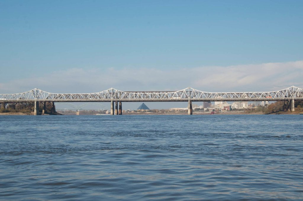
Engineer’s Bar is a giant sandbar at low water but quickly disappears as the river rises, and is completely swamped in medium water MG20 with only a few narrow bars clinging to various places along the right bank.  Don’t camp here at low water unless you can sleep comfortably through rumbling trains, non-stop interstate traffic and eighteen wheelers flying overhead.  No matter which way the wind is blowing you’re going to get noise, caustic aromas and sulfurous carbonaceous outpourings from many nearby sources.  Unless it’s dark, continue downstream ten miles and camp on the luxurious sands of the giant Ensley Bar/Dismal Point archipelago.  There are actually three bridges all clustered together that from the Lower Bridges of Memphis.  Avid Memphis kayaker Joe Royer says he prefers the shape and structure of the Lower Bridges over the more popular M Bridge.  When you float under their masses you can’t help up but notice the detailed frame work above and the beautiful stone abutments below.  Keep reading below for the history of each bridge.  If not interested fast forward to President’s Island.


734.7 The Frisco Bridge

It must be a law that any type of architectural structure in Memphis should have more than one name.  The Frisco Bridge is no exception.  Its original name was The Great Bridge at Memphis.  Later that was shortened to “The Memphis Bridge,” and commonly referred to as “The Iron Bridge.”  The name was changed again to The Frisco Bridge when the Harahan Bridge was built in 1916.  But no matter what name you call it, it is considered one of America’s great bridges.


The Frisco Bridge was the first bridge built on the lower Mississippi, and the only bridge south of St. Louis when it opened in 1892.  Building it was a monumental undertaking.  The US Army insisted on a 770 foot clear span for river navigation, and at least 75 feet of vertical clearance under the bridge.  The result was that the Frisco Bridge had the longest span of any bridge in the US at this time.  In order to secure a building permit, city officials insisted that the bridge somehow would carry pedestrian and buggy traffic as well as trains.  Thus the deck was built somewhat wider than would have been required for a single railroad track.  As a result, two way buggy traffic was periodically allowed.  If a train needed to cross the bridge, wagon and buggy traffic was stopped and cleared from the bridge, and then the train was allowed to cross. 

Leave A Comment

SECTION MILE ACCESS CITY
Middle Mississippi & Bluegrass Hills / Bootheel 195-0, 954-850 ST. LOUIS TO CARUTHERSVILLE
Chickasaw Bluffs 850 – 737 CARUTHERSVILLE TO MEMPHIS
Upper Delta 737 – 663 MEMPHIS TO HELENA
Introduction  
Memphis to Tunica
736 LBD Memphis, Tennessee, Mud Island Harbor
Buoys and Docks  
Floating Underneath a Bridge  
734.7 Lower Bridges/Engineer’s Bar
734.7 The Frisco Bridge
734.7 The Harahan Bridge
734.7 The Ghost Bunker
734.7 The Old Bridge (Memphis & Arkansas Bridge)
733 President’s Island
Fleeted Barges  
732 LBD Hole in the Wall ##2
727.3 TVA Transmission Lines
727.3 RBD The Wreck of the Raft
Tennessee Valley Authority  
725.5 LBD Entrance to McKellar Lake
7 Miles Up harbor Riverside Park Marina On McKellar Lake  
724 T.E. Maxon Wastewater Treatement Facility
Paddler’s Routes Below Memphis  
727 – 712 Dismal Point/Ensley Bar/Cow Island Bend Area
726 – 717 Armstrong/Dismal Point/Ensley Bar
720 Josie Harry Bar
718 – 713 Cow Island Bend
Goodbye Tennessee, Hullo Mississippi  
The Yazoo-Mississippi Delta and the Blues  
711 – 705 Cat Island No.50
710.8 LBD Starr Landing
712 – 695 Paddler’s Routes Around Cat Island and the Casinos
Pickett Dikes Back Channel  
639.8 RBD Tunica Riverpark Museum Boat Ramp
Tunica Riverpark Museum  
Basket Bar Dikes/Porter lake Dikes  
693.8 RBD Lost Lake Pass
703 Buck Island (No. 53)
701 Gold Strike Casino
700 Fitzgerald’s Casino
Tunica to Helena
700 Basket Bar
Paddler’s Routes Through Commerce and Mhoon Bends  
695 – 690 Commerce Bend
692.5 RBD Peter’s Boat Ramp
690 Rabbit Island
Switching to thhe Helena Gage  
Dikes and Water Levels  
687.5 Mhoon Landing
689 – 685 Mhoon Bar
690 – 683 Mhoon Bend
682 – 679 Whiskey Chute/Walnut Bend
680 Whitehall Crevasse
Paddler’s Routes Below Walnut Bend  
Stumpy Island, Shoo Fly Bar and Tunica Lake  
Main Channel  
677.4 LBD Tunica Runout
Behind Shoo Fly Bar  
Stumpy Island  
Walnut Bend Boat Ramp  
Tunica Lake Boat Ramp  
679 RBD Walnut Bend Boat Ramp
679 – 677 Hardin Cut-Off
677.4 LBD Pass Into Tunica Lake
677 – 676 Shoo Fly Bar
677 – 674 Stumpy Island
674.5 Harbert Point
672 RBD Mouth of the St. Francis River
Primitive Landing at the Mouth of the St. Francis Rive – Conditions  
RBD 3 Miles up St. Francis River Three Mile Ramp
Daytrip: St. Francis to Helena  
St. Francis to Helena: Paddler’s Descriptions  
For Intermedite Paddlers: Right Bank Route  
For Expert Paddlers: Left Bank Route  
St. Francis River  
671 – 673 LBD St. Francis Bar
669 LBD Flower Lake Dikes
668 RBD (A View of) Crowley’s Ridge D
668-663 RBD Buck Island (Prairie Point Towhead)
665.5 LBD Trotter’s Pass
663 RBD Helena Harbor
Helena Boat Ramps  
663 RBD Helena-West Helena
Quapaw Canoe Company – Helena Outpost  
Helena’s “Low Road” Into St. Francis National Forest  
King Biscuit Blues Festival (2nd Week of October)  
Helena to Friars
661.6 Helena Bridge (Hernando De Soto Bridge – US HWY 49)
663 RBD Leaving Helena Harbor
Fleeted Barges  
Small Towns in Harbors  
Buoys and Other Stationary Objects  
Highlights of Civilization  
Pollution Within the Helena Industrial Reach  
661.6 Helena Bridge (Hernando De Soto Bridge – US HWY 49)
657 LBD  
How to Get Into the Old Entrance of the Yazoo Pass  
LBD: Alternate Route to Vicksburg: Yazoo Pass  
Yazoo Pass Milage  
Rivers & Robert Johnson  
656 LBD East Montezuma Bar
657 – 654 RBD Montezuma Towhead
654.7 LBD Montezuma Landing
Shuttle Route Montezuma to Clarksdale  
652 LBD Friars Point
652.2 LBD Friars Point Landing (Unimproved)
What’s to Come Further Downstream  
Appendix  
Middle Delta 663 – 537 HELENA TO GREENVILLE
Lower Delta 537 – 437 GREENVILLE TO VICKSBURG
Loess Bluffs 437 – 225 VICKSBURG TO BATON ROUGE
Atchafalaya River 159 – 0 SIMMESPORT TO MORGAN CITY
Louisiana Delta 229 – 10 BATON ROUGE TO VENICE
Birdsfoot Delta 10 – 0 VENICE TO GULF OF MEXICO