The Lower Mississippi River Water Trail

Wax Lake Delta Passes

The Wax Lake Delta Passes are (from West to East):


Oryx Pass

Little Beach Pass

Fred Pass

Redhead Pass

Campground Pass

Shortcut Pass

Rookery Pass

Mallard Pass

Gadwell Pass

Main Pass

Greg Pass

Pintail Pass

East Pass

Getting Back

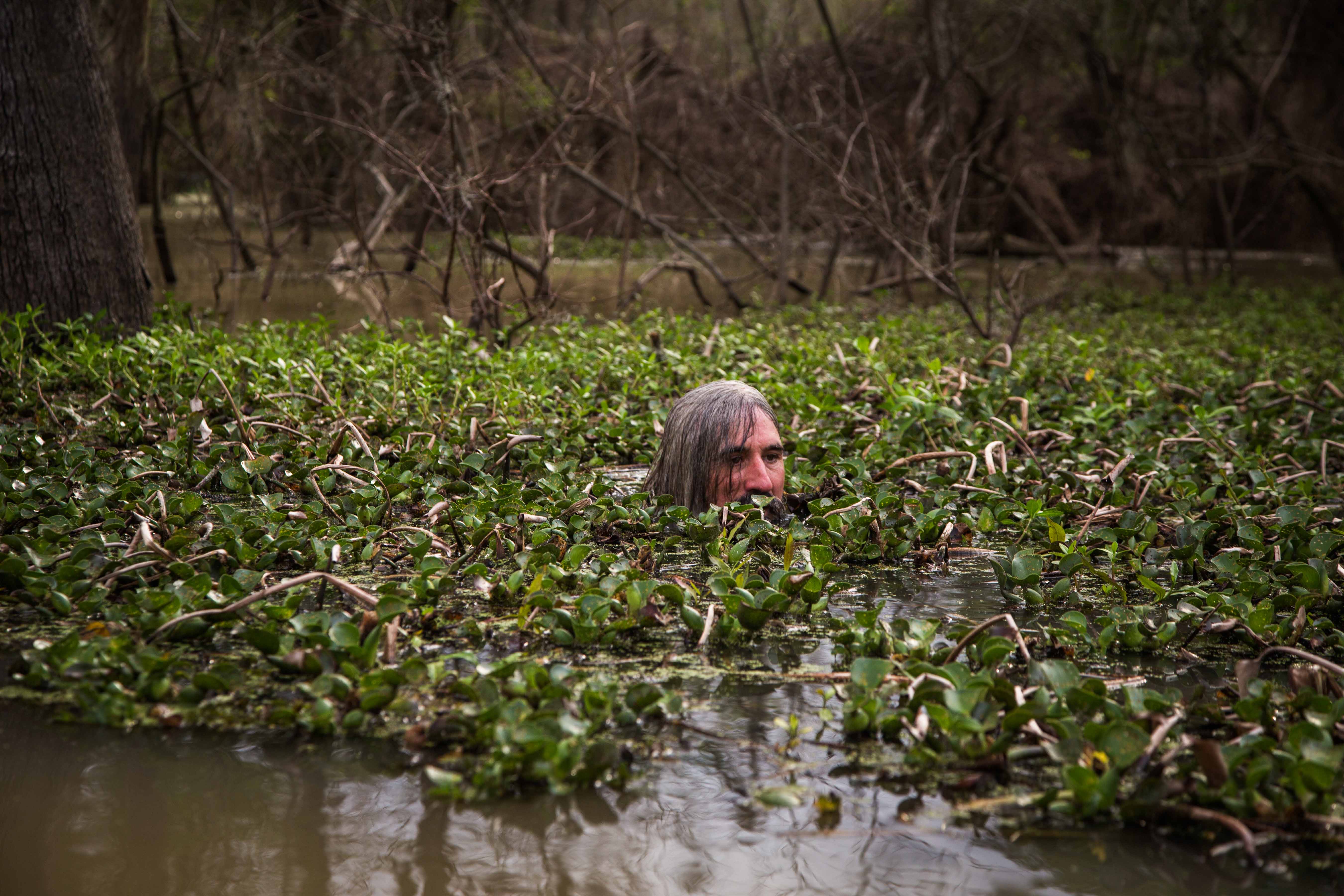
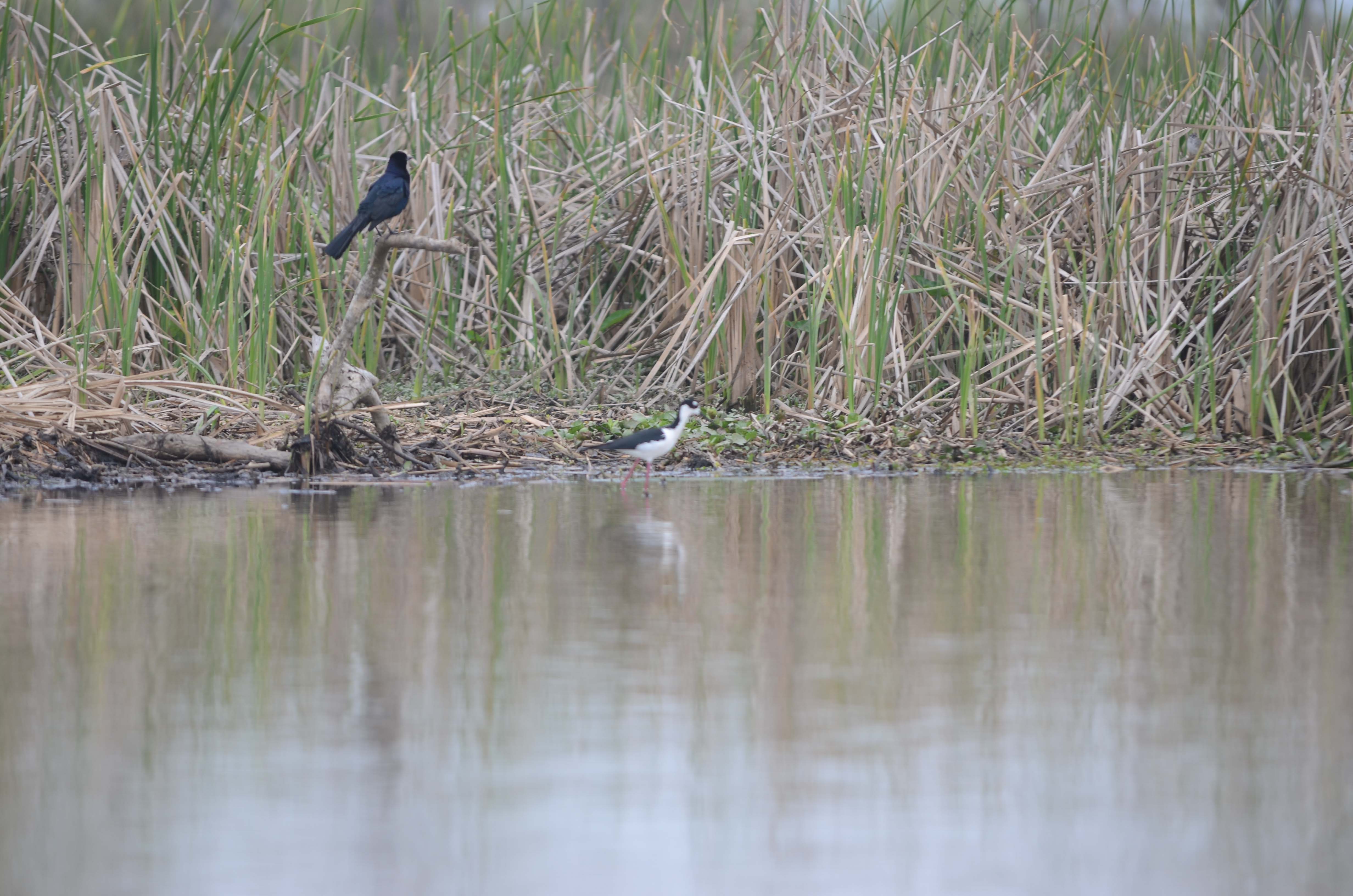
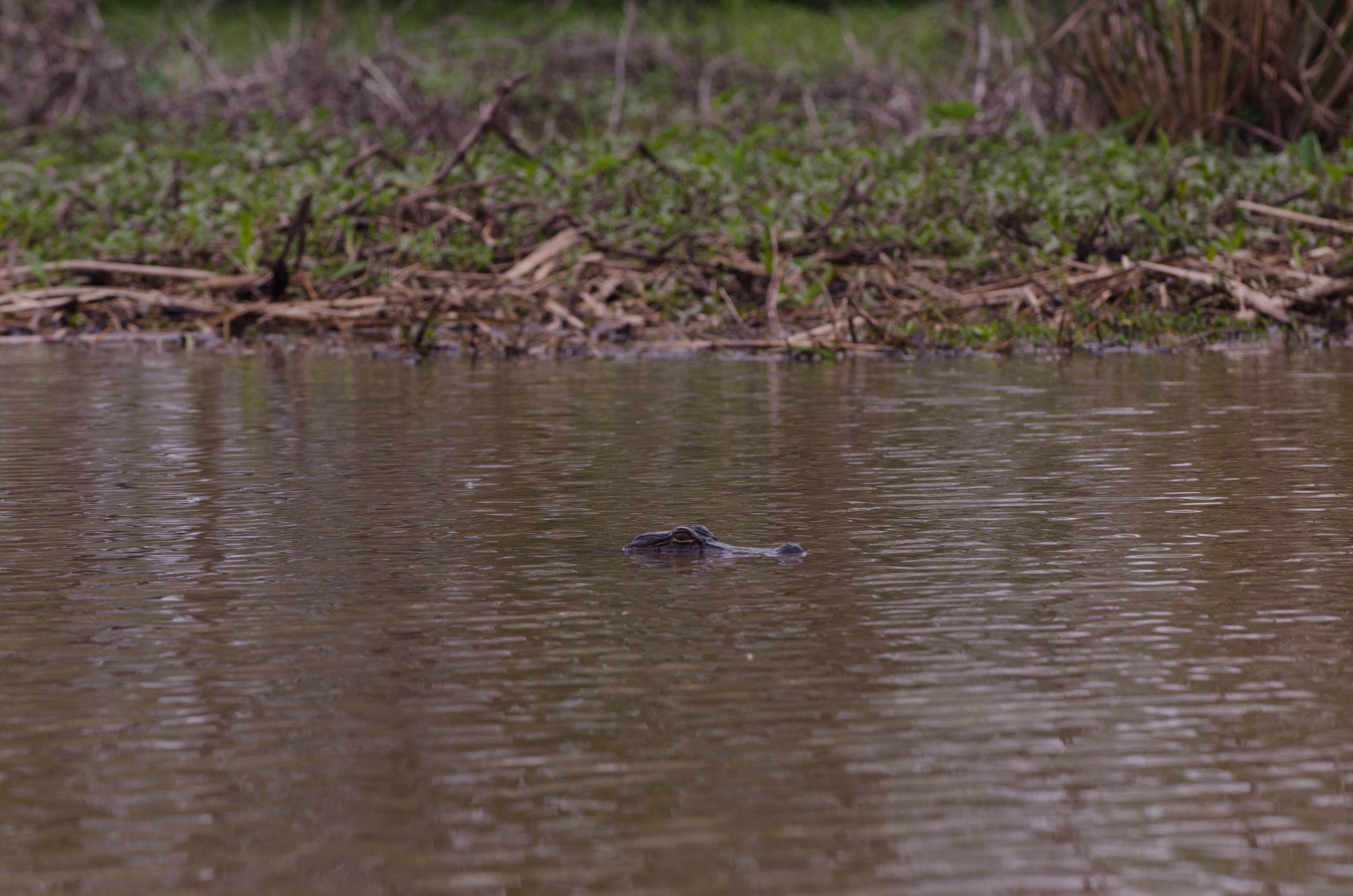
Whether you paddle back from the Gulf, or hitch a ride with a powerboat, the beautiful boat ramp below Berwick at the mouth of the Intracoastal Waterway is the best place to return to, and meet your shuttle home.  Downtown Berwick Boat Ramps is a close second but requires more upstream, paddling, and is a less desirable boat ramp.  A lot of paddlers in recent years have arranged for powerboats to shuttle them back from the ocean, or have hitched rides from passing fishing boats or workboats on their return to home port (which is almost always Morgan City for everyone in the Atchafalaya Delta).  And you might decide the same, that you don’t want to paddle upstream.  The current can sometimes be tough to paddle against, and the wind might be unfavorable.  You are probably exhausted from your long day’s paddle to reach the coast, and really don’t have the energy to paddle back.  But you can spend the night and do it in the morning.   You probably already know that it isn’t too tough to paddle upstream.  But we’re going to remind you here.  And also offer the option for an extra day or two for a supreme ending to your expedition.  You can make an extra campsite, and the take an extra day to paddle back to Morgan City.  You will never be more than 25 miles from any given extremity of the Atchafalaya Delta. The Quapaws are the downstream people, and the Omahas are the Upstream people.  You have been a Quapaw for three months or more.  Be an Omaha for a day or two.  Anyone who has paddled the length of the Mississippi can surely paddle back upstream 25 miles!  If the water is high and you have headwinds it might require 2 days of paddling.  Lastly and most importantly, there is a distinct beauty in being an Omaha and making the upstream paddle home.  You see the marshes and cane brakes and islands and mudflats up close and intimately in a way that you never do paddling downstream.  You get closer to birds and other wildlife.  You might see (and take photos of) animals you have not been able to approach, like nutria, osprey, green tree frogs, and maybe even a gator.

Upstream Paddling

The trick to upstream paddling is to find the path of least resistance.  On a river, that means staying as close to shore as possible without grounding out.  It helps to hug the inside of long bends when possible.  You will find it necessary to follow the long lines around wing dams, jetties and dikes, and paddle underneath docks or other man-made structures that get in the way.   But the most important skill in being an Omaha is learning to dive in and out of eddies.  Paddle like the French Voyageurs of the Lewis and Clark who paddled up the Missouri, and then later up the Columbia and Snake rivers.  Watch carefully in front of you for eddies and slow places and use them to your advantage.  Cut into every eddy you can find and relax when you can.  As the water speed increases past points in between eddies paddle hard and tough with quick bursts of energy.  Find the next slow place and take a break.  If the wind is blowing, hug the shore which offers the best protection.


For the most part paddling up the passes from the ocean will be enjoyable, and not too tough.  The water is slow in most passes (unless in flood).  Try to time your return with the incoming tide. The most challenging portion of your return paddle will be the last 10 miles into Morgan City where the Atchafalaya River runs most powerful.  The currents are almost always strong here, even with the tide in your favor.  Also, you will probably have to make a channel crossing somewhere along the way.  This might be a dangerous crossing with the frequent freighter traffic moving up and down the river through here.  But with careful examination, and monitoring your VHF marine radio on channel 13 you will be fine.  Make your crossing as quick as possible, in a perpendicular run straight for the opposite shore, even if it means losing some ground due to river flow.  You will quickly regain any lost ground once you resume paddling back up the other shore. 


In general the left bank descending (East Bank) will be easier to paddle alongside going upstream since it has slower flowing water.  You will have to maneuver in and out of the various bayous and bay along the way, but in general these variations in the riverbank further slow the current and make  the upstream haul a little easier.  Furthermore, the East bank features more inlets, passes, and other breaks that offer more opportunities for rest stops along the way.  Be sure to inspect Google Earth and search out options for the return journey.  Bayou Shaffer would be a good route which you can access through Sweetwater Bay, LBD 131.  But be creative and choose your own unique route.  You might hit a dead end or two, but that is part of the adventure.  The Atchafalaya Delta is a green tapestry woven of many strands of bayous, backwaters and passes, all of which you can see on Google Earth and find the route that seems best.

What do you do now with your Vessel?

After expedition completion, most paddlers arrange a return shuttle home with their canoe, kayak or paddleboard.  But a surprising number have no plans to keep their vessels, and try to sell them or donate them to a worthy cause when they reach the end of the river.  Some such recipients of donations in the past have been the Mighty Quapaw Apprenticeship Program, the Helena Canoe Club (outdoors program for Arkansas Delta youth), the Clarksdale Canoe Club (outdoors program for Mississippi Delta youth).  All of the above are associated with LiNKS, which means “Leave No Kid on Shore.”  You can donate any of your vessels to this successful program which has changed the lives of many southern youngsters who otherwise would have no access to the outdoors, and has assisted many of those to a career in outdoor leadership and education.

Leave A Comment

SECTION MILE ACCESS CITY
Middle Mississippi & Bluegrass Hills / Bootheel 195-0, 954-850 ST. LOUIS TO CARUTHERSVILLE
Chickasaw Bluffs 850 – 737 CARUTHERSVILLE TO MEMPHIS
Upper Delta 737 – 663 MEMPHIS TO HELENA
Middle Delta 663 – 537 HELENA TO GREENVILLE
Lower Delta 537 – 437 GREENVILLE TO VICKSBURG
Loess Bluffs 437 – 225 VICKSBURG TO BATON ROUGE
Atchafalaya River 159 – 0 SIMMESPORT TO MORGAN CITY
Atchafalaya Upper
Consider The Atchafalaya  
The Atchafalaya  
Alternate Route To The Gulf Of Mexico: The Atchafalaya River  
Big Geography Geography  
Atchafalaya Exit  
Intro: Atchafalaya River  
The Atchafalaya River: Best Route To The Gulf  
Best Water Levels To Paddle To The Gulf  
Traffic And Industry On The Atchafalaya  
NOTE TO PADDLERS:  
Who Is The Rivergator Written For?  
Reading The Rivergator:  
Panel Of Experts:  
Wild Miles:  
Warning: Stay Away From Intake Canals!  
What Are The Wild Miles?  
Big Trees And Floodplain:  
Important Note To Paddlers:  
Your Route: Main Channel Vs. Back Channel  
The Atchafalaya Split  
Maps And Mileage  
USACE 2012 Atchafalaya River And Outlets To Gulf Of Mexico  
Louisiana Geological Survey Atchafalaya Basin Map  
Maps Of The Atchafalaya Delta  
River Speed and Trip Duration  
Dangers Of Paddling Through Morgan City  
Expert Paddlers Only!  
Wind Direction And Speed  
Atchafalaya Delta Tides  
Tidal Influence:  
Estimate Your Camp Height  
Tidal Coefficient  
Tides In Rivers  
Tidal Bore  
Water Speed In The Passes  
Which Pass?  
Wax Lake Outlet: Alternate Route To The Gulf  
Shell Island Pass  
Location Island Pass  
Amerada Pass  
Main Channel: Melanie Island  
The Joy Of Reaching The Gulf  
Camping On The Gulf At The End Of The River  
The Best Gulf Beaches  
Open Water Of The Gulf?  
Some Helpful Hints:  
Getting Back To Land  
Getting Back  
Upstream Paddling  
What Do You Do Now With Your Vessel?  
LiNKS = Leave No Kid On Shore  
Atchafalaya Basinkeeper  
Bayou Teche Experience  
Bayou Sara kayak Rental  
Pack & Paddle  
Services For Lower Mississippi River Paddlers  
Lower Mississippi And Ohio River Forecast  
Reading Google Maps  
Lower Mississippi River Mileage  
Rivergator  
Towboat Protocol  
What To Pack:  
Atchafalaya Swamp Pack List:  
Primitive Camping In The Marshes & Swamps  
Biting Bugs  
Poison Ivy  
Can You Drink The Water?  
Where Do You Go? (To The Bathroom?)  
Water Quality  
The Atchafalaya Basinkeeper  
The Lower Mississippi Riverkeeper  
Environmental Reporting Phone Numbers:  
Maps And Mileage  
Louisiana Geological Survey Atchafalaya Basin Map  
Atchafalaya River Boat Ramps (Functional Jan 2016)  
River Gages  
Best Water Levels To Paddle To The Gulf  
What Do You Do Now With Your Vessel?  
LiNKS = Leave No Kid On Shore  
Left Bank And Right Bank  
Towboats And Buoys  
VHF Marine Radio  
Resources  
Cajun Culture And The Atchafalaya Wilderness  
SOLA Coffee Companies  
How To Brew A Great-Tasting Pot Of River-Rat Coffee  
The Atchafalaya  
A Note On Mileage  
A Note On Pronunciation  
Where To Start Your Atchafalaya River Expedition  
Leaving The Mississippi River  
Mississippi River Maps And Mileage  
NATCHEZ GAGE (NG)  
WATER LEVELS AND DIKES  
USING THE NATCHEZ GAGE:  
Three Inflow Openings At Old River  
Warning  
Old River Control Structure: 3 Inflow Channels  
316.3 RBD Hydro Inflow Channel
313.7 RBD Knox Landing
311.7 RBD Auxiliary Intake — Old River Control Structure
316.3 RBD Hydro Intake — Old River Control Structure
Short History Of The Old River Control Structure  
314.6 RBD Main Intake — Old River Control Structure
313 LBD Buffalo River
Clark Creek Natural Area  
311.7 LBD Clark Creek
311.7 – 310 LBD Tunica Hills Below Clark Creek (Mississippi Loess Bluffs ##6)
311 – 309 RBD Point Breeze
310.2 LBD Wilkinson Creek
306 LBD Welcome To Louisiana!
306 – 294 LBD Angola State Penitentiary
306 LBD Angola Ferry
304.5 – 303 LBD Shreve’s Bar
306 – 302 Back Channel Of Shreve’s Bar
306 – 302 Main Channel Of Shreve’s Bar
303.8 Old River Lock And Dam: Entrance To The Atchafalaya River
Leaving The Mississippi Towards Lock & Dam  
The Atchafalaya River: Best Route To The Gulf  
How Does A Lock & Dam Work?  
Contact Lockmaster  
Safe Paddling Through A Lock & Dam  
Lock Signals  
Inside The Lock Chamber  
Order Of Locking Through  
Mileage Down Lower Old River Channel  
6.9 RBD Three Rivers Junction
Red River  
Three Rivers WMA And Red River NWR  
Atchafalaya – A Modern History  
Atchafalaya Lower
Atchafalaya River Basin Biotas  
A Lived-In Landscape  
Atchafalaya Mileage  
RBD = Right Bank Descending, LBD = Left Bank Descending  
Gas Pipelines  
Simmesport Gage (SG)  
Water Levels According To The Simmesport Gage  
Maps And Mileage  
USACE 2012 Atchafalaya River And Outlets To Gulf Of Mexico  
Louisiana Geological Survey Atchafalaya Basin Map  
0.1 LBD Three Rivers Landing
1.4 LBD Small Dune
1.9 RBD Coville Bayou
3.4 LBD Bayou Coteau
4.5 Simmesport KCS Railroad Bridge
4.6 LBD Simmesport Sand Dune
4.8 LBD Kuhlman Bayou
5.5 Simmesport River Park
Simmesport, Louisiana  
Canadaville, Louisana  
9 – 11 RBD Odenburg Island Dikes
12.5 LBD Marine Bayou
13 – 20 Atchafalaya Squiggles
13.2 RBD Porcupine Point
14.5 LBD Cypress Point
14.5 RBD  
14.7 RBD Small Dunes
15.5 Primitive Boat Ramp (Private)
16 RBD Eddy Dune
16.5 RBD Trash Site
17 – 18 RBD Hick’s Landing/Gordon Point
18 – 20 LBD Bayou Point
Borrow Pits And Blue Holes  
20.5 LBD Small Sandy Shelves
20 – 25 Bayou Current To Elba Landing
22 RBD Cell Tower
22.2 LBD Small Hump Of Sand
23.4 RBD Barberton Landing
25.1 RBD Elba Landing
26.1 RBD Small Bluff Of Sand
26.2 LBD Broad Sandy Shelf
26.3 RBD Old Channel Of Bayou Rouge
27.1 LBD Point Coupee/Bayou Latenache Pumping Station
27.1 Morganza Floodway – North End
28.1 Underwater Pipeline Crossings
28.2 Aerial Pipeline Crossing
29.6 Melville Union Pacific Railroad Bridge
29.7 RBD Melville Boat Ramp (Primitive)
29.8 LBD Melville Ferry Barge East Bank Landing
30 – 40 Melville To Krotz Springs
31 LBD Broad Bay
31.5 LBD Cross Bayou
31.7 LBD Open Field Cow Pasture
32.5 LBD Cross Bayou Point (Owl Hoot)
35.6 LBD Small Sandbar
36 – 37 RBD Sandy Landings
37.1 RBD Cell Tower
39.7 LBD Bayou Sherman Point
Atchafalaya Basin Pack List For Swampy/Marshy Camp Sites  
Switching To The KROTZ SPRINGS GAGE (KG)  
Water Levels According To The Krotz Springs Gage  
38.5 – 42.7 Krotz Springs Utility Crossings
39.3 Water Drainage Structure: Origins Of The Teche River
39.5 RBD Cell Tower
39.6 LBD High Sand Dune
40.3 RBD Gravel Landing
40.3 Wire Suspension Bridge For Pipeline
41 Krotz Springs US Hwy 190 And 71 (2 Bridges)
41.5 Krotz Springs Union Pacific Railroad Bridge
42.3 RBD Krotz Springs Boat Ramp
Krotz Springs History  
42.5 RBD Port Of Krotz Springs
Krotz Springs To The Split  
Atchafalaya National Wildlife Refuge  
44 Sherburne Bend
44.5 RBD Frank Diesl Point
44.9 LBD Small Sand Dune
46.1 RBD Bayou Big Graw Boat Ramp
49.3 RBD Bayou Courtableau
49.7 LBD Coswell Point
51 RBD Courtableau Point
54.2 LBD End Of The East Bank Levee
55 LBD Atchafalaya NWR Boat Ramp
55.1 Two Blue Holes
55.4 LBD Alabama Point
56.4 RBD Old Atchafalaya Point
56.4 The Atchafalaya Split
Whiskey Bay Pilot Channel  
59.8 I-10 The Atchafalaya Basin Bridge
60 RBD Sand Dune
60.5 Union Texas Petrochemical Aerial Crossing
61.7 LBD Bayou Des Glaises Boat Ramp (Primitive)
62.3 LBD Bayou Des Glaises
66.4 RBD Splice Lake
66.7 LBD Pat’s Throat
68 RBD Willow Point
68.5 LBD Blue Heron Point
70.9 LBD Upper Grand River
73.4 LBD Little Tensas Bayou
75.3 LBD Texaco Resources Dock
75.5 RBD Splice Island (Bottom End)
Primitive Camping In The Marshes & Swamps  
75.7 LBD Jake’s Bayou
75.8 Three Major Pipelines
76.4 LBD Lake Mongoulois Point
77.2 RBD Bayou Chene
79.9 Tarleton Bayou
81.2 LBD Bayou Sorrel
81.2 LBD Bayou Sorrell: Alternate Route Down The Atchafalaya
3 Days On Dean’s Route  
East Grand Lake  
82.4 LBD Bee Bayou
82 – 99 Chicot Pass
83 Pipeline Tailings
83.2 Philip’s Canal
85.7 RBD Danbury Management Corp Dock
86.2 RBD Canal Entrance
86.8 RBD Canal Entrance
88.1 RBD Canal Entrance
89.7 RBD Pipeline Canal
91.2 Texas Gas Transmission Co. 12″ Gas Pipeline
Attakapas Island Wildlife Management Area  
95.4 LBD Blue Hole
96.1 Texas Gas Transmission Co. 12″ Gas Pipeline
96.7 Old Pipeline Canal
97.3 Louisiana Intrastate Gas Corp 4″ Gas Pipeline
98.2 RBD Myette Point
MORGAN CITY GAGE (MCG)  
Water Levels According To The Morgan City Gage  
Tidal Influence  
Estimate Your Camp Height  
100.2 LBD Blue Hole Landing
102 RBD Sixmile Lake: Access To Wax Lake Outlet
Wax Lake Outlet: Alternate Route To The Gulf  
Paradise Regained: The Wax Lake Delta  
103.8 LBD Narrow Bayou Leading To East Grand Lake
105 LBD Blue Point Chute: Shortcut To Cypress Wonderland
107.9 Exxon Gas Transmission Company 20″ Gas Pipeline
108.3 RBD Shortcut To Sixmile Lake
109 RBD Cypress Pass Back Channel
109.5 Duck Lake Channel
Duck Lake  
Many Rivers To Follow  
111.7 RBD Lower Atchafalaya River
111.7 RBD Riverside Pass
112.5 RBD Three Island Pass
113 RBD Little Island Pass
Main Channel Atchafalaya River  
115.1 American Pass
115.8 LBD Pipeline Canal To Dog Island Pass And Flat Lake
Flat Lake  
115.8 – 119.8 LBD Drew’s Island
117 RBD Stouts Point
119 Drew’s Pass
Dangers Of Paddling Through Morgan City  
Waves  
Small Tows In Harbors  
Towboats Vs. Tugboats  
Stay Off The River In Fog  
Fleeted Barges  
Buoys And Other Hazardous Stationary Objects  
119 LBD Swiftships Boat Yard
119.5 RBD Bayou Teche (Berwick) Lock & Dam
119.5 RBD Bayou Teche Water Trail
121 Morgan City US Hwy 90 Bridge
121.2 LBD Morgan City Downtown Landing
Morgan City  
121.3 Morgan City Texas And New Orleans Railroad Bridge
121.4 RBD Berwick Public Boat Ramp
121.4 LBD Mr. Charlie: The International Petroleum Museum
Intro: Morgan City To The Gulf Of Mexico  
Maps Of The Atchafalaya Delta  
Best Water Levels To Paddle To The Gulf  
Morgan City Gage (MCG)  
Water Levels According To The Morgan City Gage  
Flood Stage Warning:  
Weather And Tides  
Check The Winds And Weather  
Tidal Influence:  
Estimate Your Camp Height  
121.5 LBD Gulf Intracoastal Waterway (East)
121.7 – 130.3 Bateman Island
Pipelines And Electrical Lines  
124.2 RBD Berwick Intracoastal Waterway Boat Launch
124.2 RBD Gulf Intracoastal Waterway (West)
124.5 RBD Gulf Intracoastal Waterway Point (South Side)
Atchafalaya Delta Navigation Channel Buoys  
126-127 LBD Outside Bend Highground
127.4 Bateman Island Point And Bend
127.5 – 128 RBD Cypress Forests
128 – 131 LBD Sweetbay Lake
131 LBD Access To Bayou Shaffer Via Sweetbay Lake
131 RBD Glass Island
Night-Time Sky In The Atchafalaya Delta  
131.8 – 132 LBD Stands Of Young Cypress Trees
134 RBD Sandy Willow Spit
134 LBD Avoca Island Cutoff
135-136 LBD New Dike Wall
135-138 LBD New Navigation Channel Around He Avoca Island Bend
136 – 137 Sandy Marsh Island
137.8 RBD Shell Island Pass
Gulf Route: Crossing Over To The Wax Lake Delta  
Atchafalaya Delta Wildlife Management Area  
138.5 LBD Low Lying Muddy/Sandy Beach With Willows
139.1 LBD Small Shell Beach
140 LBD Deer Island
140.5 RBD Breaux’s Pass
140.2 LBD Location Island Pass
142.2 LBD East Pass
144.2 RBD Amerada Pass
144.2 RBD Willow Island
144.3 LBD God’s Island
144.8 RBD Log Island Pass
145.4 RBD Yvette Island
146 RBD Melanie Island
148.5 RBD Donna Island
150.5 RBD Eugene Island
151.5 LBD Bird Island East
Pount Au Fer/Raqet Pass  
Getting Back To Land  
Atchafalaya Delta WMA Campground  
Wax Lake Delta Passes  
Getting Back  
Upstream Paddling  
What Do You Do Now With Your Vessel?  
LiNKS = Leave No Kid On Shore  
Louisiana Delta 229 – 10 BATON ROUGE TO VENICE
Birdsfoot Delta 10 – 0 VENICE TO GULF OF MEXICO