The Lower Mississippi River Water Trail

Rivergator:

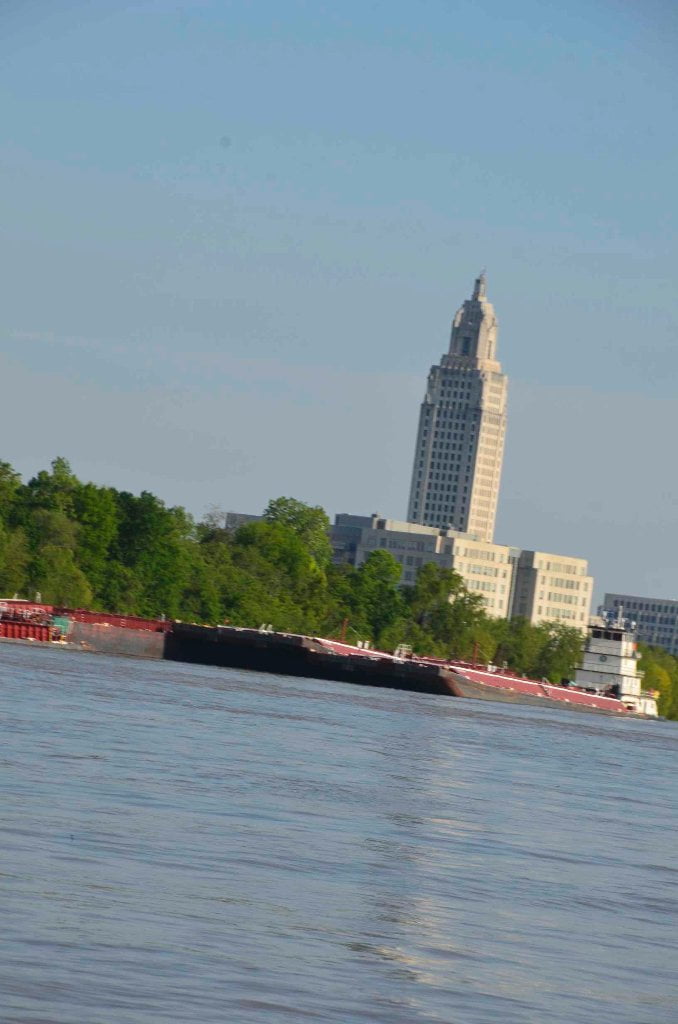
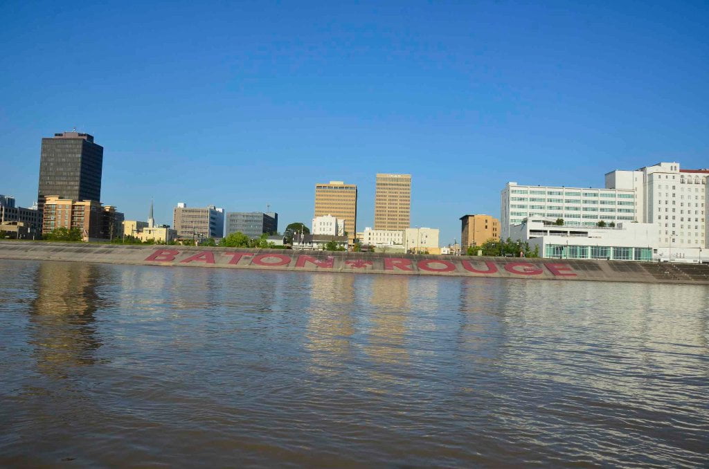
Baton Rouge to Venice

MM 230 – 10


© 2015 John Ruskey

For the Rivergator: Lower Mississippi River Water Trail

 The www.rivergator.org is a free public use website

presented by the Lower Mississippi River Foundation.

Re-printing of text and photos by permission only with proper credits.


Introduction:

New Challenges below Baton Rouge

Intro: Just when you thought you’ve learned everything there is to know about the Mississippi, you return to the river at Baton Rouge and find that the conditions have changed and the river is throwing bizarre new challenges at you — such as skyscraper-sized freighters steaming up the main channel making the biggest and most chaotic waves you’ve ever seen! You’ll experience mini-tsunamis rolling in and out of your campsite with alarming changes in water level. Your friends, the towboats you have been paddling with since Minneapolis (or Sioux City), are now joined by real honest-to-God ocean-going tugboats serving the needs of freighters. The endless lines of trees and muddy banks you enjoyed upstream are here replaced by endless miles of fleeted barges and refinery pipelines and power plant smokestacks. Wind direction becomes a concern at camp when you wonder what petrochemical plant might be sending foul carbonaceous (or worse) aromas your way throughout your sleep.

Okay, so you’ve successfully paddled two thousand miles from Lake Itasca, or maybe four thousand miles from Three Forks, Montana. The river has gently taught you its ways as you’ve proceeded downstream. We call this education “the greater school of river-rats” or BRU — the Big River University!

BRU opened up its doors to you with the lighthearted lessons of the headwaters: braided channels, open lake crossings, portaging over dams, eddies, and some swift water. Later you graduated to paddling with tows (Minneapolis), and safe paddling through locks & dams. Still later you advanced a degree when you learned to paddle through big industry with bigger tows (St. Louis). Then you reached the mouth of the Ohio. Here you begin your specialized advanced degree in Big River Navigation at BRU where the river swells to its fullness with the biggest tows ever seen on the face of the earth. Bigger whirlpools, giant eddies, and the biggest boils you’ve ever paddled through, some tending towards aquatic violence on their edges. BRU on the Lower Miss requires long hours of paddling, concentration, and quick decisions. Everything you’ve learned up to this point must be accessed and utilized: you must be able to read the river like the steamboat pilot training Mark Twain received under his mentor, the volcanic Captain Bixby (as related in his 1883 Life on the Mississippi). On the Lower Mississippi you need to apply all your river abilities to read to this monster mile-wide river swelling to its natural fullness and flexing all of its muscly challenges. And now 600 miles later downstream you have advanced to this last advanced stage of BRU as you have mastered paddling with those behemoths, and have made good navigation choices on the big volume waters. What else could you possibly need to learn to graduate (ie: safely paddle to the Gulf)?

Well, here below Baton Rouge is your entrance into the graduate program of the BRU — the Big River University. The river always has the last say and always keeps a few tricks hidden under her muddy waters! As you continue past the capitol city of Louisiana you will now have several new big river paradigms to adjust the body of your river knowledge to, namely 1) freighters, 2) endless miles of fleeted barges and anchored freighters, 3) no islands (below Bonnet Carre), 4) very limited campsites, and finally 5) tides. You will need to learn to paddle and camp with these new (and very significant) challenges always in the forefront of your decision making.

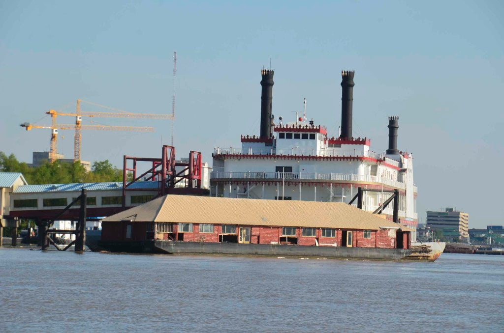
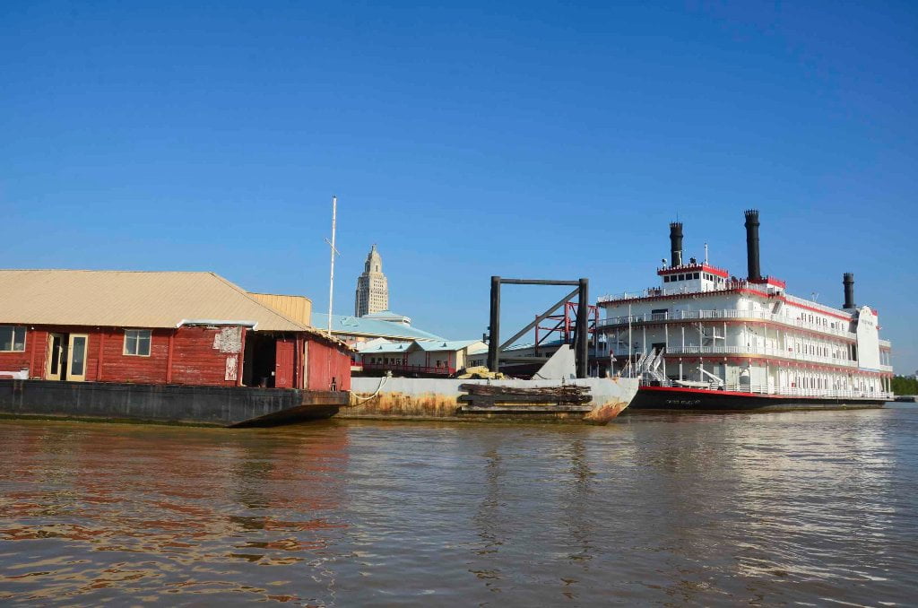
Welcome paddlers to “Chemical Corridor,” the last remaining and most difficult section of the Mississippi River before you reach the Gulf of Mexico!

Waves

Paddlers will have to be especially vigilant about increased wave height and unpredictability below Baton Rouge. Think of paddling along sea cliffs. This is the effect that parked barges, tows and freighters have on the waves bouncing around the main channel. Endless rip-rap add to this effect. Steel and concrete docking even more so. Gone is the dampening effect of long open beaches and soft muddy banks found above Baton Rouge. The result is the biggest and wildest waves you will see anywhere on the Mississippi River, all bouncing back and forth in unpredictable patterns, piling over one another in compound waves, and coming from all directions, some building in scale to resemble mini rogue waves. Picture a toyboat in a bathtub with a playful kid. This is how you will feel, and how you will look from the distance. The 20-mile industrial “gauntlet” below the Great Arch in St. Louis will give you a taste of what the next 230 miles has in store for you. Be careful when making landings or setting up camp. Pull your vessel high above water level, three feet above when possible. Waves from passing work boats, tugs and freighters could wash over any low places, especially within inlets or at the edge of shallows (where the wave heights and tide effects tend to multiply frighteningly).

The Gauntlet

Paddling downstream below Baton Rouge follows the classic dictionary definition for “Running The Gauntlet” (1) To go through an intimidating or dangerous crowd, place, or experience in order to reach a goal. (2) To undergo the punishment of receiving blows while running between two rows of men with sticks.

On the river you will have to paddle miles and miles of freighters, cruise ships, container ships, tugboats, towboats, workboats, wharves, docks, buoys, anchors, steel cables, choppy waves, weird currents, and many other challenges which might be exacerbated by wind, darkness and your state of mind. The waves slap you from side to side as they ricochet back and forth between passing tows and fleeted barges. Hard steel edges make for bigger choppier waves. Concrete docks and bank stabilization the same. You, the lonely paddler amidst the industrial megalith, must do your best to stay upright amongst the waves. The goal is of course the Gulf of Mexico, the open salty waters below the Mississippi River Delta.

When to stay on shore

As always, impatience is your worst enemy on the river. Stay on shore and await a change in the weather if any of the following conditions apply: (a) If the wind is blowing 15mph or higher from any southerly or easterly quadrants, or 20mph or higher from any other quadrant; (b) if you have three hours or less before sunset; or (c) if you are not feeling good about things (sailor’s sixth sense). Don’t allow complicating factors to get in the way of safe travel and making good decisions. Get a good night’s sleep and enjoy a full breakfast before departure. Inspect your vessel to be sure it’s in top shape and will not surprise you with any compromises in the middle of the river. Make sure you are in good communication with everyone in your party. Settle any differences. Do not let any grievances leave shore. You need to be in your best shape possible, physically, mentally and spiritually, to safely navigate what lies below you downstream in Chemical Corridor.

Leave A Comment

SECTION MILE ACCESS CITY
Middle Mississippi & Bluegrass Hills / Bootheel 195-0, 954-850 ST. LOUIS TO CARUTHERSVILLE
Chickasaw Bluffs 850 – 737 CARUTHERSVILLE TO MEMPHIS
Upper Delta 736 – 663 MEMPHIS TO HELENA
Middle Delta 663 – 537 HELENA TO GREENVILLE
Lower Delta 537 – 437 GREENVILLE TO VICKSBURG
Loess Bluffs 437 – 225 VICKSBURG TO BATON ROUGE
Atchafalaya River 159 – 0 SIMMESPORT TO MORGAN CITY
Louisiana Delta 229 – 10 BATON ROUGE TO VENICE
Introduction  
Baton Rouge to New Orleans
Baton Rouge Gauge (BR)  
230 LBD Welcome to Baton Rouge: Downtown Riverfront
Baton Rouge Sites and Services of interest to Paddlers  
Food  
229.6 – 228.6 RBD Port Of Baton Rouge
The I-10 (New) Bridge  
229 LBD Glass Beach
Directions to Glass Beach  
Daytrips from Baton Rouge  
229 LBD Old Municipal Dock
229 – 228.5 Lower Baton Rouge Anchorage
229.1 RBD Baton Rouge City Wharf: Community Coffee
SoLa Coffee Companies  
How to Brew a Great-Tasting Pot of River-Rat Coffee:  
228.9 RBD Cargill Greater Baton Rouge Port Commission Grain Wharf
Port Allen/West Baton  
229 – 228.5 LBD Lower Baton Rouge Anchorage
228.5 LBD Economy Boat Store Wharf
228.4 RBD Mouth of ICWW
228.4 RBD Intracoastal Waterway (Morgan City Port Allen Route)
Resupply from Intercostal Waterway Boat Ramp (Under Hwy 1)  
228.4 – 226 RBD Cargo Carriers Port Allen Fleet West Bank Mooring
What are Fleeted Barges?  
Paddling out of the Baton Rouge Industrial Reach  
228 RBD LSU Tigers Stadium
227.4 LBD LSU
Highlights of Industry  
Toxic Release Inventory (TRI)  
Chem Corridor Superlatives  
High-Tech Materials Used by Paddlers  
What about Terreprene?  
Green Spaces  
Wild Miles  
225.3 – 223.9 RBD Western Towing Company West Bank Fleet
225-223 Red Eye Crossing
224-221 LBD Missouri Bend Pointway
223-222 LBD Missouri Island
RBD 221.8 Dow Chemical Missouri U.S.A., Plaquemine Dock No. 2. Hydrocarbon Wharf
222 and 210 RBD Dow Chemical Company Louisiana Operations, Dexco, and Shintech Addis
Duncan Point/Manchac Point/Plaquemine Island/Sunshine Green Space  
LBD 221-220 Duncan Point
219 RBD Lowlands Opposite Duncan Point
220 RBD Sardine Point
220 RBD – 218 LBD Sardine Crossing
219 RBD Comeaux Landing
216.5 RBD Australia Landing
216.5 LBD L’Auberge Casino
216.2 LBD Longwood Plantation
214.5 RBD Manchac Point
215 LBD Bayou Manchac
212.8 LBD Small Dune
213 LBD – 211 RBD Medora Crossing
211.5 RBD The Medora Site
211 – 209.5 LBD Plaquemine Island
210.5 RBD Morrisonville
210.4 RBD Morrisonville Landing
210 RBD Dow Chemical Company Louisiana Operations
210 RBD Dow Chemical Wastewater Outfall
208.5 RBD Dow Chemical Plaquemine Point Shipyard, Cleaning Wharf
209 RBD Myrtle Grove Trailer Park
208.7 RBD Plaquemine Beach
City of Plaquemine  
Bayou Plaquemine: Alternate Route to Gulf via Atchafalaya Basin  
209 LBD Plaquemine Point
208.5 RBD Plaquemine Boat Ramp
208 RBD – 207.5 LBD Plaquemine Ferry
206 RBD Reveilletown
204.8 LBD Shintec Louisiana Plaquemine PVC Plant
205.2 RBD Small Dune
206-204 RBD Sunshine Wetlands
206 RBD – 203 Granada Crossing
203.8 LBD LBC Sunshine Terminal
203.3 RBD SNF Flopam
201.6 LBD Willow Glen Power Plant
201 – 199 RBD Point Pleasant
200 LBD – 197 RBD Bayou Goula Crossing
200.1 LBD Industrial Complex including Taminco Inc., Syngenta, and Olin Chlor Alkali
Point Pleasant/Bayou Goula Island/Point Claire Green Space  
195.6 RBD Bayou Goula Landing
196 – 194.5 LBD Bayou Goula Island
Bayou Goula  
194.8 RBD Nottaway Plantation
194 LBD Point Clair
193.5 RBD White Castle
192.7 RBD Cane Sugar Refinery (Cora Texas Manufacturing Co)
191.5 RBD – 191 LBD White Castle-Carville Ferry
Carville  
191 LBD Carville Landing
190.8 LBD Carville Boat Ramp
191 – 190 LBD White Castle Anchorage
Geismar Industrial Reach  
188-184 RBD Claiborne Island
Nurdles: What Are Nurdles?  
187.9 LBD Total Petrochemicals and Refining and Caravelle Energy Center
186.8 LBD Industrial Complex including PCS Nitrogen, Honeywell, and Williams Olefins
185.3 LBD Methanex
185 LBD Industrial Complex including Borden Chemicals, Westlake Chemicals, and Momentive Specialty Chemicals
185 LBD Geismar
184.6 LBD Rubicon and Lion Copolymer
183.9 IMTT Geismar and BASF
183.2 LBD Shell Chemical and OxyChem
183.2 LBD Sandbar below Shell Geismar
182.8 – 182 LBD Carline’s Geismar Fleeting
182 LBD Old Inger Oil Refinery Superfund Site
Philadelphia Point/ Eighty-One Mile Point Greenspace  
181 – 179 RBD Philadelphia Point
180.3 – 178.8 LBD L & L Dry Bulk Transfer & Mooring
177.3 – 175.2 LBD L & L Fleeting and Mooring
Big Foot  
178 LBD Eighty-One Mile Point
Donaldsonville Industrial Reach  
177.9 RBD Smoke Bend Sand Dune
177 RBD – 174 LBD Smoke Bend Crossing
175.4 RBD Bayou Lafourche Water Intake
175.2 Donaldsonville Boat Ramp
175 RBD Donaldsonville
173.5 RBD CF Industries
173.7 LBD Private House and Boat Ramp
Bringier Point/Houmas Point Greenspace  
173 LBD Bringier Point
172 RBD Point Houmas
170.7 LBD Houmas House Plantation and Gardens
170 LBD Burnside Terminal and Burnside Alumina Refinery
169.2 LBD Chemours
168.3 LBD Motiva Convent Refinery
167.5 Sunshine Bridge
167 -165 LBD Sunshine Anchorage
Bonfires on the Levee  
167 RBD Mosaic Faustina and American Styrenics
163.8 LBD Zen-Noh Grain
165 LBD Shell Beach
164.5 LBD Zen-Noh Point
163 LBD Nucor Steel
162 LBD Romeville Dune
161 LBD – 158 RBD Rich Bend Crossing
161.5 LBD Occidental Chemical Convent
160.9 LBD SunCoke Energy Convent Marine Terminal
160.7 RBD thru 158 RBD St James Petroleum Terminals
160.4 Mosaic Uncle Sam
159.5 RBD Burton Lane
160 RBD Chatman Town
156 LBD College Point Beach & Greenspace
Manresa On The Mississippi  
156 RBD – 152 LBD Belmont Crossing
Oak Alley Plantation  
150.4 LBD ADM Growmark St. Elmo
150.5 LBD St. Elmo Terminal Grain Elevator Wharf
149.3 LBD Paulina – Poche Park
148.1 LBD Grandview Beach
Switching To The New Orleans Gage (NO)  
Water levels according to the New Orleans Gage (NO)  
149 – 147 LBD Upper Grandview Anchorage
147 Gramercy
146.2 LBD Louisiana Sugar Refining (LSR)
145.6 LBD Rain CII Gramercy Calciner
145.4 LBD Noranda Alumina Gramercy
145.9 Gramercy Bridge (Veteran’s Memorial Bridge)
145.4 Kaiser Bauxite
Blind River  
Maurepas Swamp Wildlife Management Area  
Manchac Wildlife Management Area  
144 RBD Angelina Landing
143.6 LBD Nalco Garyville And Evonik Stockhausen
Angelina/Willow Bend Greenspace  
143.4 LBD MARQUEZ
142.4 LBD Forty-Eight Mile Point/ Belle Point
142.3 RBD Wego
142 RBD Willow Bend
141 RBD – 139 LBD Willow Bend Crossing
141.7 LBD Garyville
139.75 LBD Lions
140.6 – 140.0 LBD Marathon Ashland Petroleum, Louisiana Refining Docks 1, 2, 3 & 4
140.5 LBD Marathon Garyville Refinery, Pinnacle Polymers, And Air Products And Chemicals
139.8 LBD Cargill, Inc. – NAGOC Reserve Oilseed Wharf
139.4 LBD Cargill
139.2 LBD ADM/Growmark, Reserve Elevator Wharf
138.7 LBD Port Of South Louisiana, Globalplex Bulk Commodities Wharves
138 RBD Reserve
138 RBD – 137.6 LBD Reserve Ferry
137.8 – 135 RBD Cargo Carriers Fleeting & Mooring
135.4 – 134.7 LBD La Place Anchorage
136.7 LBD Elmwood Marine Services Repair Wharf And Capital Marine Supply, Triangle Fleet Moorings
135.7 LBD DuPont Pontchartrain Works
Bonnet Carre/Thirty-Five Mile Point Green Space  
133 RBD Bonnet Carre Point
132.9 LBD Bonnet Carre Crevasse
132.4 LBD ArcelorMittal (Bayou Steel)
132 – 131.5 RBD BONNET CARRE ISLAND
131.5 RBD Hymelia Crevasse
131 RBD HYMELIA BEACH
130 RBD Killona Landing
130 LBD THIRTY-FIVE MILE POINT
Taft/Hahnville/Norco Industrial Reach  
129.8 RBD Entergy Louisiana, Waterford Steam Electric Plants 1 & 2 Wharf
129.5 RBD Waterford 3
129.5 LBD Entergy Louisiana, Inc., Little Gypsy Power Plant
128.9 RBD Occidental Chemical Koch Industries, Taft Plant Dock
128.8 LBD False Boat Ramp
128.8 – 127.3 LBD BONNET CARRE SPILLWAY
128.8 – 127.3 LBD Bonnet Carre Anchorage
127.3 LBD SPILLWAY BOAT RAMP
128.8 – 127.3 Kugler And Kenner Cemeteries
128.4 RBD Air Products, Air Liquide, Praxair, Galata, Koch Nitrogen
128.1 – 127.8 RBD Dow Chemical Company (Union Carbide Corp)
127.8 RBD Taft
127 RBD Upper St. Rose Repair Wharf And Fleet Mooring
127 RBD Upper St. Rose Repair & Fleeting
127 LBD Shell Chemical Norco Plant
126.1 LBD Diamond And Norco
126.9 LBD Shell Norco Chemical Plant West Site And Momentive Specialty Chemicals
126 LBD Motiva Enterprises, Norco Refining Dock 1, 2, 3 & 4
126 LBD Bayou Trepagnier
125.5 LBD Shell, Motiva, Valero, Union Carbide, And Rain CII
125 LBD Valero Refining Corp., Norco Refinery Dock No.1, 2, 3, 4, And 5
124.6 LBD New Sarpy
124.4 RBD T.T. Barge Mile 125 Barge Launch And Repair Wharf
123.7 LBD 26-Mile False Point
122.7 LBD Twenty-Six Mile Point (And Greenspace)
122.5 LBD Ormand Landing And Plantation
123 RBD Dufresne
122 RBD Small Dune At Luling
121.6 RBD Hale Boggs – Luling Bridge
121 LBD Old Pan American Southern Oil Refinery
120.8 RBD Old Luling Ferry Ramp (Defunct)
Luling/Destrehan/St. Rose/Ama Industrial Reach  
120.5 LBD ADM/Growmark Destrehan Elevator Wharf
120.5 LBD Bunge Corp North America, Destrehan Elevator Wharf
120 RBD Monsanto Luling Docks No’s 2, 3, And 4
120 RBD Monsanto, OxyChem, And Air Products
Roundup  
118.8 LBD International Matex, St. Rose Terminal, Berths Nos. 2, 3, 4, 6, 7, 8, 9, 10, 11, 12, 13 14, And 15
118.6 LBD International Matex Tank Terminals (IMTT) And Shell
118.7 RBD Davis Crevasse
118 RBD – 115 LBD Fairview Crossing
117.6 RBD ADM/Growmark, Ama Grain Elevator Dock
117.5 LBD St. Rose Landing
116 – 113 RBD Kenner Bend Anchorage
114.5 RBD Fortier Manufacturing Complex
Louis Armstrong International Airport  
114.7 City Of Kenner Landing (Upper)
113 LBD City of Kenner Landing
113 LBD Kenner, LA
111-109 Wood Resources Fleeting
111 RBD Channel Shipyard Wharf
111 RBD ARTCO New Orleans Shipyard Slip
111.8 LBD Small Sand Dune
112.1 East Jefferson Parish Discharge
111 – 108 Avondale Bend/The “River Illusion”
112 – 109 LBD Twelve Mile Point Greenspace
110 – 109 LBD Twelve Mile Point
Elmwood/Bridge City/Jefferson Industrial Reach  
108.2 RBD International Matex Tank Terminals (IMTT) Avondale
107.7 RBD Avondale Ship Yard
107.6 RBD Litton Industries
106.1 Huey P. Long Bridge
106.1 RBD Fort Banks
105 LBD Camp Parapet & Parapet Line
104.8 RBD T.T. Barge Coatings, Inc
104.2 LBD Ochsner Medical Center
104.3 LBD Batture Houses
Mahalia Jackson  
104 RBD Nine-Mile Point
103.8 RBD Entergy Louisiana Nine-Mile Point Steam Electric Station
104.1 LBD New Orleans Raw Water Intake
103.8 LBD Carrolton Bend Beach
We All Live Downstream  
104 – 103 LBD Carrolton Bend
Gert Town  
103.1 – 103 RBD Cargill Westwego Grain Transfer
Smaller Tows From Here On Downstream  
102.8 USACE Boat Ramp (Restricted)
102.7 U.S. Army Corps Of Engineers, New Orleans District
Flood Control  
Americas Largest Port  
Protecting And Restoring Louisiana’s Coast  
102.3 – 102.2 RBD Low Water Sand Dunes
102 RBD Kinder Morgan Seven Oaks Terminal
101.7 LBD Audubon Park Excursion Boat Landing
102 – 101 LBD “The Fly” — Audubon Park — Audubon Zoo
Some Music Venues Of Note Within Walking Distance  
Health Food/Gourmet Food Resupply  
New Orleans / Westwego / Gretna / Algiers Industrial Stretch  
New Orleans Steamboats And Ferries  
101.9 RBD National Gypsum Co., Westwego Plant Wharf
101.7 RBD City Of Westwego Landing
101.4 RBD ST Services, LLC, Westwego Terminal Wharf
101.4 RBD Blackwater Midstream Westwego
101.4 LBD Six-Mile Point
101.1 LBD Henry Clay Avenue Wharf
100.8 LBD Nashville Avenue Wharf A, B, And C
100 LBD New Orleans Container Terminal
99.5 LBD Napoleon Avenue Container Terminal
98.2 RBD Harvey Lock – Entrance To The Harvey Canal
97.1 RBD – 97.1 LBD Gretna Ferry
97.1 LBD East Bank (New Orleans Side) Gretna Ferry
97 LBD Gretna
96.7 RBD Gretna Water Intake
96.3 LBD Old New Orleans Power Plant
95.6 Crescent City Connection – Greater New Orleans Bridge
July 2008 Oil Spill  
95.4 LBD New Orleans Convention Center
95.4 RBD Algiers Water Intake
95.4 – 94.0 LBD Welcome to New Orleans: The Riverwalk
94.9 LBD – 94.8 RBD Algiers – Canal Street Ferry
94.7 Audubon Aquarium Of The Americas
94.7 LBD Bienville St. (Aquarium Landing) Wharf
94.6 LBD Moonwalk, French Quarter
New Orleans to Venice
94.5 RBD Algiers Point
94.4 RBD Algiers Sandbar & Beach
LBD 94-93 Algiers Bend
93.9 Crescent Park
Tidal Effect Below New Orleans  
Estimate Your Camp Height  
Press Park, Gordon Plaza, And Liberty Terrace  
92.5 LBD Industrial Canal (Intercoastal Waterway East)
MRGO  
91.7 LBD Jackson Barracks
90.9 LBD Domino Sugar Factory (American Sugar Refinery)
90.6 LBD Arabi Terminal Aka Chalmette Slip No. 1 And No. 2
90.5 LBD Chalmette Primitive Landing
90.2 LBD Chalmette Battlefield & Chalmette National Cemetery
Versailles  
Chalmette / Meraux / Violet Industrial Stretch  
89.6 LBD Former Kaiser Aluminum Site
89.2 – 88.3 LBD Chalmette Refining
89.1 LBD Rain CII Chalmette Calciner
88.6 LBD – 88.6 RBD Lower Algiers Ferry
88.2 RBD Algiers Lock: Gulf Intercoastal Waterway
87.6 LBD Meraux Water Intake
87.5 LBD East Chalmette
87.0 LBD Murphy Oil USA, Meraux Refinery
Poydras Bend/English Turn Bend Green Space  
84.6 RBD Docville Farms
84.5 RBD Poydras Wetlands
84.4 RBD Poydras Lower
84.3 RBD Audubon Wilderness Park
83.9 LBD The Violet Canal
83.8 LBD Violet Dock Port, Inc., Berthing Facility No’s 1, 2, 3, 4, And 5
83.6 RBD A Studio In The Woods
82.6 – 81.6 Poydras Crevasse
81.4 LBD Caernarvon Crevasse
81.4 LBD Caernarvon Fresh Water Diversion Structure
81 RBD TWELVE MILE POINT
79.7 LBD Stolthaven New Orleans LLC, Berth No’s 3 & 4, Braithwaite
79.7 LBD Stolthaven Boat Ramp (Private)
78 LBD Shingle Point
79 – 77 English Turn Bend
“You Are On The Wrong River!”  
78.1 RBD Fort St. Leon
78.1 LBD Fort St. Marie
78 RBD Plaquemines Parish Public Boat Ramp (Shingle Park)
Belle Chasse Industrial Stretch  
76.6 – 76.4 LBD AMAX Metals Recovery
76 RBD – 75.7 LBD Belle Chasse Ferry
75.6 LBD Scarsdale Ferry Landing
72.3 RBD Chevron Oronite, Oak Point Plant Wharf
70.25 RBD Oakville
69 – 67 Jesuit Bend
Will’s Point/Jesuit Bend/Live Oak Green Space  
68 LBD Will’s Point
Over The Edge Of The Earth  
Carlisle / Phoenix / Davant Industrial Stretch  
The Last Bottleneck Of Big Industry?  
64.4 LBD 2 Tiny Refuges
63.2 – 62 RBD Conoco Phillips 66 Alliance Refinery
61.8 RBD Cenex Harvest States Cooperatives, Myrtle Grove Terminal Wharf
60 LBD Poverty Point
Camping at the Mouth of the Passes and Other Gulf Outlets Below Pverty Point  
59.4 LBD Fort Iberville / Fort De La Boulaye
57 – 56.6 RBD International Marine Terminals Shiploader Wharf
55 RBD Junior Crevasse
55.4 – 55.2 LBD TECO Davant United Bulk Terminal
51.6 LBD Plaquemines Parish Lock-Up
51.5 RBD Point Celeste
49 RBD Plaquemines Parish Water Treatment Intake
48.6 LBD – 48.6 RBD Pointe A La Hache Ferry
48.6 Ferry Landing/The Town Of Pointe A La Hache
44.5 LBD Pointe A La Hache
44.4 LBD Bohemia Beach
44 LBD Mardi Gras Pass
How Did Mardi Gras Pass Get Its Name?  
43.1 RBD Happy Jack
43 RBD Happy Jack Primitive Boat Ramp: Final Resupply?
42.8 LBD Huling Low Water Harbor
39.4 – 38.8 RBD Freeport-McMoran Sulphur Company
39.7 LBD Nestor Canal
39 RBD Freeport Sulphur Company
35.2 LBD Pointe A La Hache Relief Outlet
35.2 LBD Bass Enterprises
33 RBD Sixty Mile Point
Rising Oceans And Disappearing Landscapes  
33.2 LBD Bayou LaMoques/Balandock Canal
32 – 28 Tropical Bend
28 – 31 LBD Point Pleasant
29.1 RBD Daybrook Fisheries
29 RBD Empire Locks
Increasing Fisherman Traffic  
27.5 – 24.7 LBD Chevron Company (Oil & Butane)
26.7 LBD Chevron Pipeline Company Empire Terminal
25.2 LBD Ostrica Pass
25.2 RBD Buras Landing Boat Ramp
24.6 RBD Abandoned Mooring
24.5 RBD Motto’s Basin
24.4 – 23 RBD Ostrica Anchorage
24-23 LBD Neptune Pass
22 LBD Bolivar Point
21.4 RBD Protected Industrial Harbor
20.9 RBD Lagoons Above Fort Jackson
20.9 RBD Fort Jackson Boat Ramp
20.8 RBD Marine Spill Response Corp
Protecting New Orleans  
20.1 LBD Fort St. Philip
20 RBD Fort Jackson
19.9 LBD Harvey Pass
19.6 LBD St. Phillip’s Bend Pass
Plaquemines Bend/Fort Jackson Point  
19.5 – 18.5 RBD Fort Jackson Beach
18.5 – 12.2 Boothville Anchorage
18 LBD St. Anne’s Pass
16 LBD Olga Pass
15.5 LBD Un-Named Pass
14.5 LBD Un-Named Pass
12.5 LBD Un-Named Pass
11.9 RBD Bar Pilot’s Association
History Of The Bar Pilots  
11.5 LBD Sandbar At Mouth Of Baptiste Collette Bayou
11.5 LBD Baptiste Collette Bayou
-1.9 RBD Emeline Pass
-2.5 RBD Fimbel Pass
-6 To -8 Baptiste Collette Jetty
10.5 RBD Venice, LA, The End Of The Road
Directions To The Marinas In Tiger Pass:  
Cypress Cove Marina  
Venice Marina  
Birdsfoot Delta 10 – 0 VENICE TO GULF OF MEXICO