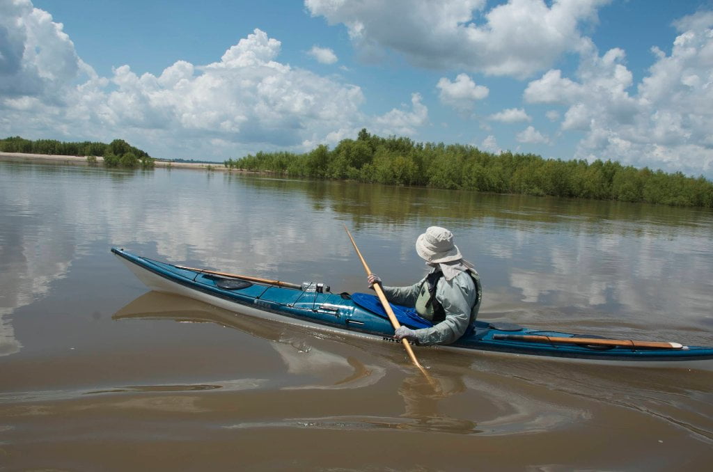
The Lower Mississippi River Water Trail

Big Trees and Floodplain:

The lower Mississippi River Valley was historically a vast expanse of bottomland and adjacent upland hardwood forests with scattered openings primarily created by fire, beaver, or large flood events by the Mississippi River and its tributaries. These openings were generally comprised of herbaceous moist-soil areas that created excellent waterfowl and other wetland wildlife habitat or giant switchcane that was almost impenetrable and an extremely important habitat component for a variety of wildlife species. Once covering 22 million acres in the Mississippi River Alluvial Plain, bottomland hardwood forests have decreased in extent to only 4.9 million acres. Extensive clearing for agriculture (i.e. soybeans, corn, or cotton) and urbanization are two of the primary reasons giant bald cypress and oak trees of pre-settlement times no longer exist. However, giant bald cypress and oak trees characteristic of yesteryear can still be seen on some of these sections of the Lower Mississippi. 


Important Note to Paddlers:

The Lower Mississippi is not for beginners, although there a couple of side channel places that beginners can get a taste of the big waters (in backwater places that open to the river such as Lake Ferguson and the Greenville Harbor, Lake Lee, Matthew’s Bend, Bunch’s Cut-Off, Old River, Stack Island Back Channel — and other protected flat water places connected to the big river — see page “Beginner Paddlers on the Lower Mississippi River”).  Advance paddlers only in the main channel.  You should be capable of self-rescue, and you should have previous big river experience, in specific: large volume waters with long crossings and industrial traffic (towboats).  Your skills should include self-rescue, long ferry-crossings, paddling in the wind, paddling in the vicinity of towboats, paddling through violent boils, violent eddies, and large whirlpools.  Ultimately you must decide whether you are capable of safely paddling the big river, and whether you are capable of leading your family or friends on the same.  Be cautious.  Take your time.  Swallow your ambition and pride.  Impatience has been the root cause of most problems encountered by Lower Mississippi River paddlers.  Enjoy the moment, not the destination. Turn around if you aren’t sure or aren’t prepared.  Use the Rivergator Safety section to assess specific skills and recommendations.  Check the river levels and weather forecast with special attention to wind speed and direction.  Carry extra food, water, and all-weather protection.  Wear wetsuit or dry suit in cold water seasons (November through April).  Carry cell phone and VHF Marine radio.  Carry an extra paddle and leave a route plan with someone on shore.  Large groups can notify the Coast Guard who will keep the towboat pilots informed of your progress.

Leave A Comment

SECTION MILE ACCESS CITY
Middle Mississippi & Bluegrass Hills / Bootheel 195-0, 954-850 ST. LOUIS TO CARUTHERSVILLE
Chickasaw Bluffs 850 – 737 CARUTHERSVILLE TO MEMPHIS
Upper Delta 737 – 663 MEMPHIS TO HELENA
Middle Delta 663 – 537 HELENA TO GREENVILLE
Lower Delta 537 – 437 GREENVILLE TO VICKSBURG
Introduction  
Greenville to Lake Providence
Greenville, Mississippi  
Greenville Accomodations and Restaurants  
Greenville Blues Festivals  
Greenville Boat Ramp  
Greenville Harbor  
537 LBD Warfield Point Park
537 LBD Old Warfield Point Boat Ramp
537 LBD New Warfield Point Boat Ramp
534 LBD Vaucluse Landing
531.5 RBD Sunny Side Landing
530.7 LBD Greenville Bridge
529 – 525.5 LBD Lakeport Towhead / American Bar
525 LBD American Cut-Off / Lake Lee
Lake Lee Public Boat Ramp  
Options for Paddlers Below Greenville Bridge Near American Bar and Lake Lee  
Lake Washington  
523 – 520 RBD Island 68
519 – 515 RBD Kentucky Bend
515 – 512 LBD Leota Bar / Cracraft Chute
514 – 512 RBD Worthington Cutoff, Matthews Bend, Grand Lake, Island 88
512 RBD (And Up Back Channel) Grand Lake Landing Boat Ramp
510 – 506 RBD Cracraft Bar
Paddler’s Choices Through Cracraft Chute & Sarah’s Cutoff  
Entering Louisiana  
503.5 RBD Bunch’s Cutoff
503 RBD Chute of Old River Lake
505 – 502 LBD Corregidor Bar
500 – 495 RBD Wilson Point Bar
496 LBD Tennis Court Landing
Vicksburg Gage  
Water Levels and Dikes  
494 – 487 LBD Baleshead / Stack Island / Ben Lamond
Two Stack Islands?  
Lake Providence  
Lake Providence Landings  
Paddler’s Choices in the Mayersville – Lake Providence Area  
487 – 481 LBD Shipland Wildlife Management Area
Lake Providence to Vicksburg
Vicksburg Gage  
Water Levels and Dikes  
Lake Providence  
Lake Providence Landing  
Paddler’s Choices in the Mayersville – Lake Providence Area  
487 – 481 LBD Shipland Wildlife Management Area
480 – 474 Fitler Bend
471 – 465 Arcadia Point Bar / Cottonwood Bar
Paddler’s Routes Arcadia Point Bar / Cottonwood Bar  
462 – 459 RBD Willow Island
461 LBD Chotard Lake Terrapin Neck Cutoff
Laney’s Landing  
459 LBD 2010 F-4 Tallulah – Yazoo Tornado
458.8 LBD Eagle Lake Pass
458 LBD Tara Landing
457 RBD Madison Parish Port and Public Boat Launch
Bluz Cruz Kayak and Canoe Race  
Willow Island, Chotard Lake, and Eagle Lake: Paddler’s Routes  
458 – 449 Milliken Bend
449 – 445 RBD Sparta Island
449 – 445 RBD Marshall Cutoff
446.5 LBD Paw Paw Chute
The “Heart of the Darkness” Tour  
Around Paw Paw to Forest Home Chute  
Paw Paw to Vicksburg Via the Yazoo  
Steele Bayou Control Structure  
What Are the Paw Paws  
Paw Paw Chute / Sparta / Brown’s Point: Paddler’s Routes  
445 – 442 Brown’s Point
444 Brown’s Point Fault Line
441 – 438.5 RBD Delta Point Bar
Habitat Restoration on the Lower Miss  
438 RBD King’s Point / Secret Entrance Into Lake Centennia
437.7 LBD Mouth of the Yazoo River
Vicksburg  
Vicksburg Services and Accommodations  
Vicksburg Services, Accommodations, and Restaurants  
Looking Downstream  
Loess Bluffs 437 – 225 VICKSBURG TO BATON ROUGE
Atchafalaya River 159 – 0 SIMMESPORT TO MORGAN CITY
Louisiana Delta 229 – 10 BATON ROUGE TO VENICE
Birdsfoot Delta 10 – 0 VENICE TO GULF OF MEXICO