The Lower Mississippi River Water Trail

654.7 LBD Montezuma Landing

Possible shuttle access to Clarksdale via Highway 1 and the Friars Point Road (17.5 miles).  Note: If you want to access Friars Point for resupply or visit continue downstream two miles to Friars Point Landing.


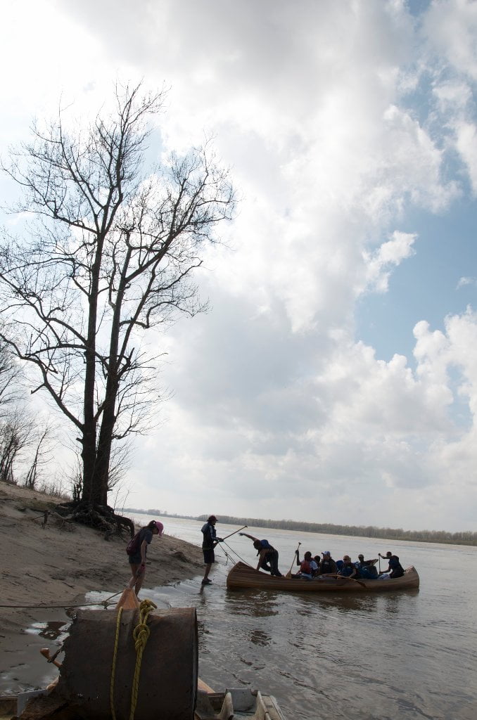
The riverbank LBD along Montezuma Bend undulates in and out of several small harbors, the last and largest of these at mile 653 is Montezuma Landing.  Also known as “Delta Landing” (for the town of Delta which was eaten by the river in the mid nineteenth century — see above).  At the north end of this open-mouthed harbor you will find a steep & narrow concrete ramp which is usable at low, medium and high waters up to 37HG when the parking lot and landing becomes submerged.  As always, paddlers can enter and exit the river wherever the road ends (and the water begins) at higher water levels, if necessary right off the levee.  Below 10HG the end of the concrete ramp steepens considerably and much caution is required when backing down.  This ramp ends completely around 0HG, which can be troublesome to powerboats on trailers, but only means a short portage for any paddlers.  Below the end of the ramp you will encounter piles of rip rap which fall off steeply into the dark depths of the eddy.  Drivers: if you back down this ramp at any levels, be sure to set your emergency brake and chock your tires with rocks from the adjacent rip-rap!   At medium and low water levels and small sand dune forms at the southern edge of the landing, piles of sand pushed up by the swirling waters of a giant eddy which is found here.  Use the eddy to your advantage entering or exiting Montezuma Landing.  Possible emergency campsite, with good protection from south or southeasterly winds, but also accessible to motorized vehicles and sometimes a popular picnic and party place. 


Shuttle Route Montezuma to Clarksdale:

http://maps.google.com/maps/ms?msid=217859314001592865582.0004b836f81f9559f31a1&msa=0&ll=
34.28729,-90.55687&spn=0.440242,0.804749

Short URL: http://g.co/maps/xfbcq


652 LBD Friars Point

Friars Point was once the major population center and seat of Coahoma County.  Friars Point was located right on the river, the downtown a levee landing where cotton was loaded onto steamboats, and gamblers might be seen strolling the streets looking for the next unwary victim.  Clarksdale at the time was just a distant dream of a frontier woodcutter named John Clark.  The unpredictable Mississippi ate the entire length of First Street one year.  No problem, the resourceful citizens simply moved commerce back to Second Street and it became center of activity for its business district.  Many a good story came from any puzzled visitor inspecting the signage and wondering why there wasn’t any First Street and why Second Street was the center of activity.  

Leave A Comment

SECTION MILE ACCESS CITY
Middle Mississippi & Bluegrass Hills / Bootheel 195-0, 954-850 ST. LOUIS TO CARUTHERSVILLE
Chickasaw Bluffs 850 – 737 CARUTHERSVILLE TO MEMPHIS
Upper Delta 737 – 663 MEMPHIS TO HELENA
Introduction  
Memphis to Tunica
736 LBD Memphis, Tennessee, Mud Island Harbor
Buoys and Docks  
Floating Underneath a Bridge  
734.7 Lower Bridges/Engineer’s Bar
734.7 The Frisco Bridge
734.7 The Harahan Bridge
734.7 The Ghost Bunker
734.7 The Old Bridge (Memphis & Arkansas Bridge)
733 President’s Island
Fleeted Barges  
732 LBD Hole in the Wall ##2
727.3 TVA Transmission Lines
727.3 RBD The Wreck of the Raft
Tennessee Valley Authority  
725.5 LBD Entrance to McKellar Lake
7 Miles Up harbor Riverside Park Marina On McKellar Lake  
724 T.E. Maxon Wastewater Treatement Facility
Paddler’s Routes Below Memphis  
727 – 712 Dismal Point/Ensley Bar/Cow Island Bend Area
726 – 717 Armstrong/Dismal Point/Ensley Bar
720 Josie Harry Bar
718 – 713 Cow Island Bend
Goodbye Tennessee, Hullo Mississippi  
The Yazoo-Mississippi Delta and the Blues  
711 – 705 Cat Island No.50
710.8 LBD Starr Landing
712 – 695 Paddler’s Routes Around Cat Island and the Casinos
Pickett Dikes Back Channel  
639.8 RBD Tunica Riverpark Museum Boat Ramp
Tunica Riverpark Museum  
Basket Bar Dikes/Porter lake Dikes  
693.8 RBD Lost Lake Pass
703 Buck Island (No. 53)
701 Gold Strike Casino
700 Fitzgerald’s Casino
Tunica to Helena
700 Basket Bar
Paddler’s Routes Through Commerce and Mhoon Bends  
695 – 690 Commerce Bend
692.5 RBD Peter’s Boat Ramp
690 Rabbit Island
Switching to thhe Helena Gage  
Dikes and Water Levels  
687.5 Mhoon Landing
689 – 685 Mhoon Bar
690 – 683 Mhoon Bend
682 – 679 Whiskey Chute/Walnut Bend
680 Whitehall Crevasse
Paddler’s Routes Below Walnut Bend  
Stumpy Island, Shoo Fly Bar and Tunica Lake  
Main Channel  
677.4 LBD Tunica Runout
Behind Shoo Fly Bar  
Stumpy Island  
Walnut Bend Boat Ramp  
Tunica Lake Boat Ramp  
679 RBD Walnut Bend Boat Ramp
679 – 677 Hardin Cut-Off
677.4 LBD Pass Into Tunica Lake
677 – 676 Shoo Fly Bar
677 – 674 Stumpy Island
674.5 Harbert Point
672 RBD Mouth of the St. Francis River
Primitive Landing at the Mouth of the St. Francis Rive – Conditions  
RBD 3 Miles up St. Francis River Three Mile Ramp
Daytrip: St. Francis to Helena  
St. Francis to Helena: Paddler’s Descriptions  
For Intermedite Paddlers: Right Bank Route  
For Expert Paddlers: Left Bank Route  
St. Francis River  
671 – 673 LBD St. Francis Bar
669 LBD Flower Lake Dikes
668 RBD (A View of) Crowley’s Ridge D
668-663 RBD Buck Island (Prairie Point Towhead)
665.5 LBD Trotter’s Pass
663 RBD Helena Harbor
Helena Boat Ramps  
663 RBD Helena-West Helena
Quapaw Canoe Company – Helena Outpost  
Helena’s “Low Road” Into St. Francis National Forest  
King Biscuit Blues Festival (2nd Week of October)  
Helena to Friars
661.6 Helena Bridge (Hernando De Soto Bridge – US HWY 49)
663 RBD Leaving Helena Harbor
Fleeted Barges  
Small Towns in Harbors  
Buoys and Other Stationary Objects  
Highlights of Civilization  
Pollution Within the Helena Industrial Reach  
661.6 Helena Bridge (Hernando De Soto Bridge – US HWY 49)
657 LBD  
How to Get Into the Old Entrance of the Yazoo Pass  
LBD: Alternate Route to Vicksburg: Yazoo Pass  
Yazoo Pass Milage  
Rivers & Robert Johnson  
656 LBD East Montezuma Bar
657 – 654 RBD Montezuma Towhead
654.7 LBD Montezuma Landing
Shuttle Route Montezuma to Clarksdale  
652 LBD Friars Point
652.2 LBD Friars Point Landing (Unimproved)
What’s to Come Further Downstream  
Appendix  
Middle Delta 663 – 537 HELENA TO GREENVILLE
Lower Delta 537 – 437 GREENVILLE TO VICKSBURG
Loess Bluffs 437 – 225 VICKSBURG TO BATON ROUGE
Atchafalaya River 159 – 0 SIMMESPORT TO MORGAN CITY
Louisiana Delta 229 – 10 BATON ROUGE TO VENICE
Birdsfoot Delta 10 – 0 VENICE TO GULF OF MEXICO