The Lower Mississippi River Water Trail

677-676 Shoo Fly Bar

Shoo Fly is what paddlers have come to name a dynamic low-lying open bar that forms below the Tunica Runout and is only visible in low water conditions, and goes completely under around 20HG.  Paddlers should avoid camping here except in the most perfect of conditions.  To be caught in the wind or an oncoming storm here would be like being caught out in the middle of the ocean.  Good rest stop or picnic place.  Back channel flowing even in the lowest of water.  I have found plenty of flowing water as low as -5HG, enough for canoes, kayaks, SUPs or other shallow draft vessels.  Shoo Fly is the last remnant of land leftover from the Hardin Cut-Off which created Tunica Lake in 1942.    Local river expert Rick Howe: “This bar was not present prior to about 1995 or so – I used to go the River from Lake through runout and back on stages down to 1 or 2MG.  About 1993 or 1995, major flood pushed/translated a huge sand bar in front of the runout and it actually damned up the runout and held Tunica Lake/Cut-Off at about 6MG for a couple of years.  Then the next year, it disappeared…moved on down the River pushed by the River currents.  Haven’t seen big bar there in years.  You mentioned current behind the bar….I suppose this is at very low levels (below 5HG, or so)?  Haven’t been there at such low levels….(We are now seeing -7MG or about -1 or -2HG…)  I actually always thought “Shoo Fly Bar” was the historic name of the natural bar on the pre-Cutoff inside bend of the River at what is now the Runout chute…  However, Shoo Fly Bar is not a bad/inappropriate name for a big sand bar that forms up at this location in the present River…”


677-674 Stumpy Island

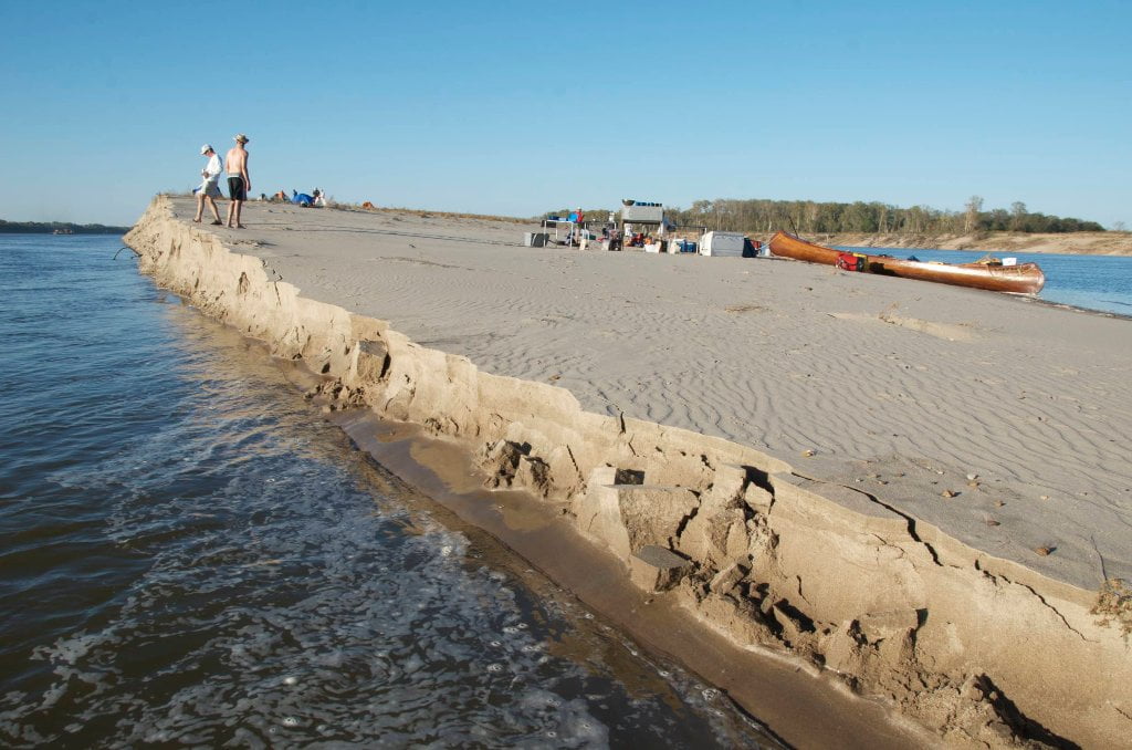
Three mile long island (at low water) topped with a young willow/cottonwood/sycamore forest with beautiful camping all around.  In high water levels best camping is found top end above the trees, and there is ample water flowing through the back channel.  (Cutoff resident Rick Howe recalled catching over 100 bass in one outing 20 years ago, and has not caught another single bass there since!)  As the water drops sandbars emerge on all sides and the back channel dries.  By low water, around 15HG there is no flow in the back channel and generous sandbars are found on all sides, especially above the island and along main channel.  Only when the river bottoms out below zero on the Helena Gauge is the full three-mile length of this island revealed, now attached to the mainland woods along the right bank.


674.5 Harbert Point

Swift currents past the point will carry the downstream paddler quickly into the final approach to the mouth of the St. Francis River.  You can stay left bank and duck behind the St. Francis Bar.  Or you can stay main channel and enjoy a quick view upstream the St. Francis into the heart of Crowley’s Ridge.  Take a moment, if you have the time, and eddy out at the mouth of the St. Francis, and enjoy the change in water color, the narrow mouth of the river (several hundred yards) and the common wildlife and river rat sightings.  Bald eagles frequent this area, and fishermen, both attesting to the prolific fishery.

Leave A Comment

SECTION MILE ACCESS CITY
Middle Mississippi & Bluegrass Hills / Bootheel 195-0, 954-850 ST. LOUIS TO CARUTHERSVILLE
Chickasaw Bluffs 850 – 737 CARUTHERSVILLE TO MEMPHIS
Upper Delta 737 – 663 MEMPHIS TO HELENA
Introduction  
Memphis to Tunica
736 LBD Memphis, Tennessee, Mud Island Harbor
Buoys and Docks  
Floating Underneath a Bridge  
734.7 Lower Bridges/Engineer’s Bar
734.7 The Frisco Bridge
734.7 The Harahan Bridge
734.7 The Ghost Bunker
734.7 The Old Bridge (Memphis & Arkansas Bridge)
733 President’s Island
Fleeted Barges  
732 LBD Hole in the Wall ##2
727.3 TVA Transmission Lines
727.3 RBD The Wreck of the Raft
Tennessee Valley Authority  
725.5 LBD Entrance to McKellar Lake
7 Miles Up harbor Riverside Park Marina On McKellar Lake  
724 T.E. Maxon Wastewater Treatement Facility
Paddler’s Routes Below Memphis  
727 – 712 Dismal Point/Ensley Bar/Cow Island Bend Area
726 – 717 Armstrong/Dismal Point/Ensley Bar
720 Josie Harry Bar
718 – 713 Cow Island Bend
Goodbye Tennessee, Hullo Mississippi  
The Yazoo-Mississippi Delta and the Blues  
711 – 705 Cat Island No.50
710.8 LBD Starr Landing
712 – 695 Paddler’s Routes Around Cat Island and the Casinos
Pickett Dikes Back Channel  
639.8 RBD Tunica Riverpark Museum Boat Ramp
Tunica Riverpark Museum  
Basket Bar Dikes/Porter lake Dikes  
693.8 RBD Lost Lake Pass
703 Buck Island (No. 53)
701 Gold Strike Casino
700 Fitzgerald’s Casino
Tunica to Helena
700 Basket Bar
Paddler’s Routes Through Commerce and Mhoon Bends  
695 – 690 Commerce Bend
692.5 RBD Peter’s Boat Ramp
690 Rabbit Island
Switching to thhe Helena Gage  
Dikes and Water Levels  
687.5 Mhoon Landing
689 – 685 Mhoon Bar
690 – 683 Mhoon Bend
682 – 679 Whiskey Chute/Walnut Bend
680 Whitehall Crevasse
Paddler’s Routes Below Walnut Bend  
Stumpy Island, Shoo Fly Bar and Tunica Lake  
Main Channel  
677.4 LBD Tunica Runout
Behind Shoo Fly Bar  
Stumpy Island  
Walnut Bend Boat Ramp  
Tunica Lake Boat Ramp  
679 RBD Walnut Bend Boat Ramp
679 – 677 Hardin Cut-Off
677.4 LBD Pass Into Tunica Lake
677 – 676 Shoo Fly Bar
677 – 674 Stumpy Island
674.5 Harbert Point
672 RBD Mouth of the St. Francis River
Primitive Landing at the Mouth of the St. Francis Rive – Conditions  
RBD 3 Miles up St. Francis River Three Mile Ramp
Daytrip: St. Francis to Helena  
St. Francis to Helena: Paddler’s Descriptions  
For Intermedite Paddlers: Right Bank Route  
For Expert Paddlers: Left Bank Route  
St. Francis River  
671 – 673 LBD St. Francis Bar
669 LBD Flower Lake Dikes
668 RBD (A View of) Crowley’s Ridge D
668-663 RBD Buck Island (Prairie Point Towhead)
665.5 LBD Trotter’s Pass
663 RBD Helena Harbor
Helena Boat Ramps  
663 RBD Helena-West Helena
Quapaw Canoe Company – Helena Outpost  
Helena’s “Low Road” Into St. Francis National Forest  
King Biscuit Blues Festival (2nd Week of October)  
Helena to Friars
661.6 Helena Bridge (Hernando De Soto Bridge – US HWY 49)
663 RBD Leaving Helena Harbor
Fleeted Barges  
Small Towns in Harbors  
Buoys and Other Stationary Objects  
Highlights of Civilization  
Pollution Within the Helena Industrial Reach  
661.6 Helena Bridge (Hernando De Soto Bridge – US HWY 49)
657 LBD  
How to Get Into the Old Entrance of the Yazoo Pass  
LBD: Alternate Route to Vicksburg: Yazoo Pass  
Yazoo Pass Milage  
Rivers & Robert Johnson  
656 LBD East Montezuma Bar
657 – 654 RBD Montezuma Towhead
654.7 LBD Montezuma Landing
Shuttle Route Montezuma to Clarksdale  
652 LBD Friars Point
652.2 LBD Friars Point Landing (Unimproved)
What’s to Come Further Downstream  
Appendix  
Middle Delta 663 – 537 HELENA TO GREENVILLE
Lower Delta 537 – 437 GREENVILLE TO VICKSBURG
Loess Bluffs 437 – 225 VICKSBURG TO BATON ROUGE
Atchafalaya River 159 – 0 SIMMESPORT TO MORGAN CITY
Louisiana Delta 229 – 10 BATON ROUGE TO VENICE
Birdsfoot Delta 10 – 0 VENICE TO GULF OF MEXICO