The Lower Mississippi River Water Trail
Note on Low-Water Camping
You can find beautiful low water camps on the giant sandbar that forms on the mainland opposite the bottom end of Choctaw Island. Or anywhere along the outside edge of the top end of the island. But this is not advised in windy weather, or cold weather, or with any remote threat of oncoming severe thunderstorms. Check latest forecasts. Storm often appear un-announced from over the horizon! But if the air is calm there will be less mosquitoes and more cooling breeze on the outer shelf of sand than somewhere close to the trees.
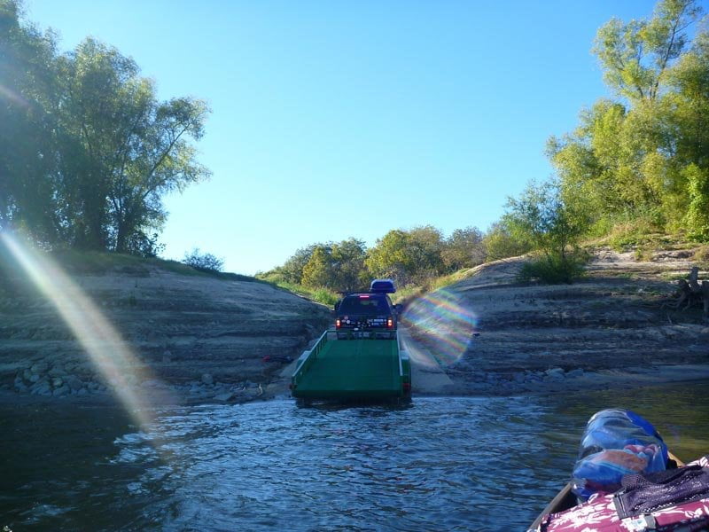
Arkansas City Boat Ramp
Narrow concrete ramp descending at steep angle from a wooded bluff that sits atop the steep muddy bank of the back channel. Grooved concrete yields better traction. Boat ramp fills with sand and mud after highwater, and needs frequent maintenance thereof. Paddlers can always find a way to get their vessels out of the water and to their vehicles. Drivers have a much more difficult time. More than one vehicle has needed to be towed out of sandy or muddy landing that looked firm! Parking lot above, and camping found beyond. Inquire locally about suitable camp sites and regulations. Never leave your vehicle unattended at this or any other river landings.
LBD 561.7 Easton Landing — Mounds Boat Ramp
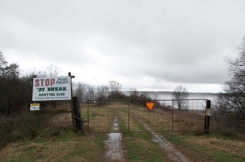
On the outside perimeter of Choctaw Island is found Easton Landing, a steep & unimproved ramp laid over the asphalt & rip-rap falling off the steep cut-bank. Mounds Boat Ramp unfortunately has become a private Boat Ramp in recent years, and is gated off the levee. If you try to drive in from Hwy 1 near Scott you will be greeted at this historic location with a large brightly-colored alarming sign that reads:
STOP
Private Property
’27 BREAK
HUNTING CLUB
Violators Will be Prosecuted!!!
with a smaller sign:
SECURITY
VIDEO SURVEILLANCE
IN USE
ON THESE PREMISES
and lastly the more generic:
POSTED
PRIVATE PROPERTY:
HUNTING, FISHING, TRAPPING
TRESPASSING FOR ANY PURPOSE
IS STRICTLY FORBIDDEN
VIOLATORS WILL BE PROSECUTED
Maybe this will change in the future, but for now paddlers wishing to exit river on the Mississippi shore will have to paddle another 25 miles downstream to Warfield Point State Park for access, if the river’s high Warfield Point will be closed; the only remaining access for paddlers is 5 miles up the slackwater Greenville Harbor, or 7 miles downstream on the Arkansas shore RBD near the Highway 82 Bridge.
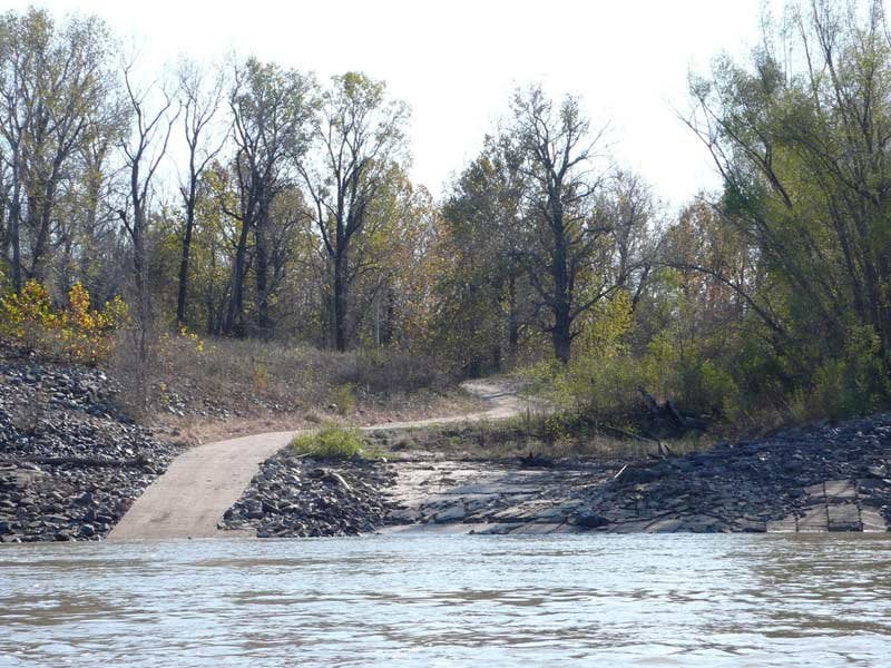
LBD 560.5 Mounds Landing
In the Great Flood of 1927 a one-mile section of the Mississippi levee collapsed and was pushed aside by the raging flood waters. In that era levees were built along the banks of the river, with no buffer zone to allow for the flood waters to spread and lessen their destructive force. As the river came around the long bend of Choctaw Island it gained power and then became squeezed in this area and easily overtopped man’s efforts. The resulting crevasse carved out two giant blue holes each over one hundred feet deep, both of which still exist today and can be seen if you make a stop in this vicinity during low or medium water levels. At high water levels the blue hole gets flooded along with the surrounding forests and there’s nothing to see except for an expanse of muddy waters surrounded by woods.
The crevasse led to the flooding of all of the Mississippi Delta below this point, from Rosedale to Drew to Greenwood and everything south. The flood water flowed gently but firmly along and gulped farms, houses, railroad lines, bridges, commissary stores, cotton gins, barns, and everything in its path in between the Yazoo and Mississippi Rivers, until being funneled down above Vicksburg, where it swept back into the mother river and caused it to swell anew (leading to other breaks downstream on the other side, now in Louisiana. This is the famous break that led blues great Charlie Patton to pen his High Water Everywhere Part 1 and High Water Everywhere Part 2 in 1929, a wildly popular song thereafter. Flood victims never outlive the experience.
.jpg)
Leave A Comment
You must be logged in to post a comment.