The Lower Mississippi River Water Trail

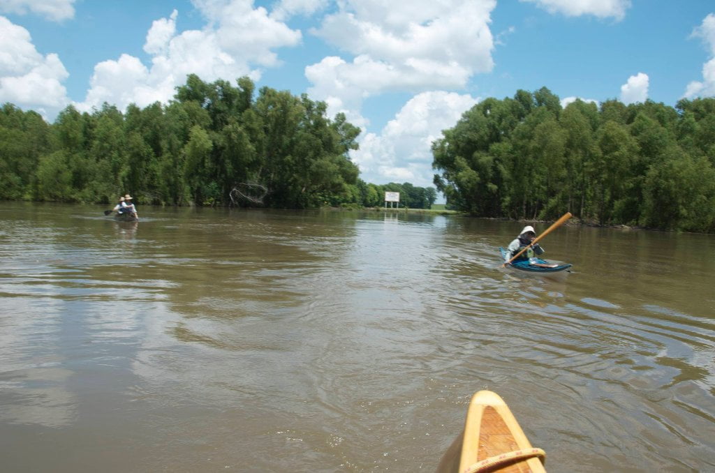
Your route: Main Channel vs. Back Channel

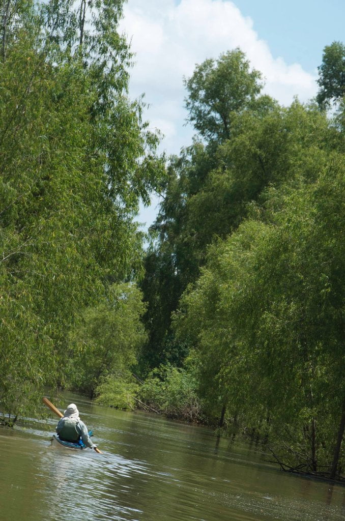
Rivergator will detail Main Channel which is almost always the fastest route on the water, but full or traffic, and Back Channel, which is slower but is full of wildlife and big trees.  Main Channel is always open regardless of river level, but back channel is dependent upon river levels.  Most back channels are closed in low water, open with slow flow in medium water, and full of strong flowing currents in high water.  Main channel hazards are buoys and towboats.  (Avoid both!)  In the back channel your main hazards are waterfalls over dikes (dependent on river level), snags, strainers and channel blockages (driftwood piling against trees or low bridge).   Rivergator will detail all known waterfalls and blockages.  But on the river things are in constant flux.  What one year is an uninterrupted flowing back channel might next year be blocked by a pile of logs and tree removal dropped by some logging operation.  Two things: 1) be a smart paddler and use you own best judgment about what’s safe to paddle and what isn’t.  And 2) let us know if you discover something of importance not listed in the Rivergator, like a dangerous waterfall or a blocked channel.  That way we can update Rivergator descriptions and keep other paddlers informed about these difficulties and possible hazards!  Dikes present special challenges to the back channel paddler.  At low water they are exposed, and you can paddle around any dike, but you will often discover strong eddies with ripping cross currents and whirlpools.   At medium water you can paddle over most dikes, but that is when the waters are at their most turbulent.  You may not see any solid evidence, but you will know they are there by the exploding boils, whipping currents, whirlpools and agitated turbulence.  In high water most dikes get swamped over by smooth flow and you hardly notice their influence.  In medium water back channels waterfalls sometimes form over a dike, with significant drops (2-3 feet), strong v-line tongues, standing waves, and turbulent side waters.  If you hear the sound of rushing water and see the plane of the back channel disappear and drop a level, and see leaping whitewater beyond — Be especially cautious!   Remember the paddler’s mantra: when in doubt, stop and scout!

Leave A Comment

SECTION MILE ACCESS CITY
Middle Mississippi & Bluegrass Hills / Bootheel 195-0, 954-850 ST. LOUIS TO CARUTHERSVILLE
Chickasaw Bluffs 850 – 737 CARUTHERSVILLE TO MEMPHIS
Upper Delta 737 – 663 MEMPHIS TO HELENA
Middle Delta 663 – 537 HELENA TO GREENVILLE
Lower Delta 537 – 437 GREENVILLE TO VICKSBURG
Introduction  
Greenville to Lake Providence
Greenville, Mississippi  
Greenville Accomodations and Restaurants  
Greenville Blues Festivals  
Greenville Boat Ramp  
Greenville Harbor  
537 LBD Warfield Point Park
537 LBD Old Warfield Point Boat Ramp
537 LBD New Warfield Point Boat Ramp
534 LBD Vaucluse Landing
531.5 RBD Sunny Side Landing
530.7 LBD Greenville Bridge
529 – 525.5 LBD Lakeport Towhead / American Bar
525 LBD American Cut-Off / Lake Lee
Lake Lee Public Boat Ramp  
Options for Paddlers Below Greenville Bridge Near American Bar and Lake Lee  
Lake Washington  
523 – 520 RBD Island 68
519 – 515 RBD Kentucky Bend
515 – 512 LBD Leota Bar / Cracraft Chute
514 – 512 RBD Worthington Cutoff, Matthews Bend, Grand Lake, Island 88
512 RBD (And Up Back Channel) Grand Lake Landing Boat Ramp
510 – 506 RBD Cracraft Bar
Paddler’s Choices Through Cracraft Chute & Sarah’s Cutoff  
Entering Louisiana  
503.5 RBD Bunch’s Cutoff
503 RBD Chute of Old River Lake
505 – 502 LBD Corregidor Bar
500 – 495 RBD Wilson Point Bar
496 LBD Tennis Court Landing
Vicksburg Gage  
Water Levels and Dikes  
494 – 487 LBD Baleshead / Stack Island / Ben Lamond
Two Stack Islands?  
Lake Providence  
Lake Providence Landings  
Paddler’s Choices in the Mayersville – Lake Providence Area  
487 – 481 LBD Shipland Wildlife Management Area
Lake Providence to Vicksburg
Vicksburg Gage  
Water Levels and Dikes  
Lake Providence  
Lake Providence Landing  
Paddler’s Choices in the Mayersville – Lake Providence Area  
487 – 481 LBD Shipland Wildlife Management Area
480 – 474 Fitler Bend
471 – 465 Arcadia Point Bar / Cottonwood Bar
Paddler’s Routes Arcadia Point Bar / Cottonwood Bar  
462 – 459 RBD Willow Island
461 LBD Chotard Lake Terrapin Neck Cutoff
Laney’s Landing  
459 LBD 2010 F-4 Tallulah – Yazoo Tornado
458.8 LBD Eagle Lake Pass
458 LBD Tara Landing
457 RBD Madison Parish Port and Public Boat Launch
Bluz Cruz Kayak and Canoe Race  
Willow Island, Chotard Lake, and Eagle Lake: Paddler’s Routes  
458 – 449 Milliken Bend
449 – 445 RBD Sparta Island
449 – 445 RBD Marshall Cutoff
446.5 LBD Paw Paw Chute
The “Heart of the Darkness” Tour  
Around Paw Paw to Forest Home Chute  
Paw Paw to Vicksburg Via the Yazoo  
Steele Bayou Control Structure  
What Are the Paw Paws  
Paw Paw Chute / Sparta / Brown’s Point: Paddler’s Routes  
445 – 442 Brown’s Point
444 Brown’s Point Fault Line
441 – 438.5 RBD Delta Point Bar
Habitat Restoration on the Lower Miss  
438 RBD King’s Point / Secret Entrance Into Lake Centennia
437.7 LBD Mouth of the Yazoo River
Vicksburg  
Vicksburg Services and Accommodations  
Vicksburg Services, Accommodations, and Restaurants  
Looking Downstream  
Loess Bluffs 437 – 225 VICKSBURG TO BATON ROUGE
Atchafalaya River 159 – 0 SIMMESPORT TO MORGAN CITY
Louisiana Delta 229 – 10 BATON ROUGE TO VENICE
Birdsfoot Delta 10 – 0 VENICE TO GULF OF MEXICO