The Lower Mississippi River Water Trail

foot long voyageur canoes out of the river and made a voyageur shelter by leaning them against some paddles and attaching lean-to tarps out from the belly.  This became our shelter for the next three days as the winds and the storms thrashed relentlessly us from all sides.  All seventeen of us huddling under our river storm shelter.  Eleven inches of rain fell in four days.  The teacher on board thought he had set his tent under a waterfall.  But no, it was just the torrential rainfall of the Mississippi Valley.  The high school kids had a blast, and why not?  They were missing an additional four days of school and getting to play in the rain.  They saw more rain that week than parts of Colorado receive in a year!  Eventually the storms passed, and a strong cold front swept across the valley and we were able to leave our storm camp.  I still hear from some of those students from time to time, and the teacher and I have become friends for life.  Oh, and one of the students ended up marrying one of my guides.  But that’s another story for another time.


449-445 Marshall Cut-Off


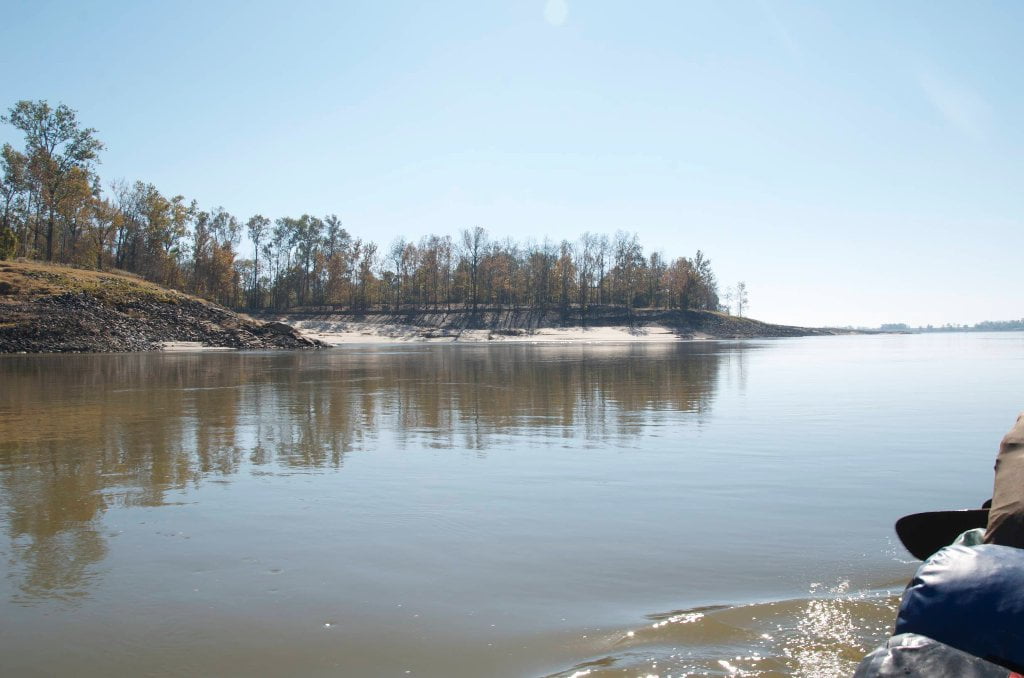
Below Milliken Bend, the river flows through Marshal Cutoff (Sparta is on RBD).  Marshall (and 15 other cutoffs) were authorized and constructed following the 1927 flood to speed flow and reduce flooding of the Mississippi River.  Prior to this 1934 cutoff the river flowed east and then made a wide bend to the southwest before turning around again at Brown’s Point and return towards the big bluffs at Vicksburg.  This bend and an old high water river chute to the west of this bend (which is now the current river channel) delineated Paw Paw Island.  The old river bend is now called Paw Paw Chute, and remains accessible by canoe or kayak at all but the lowest river stages. 


LBD 446.5 Paw Paw Chute


Paw Paw Chute provides a spectacular tour of the primeval Delta bottomlands found just over the big trees lining the main channel of the river.  It could also provide an alternate route for downstream paddlers headed to Vicksburg.  Recommended water level for this: 20VG or higher. But be forewarned: regardless of water level you might be doing some bushwhacking along the way!  Also, be ready for portages, falling spiders, flying spiders, giant golden orb spiders, snakes in the trees, snakes on piles of driftwood, swimming snakes, getting lost, getting found, getting stuck in the mud, reaching dead ends, and other fun and exciting challenges along the way.  A GPS might be helpful, but a knife and good sense and dead reckoning will be your best allies.  If you are the kind that gets easily lost or confused in the deep woods, don’t enter.  See below for a detailed description from big river expert and biologist extraordinnaire Paul Hartfield, in what he calls his “Heart of Darkness” Tour: 


The “Heart of Darkness” Tour:


First, a note on flows:  When the Mississippi River is rising, currents may be strong running up Paw Paw and through the Old Yazoo to the “New” Yazoo.  This current will 

Leave A Comment

SECTION MILE ACCESS CITY
Middle Mississippi & Bluegrass Hills / Bootheel 195-0, 954-850 ST. LOUIS TO CARUTHERSVILLE
Chickasaw Bluffs 850 – 737 CARUTHERSVILLE TO MEMPHIS
Upper Delta 737 – 663 MEMPHIS TO HELENA
Middle Delta 663 – 537 HELENA TO GREENVILLE
Lower Delta 537 – 437 GREENVILLE TO VICKSBURG
Introduction  
Greenville to Lake Providence
Greenville, Mississippi  
Greenville Accomodations and Restaurants  
Greenville Blues Festivals  
Greenville Boat Ramp  
Greenville Harbor  
537 LBD Warfield Point Park
537 LBD Old Warfield Point Boat Ramp
537 LBD New Warfield Point Boat Ramp
534 LBD Vaucluse Landing
531.5 RBD Sunny Side Landing
530.7 LBD Greenville Bridge
529 – 525.5 LBD Lakeport Towhead / American Bar
525 LBD American Cut-Off / Lake Lee
Lake Lee Public Boat Ramp  
Options for Paddlers Below Greenville Bridge Near American Bar and Lake Lee  
Lake Washington  
523 – 520 RBD Island 68
519 – 515 RBD Kentucky Bend
515 – 512 LBD Leota Bar / Cracraft Chute
514 – 512 RBD Worthington Cutoff, Matthews Bend, Grand Lake, Island 88
512 RBD (And Up Back Channel) Grand Lake Landing Boat Ramp
510 – 506 RBD Cracraft Bar
Paddler’s Choices Through Cracraft Chute & Sarah’s Cutoff  
Entering Louisiana  
503.5 RBD Bunch’s Cutoff
503 RBD Chute of Old River Lake
505 – 502 LBD Corregidor Bar
500 – 495 RBD Wilson Point Bar
496 LBD Tennis Court Landing
Vicksburg Gage  
Water Levels and Dikes  
494 – 487 LBD Baleshead / Stack Island / Ben Lamond
Two Stack Islands?  
Lake Providence  
Lake Providence Landings  
Paddler’s Choices in the Mayersville – Lake Providence Area  
487 – 481 LBD Shipland Wildlife Management Area
Lake Providence to Vicksburg
Vicksburg Gage  
Water Levels and Dikes  
Lake Providence  
Lake Providence Landing  
Paddler’s Choices in the Mayersville – Lake Providence Area  
487 – 481 LBD Shipland Wildlife Management Area
480 – 474 Fitler Bend
471 – 465 Arcadia Point Bar / Cottonwood Bar
Paddler’s Routes Arcadia Point Bar / Cottonwood Bar  
462 – 459 RBD Willow Island
461 LBD Chotard Lake Terrapin Neck Cutoff
Laney’s Landing  
459 LBD 2010 F-4 Tallulah – Yazoo Tornado
458.8 LBD Eagle Lake Pass
458 LBD Tara Landing
457 RBD Madison Parish Port and Public Boat Launch
Bluz Cruz Kayak and Canoe Race  
Willow Island, Chotard Lake, and Eagle Lake: Paddler’s Routes  
458 – 449 Milliken Bend
449 – 445 RBD Sparta Island
449 – 445 RBD Marshall Cutoff
446.5 LBD Paw Paw Chute
The “Heart of the Darkness” Tour  
Around Paw Paw to Forest Home Chute  
Paw Paw to Vicksburg Via the Yazoo  
Steele Bayou Control Structure  
What Are the Paw Paws  
Paw Paw Chute / Sparta / Brown’s Point: Paddler’s Routes  
445 – 442 Brown’s Point
444 Brown’s Point Fault Line
441 – 438.5 RBD Delta Point Bar
Habitat Restoration on the Lower Miss  
438 RBD King’s Point / Secret Entrance Into Lake Centennia
437.7 LBD Mouth of the Yazoo River
Vicksburg  
Vicksburg Services and Accommodations  
Vicksburg Services, Accommodations, and Restaurants  
Looking Downstream  
Loess Bluffs 437 – 225 VICKSBURG TO BATON ROUGE
Atchafalaya River 159 – 0 SIMMESPORT TO MORGAN CITY
Louisiana Delta 229 – 10 BATON ROUGE TO VENICE
Birdsfoot Delta 10 – 0 VENICE TO GULF OF MEXICO