The Lower Mississippi River Water Trail

For the adventurous only! Paw Paw Chute opens around 10VG but best explored when the river is 20VG or higher.  Enter opening LBD 446.5 and follow gentle bend five miles upstream as far as you feel like going.  Starts out northeasterly, becoming northerly, then northwesterly, finally westerly.


Forest Home Chute

Forest Home Chute is another old river channel. Forest Home continues another four to five miles (depending on stage), with two more road portages at low river.


The “Heart of Darkness” Tour

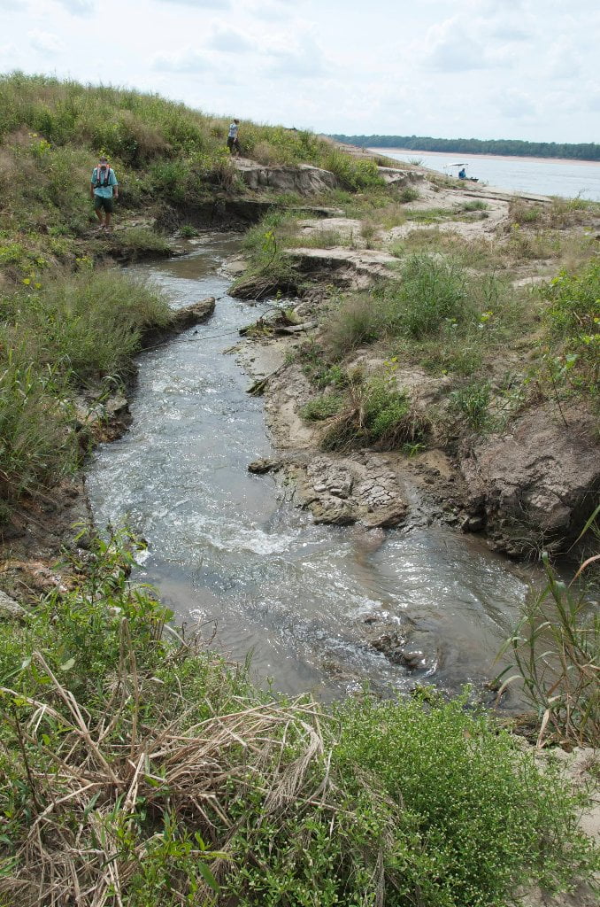
 From its confluence with Paw Paw, the Old Yazoo runs due west ½ mile to a wall of trees, where it makes a 90 degree sharp bend to the North.  This area is locally known as the Graveyard.  When the Mississippi River rises and the Yazoo is low, the Mississippi flows into Paw Paw and through the Old Yazoo, piling river flotsam and jetsam into the Graveyard.  Due to the isolation of the river to cities and towns of the Mississippi alluvial plain by levees, this consists primarily of logs (whole trees, actually) along with red and green channel markers.   This and two other channel constrictions  further along are (well, should be) easily passed at river stages >20 ft VG.  From the Graveyard, as stated above, the channel turns abruptly to the North running straight for about 1.5 mi.  At this point, it divides into 3 channels; the middle channel will take you straight into a large oxbow, while the other two get there eventually, but you’ll have to deal with trees, strainers, diminishing currents, and other backswamp obstacles.  The oxbow seems to end in a wall of willows and a large log jam after about 1.5 miles of lentic paddling, but don’t be dismayed!  If you look through the trees, you can see a body of water: the present day Yazoo River, with the Vicksburg Riverfront about 8 miles downstream.


Usptream the Yazoo to Steele Bayou

1.5 mi paddle upstream will bring you to the mouth of Steele Bayou.  Just upstream is the Steele Bayou backwater drainage structure.  When water is being released through this structure, tens, if not hundreds of thousands of gar (spotted, long-nose, alligator) school in the currents…quite a sight to see!


Downstream the Yazoo to Vicksburg

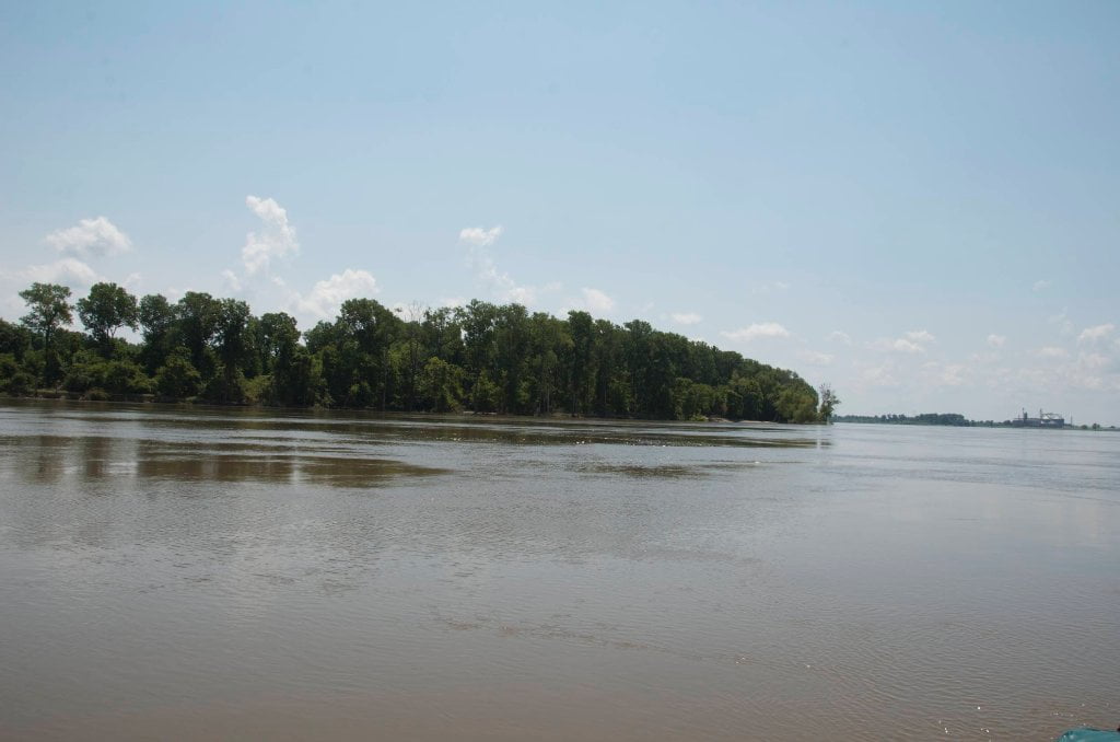
After leaving the Old Yazoo follow the New Yazoo a little over eight miles downstream to the Gibraltar of the South, Vicksburg.


LBD 437.7 Mouth of the Yazoo River

Red channel marker LBD 437.3  It’s best to cut the corner tight when entering the Yazoo.  Watch for Towboats.  Paddle approximately one and a half miles up the Yazoo to reach the public boat launch at the foot of Clay Street.


Warning: Turn left for Vicksburg!

There is no public access on the main channel of the river below here.  You must enter the Yazoo to reach downtown.  Paddler’s intending to meet their shuttles or resupply in Vicksburg will need to turn left!

Leave A Comment

SECTION MILE ACCESS CITY
Middle Mississippi & Bluegrass Hills / Bootheel 195-0, 954-850 ST. LOUIS TO CARUTHERSVILLE
Chickasaw Bluffs 850 – 737 CARUTHERSVILLE TO MEMPHIS
Upper Delta 737 – 663 MEMPHIS TO HELENA
Middle Delta 663 – 537 HELENA TO GREENVILLE
Lower Delta 537 – 437 GREENVILLE TO VICKSBURG
Introduction  
Greenville to Lake Providence
Greenville, Mississippi  
Greenville Accomodations and Restaurants  
Greenville Blues Festivals  
Greenville Boat Ramp  
Greenville Harbor  
537 LBD Warfield Point Park
537 LBD Old Warfield Point Boat Ramp
537 LBD New Warfield Point Boat Ramp
534 LBD Vaucluse Landing
531.5 RBD Sunny Side Landing
530.7 LBD Greenville Bridge
529 – 525.5 LBD Lakeport Towhead / American Bar
525 LBD American Cut-Off / Lake Lee
Lake Lee Public Boat Ramp  
Options for Paddlers Below Greenville Bridge Near American Bar and Lake Lee  
Lake Washington  
523 – 520 RBD Island 68
519 – 515 RBD Kentucky Bend
515 – 512 LBD Leota Bar / Cracraft Chute
514 – 512 RBD Worthington Cutoff, Matthews Bend, Grand Lake, Island 88
512 RBD (And Up Back Channel) Grand Lake Landing Boat Ramp
510 – 506 RBD Cracraft Bar
Paddler’s Choices Through Cracraft Chute & Sarah’s Cutoff  
Entering Louisiana  
503.5 RBD Bunch’s Cutoff
503 RBD Chute of Old River Lake
505 – 502 LBD Corregidor Bar
500 – 495 RBD Wilson Point Bar
496 LBD Tennis Court Landing
Vicksburg Gage  
Water Levels and Dikes  
494 – 487 LBD Baleshead / Stack Island / Ben Lamond
Two Stack Islands?  
Lake Providence  
Lake Providence Landings  
Paddler’s Choices in the Mayersville – Lake Providence Area  
487 – 481 LBD Shipland Wildlife Management Area
Lake Providence to Vicksburg
Vicksburg Gage  
Water Levels and Dikes  
Lake Providence  
Lake Providence Landing  
Paddler’s Choices in the Mayersville – Lake Providence Area  
487 – 481 LBD Shipland Wildlife Management Area
480 – 474 Fitler Bend
471 – 465 Arcadia Point Bar / Cottonwood Bar
Paddler’s Routes Arcadia Point Bar / Cottonwood Bar  
462 – 459 RBD Willow Island
461 LBD Chotard Lake Terrapin Neck Cutoff
Laney’s Landing  
459 LBD 2010 F-4 Tallulah – Yazoo Tornado
458.8 LBD Eagle Lake Pass
458 LBD Tara Landing
457 RBD Madison Parish Port and Public Boat Launch
Bluz Cruz Kayak and Canoe Race  
Willow Island, Chotard Lake, and Eagle Lake: Paddler’s Routes  
458 – 449 Milliken Bend
449 – 445 RBD Sparta Island
449 – 445 RBD Marshall Cutoff
446.5 LBD Paw Paw Chute
The “Heart of the Darkness” Tour  
Around Paw Paw to Forest Home Chute  
Paw Paw to Vicksburg Via the Yazoo  
Steele Bayou Control Structure  
What Are the Paw Paws  
Paw Paw Chute / Sparta / Brown’s Point: Paddler’s Routes  
445 – 442 Brown’s Point
444 Brown’s Point Fault Line
441 – 438.5 RBD Delta Point Bar
Habitat Restoration on the Lower Miss  
438 RBD King’s Point / Secret Entrance Into Lake Centennia
437.7 LBD Mouth of the Yazoo River
Vicksburg  
Vicksburg Services and Accommodations  
Vicksburg Services, Accommodations, and Restaurants  
Looking Downstream  
Loess Bluffs 437 – 225 VICKSBURG TO BATON ROUGE
Atchafalaya River 159 – 0 SIMMESPORT TO MORGAN CITY
Louisiana Delta 229 – 10 BATON ROUGE TO VENICE
Birdsfoot Delta 10 – 0 VENICE TO GULF OF MEXICO