| Introduction |
|
| Vicksburg |
|
| USFW and the LMRCC |
|
| Bluz Cruz |
|
| Vicksburg Services and Accommodations |
|
| Putting In: Clay Street Landing / Yazoo River |
|
| Down the Yazoo to the Mississippi |
|
| 437 |
Entering the Mississippi |
| 437 |
Delta Point |
| 437 |
Centennial Cutoff |
| 434.5 LBD |
Ergon General Store (Tow Boat Supply) |
| 437 – 435 LBD |
Walnut Hills (Mississippi Loess Bluff ##1) |
| Greatest Dust Storm Ever |
|
| Bluff Beat |
|
| The Nice Mississippi Loess Bluffs |
|
| No Levees |
|
| 436.5 LBD |
City of Vicksburg Riverfront Park |
| 435.7 LBD |
Vicksburg Bridges: US 80 and I-20 |
| The Zen od Paddling the Big River |
|
| Paddler’s Choices Below Vicksburg |
|
| Crossing Over to Delta Point |
|
| Vicksburg Bridge |
|
| Main Channel LBD |
|
| Main Channel RBD |
|
| LBD Private Boat Ramp |
|
| 433.2 LBD |
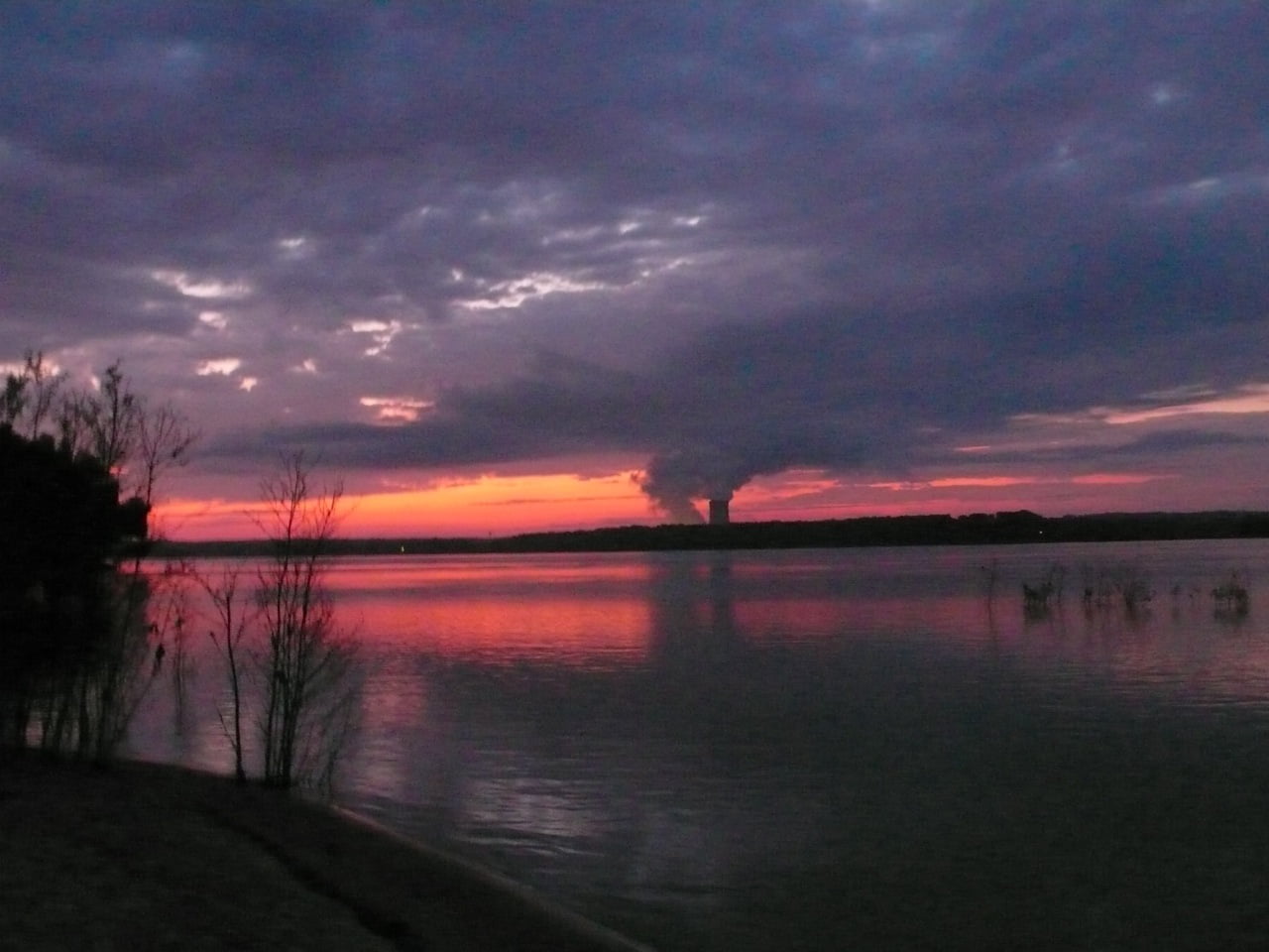
Baxter Wilson Steam Plant |
| 432 – 430 RBD |
Racetrack Towhead Back Channel |
| 432 – 430 RBD |
Racetrack Towhead Main Channel |
| 431 – 424 LBD |
Below Racetrack Dikes / Towhead |
| 430 – 427 RBD |
Reid Bedford Bend |
| 427.3 RBD |
Reid Bedford Point |
| 426 LBD |
Letourneau Public Boat Launch |
| 426.5 LBD |
Hennessey’s Bayou |
| 426 LBD |
Letourneau |
| Palmyra / Togo / Middle Ground Island |
|
| Paddling in the Port Gibson Area |
|
| Main Channel Route |
|
| 425 LBD |
Entrance to Palmyra Lake Back Channel |
| Palmyra Lake Back Channel |
|
| Hazard: Low Bridge Palmyra Lake |
|
| 416 RBD |
Togo Island Back Channel |
| 414 RBD |
The Crossroads |
| 408.5 LBD |
Big Black River |
| HWY 61 Boat Ramp |
|
| 407.8 LBD |
Grand Gulf State Park |
| Middle Ground Island Back Channel |
|
| 404 RBD |
Yucatan Ditch |
| 405 – 401 RBD |
Coffee Point Dikes |
| 423 RBD |
Diamond Cut-Off |
| 421 – 419 RBD |
Newtown Bend Sandbar |
| 419.6 LBD |
Lake Karnac |
| 417 – 414 RBD |
Togo Island |
| 416.5 LBD |
“Big Momma” Dike |
| 418 – 413 RBD |
Big Black Island |
| 417 – 414 RBD |
Togo Island Bend & Dikes |
| Mississippi River Dead End? |
|
| 414 RBD |
Palmyra – Togo Island Crossroads |
| Big Black Bluff, The Grand Gulp (Mississippi Loess Bluff ##2) |
|
| 410 RBD |
Middle Ground Island |
| Honeymoon Island |
|
| 404.8 RBD |
Port of Claiborne County |
| Phatwater Mississippi River Challenge Rip |
|
| 404.2 RBD |
Yucatan Ditch |
| 399 LBD |
High Bluffs |
| 395 LBD |
Bayou Pierre |
| Mississippi Water Levels |
|
| Natchez Gage (NG) |
|
| Water Levels and Dikes |
|
| Using the Natchez Gage |
|
| Louisiana Daytrip: St. Joseph to Waterproof |
|
| 396.4 RBD |
St. Joseph Boat Ramp |
| 396.4 RBD |
Lake Bruin State Park |
| 396.4 RBD |
Fish Tale Grill / Lake Bruin Lodge & Country Store |
| 395 LBD |
Mouth of Bayou Pierre |
| Main Channel St. Jo to Waterproof |
|
| RBD Med / High Water Route – Back Channel |
|
| LBD Med / High Water Route – Back Channel |
|
| 392 RBD |
Bondurant Towhead |
| 389 LBD |
Rodney Chute |
| 384 LBD |
Spithead Towhead |
| Petit Gulf Hills – Mississippi Loess Bluff ##3 |
|
| 394 LBD |
Bruinsburg Landing |
| 392 LBD |
Rodney (Ghost Town) |
| 390 – 389.5 RBD |
Brown’s Field Island |
| 385.9 LBD |
Below Brown’s Field Wetlands |
| 389 – 387 LBD |
Cottage Bend Islands |
| 389 LBD |
Rodney Lake Side Trip |
| 381 |
Waterproof Landing |
| 381 – 374 RBD |
Waterproof Island |
| 373 – 371 LBD |
Fairchild (Skull) Island |
| Natchez Bluffs |
|
| The Great Sun – The Natchez People |
|
| Adam Elliott, Natchez Outpost of the Quapaw Canoe Company |
|
| 370 LBD |
Greens Bayou |
| 369 |
Highline |
| 370 – 368 LBD |
Opposite Rifle Point |
| 369 – 367.5 RBD |
Rifle Point |
| 368 – 366 LBD |
Bluff Bars |
| 367 LBD |
Devil’s Punchbowl |
| 367.5 RBD |
Opening to Old River – Top End (Marengo Bend Lake) |
| 367 – 365 LBD |
Remnants of Cypress Forest |
| 365 LBD |
Opening to Old River – Bottom End (Merengo Bend Lake) |
| 363.5 LBD |
Natchez-Under-The-Hill |
| Some Natchez Stories |
|
| The Natchez Bluff – Mississippi Loess Bluff ##4 |
|
| 363 |
Natchez Bridge |
| 363 RBD |
Vidalia Boat Ramp |
| 362.8 RBD |
Vidalia Boat Ramp (Lower) |
| 361 LBD |
St. Catherine Creek(New Mouth) |
| 360 – 356.5 RBD |
Natchez Islands |
| 355 LBD |
Carthage Point |
| 358 – 355 LBD |
Carthage Point Towhead |
| 356.5 – 360 RBD |
Morville / Jeffries Landing |
| 352.5 LBD |
St. Catherine National Wildlife Refuge |
| Wood Storks |
|
| Wintering Waterfowl |
|
| Alligator Gar |
|
| Bottomland Harwood Forests |
|
| 352.5 – 346.5 LBD |
Opposite Warnicotte / Esperance Archipelago |
| 348.6 RBD |
Esperance Landing |
| 348 – 344 RBD |
Esperance Point |
| 347.2 LBD |
Old Mouth of St. Catherine Creek |
| 348 – 345 LBD |
Ellis Cliffs (Mississippi Loess Bluff ##5) |
| 344 RBD |
Esperance Bottom |
| 341.3 RBD |
Fairview / Old River |
| The Mamie S Barret |
|
| 346 – 341 |
Glasscock Cut-Off |
| 341.1 LBD |
Washout Bayou / Homochitto River |
| 340.1 RBD |
Oil Well & Boat Ramp |
| 340 – 338 LBD |
Buck Island |
| 338.5 – 334 RBD |
Fritz Island |
| 340 – 332 |
Dead Man’s Bend |
| 332 – 328 |
Jackson Point / Widow Graham Bend |
| 326 RBD |
Union Point |
| 325.5 – 322.5 RBD |
Palmetto Island |
| 325 – 320 |
Three Rivers WMA and Red River NWR |
| 323 LBD |
Artonish Boat Ramp |
| 323 – 321 RBD |
Black Hawk Island |
| 321 – 319 LBD |
Palmetto Bend |
| Alternate Route to the Gulf of Mexico: The Atchafalaya River |
|
| The Atchafalaya |
|
| 316.3 RBD |
Hydro Intake – Old River Control Structure |
| Short History of the Old River Control Structure |
|
| 314.6 RBD |
Main Intake – Old River Control Structure |
| 313 LBD |
Buffalo River (Old Mouth of the Homochito River) |
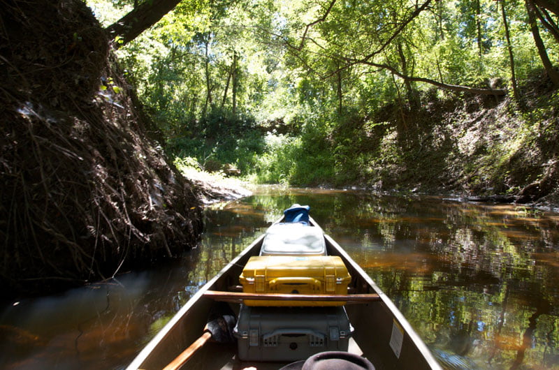
| Clark Creek Natural Area |
|
| 313.7 RBD |
Knox Landing |
| 311.7 RBD |
Auxiliary Intake — Old River Control Structure |
| 311.7 LBD |
Clark Creek |
| 311.7 – 310 LBD |
Tunica Hills Below Clark Creek (Mississippi Loess Bluff ##6) |
| 311 – 309 RBD |
Point Breeze |
| 310.2 LBD |
Wilkinson Creek |
| 306 LBD |
Welcome to Louisiana! |
| 306 – 294 LBD |
Angola State Penitentiary |
| 306 LBD |
Angola Ferry |
| 304.5 – 303 LBD |
Shreve’s Bar |
| 303.7 |
Old River Lock and Dam: Entrance to the Atchafalaya River |
| The Atchafalaya River: Best Rout to the Gulf |
|
| 306 – 302 |
Back Channel of Shreve’s Bar |
| 306 – 302 RBD |
Main Channel of Shreve’s Bar |
| 304 RBD |
Carr Point |
| 302.8 RBD |
Torras Landing |
| 302.5 – 298 LBD |
Hog Point Sandbar |
| 299 – 298 LBD |
Hog Point Towhead |
| 300.2 – 298 RBD |
Miles Bar Towhead |
| 297 RBD |
Raccourci Runout / Monday Lake |
| 295.5 RBD |
Leatherman Point |
| 294.7 LBD |
Sugar Lake Bayou |
| 293 LBD |
Tunica Bayou |
| 293 – 291.5 LBD |
Tunica Hills (Mississippi Loess Bluffs ##7) |
| Tunica Hills WMA |
|
| 293 – 290 RBD |
Tunica Bar Towhead |
| 291.9 LBD |
Little Hollywood |
| 291.8 LBD |
Como Bayou |
| 289.8 LBD |
Polly Creek |
| 289.5 – 289 RBD |
Greewood Bar |
| 287.5 LBD |
Greewood Dune |
| 287.5 – 284 LBD |
Little Island |
| 283.3 LBD |
Sebastopol |
| 281.5 RBD |
Below Burnette Point |
| 281.5 – 280.5 RBD |
New Tex Landing |
| 281 – 278 LBD |
Morgan’s Bend (Iowa Point) |
| 278.5 – 277.8 LBD |
Iowa Point Bottom End of Morgan’s Bar |
| 279.6 – 279 RBD |
Morganza Spillway Entrance |
| 278.8 RBD |
Cement Silo |
| 277.2 RBD |
Morganza Crevasse |
| 276.6 RBD |
Protected Dune |
| 275.5 RBD |
Before Boies Point “Hidey Hole” |
| 276 – 275 LBD |
Collapsing Muddy Banks |
| 275 – 270 LBD |
Cat Island National Wildlife Refuge |
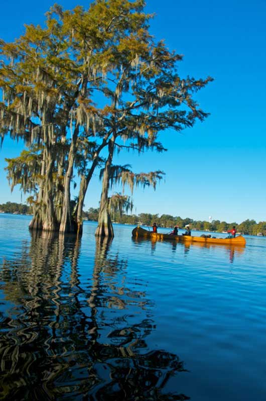
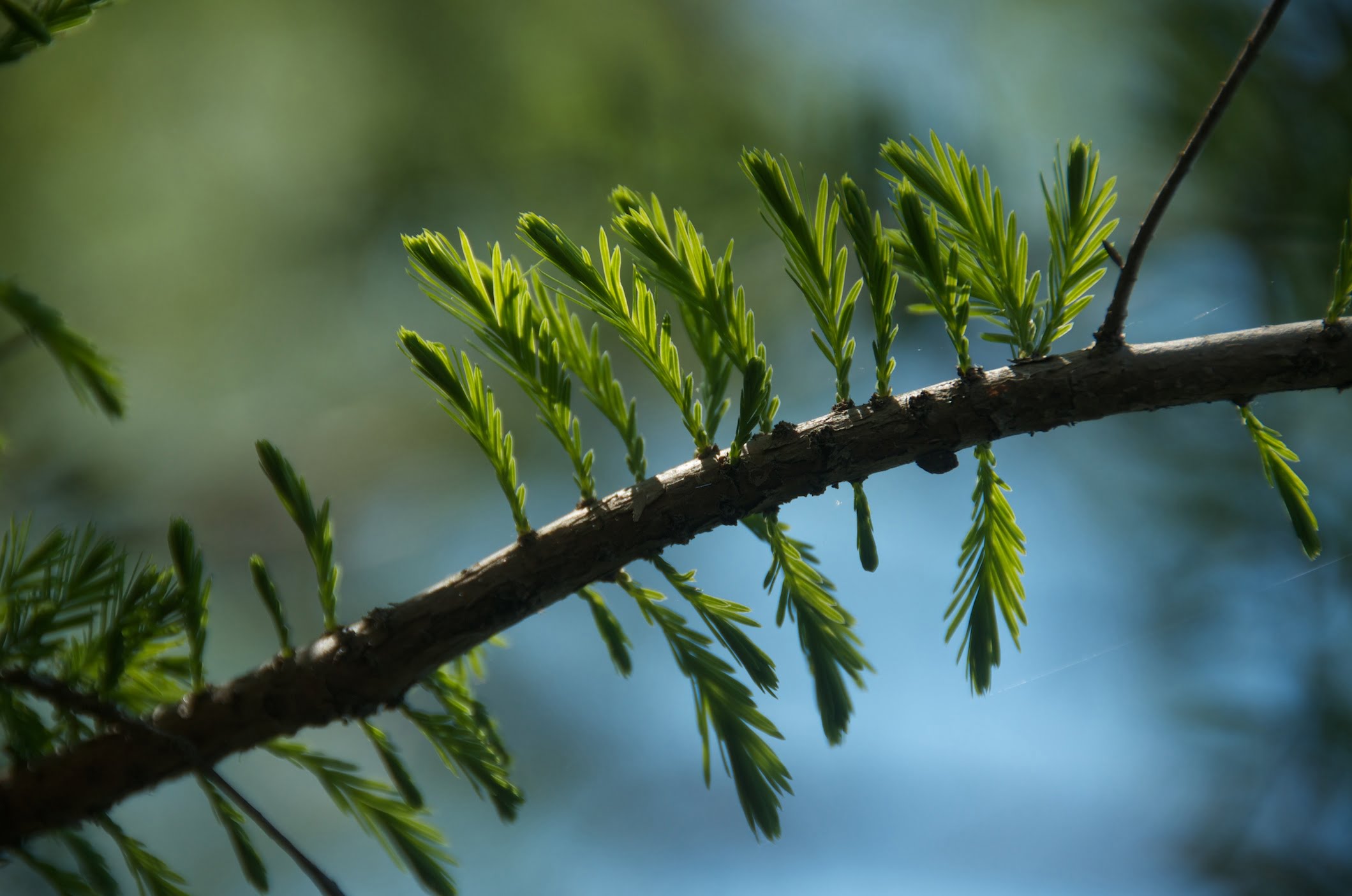
| Cypress-Tupelo Swamp |
|
| Bottomland Harwood Forests |
|
| Wading Birds |
|
| Wintering Waterfowl |
|
| 273 – 270 RBD |
St. Maurice Island |
| 274.4 LBD |
Hardwick’s Ditch / Access to the Co-Champion Cypress Tree |
| 270 LBD |
Double Silo Hunting Club “Cajun Condo” |
| 268.5 – 268 RBD |
Graveyard Landing |
| 266.2 LBD |
Bayou Sara |
| 266 LBD |
Old St. Francisville Ferry Landing |
| St. Francisville, LA |
|
| St. Francisville History |
|
| 265.5 LBD |
Army Corps Work Ramp |
| 265.5 LBD |
St. Francisville Mat Casting Field |
| 264.8 LBD |
St. Francisville Boat Ramp |
| Paddling Through the Narrows Below St. Francisville |
|
| 264.7 LBD |
Small Bayou |
| 263 – 261 LBD |
Sandy Dunes Dugan Landing |
| 263 RBD |
Big Cajun Power Plant I and II |
| 261.8 |
John James Audubon (New Roads) Bridge |
| 260.1 LBD |
Crown Vantage Outflow |
| 259.9 LBD |
Transmontaigne Docking |
| 259 RBD |
Big Cajun I Power Plant |
| 259 – 256 LBD |
Fancy Point Towhead |
| 257 RBD |
Hermitage Dune |
| 256 – 255.5 LBD |
Fancy Point Sandbar |
| 255.5 – 253.8 RBD |
Point Menoir |
| 255.5 LBD |
Thompson Creek |
| 255 LBD |
Georgia Pacific Port Hudson Paper Mill |
| 257 RBD |
Hermitage Dune |
| Water Quality |
|
| The Lower Mississippi Riverkeeper |
|
| Environmental Reporting Phone Numbers |
|
| 255 – 254.2 LBD |
Thompson Creek Bluffs (Mississippi Loess Bluff ##8) |
| 253.6 LBD |
Amoco Pipelnie Dock |
| 252.2 – 246.5 LBD |
Profit Island |
| 252.8 – 252.2 LBD |
Profit Island Chute (Entrance) |
| Profit Island Chute Weir |
|
| Warning!! |
|
| Profit Island Chute (Industrial Area) |
|
| 250.3 RBD |
Bald Eagle Nest |
| 250.2 RBD |
Wreckage of Crane Boat |
| 247.2 RBD |
Smithfield Boat Ramp |
| 246.5 – 246 LBD |
Profit Island Chute (Exit) |
| The Monmouth Disaster |
|
| 246.2 RBD |
Small Dune |
| 246.5 – 245.8 LBD |
Sandbar at Bottom of Profit Chute |
| First Sighting of Baton Rouge (Still 12 Miles Downstream) |
|
| 245 LBD |
Devil’s Swamp Bayou |
| “The Very Bottom” |
|
| Baton Rouge Crossroads |
|
| 241 – 239 LBD |
Thomas Point (Mallet Bend) |
| 239 – 235 LBD |
Allendale Reach (Thomas Point to Wilkerson Point) |
| 239 – 235 LBD |
Allendale Reach: Fleeted Barges |
| 235.8 LBD |
Devil’s Swamp Bayou |
| 235.8 LBD |
Bayou Baton Rouge |
| 235.2 LBD |
Baton Rouge Harbor |
| 235.2 LBD |
Baton Rouge North Wastewater Treatment Plant Outfall |
| 236 233 LBD |
Mulatto Bend (Wilkerson Point) |
| 235 RBD |
Point Place Landing (Wilkerson Point) |
| 234.2 RBD |
Wilkerson Landing Boat Ramp |
| 235 – 234.7 LBD |
Southern Univ., Istrouma (Scott’s) Bluff, Mississippi Loess Bluff ##9 |
| 233.9 RBD |
US 190 and Railroad Bridge (Old Bridge) |
| Navigating Baton Rouge Harbor |
|
| 233.7 LBD |
Monte Sano Bayou |
| Supertankers? Welcome to Chemical Corridor |
Monte Sano Bayou |
| 232.9 RBD |
CSS Arkansas |
| 233.8 LBD |
Formosa Plastics Corp., Baton Rouge North Wharf |
| 233 LBD |
Kinder Morgan (Exxon Petroleum Coke) |
| 232.2 LBD |
ExxonMobil |
| 232.2 LBD |
ExxonMobil Graffiti Wall |
| 231.8 RBD |
Placid Refining |
| 231.9 LBD |
Sunrise, Louisiana |
| 230 LBD |
Welcome to Baton Rouge: Downtown Riverfront |
| Baton Rouge Sites and Services of Interest to Paddlers |
|
| 230.1 RBD |
West Baton Rouge Tourist Commission, Court Street Landing |
| 229.6 LBD |
City Excursion Wharf AKA “The Paperclips” |
| 229.6 LBD |
USS Kidd |
| 229.4 LBD |
Argosy Casino |
| 229.3 LBD |
I-10 Highway Bridge “New Bridge” |
| 229.1 LBD |
Glass Beach (Baton Rouge Boat Ramp) |
| 229 LBD |
Old Municipal Dock |
| 229.1 RBD |
Greater Baton Rouge Dock No.1 Wharf: Community Coffee |
| How to Brew a Great-Tasting Pot of River-Rat Coffee |
|
| 228.3 RBD |
Intercostal Waterway (Port Allen Lock & Dam) |
| Resupply from Intercostal Waterway Boat Ramp (Under HWY 1) |
|
| 227.4 LBD |
LSU |
| Baton Rouge Gage (BG) |
|
| Water Levels According to the Baton Rouge Gage (BG) |
|
| Leaving Baton Rouge and Heading Downstream |
|
| Welcome to Sola (South Louisiana)! |
|
| Baton Rouge to New Orleans to Venice |
|
| Venice to the Gulf |
|
| About “Cancer Alley” |
|
| Possible Campsites Along the Lower Mississippi River |
|
| Baton Rouge to New Orleans |
|
| 220 LBD |
Duncan Point |
| 214 – 215 RBD |
Manchac Point |
| 210 LBD |
Bar Above Plaquemines LBD > 20 |
| 209 LBD |
Plaquemines LBD > 30 |
| 195 LBD |
Bayou Goula Sandbar LBD > 25 |
| 194 LBD |
Point Claire LBD > 35 |
| 177 LBD |
Eighty-One Mile Point LBD > 30 |
| 171 LBD |
Point Houmas > 30 |
| 154 LBD |
College Point > 30? |
| 149 LBD |
Pauline Bar (Magnolia Landing) LBD > 30 |
| 143 LBD |
Belle Point LBD > 30? |
| 132 RBD |
Bonnet Carre Island > 25? |
| 130 LBD |
Thirty-Five Mile Point LBD > 30 |
| 129 LBD |
Bonnet Carre Upper LBD > 40 |
| 127 LBD |
Bonne Carre Lower LBD > 40 |
| 109 LBD |
Opposite Twelve Mile Point RBD > 35? |
| 95 LBD |
Algier’s Point |
| 94.7 LBD |
The Moonwalk — French Quarter and French Market |
| 11 LBD |
Mouth of Baptiste Collette Bayou |
| 10 RBD |
Mouth of Grand Pass |
| Appendix |
|