The Lower Mississippi River Water Trail

rbd 820-815 Wright’s Point – Tamm Bend

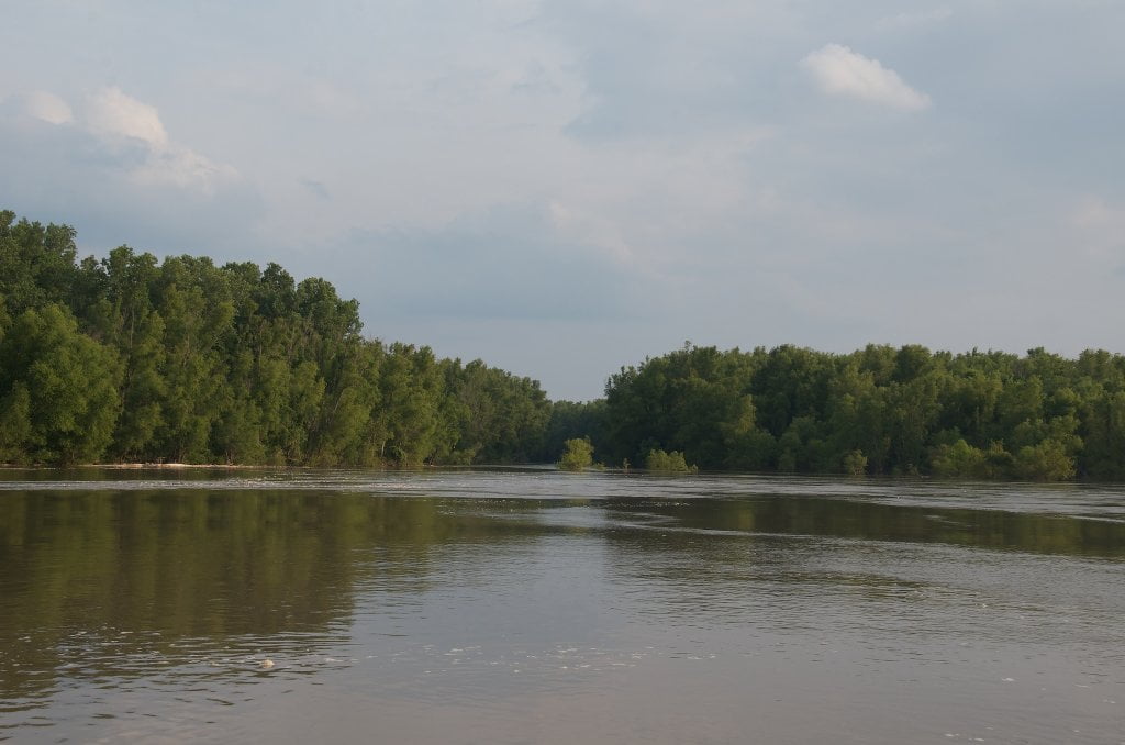
The main channel of the Mississippi makes a classic 180 degree bend around Wright’s Point.  In your canoe or kayak, you might not appreciate the shape of the channel.  But on your map or from the air you will see two distinctively shaped bends called Tamm and further downstream Barfield, one seemingly flowing in the reflection of each other.  Hence the beauty of the meandering river.


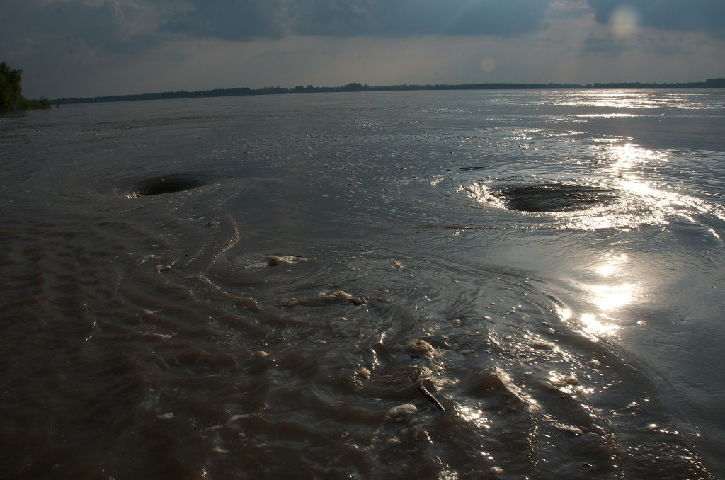
During low water you will need to follow the main channel almost eight miles to get around the deep forested Wright’s Point.  At lowest of water levels (below 5 CuG) a striking flat bar is created at the base of the forest around the bottom of Wright’s Point which could make for beautiful sandbar camping.


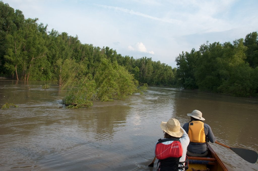
During high water you have the option of cutting behind Wright’s Point through a mile-wide back channel that will slice 5 miles off your journey.  As with all back channels the water flows slower behind Wright’s, but you will make up any lost speed with wildlife and peaceful flow, and of course less distance.  Three canoeists recently jumped into this back channel after crossing paths with the 2-screw Daytona pushing 12 petroleum barges.  After a half hour of paddling down the length of the back channel the three canoeists eagerly re-entered the main channel and found themselves again confronted amid-ships with the very same 2-screw Daytona!  I would have liked to known the tow pilot’s thoughts as he noticed this same canoe 8 miles downstream!


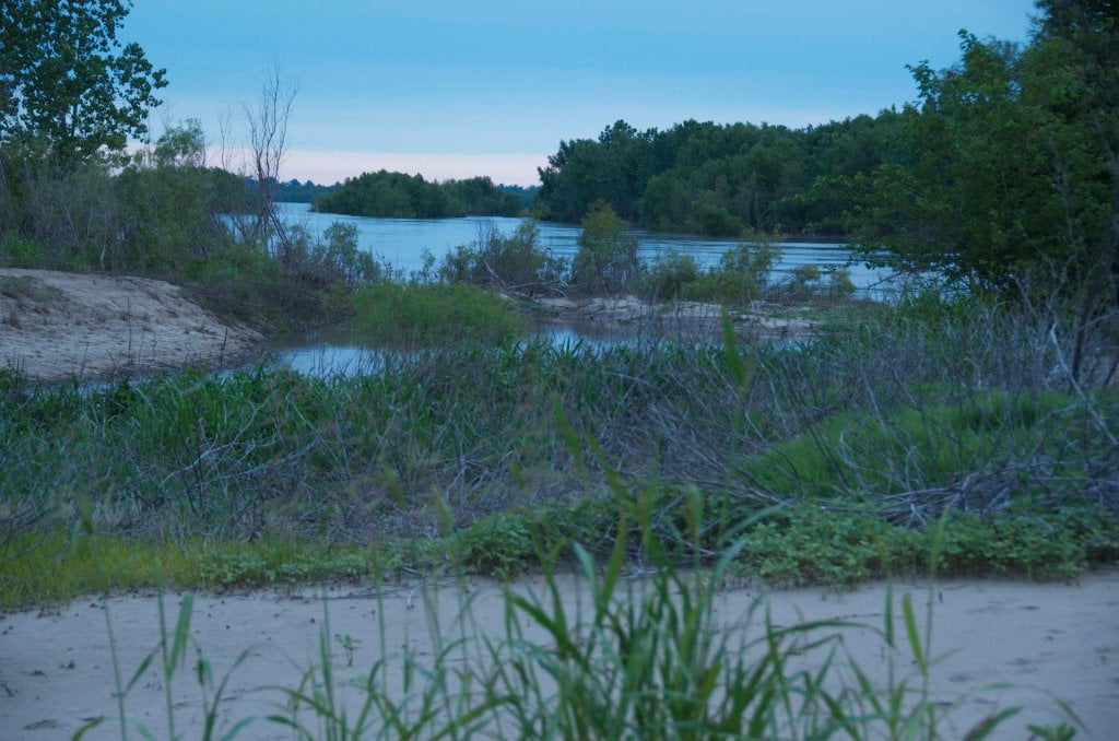
Following the main channel paddlers will scoot past the nondescript mouth of the Obion  River LBD 819.3 (which would make an interesting sidetrip for paddlers wanting to view turtles, waterfowl and other local wildlife) and not far downstream Tamm’s Landing LBD 817.8.


LBD 819.3 Mouth of the Obion River

The Obion is the biggest Mississippi River tributary in Northwestern Tennessee, but unfortunately its entrance into the big river is diminished by the unsightly placement of a small industrial docking in the form of a gravel operations.  Gravel is dredged from the bottom of the Mississippi River and used on land for road building and concrete.  Undoubtedly this ugly floating dock & separator was placed at the mouth of the Obion to take advantage of the smaller river’s scouring action.  But this seems like an insulting way to herald the entrance of noble Obion which provides irrigation and drinking water for all of this corner of Tennessee, including nearby Dyersburg and environ via its famous tributaries the Forked Deer.


Adventuresome paddlers could make a detour by paddling their canoe or kayak or stand-up-paddleboard up the Obion and explore the bottomlands of western Tennessee.  The channel is lined by fields of corn and soybeans for several miles up to the junction of the Forked Deer, and here the noble forests are protected when you cross the boundary of Moss Island WMA.   


Marion Bragg’s Historic Names and Places on the Lower Mississippi reports that “One of the legends connected with the Obion is that Davy Crockett killed 105 bears near the mouth of the river. The story may be true, for most of the early explorers and early settlers who recorded their experiences mentioned that bears were very plentiful along the banks of the Mississippi before the wilderness was overrun with people.”


39 miles upstream the Obion/Forked Deer is Dyersburg, NW Tennessee’s largest population and cultural/education center.  Home of Dyersburg State Community College.  Biologist Dr. Ken Jones of DSCC has conducted colony counts of the endangered Least Tern for the past twenty years down the Middle and Lower Mississippi River.  On some islands on some ideal years the count has exceeded 3,000 colonies.   Other years (notably 2011) the count was negligible due to the flood which occurred during mating season. 


The Mississippi River Corridor-Tennessee has been working for years to create a “blueway” to run the rivers from the Forked Deer River in Dyersburg, Tenn., onto the Obion and then follow the Mississippi River to Memphis.  This effort coincides with the slow but steady rise of recreational paddlers on the Lower Mississippi — which not coincidentally is the primary reason the Rivergator guide is now being written and published!

Leave A Comment

SECTION MILE ACCESS CITY
Middle Mississippi & Bluegrass Hills / Bootheel 195-0, 954-850 ST. LOUIS TO CARUTHERSVILLE
Chickasaw Bluffs 850 – 737 CARUTHERSVILLE TO MEMPHIS
Introduction  
Caruthersville to Osceola
850 – 737 LBD Options for Paddlers in the Caruthersville Stretch
Above Caruthersville  
Below Caruthersville  
850 RBD Caruthersville Harbor Boat Ramp (1/2 Mile Up Harbor)
849 RBD Mouth of the Carutherville Harbor
849 RBD Trinity Barge Fabrication Plant
847 RBD Blaker Towhead
846.5 Caruthersville
846 RBD Isle of Capri/Lady Luck Casino and Casino Inn Suites
845 – 840 LBD Caruthersville – Linwood Bend
850 RBD – 840 LBD Day Trip: Caruthersville to Booth’s Point
840 LBD Linwood Bend Boat Ramp
839 Caruthersville Bridge
Bridges and Mud: How Deep is the Mississippi Mud  
Several Routes Around Islands 18, 20 and 21  
838 – 835 LBD Island 18 Towhead
829 – 832 RBD Island 20 Dikes and Towhead
823 – 829 LBD Island 21
Routes for the Paddler Around Tamm/Barfield Bends  
820 – 815 RBD Wright’s Point – Tamm Bend
819.3 LBD Mouth of the Obion River
Moss Island WMA  
817.7 LBD Tamm’s Landing and Ed Jones Boat Ramp
817.7 – 801.8 LBD Chickasaw National Wildlife Refuge
No Levee?  
814 LBD Nebraska Landing
815 – 805 LBD Barfield Bend
809.3 RBD Barfield Boat Ramp
806 RBD Tomato Arkansas
805 – 801 RBD Island 25
Paddler’s Options in the Island 30 – Osceola Area  
800 – 796.5 RBD Island 26 and Forked Deer Island 27
803 – 787 RBD Ashport-Keyes Gold Dust
796 – 791 RBD Ashport Gold Dust Dikes
797 LBD Shoaf Landing
797 LBD Lower Forked Deer River
796 LBD Ashport-Keyes Boat Ramp
793 – 785 RBD Island 30
796 LBD Ashport-Keyes Boat Ramp
Neark (Jacksonville) Landing  
786.5 LBD Back Channel Island 30
785 RBD Osceola Arkansas
783.5 RBD Sans Souci Boat Ramp
Osceola to Shelby Forest
785 RBD Osceola Arkansas
783.5 RBD Sans Souci Boat Ramp
782 LBD Driver Island
779.8 LBD Old Mouth of the Forked Deer
779 – 778 LBD First Chickasaw Bluff
Alternate Paddler’s Route Around Hatchie River & 2nd Chickasaw Bluff  
778 – 773 RBD Sunrise Towhead – Island 34
777 – 773.5 LBD Hatchie Towhead
773.5 LBD Mouth of the Hatchie River
773.5 LBD Lower Hatchie National Wildlife Refugee
771 – 772 LBD Angelo Towhead
771 LBD Randolph Landing
771 – 769 LBD The Second Chickasaw Bluff (Richardson Bluff)
768.9 LBD Richardson’s Landing
768 LBD Randolph’s Landing/Duvall’s Boat Ramp
766 – 763 LBD Below Richardson’s Landing Dikes and Bar
Dyess Arkansas, Birthplace of Johnny Cash’s Five Feet High and Rising  
Five Feet High and Rising  
767.6 – 761.5 RBD Island 35
767 RBD Island 35 Boat Ramp
Back Channels of Island 35  
767.6 RBD Entrance
761.5 RBD Exit Behind Dean Isand
Memphis Gage  
Dikes and Water Levels  
Reading Google Maps  
761.5 – 757 RBD Dean Isand
761.5 – 757 RBD Back Channel of Dean Isand
Third Chickasaw Bluff  
758 – 754 LBD Denseford Bar and Dikes/Hen and Chicks
752.7 LBD Shelby Forest Boat Ramp
Shelby Forest to Memphis
Memphis Gage  
Dikes and Water Levels  
752.7 LBD Shelby Forest Boat Ramp
Hen & Chicks Round Trip  
754 – 745 LBD Meeman Shelby Forest State Park
754 – 747.5 RBD Back Channel of Brandywine Island
Buoys and Dikes  
Paddling Into Memphis: Three Distinct Routes  
749 – 742 LBD Hickman Bar
Picknicking and Camping on Hickman  
746 LBD Upper Hickman
745 LBD Middle Hickman
744 LBD Lower Hickman
743 LBD Below Lower Hickman
740.6 LBD Loosahatchie River
743.5 – 740 LBD Redman Point Bar
Memphis Upper Waswater Treatment Plant  
M.C. Stiles Waterwater Treatment Facility  
739 LBD Conoco Lucy-Woodstock Memphis Chemical Terminal Dock
740.6 LBD Wolf River
738.4 LBD Mud Island Upper Boat Ramp
740 – 737.5 Loosahatchie Bar
737.5 Ferry Crossing to Memphis From the Bottom of Loosahatchie Bar
737 Memphis “M” Bridge (Hernando De Soto Bridge)
736 LBD 4th Chickasaw Bluff: Memphis
736 LBD Memphis Mud Island Harbor
Mud Island Riverpark & Museum  
Memphis Yatch Club Marina & Boat Ramp  
Coast Guard Boat Ramp  
Memphis Conveniences Useful to Paddlers  
Several Challenging Round-trips From Memphis  
The Lossahatchie Redman Figure-Eight  
The Loosahatchie Roundtrip  
Hickman Bar Roundtrip  
Upper Delta 737 – 663 MEMPHIS TO HELENA
Middle Delta 663 – 537 HELENA TO GREENVILLE
Lower Delta 537 – 437 GREENVILLE TO VICKSBURG
Loess Bluffs 437 – 225 VICKSBURG TO BATON ROUGE
Atchafalaya River 159 – 0 SIMMESPORT TO MORGAN CITY
Louisiana Delta 229 – 10 BATON ROUGE TO VENICE
Birdsfoot Delta 10 – 0 VENICE TO GULF OF MEXICO