The Lower Mississippi River Water Trail

(Information gleaned from website Historic Memphis Bridges:
http://www.historic-memphis.com/memphis-historic/bridges/bridges.html)


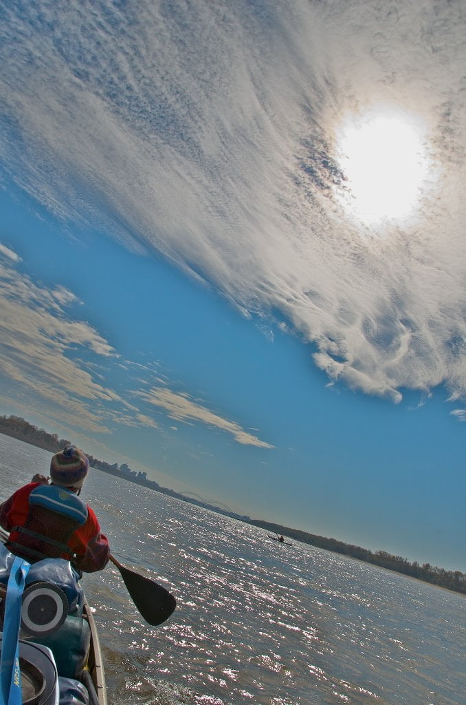
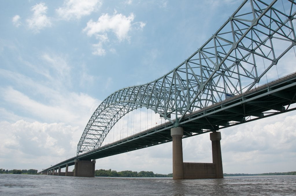
During the 2011 Flood myself and 2 other canoeists flew under the M Bridge at 10 knots with water piling high in a distinctive dome shape against center pier.  [You can see this effect in a YouTube video Surfing a 300-Mile long Wave]  In retrospect it looked something like the domed nose of an empty freighter pushing a pile of water.  Extreme paddlers eddy out into the backwash downstream of the piers, but do so at your own risk and only if you are capable of self-rescue.


LBD 736 4th Chickasaw Bluff: Memphis

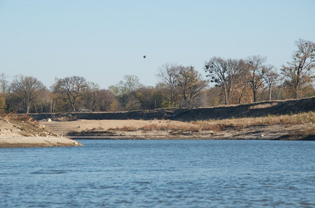
If you started at Osceola or above, you have seen all of the four Chickasaw Bluffs, and now you are at the last one.  Below here the river leaves the bluffs and disappears into the endless expanse of the Mississippi Delta.  Over left bank you can see the 4th Chickasaw Bluff downtown Memphis topped by a conglomeration of skyscrapers such as the bronze pinpoint of the Raymond James Tower and the creamy square I-Bank building.  After sliding under the M Bridge and passing underneath Mud Island Riverpark Museum stay with the fast water until you see the seven flags that have ruled over this location atop the 4th Chickasaw Bluff: France, England, Spain, Confederacy, North Carolina Guilford Courthouse, Tennessee, and America.  (Note: Tennessee was once considered part of the North Carolina Territory.  Also: the Confederacy flag flying here is not the more popular (and controversial) battle flag with the red triangles and blue x-diagonals filled with white stars, but the political flag with a circle of stars in a blue square and red & white rectangles.)  The harbor opens up just past a muddy/grassy/sometimes sandy point that marks the end of Mud Island.   Mud Island Harbor runs two miles along the base of downtown Memphis and the 4th Chickasaw Bluff, and was created by the re-routing of the Wolf River.  Its the best and safest access into downtown Memphis.


Wait until you can look down right down Beale Street (it will be on your left), then turn left and paddle hard.   Watch for traffic entering or exiting the harbor.  Popular anchorage for pleasure boats, yachts, bass boats, and john boats, and also the Coast Guard, the Memphis Queen, and small harbor tows. Warning: If you need to get into Memphis for whatever reason, don’t go past the Harbor.  There is no public landing for Memphis further downstream.


LBD 736 Memphis Mud Island Harbor

https://maps.google.com/maps/ms?msid=217859314001592865582.0004e42af49f035db404b&msa=0&ll=
35.145372,-90.053236&spn=0.021687,0.028174

http://goo.gl/maps/grJfO


Mud Island Harbor runs two miles along the base of downtown Memphis and the 4th Chcickasaw Bluff, and was created by the re-routing of the Wolf River.  It’s the best and safest access into downtown Memphis.  Known by various names.  In the 1900s the local blacks called it “Muddy Island.”  Delta bluesman Wesley Jefferson the “Mississippi Junebug” worked for a hardwood flooring mill near the Wolf River in the 1960s.  On sunny off days he would take his children and guitar and spend the day picnicking on the edge of the river at Muddy Island.  When the Wolf River was diverted in 1946 there was an effort to rename it the “Volunteer Bicentennial Park Island,” but fortunately that PR campaign never held.  Recently there have been efforts to clean up the image with a brand new moniker “River Island.”  Sigh.

Leave A Comment

SECTION MILE ACCESS CITY
Middle Mississippi & Bluegrass Hills / Bootheel 195-0, 954-850 ST. LOUIS TO CARUTHERSVILLE
Chickasaw Bluffs 850 – 737 CARUTHERSVILLE TO MEMPHIS
Introduction  
Caruthersville to Osceola
850 – 737 LBD Options for Paddlers in the Caruthersville Stretch
Above Caruthersville  
Below Caruthersville  
850 RBD Caruthersville Harbor Boat Ramp (1/2 Mile Up Harbor)
849 RBD Mouth of the Carutherville Harbor
849 RBD Trinity Barge Fabrication Plant
847 RBD Blaker Towhead
846.5 Caruthersville
846 RBD Isle of Capri/Lady Luck Casino and Casino Inn Suites
845 – 840 LBD Caruthersville – Linwood Bend
850 RBD – 840 LBD Day Trip: Caruthersville to Booth’s Point
840 LBD Linwood Bend Boat Ramp
839 Caruthersville Bridge
Bridges and Mud: How Deep is the Mississippi Mud  
Several Routes Around Islands 18, 20 and 21  
838 – 835 LBD Island 18 Towhead
829 – 832 RBD Island 20 Dikes and Towhead
823 – 829 LBD Island 21
Routes for the Paddler Around Tamm/Barfield Bends  
820 – 815 RBD Wright’s Point – Tamm Bend
819.3 LBD Mouth of the Obion River
Moss Island WMA  
817.7 LBD Tamm’s Landing and Ed Jones Boat Ramp
817.7 – 801.8 LBD Chickasaw National Wildlife Refuge
No Levee?  
814 LBD Nebraska Landing
815 – 805 LBD Barfield Bend
809.3 RBD Barfield Boat Ramp
806 RBD Tomato Arkansas
805 – 801 RBD Island 25
Paddler’s Options in the Island 30 – Osceola Area  
800 – 796.5 RBD Island 26 and Forked Deer Island 27
803 – 787 RBD Ashport-Keyes Gold Dust
796 – 791 RBD Ashport Gold Dust Dikes
797 LBD Shoaf Landing
797 LBD Lower Forked Deer River
796 LBD Ashport-Keyes Boat Ramp
793 – 785 RBD Island 30
796 LBD Ashport-Keyes Boat Ramp
Neark (Jacksonville) Landing  
786.5 LBD Back Channel Island 30
785 RBD Osceola Arkansas
783.5 RBD Sans Souci Boat Ramp
Osceola to Shelby Forest
785 RBD Osceola Arkansas
783.5 RBD Sans Souci Boat Ramp
782 LBD Driver Island
779.8 LBD Old Mouth of the Forked Deer
779 – 778 LBD First Chickasaw Bluff
Alternate Paddler’s Route Around Hatchie River & 2nd Chickasaw Bluff  
778 – 773 RBD Sunrise Towhead – Island 34
777 – 773.5 LBD Hatchie Towhead
773.5 LBD Mouth of the Hatchie River
773.5 LBD Lower Hatchie National Wildlife Refugee
771 – 772 LBD Angelo Towhead
771 LBD Randolph Landing
771 – 769 LBD The Second Chickasaw Bluff (Richardson Bluff)
768.9 LBD Richardson’s Landing
768 LBD Randolph’s Landing/Duvall’s Boat Ramp
766 – 763 LBD Below Richardson’s Landing Dikes and Bar
Dyess Arkansas, Birthplace of Johnny Cash’s Five Feet High and Rising  
Five Feet High and Rising  
767.6 – 761.5 RBD Island 35
767 RBD Island 35 Boat Ramp
Back Channels of Island 35  
767.6 RBD Entrance
761.5 RBD Exit Behind Dean Isand
Memphis Gage  
Dikes and Water Levels  
Reading Google Maps  
761.5 – 757 RBD Dean Isand
761.5 – 757 RBD Back Channel of Dean Isand
Third Chickasaw Bluff  
758 – 754 LBD Denseford Bar and Dikes/Hen and Chicks
752.7 LBD Shelby Forest Boat Ramp
Shelby Forest to Memphis
Memphis Gage  
Dikes and Water Levels  
752.7 LBD Shelby Forest Boat Ramp
Hen & Chicks Round Trip  
754 – 745 LBD Meeman Shelby Forest State Park
754 – 747.5 RBD Back Channel of Brandywine Island
Buoys and Dikes  
Paddling Into Memphis: Three Distinct Routes  
749 – 742 LBD Hickman Bar
Picknicking and Camping on Hickman  
746 LBD Upper Hickman
745 LBD Middle Hickman
744 LBD Lower Hickman
743 LBD Below Lower Hickman
740.6 LBD Loosahatchie River
743.5 – 740 LBD Redman Point Bar
Memphis Upper Waswater Treatment Plant  
M.C. Stiles Waterwater Treatment Facility  
739 LBD Conoco Lucy-Woodstock Memphis Chemical Terminal Dock
740.6 LBD Wolf River
738.4 LBD Mud Island Upper Boat Ramp
740 – 737.5 Loosahatchie Bar
737.5 Ferry Crossing to Memphis From the Bottom of Loosahatchie Bar
737 Memphis “M” Bridge (Hernando De Soto Bridge)
736 LBD 4th Chickasaw Bluff: Memphis
736 LBD Memphis Mud Island Harbor
Mud Island Riverpark & Museum  
Memphis Yatch Club Marina & Boat Ramp  
Coast Guard Boat Ramp  
Memphis Conveniences Useful to Paddlers  
Several Challenging Round-trips From Memphis  
The Lossahatchie Redman Figure-Eight  
The Loosahatchie Roundtrip  
Hickman Bar Roundtrip  
Upper Delta 737 – 663 MEMPHIS TO HELENA
Middle Delta 663 – 537 HELENA TO GREENVILLE
Lower Delta 537 – 437 GREENVILLE TO VICKSBURG
Loess Bluffs 437 – 225 VICKSBURG TO BATON ROUGE
Atchafalaya River 159 – 0 SIMMESPORT TO MORGAN CITY
Louisiana Delta 229 – 10 BATON ROUGE TO VENICE
Birdsfoot Delta 10 – 0 VENICE TO GULF OF MEXICO