The Lower Mississippi River Water Trail

Reading the Rivergator:

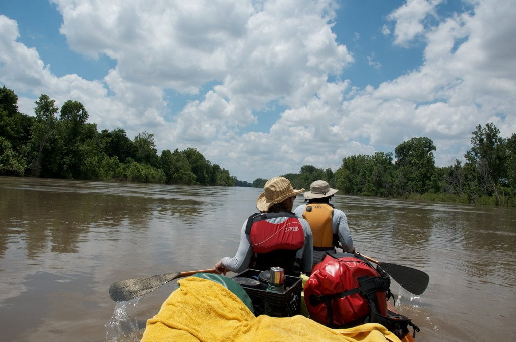
The Rivergator reads like a big river expedition, starting in Caruthersville and following the Lower Mississippi downstream mile-by-mile.  (Note: we are currently in the second year of a four year project: ultimate start place will be St. Louis, with end place in the Gulf of Mexico, almost 1200 miles of free-flowing river)  The descriptions are factual and the information is the most up-to-date available, but I have tried to enliven the writing with “the feel” whenever possible.  Each piece is titled with headings in bold that include 1) the name of the important features along the way, 2) which side of the river it’s on, and 3) its mileage.   For example, “The Mouth of the Caruthersville Harbor 849 RBD.”  849 is the mileage above the head of passes near the Gulf of Mexico.  RBD=right bank descending and LBD=left bank descending.  Paddlers are offered many route choices beyond the main channel in the plethora of sluices, back channels, secret passages, and tributaries along the way, using Google maps for illustration.  On your laptop or home computer you could open two pages, one for the text and one for google maps.  On the river you can switch back and forth on your smart phone.  Or you can print the text and use the US Army Corps Lower Mississippi Maps hard copy or online.  The Rivergator is actually three guides wrapped up into one, because every island, landing and riverbank has to be described in three different water levels, low, medium and high.  The Mississippi fluctuates 40-50 vertical feet in any given year, with enormous changes as result, whole islands disappear in high water, while some good landings become fields of mud at low water.


Panel of Experts:

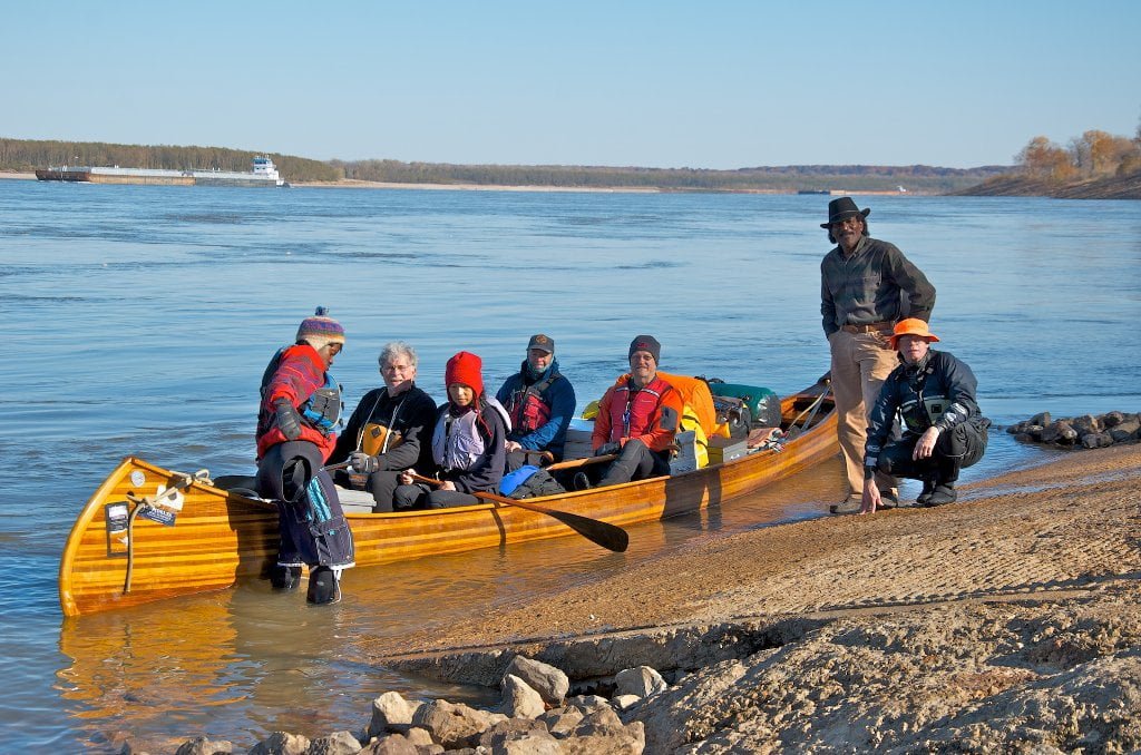
All writing is reviewed by a panel of paddlers, naturalists and other river experts including Dr. Ken Jones, big river pilot and Dyersburg biologist; Jim Stark, Dyersburg kayaker; Diana Threadgill, director of the Mississippi River Corridor-Tennessee; Keith Kirkland, big river canoeist, trailblazer and Wolf River Conservancy outdoors programs director; Bruce Van Wyngarden, big river pilot and founding editor of the Memphis Flyer;  Joe Royer, pioneering Memphis kayaker and founder of Outdoors Inc;  Dale Sanders, big river kayaker and adventurer extraordinaire;  Terry Eastin, Director of the Mississippi River Trail;  Colton Cockrum, river canoeist and founder of the Memphis River Warriors;  Bayard Morgan, canoeist and river advocate;  John Gary, big river pilot and all-around river-rat; Mike Beck, big river kayaker; Mark River Peoples, big river guide, and Chris “Wolfie” Staudinger, big river guide, Braxton Barden, avid paddler and mariner.  I, John Ruskey, am the primary author.  I have been taking notes, photographs and documenting the river since my first raft trip down the Mississippi in 1982, and so the Rivergator is the culmination of 30 years of exploration.  I have paddled the Mississippi on anything that floats including a log!  To verify all information I have been making “refresher expeditions,” (I last paddled this section with a team of explorers during the June rise, 2013).  I’ll try to keep myself out of it as much as possible, and let the river speak for herself.  But I’ll also spice the journey with stories and vignettes from my adventures along the way – and those of others who have first-hand experience.  Other important Rivergator sources include the National Weather Service “Lower Mississippi River Gauge and Week Forecast,” the US Army Corps 2007 Flood Control and Navigation Maps: Mississippi River, Google Maps Satellite View, Marion Braggs’ Historic Names and Places on the Lower Mississippi River,Teresa Tidwell’s Caruthersville, Missouri: 150 Years, Historic-Memphis.com, The Wolf River Conservancy, The Mississippi River Corridor-Tennessee, The Lower Mississippi River Conservation Committee, Wikipedia, Quapaw Canoe Company and Wild Miles.  See “Sources” for complete listing and suggestions for further reading.

Leave A Comment

SECTION MILE ACCESS CITY
Middle Mississippi & Bluegrass Hills / Bootheel 195-0, 954-850 ST. LOUIS TO CARUTHERSVILLE
Chickasaw Bluffs 850 – 737 CARUTHERSVILLE TO MEMPHIS
Introduction  
Caruthersville to Osceola
850 – 737 LBD Options for Paddlers in the Caruthersville Stretch
Above Caruthersville  
Below Caruthersville  
850 RBD Caruthersville Harbor Boat Ramp (1/2 Mile Up Harbor)
849 RBD Mouth of the Carutherville Harbor
849 RBD Trinity Barge Fabrication Plant
847 RBD Blaker Towhead
846.5 Caruthersville
846 RBD Isle of Capri/Lady Luck Casino and Casino Inn Suites
845 – 840 LBD Caruthersville – Linwood Bend
850 RBD – 840 LBD Day Trip: Caruthersville to Booth’s Point
840 LBD Linwood Bend Boat Ramp
839 Caruthersville Bridge
Bridges and Mud: How Deep is the Mississippi Mud  
Several Routes Around Islands 18, 20 and 21  
838 – 835 LBD Island 18 Towhead
829 – 832 RBD Island 20 Dikes and Towhead
823 – 829 LBD Island 21
Routes for the Paddler Around Tamm/Barfield Bends  
820 – 815 RBD Wright’s Point – Tamm Bend
819.3 LBD Mouth of the Obion River
Moss Island WMA  
817.7 LBD Tamm’s Landing and Ed Jones Boat Ramp
817.7 – 801.8 LBD Chickasaw National Wildlife Refuge
No Levee?  
814 LBD Nebraska Landing
815 – 805 LBD Barfield Bend
809.3 RBD Barfield Boat Ramp
806 RBD Tomato Arkansas
805 – 801 RBD Island 25
Paddler’s Options in the Island 30 – Osceola Area  
800 – 796.5 RBD Island 26 and Forked Deer Island 27
803 – 787 RBD Ashport-Keyes Gold Dust
796 – 791 RBD Ashport Gold Dust Dikes
797 LBD Shoaf Landing
797 LBD Lower Forked Deer River
796 LBD Ashport-Keyes Boat Ramp
793 – 785 RBD Island 30
796 LBD Ashport-Keyes Boat Ramp
Neark (Jacksonville) Landing  
786.5 LBD Back Channel Island 30
785 RBD Osceola Arkansas
783.5 RBD Sans Souci Boat Ramp
Osceola to Shelby Forest
785 RBD Osceola Arkansas
783.5 RBD Sans Souci Boat Ramp
782 LBD Driver Island
779.8 LBD Old Mouth of the Forked Deer
779 – 778 LBD First Chickasaw Bluff
Alternate Paddler’s Route Around Hatchie River & 2nd Chickasaw Bluff  
778 – 773 RBD Sunrise Towhead – Island 34
777 – 773.5 LBD Hatchie Towhead
773.5 LBD Mouth of the Hatchie River
773.5 LBD Lower Hatchie National Wildlife Refugee
771 – 772 LBD Angelo Towhead
771 LBD Randolph Landing
771 – 769 LBD The Second Chickasaw Bluff (Richardson Bluff)
768.9 LBD Richardson’s Landing
768 LBD Randolph’s Landing/Duvall’s Boat Ramp
766 – 763 LBD Below Richardson’s Landing Dikes and Bar
Dyess Arkansas, Birthplace of Johnny Cash’s Five Feet High and Rising  
Five Feet High and Rising  
767.6 – 761.5 RBD Island 35
767 RBD Island 35 Boat Ramp
Back Channels of Island 35  
767.6 RBD Entrance
761.5 RBD Exit Behind Dean Isand
Memphis Gage  
Dikes and Water Levels  
Reading Google Maps  
761.5 – 757 RBD Dean Isand
761.5 – 757 RBD Back Channel of Dean Isand
Third Chickasaw Bluff  
758 – 754 LBD Denseford Bar and Dikes/Hen and Chicks
752.7 LBD Shelby Forest Boat Ramp
Shelby Forest to Memphis
Memphis Gage  
Dikes and Water Levels  
752.7 LBD Shelby Forest Boat Ramp
Hen & Chicks Round Trip  
754 – 745 LBD Meeman Shelby Forest State Park
754 – 747.5 RBD Back Channel of Brandywine Island
Buoys and Dikes  
Paddling Into Memphis: Three Distinct Routes  
749 – 742 LBD Hickman Bar
Picknicking and Camping on Hickman  
746 LBD Upper Hickman
745 LBD Middle Hickman
744 LBD Lower Hickman
743 LBD Below Lower Hickman
740.6 LBD Loosahatchie River
743.5 – 740 LBD Redman Point Bar
Memphis Upper Waswater Treatment Plant  
M.C. Stiles Waterwater Treatment Facility  
739 LBD Conoco Lucy-Woodstock Memphis Chemical Terminal Dock
740.6 LBD Wolf River
738.4 LBD Mud Island Upper Boat Ramp
740 – 737.5 Loosahatchie Bar
737.5 Ferry Crossing to Memphis From the Bottom of Loosahatchie Bar
737 Memphis “M” Bridge (Hernando De Soto Bridge)
736 LBD 4th Chickasaw Bluff: Memphis
736 LBD Memphis Mud Island Harbor
Mud Island Riverpark & Museum  
Memphis Yatch Club Marina & Boat Ramp  
Coast Guard Boat Ramp  
Memphis Conveniences Useful to Paddlers  
Several Challenging Round-trips From Memphis  
The Lossahatchie Redman Figure-Eight  
The Loosahatchie Roundtrip  
Hickman Bar Roundtrip  
Upper Delta 737 – 663 MEMPHIS TO HELENA
Middle Delta 663 – 537 HELENA TO GREENVILLE
Lower Delta 537 – 437 GREENVILLE TO VICKSBURG
Loess Bluffs 437 – 225 VICKSBURG TO BATON ROUGE
Atchafalaya River 159 – 0 SIMMESPORT TO MORGAN CITY
Louisiana Delta 229 – 10 BATON ROUGE TO VENICE
Birdsfoot Delta 10 – 0 VENICE TO GULF OF MEXICO