The Lower Mississippi River Water Trail
Rivergator Appendix 11:
Gators to Freighters
Gators & Freighters
The Rivergator Oct 21-Nov 4, 2015 Expedition
Baton Rouge to the Gulf of Mexico
Introduction:
Greetings from Bayou Goula Island, day 3 of the Gators & Freighters Expedition. I am waking up in the pre-dawn light with Orionids streaking down through cloud-dappled skies in a mostly dark place, an anomaly in this otherwise very crowded stretch of river with 200 petrochemical plants in 140 miles of river(!) But even here amongst the chaos a great horned owl lulled me to sleep, and the distant crying of a coyote awoke me. With the exception of a tiny glimmer seen upstream over Pleasant Point (from the Willow Glen Power Plant) and a few individual light from a single dock across the river, and a periodic roaring from somewhere in the vicinity of White Castle, this is a wild place, no tracks here on the sand but animals and leaves. We found a narrow inlet parting the broad sandbar of this island from its main forested body, and made a beautiful camp on a sandy shelf. This might be our last “wild” camp until we reach the Gulf. One of the Queens emerged from the darkness above Palo Alto Landing and silently slid by downstream around the island, her lights blinking on and off melismaticaly (sp?) through the young willows covering a small mounded rise at the top of the island.
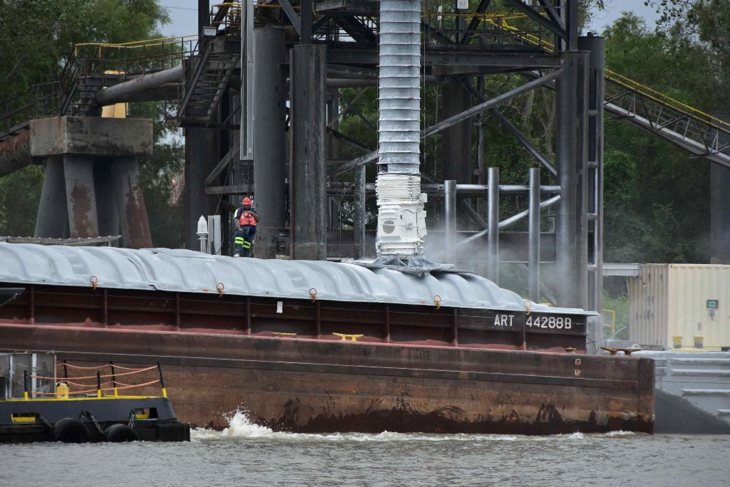
This is exactly why we are making this expedition down Chemical Corridor, through the busiest and most dangerous stretch of river on the entire Mississippi. Our official Rivergator recommendation is for paddlers to take the Atchafalaya Route. But we know most of you will want to follow the Mississippi through New Orleans. And so we are determined to find the best landings and campsites, and describe these busy waters so that your journey will be safer and more enjoyable. We also intend to to help you find the prettiest places — and isolated pockets of wild like this one — within the roaring industry of Southern Louisiana.
Let me introduce the voyageurs: On board this final expedition we have two seasoned adventurers, Ben Quaintance and Robert Landreneau. Robert frequents the Atchafalaya Basin and is a social worker from Lafayette. He has paddled with us Quapaws in several Bluz Cruzs, and at the last Phatwater. Ben lost his wife last year, but is keeping her spirit alive (and their intended retirement wishes to travel and see the world) by making long trips like these. He paddled the Upper Mississippi from Lake Itasca to Winonah, MN this very summer. So he will have bookended the Mississippi, with only the center section missing now.
Donovan Hohn is writing a book about the Mississippi as a follow-up to his brilliant 2014 Moby Duck*. Like me he is away from his wife and kids, a tricky balance of the heart, torn between a loving home and the call of the wild. He recently published a piece in the New Republic http://www.newrepublic.com/article/123162/everybody-hates-henry-david-thoreau defending our first, and possibly most influential naturalist and conservationist, Henry David Thoreau (not to mention poetic writer and free thinker!)
*Moby-Duck: The True Story of 28,800 Bath Toys Lost at Sea, and of the Beachcombers, Oceanographers, Environmentalists and Fools, Including the Author, Who Went in Search of Them.
Paul & Michael Orr are two friends who are saviors of the Lower Mississippi River, indeed of all of southern Louisiana. They are following in the footsteps of their mother, Marylee Orr, who the Pope must have been thinking about when he wrote the Laudato Si. They are both seasoned sailors, and naturalists, and walk the earth softly and with a keen curiosity. Paul is also the Lower Mississippi Riverkeeper.
From Quapaw Canoe Company is Mark River and Zoe Sundra. Zoe is our newest voyageur. On land she is our “secretary of the river,” and is also a textile artist and recorded singer/songwriter. You all know River, our lead guide and teacher. He oversees our youth programs in Clarksdale, and is also the southern leader for the 1Mississippi campaign. He is captain of one of the canoes. Quapaw graduate Chris Staudinger (“Wolfie”) joined us for this stretch, and boy are we glad to have him! I see him scribbling down notes so maybe, hopefully, you will hear his rich and colorful voice in one of these expedition updates.
To join us later in the expedition is Mary Ann Sternberg, author of the classic Along the River Road: Past and Present on Louisiana’s Historic Byway, and Dean Klinkenberg, author of the Mississippi River Traveler series.
Now a suffuse salmon warmth is spreading underneath the layers of clouds over Point Claire (looking east across the back channel of Bayou Goula Towhead) becoming peachish and then reddish towards its extremities. Waterfowl are seen everywhere around us, ducks, egrets, herons, taking advantage of the receding waters, and bright lines are etched in the face of the river indicating vigorous fish and amphibian activity. The mosquitoes are thick and ravenous. But the coffee is hot, and Irish oats will fill any empty places as we pack and ready ourselves for the challenging day ahead.
Most paddlers are an independent lot, and will do it on their own regardless. Which begs the question of why do we keep exploring when we could be safe at home with our loved ones? And Why the Rivergator? Why describe this less attractive route to the Gulf of Mexico when we could be only recommending and describing the Atchfalaya?
Well, it’s for wild places like this, like beautiful Bayou Goula, caught in between the cracks of civilization and the spread of industry up the Mississippi. A flower growing in between the cracks in the concrete. Tender places easily bulldozed or paved over. We feel the need to find them and share them, along with all of the possible routes and dangers involved. So that you, dear readers and dear paddlers, you can at the very least gain a little insight as to what’s here, and hopefully make your best decisions thereafter.
Yours in service of the Big River, “Driftwood” John Ruskey
Day 1- Glass Beach to Manchac Point-15 miles (Mark River)
The expedition crew wakes with great spirit and energy, finally getting the chance to start our journey. After many weeks of planning and packing, the time has come to get to the river. A morning breakfast of bacon, grits, granola, grapes, and strawberries points us in the right direction, as we meet and greet the rest of the team.
We gather to watch a orientational video from the LEAN team, Michael and Paul Orr, to familiarize us to the region and explain its complex checks and balances. Afterwards, writer Mary Ann Steinberg, explained to me the difference between Creole and Cajun, and turned me on to some books to read. The last minute pack followed, as we got closer to heading for the Mississippi River.
We head to Glass Beach to launch. On the ride over, I pictured 200 industrial refineries within 85 miles. I think about my Mother, Iveara Peoples who died of cancer, and now I’m going through ” Cancer Alley”. I imagine a dense, dark cloud hovering over the river, with pollutants and carcinogens painting the scenery bleak-a human wasteland. As we get closer, I look around at my team, slowly changing my perspective, knowing we are in this together, and we have to complete a five year project- the Rivergator.
We arrive at the boat ramp, as loved ones, media, and our ground crew showed moral support. The day is bright and beautiful, as we paddle across to the west bank. Fours bald eagles glide above us giving me goose bumps. A gorgeous bluff of sand, just pass the Intercostal Waterway, lined with willows, sycamores, and cottonwood trees, is where we stopped for lunch. The sand showed evidence of beavers dragging saplings to their lodge. My view of this stretch of river is changing rapidly. Even though filled with industries and refineries, it’s still the beautiful Mississippi River.
We continue downstream towards Red Eye Crossing, as the incredible LSU Tiger Stadium, sits on the east bank. I smile brightly, always seeing the stadium on television, and now seeing it from the river. Large ocean liners breeze pass us creating a modest wake. I ‘m surprised, thinking their wakes would surpass those of the towboats. Cliff swallows skim the surface of the river, harvesting small fish confused in the surf. My day gets better, as three more bald eagles meet us at Missouri Bend, while a flock of pelicans soar high in formation. I take this time to think about my friends and family in Missouri. A large dredging operation was in progress at Sardine Crossing, as we see Manchac Bend in the distant. A large bluff on sand greets us at Manchac Point and we stop for camp.
All the studying, and literature I’ve read about this section of the Mississippi River gave me a grim feeling, but the incredible sunset slowly changed the images created in my mind.
Day 2- Manchac Point to Bayou Goula Towhead-19 miles (Mark River)
Morning comes slowly on Manchac Point, as I gaze out my tent at the sky. Is it the glow from the industries, or the crescent moon, keeping the night illuminated? The visibility throughout the night kept me staring off the bluff at the Mississippi River. I marvel at the fact that I could see everything.Constant towboat traffic occasionally rocked me to sleep, but the night continuously had me checking the time, thinking the sun would rise soon-not wanting to be late to prepare breakfast.
The sun finally shows its presence as the crew slowly exit their tents to the smell of bacon and eggs. After breakfast,everyone took the time to write in journals and look over maps, eventually making it to their tents to pack up and start the day. I stayed by the fire stuffing two roast with garlic, and brazing them in olive oil, to be slow cooked all day in the canoe.
We launch our boats and start the Medora Crossing, and to our surprise, two towboats are in the main channel. One going upstream and the other downstream, so we have to make a decision. My initial thought was no-not wanting to tire my crew to early, but the other boat says, “Let’s do it!” The upstream tow was further away than the down-streamer, but we had the current and boats pointed downstream at a 45 degree angle on our side. The adrenaline kicked in and my paddle dug in deep, as the downstream tow gives us a warning horn. We make the crossing with plenty of time to share, as a bald eagle greets us on the other side as we head towards Plaquemine Bend. We dodge the car ferry and take the back channel of Plaquemine Island , as another bald eagle points us in the right direction.
We continue on and make the Granada Crossing and head towards St. Gabriel Bend. We eat lunch at Point Pleasant, as a alligator watches us from the water adjacent to the sand dune. This is the first time I’ve seen an alligator on the main channel of the Mississippi River. It must have heard about www.rivergator.org and came to check us out.After lunch we tried to get close for a picture , but it submerged never to be seen again.
We see our evening camp in the distant, while making the Bayou Goula Crossing, heading towards Bayou Goula Towhead where we would camp for the evening. Two fisherman on the east bank yell out, “Where y’all headed?”
We respond ,”the Gulf of Mexico.” They repeat with amazement, “the Gulf of Mexico!”
We take advantage of the early camp. Some bathe, some explore, and I focused my attention on the garlic roast. We enjoy a meal of garlic roast, red cabbage salad, cornbread , and roasted potatoes, with salad dressing of olive oil, soy sauce, apple cider vinegar, and cumin. After dinner the wind dies slightly as the sun disappears in the horizon and the mosquitoes chased us to our tents.
Day 3- Bayou Goula Towhead to Point Houmas – 23miles (Mark River)
My morning starts at 5:10 am. I take the time to walk across the long sandbar at the top end of Bayou Goula Towhead enjoying the pristine beach, but mainly to spend some time with myself for awhile before preparing breakfast. I’ve come to a conclusion. The illumination of the sky is not from the moon, but the glow from the paper mills, refineries, grain operations, and waste management companies in this heavily saturated industrial complex. It looks like an Alaskan summer. I sit in the semi-darkness questioning how this might effect the nocturnal wildlife in the region. I have been hearing great blue herons squawking in the night and maybe they have adjusted to this setting. I also realized that the ex-foliate the crop-dusters spray on the cotton to make the leaves fall off, causes the trees in the Delta to miss their fall color.My thoughts get interrupted when a large towboat comes cruising through the channel with all its lights beaming and spotlights me on the beach. I blew my cover by wearing my headlamp.
We start the day paddling down the back channel of the island, headed across the main channel to Nottaway Plantation of White Castle, LA. to refill our jugs of water. I stay with the boat to make sure the crashing waves from the towboats didn’t damage the Grasshopper canoe. I give a Quapaw Who-ute! to warn the others that two towboats, an up-streamer and down-streamer were converging on the bend . This would send crazy waves toward us and it’s better to be in the canoe paddling. The ground crew guys luckily brought our jugs by golf cart and we launched right on time.
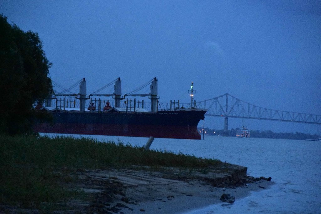
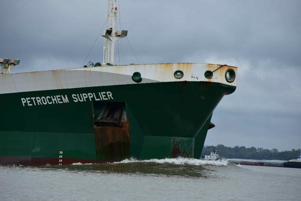
After the towboats we paddled through rough, choppy water for the next two hours. The smell of sugar cane is in the air, as we plow towards New River Bend. At a distance two ocean-liners are docked in the middle of the channel. We go between them waving at the crew. I seen five today. The SeaQueen, the USB Tampico, the Scarlet Falcon, the Darya Moti, and the Tequila Sunrise. They where being loaded with grain, coal, and petroleum.
We stop above Philadelphia Point to have lunch. Before we got close to completing our meal, a security guard from Borden Chemical harassed us until we left. It wasn’t scary, he only had a walkie-talkie and a flashlight, but he treated us like we were terrorists. He eventually threaten to call the sheriff and the Coast Guard, “you have 3 minutes to leave!” he yelled over and over again. So we packed up and moved on.
We continue on to Smoke Bend. Two fishing boats where anchored at the buoy line fishing for catfish. One asked, “Where y’all headed ?” I replied, “to the Gulf.” They respond in unison, “To the gulf?!!!!” We laughed, made the Smoke Bend Crossing to Bringier Point, and made camp just before Point Houmas.
There are no more islands to camp on from here to New Orleans, so we are finding selective sandbars for the rest of the expedition. With all the industry and towboat traffic, the river feels crowded, but I still feel the essence of the Mississippi River’s existence.
Day 3: Is the Wind your Friend? (Driftwood Johnnie)
Saturday, Oct 24, 2015 – Bayou Goula Towhead to Point Houmas. Miles 196 – 173 or 23 miles in SE wind 10-15 gusting to 25. Even though we have made tried to please the four Unoli, the Cherokee word for the winds, and made offerings to the four directions, the wind has definitely not been our friend so far on this expedition. Just the opposite. Several weeks ago we enjoyed nothing but tail winds for a whole week while paddling with Dave Cornthwaite and Emily Penn and their group of adventurers. But this week the tables have turned and a relentless East or Southeast wind has slapped us silly. We have enjoyed a few moments of respite while circling around some long bends in zig-zag directions, like coming around Point Manchac, and Point Claire, where 5 miles of tailwind buoyed us along, and a wonderful pool of smooth green water coming past Philadelphia Point and around 81 Point. But elsewhere the wind has awaited us, sometimes stirring the main channel into a boiling cauldron of rocky white-capping waves. At the same time we are paddling low water (hovering around 7 on the Baton Rouge Gage) which means slow water. Painfully slow. As slow as the Sunflower through Clarksdale, it seems, which means not moving at all in some pooling places. This creates a double-whammy for long distance paddlers.
The wind creates bigger waves in slow water… I wonder why? The same 10 mile an hour wind in high water would make rolling one-foot waves, but for us it’s two feet waves. At 15 they rise to three feet. At 20 they start haystacking into 3-4 foot rollers and the big canoes, while still not taking on any water, rise above the biggest wave, nose in the air, and smack the one following. The big waves to come in periodic trains, with lulls in between. There seems to be an inverse property between water speed and the height of the waves. I am guessing the high water turbulence has a dampening effect. Long distance paddlers coming down the Mississippi take note! I would highly recommend to try and reach this stretch of river when it’s at least 20 Baton Rouge gage. Higher would be better for distance made, but your campsites become extremely limited above 20. Below 20 we have been discovering (so far) one beautiful campsite after another, tall rolling dunes with easy access to the shade and protection of young willow forests. Good landings, and quick exits from the waves of passing freighters and tugboats (meaning real tugboats — the ones that frequent ocean harbors and help freighters in and out of dock — as opposed to our Mississippi River towboats, which push barges up and down the river).
Day 4 – Point Houmas to Paulina – 24 miles
To avoid the Friday night local gathering on Point Houmas, we pick a camp site right before the point. A small oasis of the finest grain of sand, with willow trees baring roots high on their trunks, as result of the unusual water levels this summer. At night when the wind blows, the roots look like skirts on hula dancers.
Another thing I’ve noticed, there’s a huge population of beavers. Every sandbar shows evidence, but you don’t see or hear them. They manage to thrive in this industrial haven, a place where predators are unlikely to hunt due to noise and people. They don’t even perform their territorial tail splash. It’s also better to be on the main channel away from all the alligators.
We get an early start so we can pick up writer, Mary Ann Sternberg, at the Sunshine Bridge. As we paddle around Houmas Point, a man and his young son are fishing from the sandbar. It was like seeing myself as a kid — little bow-legs, a pop-belly, and a big head, standing by the fishing pole, and being impatient, “It’s moving, Dad! It’s Moving Dad!”
“No it’s not,” he would say. But I would keep repeating “It’s moving, Dad! It’s Moving Dad! There’s something on there!”
And he would say, “okay, okay, reel it in.” But nothing would be on there. And eventually he would run me off to go explore.
We continue on to Burnside Bend, making our pick-up point. We paddle past the Sunshine Anchorage , a designated mooring spot for ocean- liners to anchor. As we paddle on headed to St. Alice Bend, the head wind increases to 20 miles per hour, making us earn every bit of progress. The river is so wide here, when the water is low, the wind predicts the conditions. We paddle hard and stop for lunch early at Wilton Landing. As we eat, it starts to rain.
Back in the canoe, it rained throughout the day. Stopping occasionally, but returning harder. I get encouragement from the eagles, herons, egrets, and cormorants, as they continue on like nothings happening. We head towards Romeville Bend and see the steeples from St. Michael’s Church (Convent, LA).
We make the Rich Bend Crossing , to Rich Bend, to College Point, and on to the Belmont Crossing. On the east bank is the town of Wallace and the west bank is Paulina. As we come around the bend I see a sign that says, “Paddlers Welcome” at Magnolia Landing where we are greeted by the owner, Charlie Poche, and his nephew Doug, and we camp there for the evening. A fire is burning for us, and several big piles of firewood nearby, and later Rickie Poche arrives to hand deliver some andouille that he made yesterday. What a refreshing greeting for weary paddlers!
Hurray for river angel Charlie Poche and his family!
The conditions are changing rapidly as we get closer to New Orleans. The flat water and headwinds are dictating our progress making the expedition tedious and challenging, but without these natural events, we wouldn’t exist.
Day 5,6 – Paulina – Poche Park — “Paddlers Paradise”
Our camp site in Paulina, LA. is owned by a huge, multi-generational family of Cajuns. A designated place for paddlers between Baton Rouge and New Orleans. A place like no other. Someone, out of the 30 family members living in this homestead, will greet and make sure your crew has what’s needed. Firewood stacks in strategic locations. Willow trees covering the area. A beautiful lake with an alligator. If you’re lucky, you receive homemade sausage or my favorite – hogshead cheese.
At 3am the torrential rains returned. It’s now 7am. It’s too wet to start a fire , so everyone hunkers down in their tents. I get dressed in rain gear to consult with our captain to assess the day. I step out of my tent and sink in 10 inches of mud. The campsite has turned into a floodplain. The river was beautiful with a thin layer of haze with drops of hard, but calm, rains barely breaking its surface. Towboats and ocean freighters patiently plowing through the blissful water. Cliff swallows fishing with no deter. I never knew such a hard rain could be so peaceful, nature going about its business.
We decided we would have to evacuate the campsite. Storms and high winds were predicted throughout the day. It would be unsafe on the Mississippi River today. The warm rains had relinquished our cooler of its ice. We had to grab our necessities and haul food to the levee; leaving tents, kitchen gray box, cooler and voyageur canoes. Full evacuation!
The crews regrouping, working together to make this the most efficient process as possible. Everybody is drenched. The campsite has become a swamp and with us churning the mud walking, it has become a mud-pit. Some build trenches to channel the water away from their tents. I pack light. I leave some heavy clothing in my large dry-bag and set it in the middle of my tent, an act of true faith. We start to haul provisions to our rendezvous spot on the levee. Batteries, computers, maps, personals, and food. Multiple trips walking back and forth to the levee in in muck. Moral is high as the adventure endures.
Having participated in many expeditions, I have discovered and valued the unexpected trials and tribulations that make our day to day conveniences irrelevant. I look around at our crew, smiling, wet, tired – really wet. And you can have all the right gear, vessels, and gadgets, but you can’t control mother nature. She humbles us every time.
Day 7 – Paulina to Bonne Carre Island -17 miles
The rains finally stop, as we pack up from base camp, headed to resume our voyage. We load up the vehicle and head back to Paulina, LA. to assess our tents and belongings we left behind the previous day. My soul is still wet from the torrential rains that delayed us. The one convenience I like to have more than anything else is a dry tent. As I see it from a distance, I know it’s soaked. We all drain and hang them from the willows, hoping the breeze would expedite the drying process.
We all sigh for awhile, but the mood starts to change as we pack the canoes. We have survived adversity, and now it’s time to get down the river. I linger for a little longer, knowing I will miss my other team at the Mississippi River Network meeting in New Orleans. My first couple of paddle strokes brought me instantly out of my funk. It was good to back on the river.
We paddle under the Wallace-Gramercy Bridge flowing towards Bell Point. We come across a bauxite factory at Willow Bend called Kaiser Bauxite . Past the complex, an orange substance was being pumped into the Mississippi River. This can’t be good. We take pictures and head pass the bend to stop for lunch as three bald eagles serenade us in the sky. After lunch we continue pass Tigerville, to Bonne Carre Point, and stop for camp at Bonne Carre Island.
There is deep narrow pool behind camp, which is the start of the back channel of the island. Some of the crew jump in the Cricket canoe and set off to explore while the rest cooked dinner. They returned hours later with a alligator skull. What a find! We find the River Gator — his skull anyway!
We enjoy our meal of red cabbage salad and lentil/turmeric/red potato/cauliflower stew and then go over the map of today’s paddle. While we are discussing our route, the mosquitoes ambush us. I look down at my boots and they are covered! Not hundreds – but thousands! We retreat to our tents for the evening. I stare at the ceiling of my tent as I write. Thousands of mosquitoes are patiently waiting for me to exit. I’ve had numerous cups of ginger tea, and it’s only a matter of time before I face the swarm.
Day 8 – Bonne Carre Island (RBD132) to Algiers Point (LBD95) – 37 miles
SMELLS by Wolf E. Staudinger
This part of the river is at once very familiar to me and very brand new. I’ve lived most of my life within miles of the river near New Orleans, but now that I’m seeing it from the inside out, it looks, feels, and smells a lot different.
Here are some of the smells we’ve been smelling in the last few days between Baton Rouge and St. Charles parish, where we’re camped:
– diesel fuel: there are so many tow boats, freighters, tug boats, crew boats, dredges, cranes, and trains around here that there’s always a lingering burnt diesel smell.
– raw gasoline fumes, coming from one of these petrochemical loading docks, where six or ten hoses dangle from a tall bulwark, waiting to hook up to a freighter bound for China.
– willows as usual, thankfully. John said that the willows in Paulina we’re giving off a particularly light and sweet smell.
– a very concentrated spray paint / mineral spirits smell
-sour malty corn. We’re seeing the end of the road for the fields and fields of corn that this country grows. Down here, the corn shoots out of these big tubes, dangling from the loading docks, and into the holds of freighters with names like Hai Wei or the Sea Queen. All concentrated, though, the corn smells kind of dank.
– steak! Saturday must have been steak day for the barge crews. the towboats had their grills smoking and charring some nice big corn-fed cow meat.
– cow manure. Even though this 85 mile stretch of river has the largest refining capacity of any place in America, it’s really rural. We also have smelled a thick burning wood smell, accompanied by a cloud of smoke over the horizon, which we think was a sugarcane field ablaze. This whole area was originally settled to farm sugar, indigo, and cotton.
– deep malty hot dog with an after hint of burnt molasses. This is the smell of a sugar refinery.
– rain. we’ve gotten our fair share of rain. It comes in rattling sheets across the water. and it smells a lot different from the river water. John says the river water has a “sickly, curdled milk smell,” similar to the smell of the water in Memphis.
– the pollen of a banana blossom. It’s banana season in southern Louisiana. Back in the spring or summer, the tree dropped a rope from which dangles a deep purple teardrop-shaped mass as thick as a cabbage. That’s the flower and it is pungent and fertile. From the rope grows a bunch of green bananas. In Donaldsonville, bayou lafourche (luh-foosh) used to split off from the Mississippi River and go south towards Houma and the gulf. But at some point, bayou lafourche was cut off from the river by the levees. Now, a set of huge pumps and pipes carry the Mississippi River water up over the levees and into bayou lafourche. At the strange grassy place where the water churns up from these pipes and bayou lafourche begins, we found a grove of flowering and fruiting banana trees.
– satsuma: it’s also citrus season down here. And The Orrs as well as the Pochés shared some of their fruit.
– smell of mustard burnt sugar dry ramen noodle shrimp/chicken powder flavor packet
– during the storm, Zoe lent me her instyle magazine, which had several perfume samples never before experienced in this tent, and vastly different from the other smells floating around in it.
– my mother’s chicken fricasse. She, my sisters, my neice, and my nephews met up with us at the top of New Orleans, and delivered two big pans of chicken and gravy. We took them to our campsite and devoured them here on Algiers Point: a familiar taste with a view of the city I’ve never seen.
Day 10 – Will’s Point (Jesuit Bend/East Bank/LBD68) to to Bohemia (Point a la Hache/East Bank/LBD 46) 22 miles in East headwind 10-15mph gusting to 25mph, sunny and hot (in the 80s)
In today’s dispatch, our newest Mighty Quapaw, Zoe Sundra takes the wheel and shares her story.
Quick Intro: the voyageurs paddle hard into increasing headwinds, another storm system approaching. We are trying to get 30 miles to Port Sulphur for a beer pickup from Linda & Barbara who just happen to be traveling through, and then go another 5 miles to get to a good camp. But the fates have something else in mind. The wind intensifies. Five more miles to Port Sulphur. We fee like crying. But then we spot an osprey atop a tall sycamore, as if signaling us. At LBD46 a possible campsite at Bohemia swings into view. Dry sand, humps of grass, a beautiful beach several hundred yards long. It looks like paradise. It is! It’s Bohemia in the Louisiana Delta. It’s madgical. We feel like “Delta Bohemians.” With one hour remaining before sunset a decision is made. We make camp. But oh no! At dark a container ship passes and the waves crash high up the beach and quench our fire. Is this a safe place to be? The weary voyageurs nerves are frayed, and an uneasy sleep begins with severe storms advancing across the south. We are running out of battery power, so the next dispatch will not be sent until Monday. Photos by John Ruskey
Zoe Sundra: Thoughts and observations from the first half of Rivergator Baton Rouge -The Gulf
Today was a strong day. Yesterday proved how strong I am and how strong the team is after pushing through 37 miles to an unsure camp at Algiers Point, New Orleans. We spotted a sandbar in the distance that may as well have been a desert oasis and pulled Cricket and Grasshopper onto shore. Celebration m&ms all around and Chicken Fricassee for dinner courtesy of Wolfie’s mama. Beers at the bar later that night, just over the levee.
Around hour 5 of each day my mind drifts and wanders to the same few topics:
Boyfriend (paddle stroke), debts I have to pay off (paddle stroke), what are we going to cook for dinner? (Paddle stroke), call your mother (stroke), call this friend (stroke), call your mother (stroke), call your sister (stroke), boyfriend (stroke) and so on until we have and water break, bathroom break or lunch break.
The freighters seems like dinosaurs, living monsters of an extinct era now tended to by foreigners unable to leave their docks. Some of my favorite names have been Alpine Hibiscus, African Griffon, Monica and best of all Glovis Maple.
There’s been a headwind on and off throughout the trip and has created some of the biggest waves and rollers I’ve ever seen, John too it turns out. Paddling through the chop and wind feels like stirring peanut butter with a toothpick. It is hard and I can do it, but I am tired and the days are long. The first 2 days I was pushing off feelings of incompetence but now I am so much stronger, the boat is well balanced and team morale is high, even in the rain. Mark and John have been saying that just when you can’t paddle another stroke, just when you think you can’t make it another day, the wind turns and the river rewards you. I have found this to be true over and over again. The river takes care of us.
Our mornings are calm. Even if we have to push off by 8, there’s about 20 minutes before everyone gets up and after breakfast is made where it’s the river, the sun and us. John, River and I sometimes talk, sometimes don’t and let the hum of barge, freiter and now distant car traffic make the unnecessary noise for us. The river turns from steel grey to lead to blues and pinks as the sun rises, silhouetting the willow trees and creating perfect feathered fingers from the leaves.
I would rather paddle through a 15 mph headwind in the rain past barges and through rollers than work another day in NYC.
But that headwind can be a bitch.
Our crew consists of paddlers, journalists, novelists, bandits and romantics, all of them men, and one bossy gypsy folk singer/rockstar. I fit in surprisingly well.
I’m pushing for a river name and occasionally will throw out suggestions (although I understand river names must be given, and earned). Sea Queen, Heron, Roller…none have really stuck but it’s been entertaining to hear Mark River and Wolfie test them out at meal times.
One of the main challenges I’ve faced on this expedition is having to use the bathroom at night. Not only is it a trial to leave the comfort of my tent, but I will have to battle an army of mosquitos in order to relieve myself. Not to mention I’m a woman and it requires a different set of skills. I put this problem to the group and River suggested a ziploc bag that I keep outside my tent. Two gallon size freezer bags later I am sleeping soundly, stress (and bug bite) free.
Yesterday a tug captain pulled up right next to our canoe, stuck his head out his door and yelled.
“Where y’all from?”
“Mississippi!”
“Where you goin?”
“The Gulf!”
“Where’d you start from?”
“Baton Rouge!”
“Y’all are crazy!” and he pulled away, but not before doing a small circular maneuver around us that was either and show of support or intimidation.
We guessed it was the former because about 2-3 hours later he found us again after rotating a freighter and insisted we have marine radios tuned to channel 67 in order to hear the river traffic. We smiled and gave a thumbs up, even though we have radios and are constantly listening and navigating around them. This conversation was about the 4th one we’d had in the past 2 days.
Today was a strong day. I only cramped during our first hour, afterwards my pacing was easy to find and we cruised along downstream, at times (as River puts it) I felt like we were flying over the water.
John has taken to “playing” with the freighters. He’ll steer us straight into the bow and then quickly turn us to float in between the ship and her anchor chains. It’s very fun, would give the coastguard (and my mother) a heart attack and it again reminds me that I am alive. We are actively creating an adventure we will never forget.
One night it was dry and windy, with clear skies. I took a walk in the moonlight because I could and it was gorgeous. The wind blew hard and chased away the mosquitos and I was free. I returned to my tent and made my nightly phone call to my boyfriend. He and I are currently on the definition of different planets. He is backstage in a 2000 seat theater in another country, and I just smashed a blood filled mosquito against the wall of my tent.
Still we make it work, and we do it well.
I am grateful for the marvels of technology.
There is no way to describe the experience and shift my life has taken this year. From 10 years of working in the NYC fashion industry to paddling at the front of a wooden canoe through swells, rollers and wind on the Mississippi River…it’s f—ing amazing.
Mark River: To the End of the World and Back
Last 3 Days of Gators & Freighters
By Mark “River” Peoples
Quick Re-Cap: Chemical Corridor turned out to be full of surprises. 25% of America’s petrochems are produced within this 250 mile stretch of river by 200 petrochem plants. Sounds awful, doesn’t it? It wasn’t. We found sparkling pockets of wetlands, woods and sandbars in between. Mark River and all of our guest writers have been sharing this wonder of discovery. I have tried to share the same through photography. The industrial places are an incredible education about how American industry works. Almost all of the pilots we met were polite and courteous, and seemed to be watching out for us in our odyssey. This strange juxtaposition makes the wild places even more beautiful. It is our intention to describe them all in the upcoming 2015 edition of the Rivergator: Paddler’s Guide to the Lower Mississippi. The 9-member crew reached the Gulf of Mexico at the beginning of November. The 2011-2015 Rivergator Explorations are Complete. Writing and photos will appear online on the Rivergator.org by the end of the year.
Day 12: Bohemia to Venice – 35 miles
We leave our exquisite beach willing and anxious after a two day storm camp. It’s time to resupply, so we cross the channel looking for a boat ramp, which leads to Port Sulfur. We find the small ramp, secure the boats, and walk over the levee. One team goes to the grocery store and another to a small cafe directly over the levee called La Caffe Casa. The plan was to charge electronics for the last time before the Gulf of Mexico, and to dry our souls before the days paddle. This little”gas station” is also a great place to have burgers and po-boys. It’s local the hangout for truckers, boat captains, fishermen, rig workers, and locals, all wearing the same signature white boots.The people are very kind and quick to start a conversation. They also have a great jukebox.
We ordered some po-boys to go and thanked the locals for their hospitality. The team headed back to the boats to start our paddle to Venice. Our sandwiches are fresh, so we pull over shortly for lunch. A loud roaring sound blares through the trees and suddenly an airboat shows up out of nowhere. Three men curious of our intentions and our feelings for them were mutual. They each had a shotgun and various pistols, strapped to their bodies with a cooler full of beer.
“What y’all doing in those canoes.”
I reply, “Headed to the Gulf of Mexico!”
“Y’all crazier than us!” and then: “Y’all want a beer?”
With all that fire power, the answer was yes. We chatted for awhile and we found out they were hunting pigs. With that loud motor, they were not going to see anything that day. They left,”before we figured out who they were” and motored across the channel. What a crew!
Continuing on towards Venice, gulls, brown and white pelicans, and terns fill the sky, along with ospreys and eagles. More commercial fishermen, all heading to the gulf, a sport-fishing paradise. The paddle was demanding and tedious, dealing with the marine traffic,which we had become accustomed to. We passed an old fort called Ft. Jackson, continuing on trying to beat the sunset. Local kids were waded out in the shallows fishing for mullet, as they leaped out of the waters surrounding us. We passed the town of Venice and found a small inlet protected by a rock dike to camp for the evening. Campsites are becoming a challenge. All dry land is overrun with fire ants, briar patches, and wild pigs. The driftwood selection is limited as we scavenge wet wood from the revetment. We all are exhausted from the paddle, but our moral is high, as we will be sleeping on the Gulf of Mexico tomorrow night.
Day 13: Venice to the Gulf of Mexico – 23 miles
Last night at sunset we arrived on a small slither of land protected by an unusual formation of dikes. Large cane groves, with briar patches and fire ant mounds throughout. The land was uprooted from pig activity, with very few options to camp. The beach was small, but functional. We didn’t seem to mind knowing we would see the gulf the next day.
I find myself a modest briar patch with a little bit of sand in the middle. I set my tent in the dark, as the cane comes alive. Moon Flowers started to bloom in the night. Wild pigs scampering. Red wing blackbirds inhabit the cane keeping the night full of sounds. The smell of the ocean filled the air, as the Mississippi River shows characteristics of the gulf. Warm winds and waves crashing from the sea-going vessels, send me into a deep sleep. Darkness extends forever as if we are at the end of the world.
In the middle of the night I stare at the fly of my tent admiring the community of mosquitoes using my home as a wind break. Opportunistic spiders and crabs set themselves up for the ambush. Animals rustle in and out of the cane, making the night full of questions. I take a bathroom break. Somehow I got turned around in my tent, exited through the wrong door, and into a fire ant mound. This is one of the tragedies of pitching your tent at night. Instantly ants swarm up my legs, as I somehow run through a huge briar patch, into the water. My feet seemed to move so fast, I never touch the ground.
The morning finally arrived, as I continued to kill fire ants in my tent. The sunrise is beautiful. Everyone is exited, anticipating the arrival to the Gulf of Mexico. I take a short walk, and underneath a small tree, something is stirring. Looking more closely, I realize, it’s a baby pig. Only a couple days old and about the size of a small potato, its smooth skin looked radiant in the sun. Its eyes were barely open and its belly fat from suckling. It looked comfortable and healthy. I must have scared the mother off.
I had a suddenly realization: this piglet looks like me.
I instantly get emotional. This little piglet, little River, made the thoughts of my Mother occupy my mind for the remainder of the day. She was with me as I headed for the gulf. I could only imagine the feelings the piglet was enduring. Was the mother close? It looked well fed. Will she come back for it? I could only hope. If it was anything like me, it made it.
We share stories about our unique camp around breakfast, as anticipation of the gulf flow through our hearts. We paddle towards Pilot Town, an establishment for pilots waiting to board any freighters entering the Mississippi River. It was a quiet place, with authentic history and the feeling of old. The marsh surrounding the town was full of wildlife: deer, rabbits, coyotes bobcats, and pigs had taken over the area. The cane was full of fish, frogs, herons, and snakes. Crabs and crayfish built cities in the marsh. It reminded me of an old Key West village.
This is our last stop before the gulf. Commercial fishermen in their fast boats zoom past us . Cane lines the channel on both sides. Activity in the cane can be heard frequently as we hug the marsh. The cane is very important for fish and shrimp reproduction.
We paddle hard into the evening. The marsh finally opens up. Oil rigs litter the skyline. Flocks of sea-birds fill the sky. The sounds in the air are loud and vibrant. My emotions take over, as I turn my back trying to hide. Another accomplishment for a young man born in East St. Louis. A place where most of the kids don’t make it to the age 18. A place where kids can pick sports or a life of crime. I’m happy my parents kept my mind occupied by sports and the Mississippi River. Thank You!
Day 14 – Upstream: Gulf of Mexico back to Venice – 24 miles
The night was majestic as our tents hugged the water line along a small wet beach in the gulf. When we pulled up to the beach the night before, a coyote scampered off. You wonder how they got here? All the marsh and wet ground. Where do they build their dens? The tide was suppose to rise one foot, but the beauty and sounds of the gulf mesmerized my mind to the point were I didn’t care. The sounds of the apps you can purchased don’t compare to nature’s version. I stared into the horizon at oil rigs in the distant, while waves crashed the shore just a few feet away from my tent. The stars are within an arms reach. I didn’t sleep much, enjoying the sights and sounds of the gulf.
The sunrise comes quickly as flocks of birds in the thousands hover and occupy the shoreline by camp. Brown and white pelicans, gulls and terns, eagles and osprey, and many more, cover the skyline. I realize why that coyote was in the cane. That’s where it ambushes the birds.
We eat a hardy breakfast and share our thoughts about the expedition with each other. I’m overwhelmed by emotions, but happy and proud of the completion of the Rivergator. All the hard work and sacrifice has resulted in success. We all have learned a lot about this great river and how it’s connected to many aspects of life. Freshwater is what these expeditions are all about, and the more I see, the more I know, about its importance to mankind.
A paddle upstream to Venice will complete the expedition. It has been one of the toughest to date, but I’m able to smile knowing how much each of the trips have effected my life. I haven’t had my Mother physically in my life for 36 years, but she is always with me throughout my journeys along the Mississippi River.
Day 14 – Mouth of Baptiste Collette to Southeast Pass Island (-13 Below Head of Passes) 22 miles in gentle SE (headwind), sunny and hot (in the 80s)
Oh the Joy! We Reach the Gulf Coast at Southeast Pass! After two weeks of hard paddling, winds, storms, storks, beaches, batture, wetlands, petrochemical giants, fishermen, freighters, and a few river-gators, the nine voyageurs canoe past mile -O- the legendary Head of Passes, and enter the Pass La Outre. Six miles downstream we cut into the peaceful, Southeast Pass which is lined by tall canes and grasses. A few scattered willows gives way entirely to cane, marshy grasses and floating vegetation. Seven more miles we paddle on into sunset, and Hallelujah! — there she blows! We cut through a final channel of cane — and then the horizon breaks wide open and a cacophony of shorebirds fills the air! My eyes fill with tears at the sight. To the south-southeast we are greeted by the open waters of the Gulf of Mexico. After 14 days of paddling we reach the end of the river! The horizon is broken by dozens of oil derricks, rigs and support boats. But the fish and birds are amazing. And the wing-shaped Southeast Island becomes our last camp of the expedition. We give our thanks to all of those who helped us reach our destination: Marylee Orr, Mary Ann Sternberg, Mike Beck, and especially Robert Landreneau (the grizzled Cajun paddler who helped us in the journey from Baton Rouge to New Orleans).


Leave A Comment
You must be logged in to post a comment.