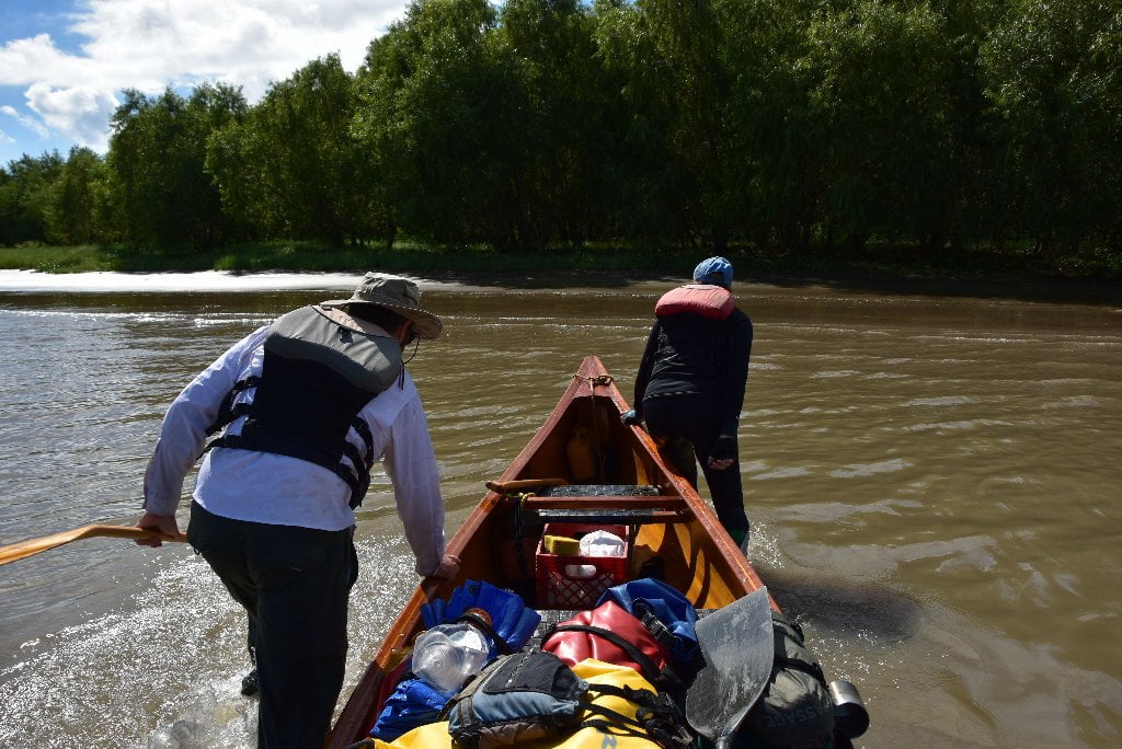
The Lower Mississippi River Water Trail
Tides in Rivers
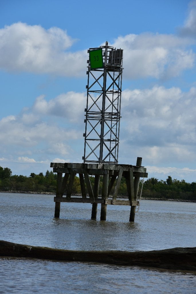
The tide reigning before a coast spreads upwards in rivers with identical periodicity, but the dissipation of the energy gradually reduces the amplitude and the tide ends up being imperceptible, with this being the boundary of the maritime part of the river. On the Atchafalaya this boundary is normally found around 50 miles upstream, in the Myette Point area (On the Amazon River is over 600 miles!).
Tidal bore
In normal conditions, the Atchafalaya River does not experience tidal bores, although this phenomena might occur during hurricanes or periods of high southerly winds. What is a tidal bore? In an estuary and even more so in a river with a wide mouth, the high tide is of much shorter duration than the low tide; it may even be that the ascent of the water up-river is almost instantaneous, this is the moment of the tidal bore, breakwaters that enclose the whole bed of the river which in turn also surges quickly upwards. In Brazil, the tidal bore of the Amazon River is known as the pororoca. It comes from the Tupi language and means “great destructive noise”. It occurs in spring tides, and waves of up to 12 feet in height are formed which are taken advantage of by surfers from around the world who come to the mouth of this river to surf tens of miles up the river with the waves.
Water Speed in the Passes
In general the water slows the further outwards you go down any one pass towards the Gulf. Just like the river, in high water it’s faster and in low water it’s slower. Incoming and outgoing tides have their effect, as already described. Paddlers used to enjoying 3-5 mph in the main channel of the Atchafalaya can expect the water speed to gradually diminish as the river approaches the open waters of the ocean, down to 2-3 mph in the main passes, and maybe 1-2 in the smaller passes, and then maybe 1mph arpound the final island, to final calm completely when you paddle into the deep water of the Gulf. Not only is the water volume decreasing every time the river splinters into another pass, but it also reaches sea level, thereby losing all of the “pulling” effect of gravity.
Which Pass?
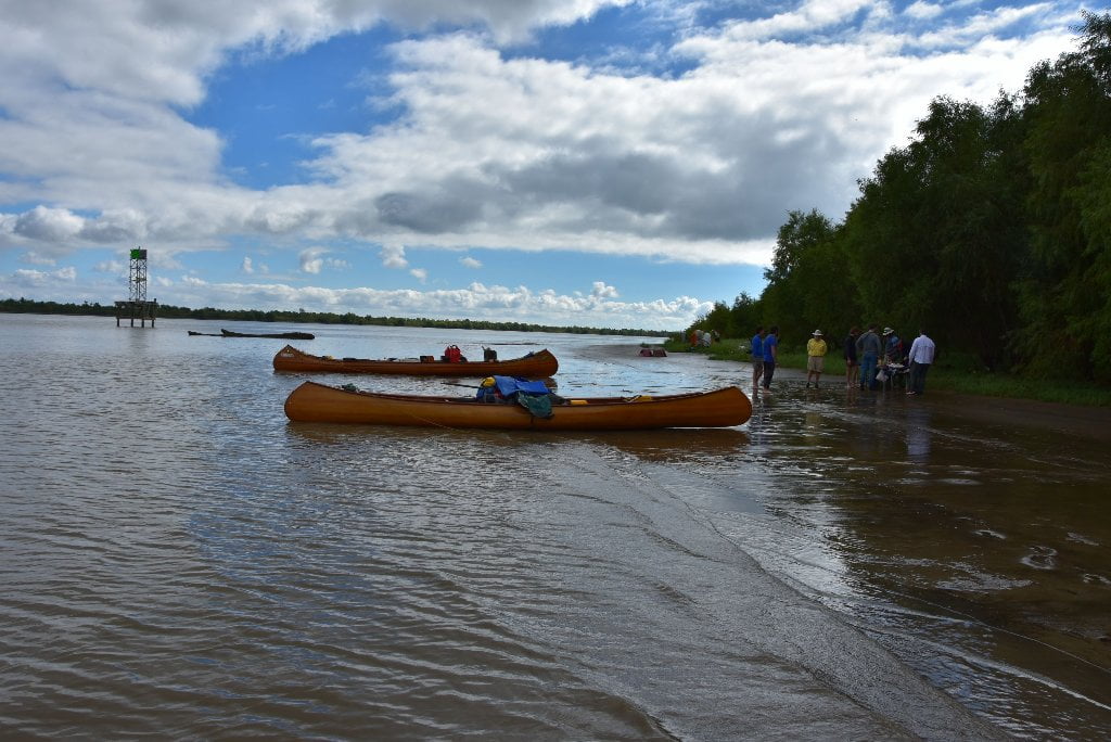
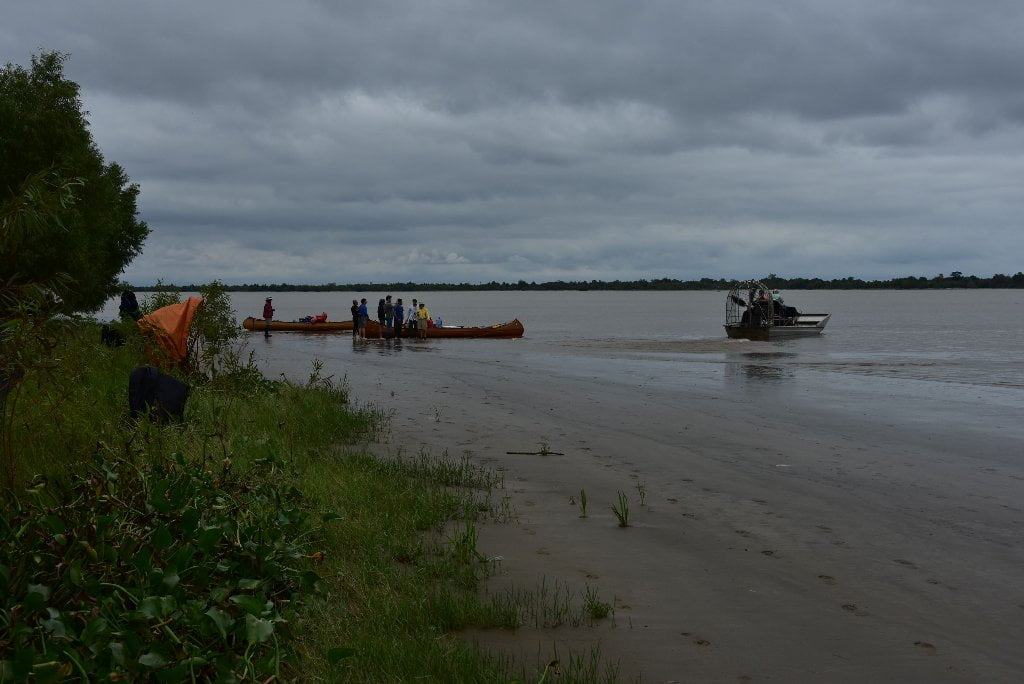
You are nearing the end of you expedition, and some fore-planning is in order. Where exactly is the end of your long journey? Which of the many passes you follow depends on personal judgement, stamina, and the weather forecast. The strongest recommendation the Rivergator makes is to not rush the end of your expedition. If the weather allows, enjoy the unique beauty and biota of the Gulf Coast. Camp an extra night on a beach towards the end of the river, like the long beach found at Melanie Island (145RBD), or at one of the Atchafalaya Delta WMA campgrounds. You could also paddle out the Wax Lake Delta, or return by the Wax Lake Delta. Read below and study the maps. With an extra day or two of paddling, and then add on a last day for an overnight camp, and a day for the return paddle, and you could be celebrating your successful odyssey on a sandy beach covered with seashells, and your joy would be magnified by the many crabs, fish and birds there to help celebrate! What are an extra 2-3 days when you have been on the water 3 months already?
Wax Lake Outlet: Alternate Route to the Gulf
Most Paddlers will go through Morgan City to reach the Gulf, but please be aware that you could turn right at Myette Point 102 RBD and cross Sixmile Lake to access the Wax Lake Outlet. Check the route on Google Earth. Follow the Wax Lake Outlet to the Wax Lake Delta. This could be a final Gulf Coast destination for long distance paddlers. Your return route could be back up the same outlet, but a more interesting route would be to circle back up the Atchafalaya Delta and end in Morgan City (Intracoastal Waterway/Berwick Boat Ramp is the best location). Or you could paddle west into Bayou Sale Bay and pull out at Burns Point Park (as several expeditions have done in recent years).
Shell Island Pass
Your first West Bank option down the main channel of the Atchafalaya would be the Shell Island Pass (137.8 RBD). This is very first possible western exit into the Gulf of Mexico off the main channel of the Atchafalaya, and begins at the base of Shell Island (which is indeed a pile of shells – at least here at the mouth of the exit). In 2015 we found the inflowing water speed to be 2-3 mph when the river was at 5 feet on the Morgan City Gage (MCG), and the banks of the pass were at bank full. Expeditions could paddle out to the Gulf from the Atchafalaya and make a three-mile crossing over to the Wax Lake Delta for the return trip to Morgan City. Check forecasts first before attempting this route. You would not want to be be making an open bay crossing in high winds from any direction. The Atchafalaya Delta WMA Campground is located at the top end of Camp Island in Crewboat Channel of the Campground Pass, in between Campground Pass and Main Pass. The Wax Lake Delta Passes are (from West to East): Oryx Pass, Little Beach Pass, Fred Pass, Redhead Pass, Campground Pass, Shortcut Pass. Rookery Pass, Mallard Pass, Gadwell Pass, Main Pass, Greg Pass, Pintail Pass, East Pass.
Location Island Pass
Your second choice would be the Location Island Pass (140.2 LBD) which is the first East Bank Pass option to the Gulf, and is short and sweet. You could paddle two miles down this pass and make a landing on the beautiful beaches of Plumb Island Point. Check route on Google Earth. If the weather is good camp one night on the beaches of Plumb Island Point and then turn around and paddle back to Morgan City.
Amerada Pass
Third Choice: Amerada Pass (144.2 RBD) would be a good choice for paddlers to reach the Gulf, then turn around and camp at a designated Campground. The Atchafalaya Delta Wildlife Management Area maintains a boat-access only campground approximately one mile down Amerada Pass on Willow Island. You could paddle down, check in with the ranger at Park Headquarters, and then paddle out to the Gulf. Break open your bottle of champagne, celebrate your successful expedition, and then paddle back to camp. This would be an excellent way to end your great adventure. The only drawback is that there are no views of the open Gulf from here. On the other hand, you would be in good company in a safe place. And you would get a first hand look at the Atchafalaya Delta flora and fauna, along with possible interpretation from WMA staff. Amerada Pass continues on to Catfish Pass and Arrowhead Island.
Main Channel: Melanie Island
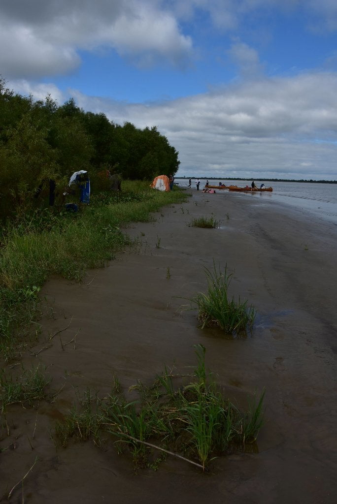
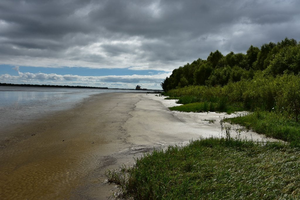
We’re saving the best for the last: Melanie Island. Imagine paddling around God’s Island, and reaching the open waters of the Gulf. You celebrate the completion of your adventure in the middle of the main channel of the Atchafalaya as it flows towards towards South America. Then you cut back to the West Bank, right back descending and make landing on a sparkling white beach running as far as the eye can see. Welcome to Melanie Island! Excellent location to turnaround, Melanie Island is also the very last island of any size on the main channel of the Atchafalaya with safe dry ground suitable for camping and celebrating your successful expedition. It is also wild, primitive, and full of bird and animal life. Best of all, Melanie Island features the longest beach on the entire Atchafalaya Delta! There is a full half mile of beautiful sun-filled shell beaches on Melanie Island, with endless campsites to chose from. As such, the Rivergator recommends not going beyond this point. Melanie island would make an excellent choice as a turnaround place for your expedition down the Mississippi/Atchafalaya River systems. The beach is mostly shells at bottom end, but becomes more sandy towards top end. Walk the whole thing and savor your great adventure, and then pick out the best spot for your final camp.


Leave A Comment
You must be logged in to post a comment.