The Lower Mississippi River Water Trail
Whiskey Bay Pilot Channel
Most of the Atchafalaya River flows into the Whiskey Bay Pilot Channel, hence it is the fastest route, and is indeed today considered the main channel. This route is a good choice if you want to make the best speed possible, and aren’t interested in some sight-seeing and exploring some of the back channels of the Atchafalaya Basin. At most water levels the Whiskey Bay Pilot Channel will cut your travel time in half compared to paddling the Old Channel.
The Whiskey Bay Pilot Channel was cut 40 feet deep into the center of the Atchafalaya in 1934-1937 to create a waterway navigable to towboats. In 1973, a large flood threatened to destroy the main control structure and the Corps began a redesign of the control system to include additional structure elements. The resulting “Old River Control Structure” that exists today was designed and built to allow as much as half of the combined flow of the Rivers to be diverted down the Atchafalaya during a major flood and to allow configuration of the flow to minimize stress to the structures. In addition to the control structures, levees were built outside the lowest area through the Atchafalaya Basin, roughly five to ten miles on either side of the Atchafalaya River, from Simmesport to Morgan City. The construction of the levees and subsequent straightening of the Atchafalaya River main channel changed the hydrology and siltation of the Atchafalaya Basin, both inside and outside of the levees. The new “main channel” follows the Whiskey Bay Pilot Channel, and the previous channel through Butte La Rose is silting in. Some historic channels were cut off by the levees and others were intentionally closed at the river to force the bulk of Basin water to be carried by the new main channel and hence, to scour the channel wider and deeper so that the flood control mandate could be met. A larger channel would also provide for easier navigation on the River. (Friends of the Atchafalaya)
59.6 LBD Cell Tower
59.6 Gulf States Utility Co. Aerial Crossing
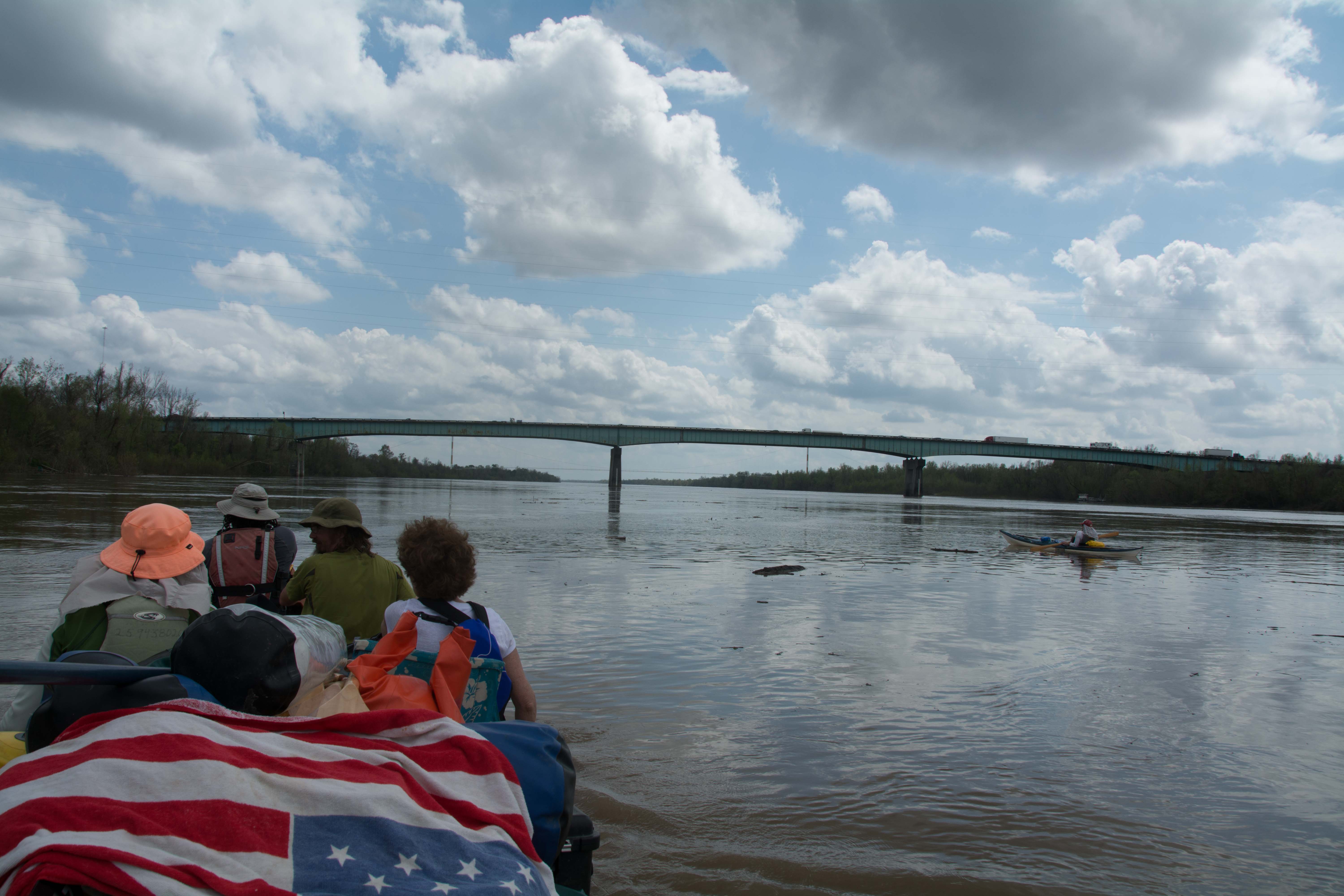
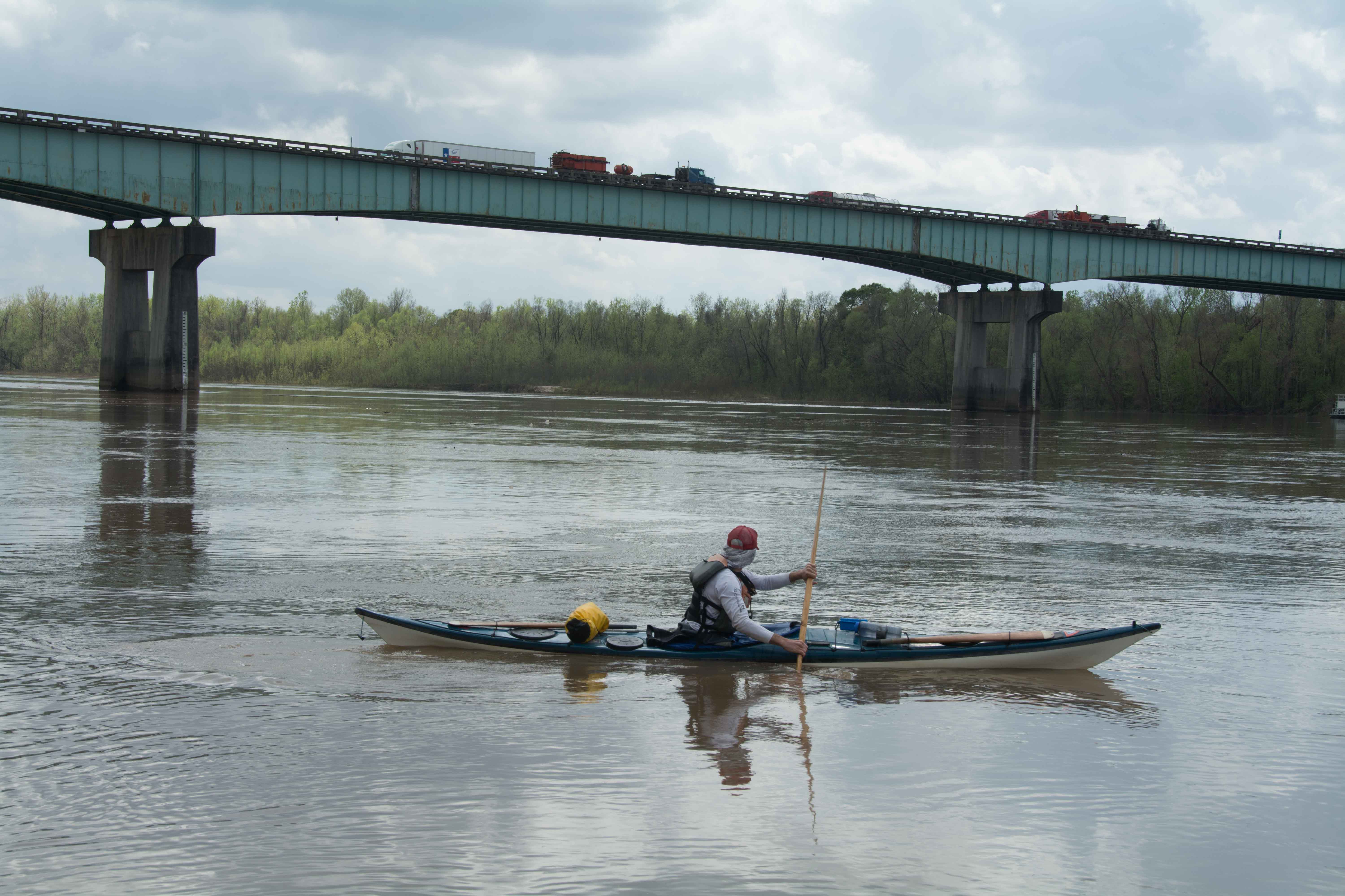
59.8 I-10 The Atchafalaya Basin Bridge
Also known as the “Swamp Expressway.” This is probably the ugliest bridge on the Atchafalaya River; it’s nothing more than a cold steel megalith cutting across the horizon as if a monotone grey-green skyscraper fell over here. Unlike the other elegant bridges that seem to enhance the beauty of the scene (i.e. truss bridges, suspension bridges, and cable stay bridges seen elsewhere) the I-10 Bridge denigrates the view, slicing it in half like a meat chopper’s cleaver.
Paddlers can make land contact here, but the site is very primitive, and feels a bit hostile. Besides being a steep bank (actually a cliff) composed of rangia shells with no easy access to river (except in high water when the water is at bank full level) this hangout is trashed out and has the feel of a place you might not want to be after dark. There is no boat ramp here, but a gravel ramp is found two miles downstream on the east side of the river, left bank descending at 60.7 LBD. (Note: We’re calling this the Bayou Des Glaises Boat Ramp for the nearby bayou of the same name.) Also, you passed the Atchafalaya NWR Boat Ramp four miles upstream, at 55 LBD.
The Atchafalaya Basin Bridge, also known as the “Louisiana Airborne Memorial Bridge,” is a pair of parallel bridges that carries I-10 over the Whiskey Bay Pilot Channel. With a total length of 96,095 feet (29,290 m) or 18.2 miles, it is the 3rd longest bridge in the US and the fourteenth-longest bridge in the world by total length. The bridge includes two exits: one for Whiskey Bay (LA 975) and another for Butte La Rose (LA 3177). While the bridges run parallel for most of their length, they merge when crossing the Whiskey Bay Pilot Channel and the Atchafalaya River. The average daily traffic count is (as of 2011) 24,540 vehicles. Accidents occur frequently near the two river crossings as both are very narrow and lack shoulders. Accidents along the bridge can be problematic as the Atchafalaya Basin is sparsely inhabited. In 1999, Gov Mike Foster lowered the speed limit on the bridge from 70 MPH to 60 MPH. In 2003, the Louisiana Legislature enacted new traffic regulations for the bridge. The speed limit for 18-wheelers was lowered to 55 MPH, and they must remain in the right lane while crossing the bridge.
60 RBD Sand Dune
There is a mound of sand with willow on top that gets regenerated here by the fast water swelling up under the bridge, and would make a great campsite except for the never ceasing cacophony of traffic going over the I-10 bridge. If you spent the night you are likely to hear the passage of 12,270 vehicles in a 12-hour stay, according to average traffic count in 2011. It would make a better picnic place, since you wouldn;t need to stay too long – in which case you might only hear 1,022 vehicles go by (with a one-hour lunch!).
60.5 Union Texas Petrochemical Aerial Crossing
61.7 LBD Bayou Des Glaises Boat Ramp (primitive)
This gravel boat ramp is found just downstream of an bankside aggregate operation. Cut in left bank descending below the last of the gravel or sand barges parked here and make landing. PS: We’re calling this the Bayou Des Glaises Boat Ramp for the nearby bayou of the same name.
62.3 LBD Bayou Des Glaises
1st natural opening off the Atchafalaya below the end of the levee (eight miles upstream at 54.2). No flow except in highest of water levels. Leads to Stand Canal which sometimes connects to Pat’s Throat, mile 66.7
64.4 Southern Natural Gas Company 10” Pipeline
66.4 RBD Splice Lake
Cool place to stop and explore! A path leads from the river to an inlet on Splice Lake. Possible camping in woods at head of trail. Vibrant wooded area full of wildlife, and mixed deciduous forest becoming cypress in a ring around the lake.
66.7 LBD Pat’s Throat
Pat’s Throat is a very narrow bayou (not wider than a ditch at river startplace) connecting at mile 66.7 left bank descending. Pat’s Throat runs during the spring pulse, when the water is above 24 KG, and connects to Straight Bayou and Bristow Bayou.
67.1 LBD Pioneer Natural Gas Company
68 RBD Willow Point
Flooded willow forests in high water levels, as the river drops paddlers can find possible low/medium water picnicking and camping, but the sandbars don’t emerge below 15KG.


Leave A Comment
You must be logged in to post a comment.