The Lower Mississippi River Water Trail

LBD Mile 537 New Warfield Point Boat Ramp


A new public boat ramp was completed in 2013 at Warfield Point near observation tower, with parking.  This ramp will reach the river at all water levels, from low water to flood stage.  Paddlers can enter the main channel of the river from here without having to jockey for position amongst harbor tows and associated traffic.  Safe parking within park.  Notify park officials if leaving vehicle overnight.


536-531 Vaucluse Bend/Island 84


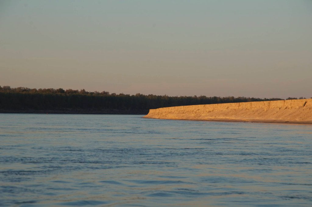
Below Warfield Point the river opens southwestward up a mile wide into a vast moving pool that flows into and then south around Vaucluse Bend with Island 84 on the left.  Be vigilant for tows that often come to a stop in this area for servicing, crew changes and refueling from the nearby Economy Boat Store.  One of the first points of interest downstream is the Greenville Discharge Area, LBD 536, only visible in low water.  In high water you can stay left bank descending and save considerable mileage, but in low water you will have no choice except to the flow around the perimeter of the wide bend.  Island 84 is a low-lying sandbar with no protection.  Only exposed in low waters, below 25 GG.  Below 15 Island 84 grows into a sprawling 3-mile long sandbar punctuated with numerous inlets and back channel pools that trap fish and attract egrets, herons and occasional bald eagles.  These pools make for wonderful walks, and create a turtle heaven.  The waters get squeezed towards the bottom of the island and carve a cliff of sand along the edge of Is. 84, if the weather is calm you can locate possible camping downstream of this sandy cliff, but again there is no privacy or protection.


534 Vaucluse Landing


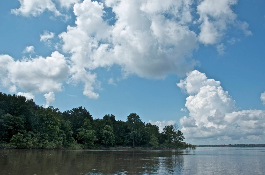
The top end of Chicot Lake, the largest oxbow lake in North America, is found just through the woods and over the levee from Vaucluse Landing.  In the geologic history of a meandering waterway, a free-flowing river periodically cuts off its own bends and isolates them in half-round lakes known as oxbows.  Vaucluse Landing is the site of one of these ancient cutoffs.  Today the river slams strongly against the banks here before being funneled downstream under the bridge.


From Marion Bragg’s Historic Names & Places:


During major floods, Vaucluse Landing is one of the places that engineers and flood fighters watch with some apprehension. Large sandboils have often erupted in the area in the past, and sandboils have to be controlled or they can cause a levee to collapse.

Leave A Comment

SECTION MILE ACCESS CITY
Middle Mississippi & Bluegrass Hills / Bootheel 195-0, 954-850 ST. LOUIS TO CARUTHERSVILLE
Chickasaw Bluffs 850 – 737 CARUTHERSVILLE TO MEMPHIS
Upper Delta 737 – 663 MEMPHIS TO HELENA
Middle Delta 663 – 537 HELENA TO GREENVILLE
Lower Delta 537 – 437 GREENVILLE TO VICKSBURG
Introduction  
Greenville to Lake Providence
Greenville, Mississippi  
Greenville Accomodations and Restaurants  
Greenville Blues Festivals  
Greenville Boat Ramp  
Greenville Harbor  
537 LBD Warfield Point Park
537 LBD Old Warfield Point Boat Ramp
537 LBD New Warfield Point Boat Ramp
534 LBD Vaucluse Landing
531.5 RBD Sunny Side Landing
530.7 LBD Greenville Bridge
529 – 525.5 LBD Lakeport Towhead / American Bar
525 LBD American Cut-Off / Lake Lee
Lake Lee Public Boat Ramp  
Options for Paddlers Below Greenville Bridge Near American Bar and Lake Lee  
Lake Washington  
523 – 520 RBD Island 68
519 – 515 RBD Kentucky Bend
515 – 512 LBD Leota Bar / Cracraft Chute
514 – 512 RBD Worthington Cutoff, Matthews Bend, Grand Lake, Island 88
512 RBD (And Up Back Channel) Grand Lake Landing Boat Ramp
510 – 506 RBD Cracraft Bar
Paddler’s Choices Through Cracraft Chute & Sarah’s Cutoff  
Entering Louisiana  
503.5 RBD Bunch’s Cutoff
503 RBD Chute of Old River Lake
505 – 502 LBD Corregidor Bar
500 – 495 RBD Wilson Point Bar
496 LBD Tennis Court Landing
Vicksburg Gage  
Water Levels and Dikes  
494 – 487 LBD Baleshead / Stack Island / Ben Lamond
Two Stack Islands?  
Lake Providence  
Lake Providence Landings  
Paddler’s Choices in the Mayersville – Lake Providence Area  
487 – 481 LBD Shipland Wildlife Management Area
Lake Providence to Vicksburg
Vicksburg Gage  
Water Levels and Dikes  
Lake Providence  
Lake Providence Landing  
Paddler’s Choices in the Mayersville – Lake Providence Area  
487 – 481 LBD Shipland Wildlife Management Area
480 – 474 Fitler Bend
471 – 465 Arcadia Point Bar / Cottonwood Bar
Paddler’s Routes Arcadia Point Bar / Cottonwood Bar  
462 – 459 RBD Willow Island
461 LBD Chotard Lake Terrapin Neck Cutoff
Laney’s Landing  
459 LBD 2010 F-4 Tallulah – Yazoo Tornado
458.8 LBD Eagle Lake Pass
458 LBD Tara Landing
457 RBD Madison Parish Port and Public Boat Launch
Bluz Cruz Kayak and Canoe Race  
Willow Island, Chotard Lake, and Eagle Lake: Paddler’s Routes  
458 – 449 Milliken Bend
449 – 445 RBD Sparta Island
449 – 445 RBD Marshall Cutoff
446.5 LBD Paw Paw Chute
The “Heart of the Darkness” Tour  
Around Paw Paw to Forest Home Chute  
Paw Paw to Vicksburg Via the Yazoo  
Steele Bayou Control Structure  
What Are the Paw Paws  
Paw Paw Chute / Sparta / Brown’s Point: Paddler’s Routes  
445 – 442 Brown’s Point
444 Brown’s Point Fault Line
441 – 438.5 RBD Delta Point Bar
Habitat Restoration on the Lower Miss  
438 RBD King’s Point / Secret Entrance Into Lake Centennia
437.7 LBD Mouth of the Yazoo River
Vicksburg  
Vicksburg Services and Accommodations  
Vicksburg Services, Accommodations, and Restaurants  
Looking Downstream  
Loess Bluffs 437 – 225 VICKSBURG TO BATON ROUGE
Atchafalaya River 159 – 0 SIMMESPORT TO MORGAN CITY
Louisiana Delta 229 – 10 BATON ROUGE TO VENICE
Birdsfoot Delta 10 – 0 VENICE TO GULF OF MEXICO