The Lower Mississippi River Water Trail
Private Landing at edge of 9,000 acre Tara Wildlife Preserve. Annual Mississippi River Nature Weekend (“Stork & Cork”) towards the end of August and a Spring Birding Weekend at the end of April.
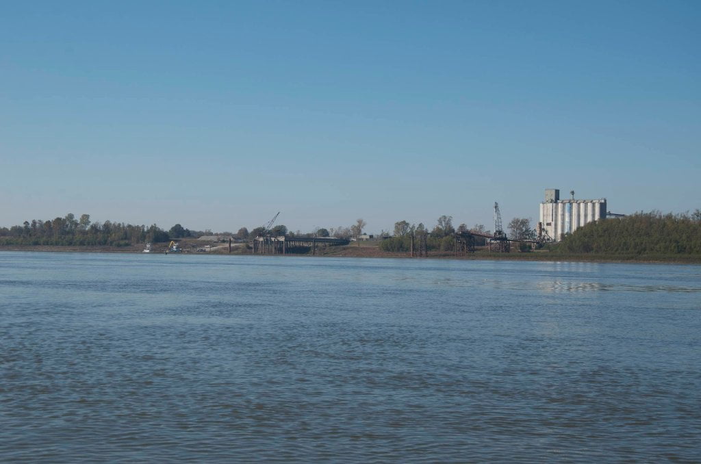
Madison Parish Port and Public Boat Launch RBD 457
Primitive launch point. Carry your vessel to the water’s edge over mud, sand, gravel, rip-rap and whatever else you might encounter there. No concrete, no improvement. Rough parking on muddy gravel above rip-rap. Don’t leave your vehicle overnight. Arrange shuttle. In an emergency you could find water at the nearby Bunge Grain elevator offices. Otherwise keep on downstream for resupply in Vicksburg. Land access from US 65 at Talla Bena.
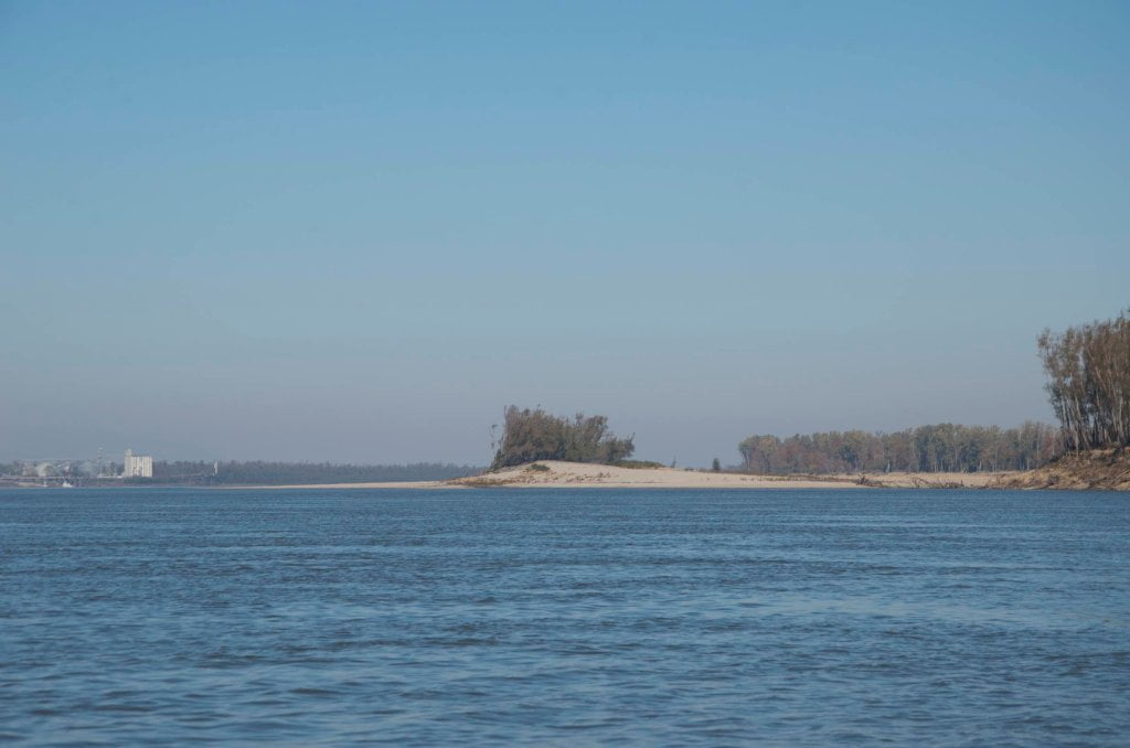
Tara Island Back Channel
Paddlers can cut behind Tara Island LBD 455 above 25VG, but you might want to camp elsewhere. The noisy Madison Parish Port is right across the channel.
458-449 Milliken Bend
Below Willow the mile-wide channel flows south past Chotard, Eagle Lake, Tara and then starts curving eastward into Milliken Bend. Tara Island is LBD 455 with possible low or medium water camping, but you might want to camp elsewhere. The noisy Madison Parish Port is right across the channel. The river feels sluggish here at low water (maybe two or three mph) but picks up spirit in high water and clips right along downstream at five to seven miles per hour — or faster in higher water levels. You’ll want to stay with the best flow along the right bank descending, several hundred yards out. Find the “boil-line” and keep with it as the miles slide by. The foam tends to collect along this line, and during a river rise so does the driftwood. You’ll find your best river current in this vicinity. Follow the foam. Upstream tows tend to cross channel out of Paw Paw and stay with the slower water LBD left bank descending along Forest Home Towhead, which is built up along a six-mile long chain of dikes extending outwards. Twelve dikes total over six miles! In normal conditions there will be a red “nun” buoy placed at the end of each and every dike.
RBD 449-445 Sparta Island
As you slide into Marshall Cut-Off, and if the water is above 25 Vicksburg Gauge you can stay right bank and cut behind Sparta Island to re-enter the river three miles downstream near Brown’s Point. In 1999, I was leading a group of high school students from Denver Colorado on a 5-day expedition from Greenville to Vicksburg. We were planning our Vicksburg take-out on Day 5. Vicksburg was only ten miles downstream and the excitement was building. But the river gods had other ideas in store for us. A line of severe thunderstorms hit us as we paddled down along Milliken Bend, sheets of rain and we were forced to take shelter out of the wind behind Sparta. The storms continued all day and we abandoned plans for takeout, but instead hoisted our thirty

Leave A Comment
You must be logged in to post a comment.