The Lower Mississippi River Water Trail
hopped and skipped over the levee and cleared out several thousand acres of land by Eagle Lake, and ravaged some of the Eagle Lake community, before continuing northeasterly and growing in size. When it reached Yazoo City it was a monstrous 1-2 miles wide. It buzzed a wide path from one end of the state to the other, crossing Hwy 61, the Big Sunflower, the Yazoo River, US 49, the Big Black, I-55, US 51 and onwards until finally petering out in the vicinity of the Pearl River headwaters somewhere near Sturgis, Mississippi.
Kansas City tornado expert Stan Finger reported that: “the tornado was on the ground for 149 miles, from 5 miles west of Tallulah, Louisiana, to about 5 miles north of Sturgis, Miss. The tornado was on the ground for nearly 3 hours and reached a maximum width of 1.75 miles. Storm damage surveys placed Saturday’s tornado at EF3 during much of its path but EF4 through Yazoo and Holmes counties. 10 people died and nearly 50 were injured. Only five tornadoes in recorded history have confirmed damage paths longer than the Yazoo City tornado, which traversed nearly the entire width of Mississippi before dissipating. The longest track of them all belongs to the Tri-State Tornado of 1925, which was on the ground for 219 miles. That tornado killed nearly 700 people.”
(From Stan Finger: Finger on the Weather)
LBD 458.8 Eagle Lake Pass
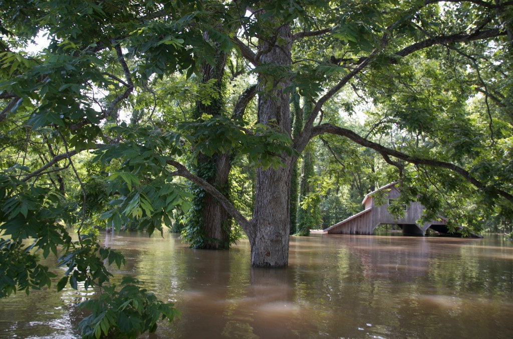
At the South end of the tornado cut and several miles downstream of Chotard/Terrapin Cut-Off is the mouth of the Eagle Lake Pass, left bank descending 458.8. At low water this is nothing more than a ditch through the scraggly tornado ravaged woods. At medium water you can paddle in a short ways but might have to portage over fallen trees and a beaver dam. At high water you can work your way two miles through this wildlife-filled chute to where it opens up into a small lake at the base of the levee. This lake is a hotbed of bird life, fish and amphibians. It is also a known alligator habitat. You will see many random pieces of wood floating about. When you see a piece of driftwood that slides through the water on its own volition you will have found the American alligator!
Over the levee from this small lake is one of the most beautiful lakes in all the Lower Mississippi River Valley, Eagle Lake. Eagle Lake was formed when Terrapin Neck collapsed and was cut off in 1866. Its shape is reminiscent of a giant eyeball. Maybe it is the eye of the Delta. Eagle Lake makes a sharp hairpin curve literally turning back on itself around the point of land found in its iris. The far eastern end of Eagle Lake connects to Steele Bayou which has as its headwaters at another oxbow lake, Lake Whittington (above Greenville). Not far downstream Steele Bayou confluences with the Big Sunflower and the rivers flow together into the Yazoo 10 miles above Vicksburg. The bald eagle is making a comeback around its namesake lake. It is also seen in the big trees along the main channel of the Mississippi near Brown’s Point, or consuming a fish or turtle along one of the river sandbars.
Leave A Comment
You must be logged in to post a comment.