The Lower Mississippi River Water Trail
RBD 599 Mouth of the White River
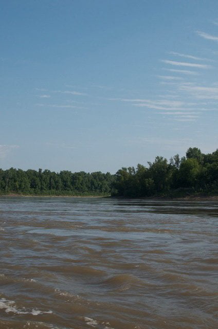
Like most Mississippi River tributaries and passes, the mouth of the White River angles downstream pushed by the implacable power of the big river. Even though this is the biggest right bank tributary between St. Louis and the Arkansas, it’s difficult to see the White River confluence as you approach from upstream, and unless you’re looking for it you may not notice the opening until you have paddled by and look back. In a mile wide river it might be too late to turn in if this was your intention! Looking back upstream from below the White River confluence grins wide open like the Cheshire Cat and the new lock and dam can be seen a few hundred yards upstream. If you are planning on turning up into the White for a paddler’s visit to the wilderness upstream, be sure to stay RBD as you come around Scrubgrass Bend. Make you crossing somewhere below Smith Point and paddle over the boiling waters to the Arkansas shore to gain entry.
The White River
The 722-mile long White River creates a wonderland of endless possibilities for the adventurous paddler. Upstream of its mouth lies the largest roadless bottomland hardwood forest in the center of the country, a sprawling morass of thick forests, caney bottoms, cypress bayous & swamps and the meandering channel of the White River itself. Not many paddlers will opt to paddle upstream and into such wild haunts, but its fun to dream about. Open up a map and let your imagination follow the maze of waterways and globs of land in between. Just thinking about the possibilities is enough to keep the armchair paddler amused for many long winter nights and maybe make plans for a summertime foray. You could paddle up the White and reach any number of upstream tributaries such as the the Bayou Des Arc, the Little Red River, the Black River, James River and Roaring River. The Cache River is one of the first big tributaries you’ll encounter. It recently made world news when the Oh-My-God! Ivory Billed Woodpecker was thought to have been rediscovered. The fabulous Buffalo River, the first designated Wild & Scenic River in the nation is one of the White River tributaries.
On the other hand you could reach points westward, all the way up to the Great Plains and the Rocky Mountains beyond, by paddling ten miles up the White, lock over to the Arkansas and paddle the Arkansas River up to Little Rock and from there to all points upstream through Oklahoma & Kansas & finally Colorado. This was once once a common trade & migratory route to reach the civilizations of the Great Plains, and the dugout canoe was the preferred means of travel.
Viewed from above using topo maps or from google earth the approximately ten-mile wide floodplain of the White River reminds one of the middle section of the famous Atchafalaya River Basin, the river of trees, being another very wide bottomland hardwood forest in which the primary river splits into a myriad of braided channels, back channels, bayous, and isolated lakes. The above mentioned Ivory-Billed Woodpecker was never definitely confirmed, but if it is to be found anywhere, it will be somewhere in this region. The forests and swamps so loved by this shy feathered giant run contiguously for hundreds of miles out of central Arkansas down to this confluence — and beyond, over the forested bottoms of Big Island and the Lower Arkansas River.
Montgomery Point Lock & Dam
At the mouth of the White River
N33.945278 W91.083333
Any travel up the White or the Arkansas requires passing through the White River Lock and Dam. This newly constructed monstrosity is a lowhead installation, meaning it is necessary to lock through only in times of low water. If you’ve never done this before it can be quite the thrill for someone in a canoe or kayak or stand up paddleboard. You will have to await your turn to lock through, of course. Commercial vessels take priority over pleasure craft such as yours. The usual sequence is first come first served, although this selection is entirely up to the judgement of the lock master. Don’t be intimidated by your relative size when compared to the tows. You have as much right as any vessel to lock through, although pleasure craft such as canoes & kayaks are last in the list of preference, behind official US vessels, passenger vessels, and towboats. Regardless of order US Maritime Law requires free & complete passage to any canoe or kayak on a river (or navigable waterway) has been blocked. Make sure you have a long rope (50 feet is the law) and your life jacket on or at least accessible on deck. (Note: there is some uncertainty about the legality of Stand Up Paddleboards getting through Locks & Dams).
[CLICK HERE: Paddling Through a Lock & Dam]
Here’s the procedure: paddle up to the retaining wall of the lock and dam (below the tall control tower left bank ascending). The retaining wall is the long concrete wall abutting perpendicular the dam proper. Locate red pull rope and give it a yank. If the lock master hasn’t already seen you, he will now. If you have a VHF marine radio you might want to radio the lockmaster on channel 16, or if you can get reception with a cell phone you could call (870) 548-3400. You will see a signal light. Red means the lock is busy, yellow means its getting ready for passage, green means proceed. If the traffic light is green the giant gates will of course be open and you can paddle into lock chamber. In addition to the traffic lights the lock operator will signal you with an air horn, one long blast (4 to 6 seconds) means you can paddle into the lock. You are required to have 50 feet of rope on board to tie loosely onto the side of the lock chamber at one of the mooring bitts built into the wall. Best attachment for paddlers is to run your rope around bit and keep the end of the rope with your vessel in case you need to quickly untie and get away from wall. Now the fun part. The free ride up a water elevator. Actually you will feel like you are a leaf stuck in a toilet bowl as the water level rises. Change in height depends on river levels. Await the water change. The doors will open. The light turns green. Listen for one short whistle blast (1 second) which means its okay to leave the lock. Easy, right? Paddle on out and continue your journey upstream into the hinterlands of the American West.


Leave A Comment
You must be logged in to post a comment.