The Lower Mississippi River Water Trail
LBD 624.5 Mouth of DeSoto Lake
[CLICK HERE: Map of Island 64, Mellwood Lake, DeSoto Lake]
Similar to the mouth of Mellwood Lake but longer, almost a mile from the river to the open lake. Any paddler intending to enter DeSoto Lake (possible take-out) will have to begin planning miles upstream, inspect maps and start your route as you leave the bottom end of Island 64 before the first of the Sunflower Dikes. At medium and high water levels the main channel of the river will thrust you outwards to the Arkansas side. As result you will have to either hug the Mississippi side and make a run over the sometimes turbulent Sunflower Dikes, or you will be required to make a very strong ferry crossing below the last dike (opposite Mellwood at 625.6). At low water you will have to paddle beyond the last of the sandy islands growing around the Sunflower Dikes (see above) and then cut back upstream into the becalmed waters behind. Like all river connections the Mouth of DeSoto Lake remains hidden until you are right on it or are approaching from just the right angle. There are several public use boat ramps (and many private ones) on DeSoto Lake, most easily accessed is Hillhouse Landing. Viable start place or end place for any paddler. Stillwater paddling across lake, but if you want to see wildlife, especially birds, turtles and deer, the effort will be rewarded.
LBD 621-624 Jug Harris Towhead
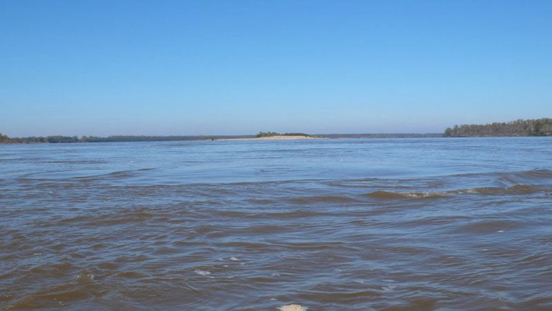
Following the main channel past Mellwood Lake the river is thrust outwards by a prominent point below the 624.8 light for a crossing back to the Mississippi side. If you maintain this channel you will enjoy a fast ride on a boiling tongue of water past an eddy below this point and you can make a run down the (green) buoy line alongside the Ludlow Dikes. Jug Harris Towhead is found RBD a low island, submerged above 30HG, excellent low water camping, gravel bar emerges top end below 15HG. There is a line of trees growing atop a ridge center island that is bisected by a low spot near mile 622 which can make an excellent low-water camp, but the area is backed by a hunting camp so don’t be surprised if you have visitors on 4-wheel drive. At higher water levels you can paddle over the topmost Ludlow Dikes and enjoy the back channel of Jug Harris.
RBD 620.8 Mouth of the Chute of Island 68
Island 68 is completely enveloped by the forests surrounding Jug Harris, but its mouth can be accessed at all but low water levels. Adventurous paddlers will enjoy a glimpse into a primeval world through this narrow chute which opens up into a lake beyond. I’ve seen many poisonous snakes here (primarily copperheads) and gators in the shallow lake beyond. Also, I’ve found Bear tracks in the mud.
LBD 619-621 Island 67
Designated Left Bank only because the center line of the river crowds the Arkansas shore around Wood Cottage (619.6). This resplendent sun-drenched island sits middle river with big flowing channels on either side, a very deep main channel that gets crushed towards the shore and a shallower back channel that is open until lower water levels, shuts completely off around 10HG.
As you approach from up river Island 67 seems to dance on the top of the river mid channel equidistant from either bank. In the full sun it shimmers like a sail boat viewed over the sea. In cloudy weather it reminds one of a moody scene from Ireland or the Aleutian Peninsula. This is a place filled with endless light and the colors of the sky and the water. The island is mostly sand with a few muddy patches that come and go according to the fluctuations of the river currents and water level. Outdoor artists like Walter Anderson would have loved Island 67. It sits somewhere between heaven and earth perched on the face of the biggest river in North America.
Island 67 sits far enough away from forests on either side that there are less mosquitoes and few predators. But also no deer or other mammals. At low water coyotes sometimes cross the sandbars in search of midnight snacks washed up by the river. The nesting Least Tern loves the remoteness of this island, and its also the favorite nesting site for Canada Geese. Paddlers ought to avoid camping here during Goose nesting season (April-June). If you make landing and find goose eggs, please don’t camp. Their preferred nesting is under the willows straddling the highest dunes. The sensitive Canada geese will easily abandon nesting sites — and your conscience will have to bear the weight of dozens of unborn goslings.
Of course this openness leaves Island 67 subject to storms, wind and any severe weather. Choose landings accordingly, and make campsites only when necessary. Always tie down your vessel in any landing subject to wind, waves, and changing water levels. You will have a very long swim if you lose your vessel here!


Leave A Comment
You must be logged in to post a comment.