The Lower Mississippi River Water Trail
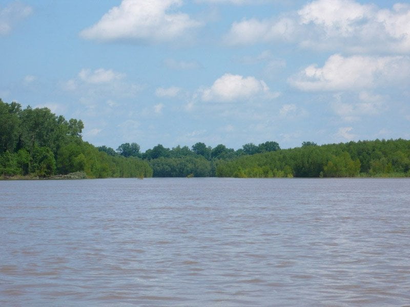
If you aren’t in any particular hurry, you might as well stay RBD and visit this amorphous confluence, one of the most important geographic & historic locales on the continent. You will know you’re there when you find the color change in the waters where the rivers meet. The muddy yellow waters of the Arkansas hug right bank for miles downstream while the muddy green waters of the massive Mississippi lazily reach out with swirling octopus arms and greedily engulf great gulps of Arkansas River water one muddy slurp after another until there is nothing left of it save new colors splashed up on the muddy banks and new earth tones left in the sandbars below. Zoom in for a close up look off Google Earth, the subtle tonalities of mud can be seen from space! During low water levels the color line between the great rivers is usually clearly etched. However in highwater it becomes almost impossible to find as the big rivers have been mixing surreptitiously behind islands and through flooded forests throughout the entire bottom end of Big island above this point.
A Detour Up & Down the Arkansas
[CLICK HERE: Map of A Detour Up & Down the Arkansas]
A fun detour is to paddle upstream a ways up the Arkansas River and then turn around and paddle back to the Mississippi and continue on your way.
We call this maneuver the Omaha & Quapaw or Up and Down. Its a simple roundtrip. Its like climbing a mountain where you have to work hard to get up, but then get an easy trip back while gravity (and the flow of water) helps you back down. You can easily paddle upstream the Arkansas from the confluence a few hundred yards to the bottom of Big Island (LBD Arkansas River), which stands fairly high along its southern end. Or with a little more time and motivation you can paddle a few miles to one of the beaches on Cat Island which is found RBD one mile upstream. During high water you might have to paddle two miles to reach the sand (goes completely under around 30AG). Stop for a picnic or walk and then turn around and paddle back out. Go as far as you like, or your day will allow, and then turn around. When you are going upstream you are being an Omaha, the people who went upstream. When you turn around back downstream you are being like the Quapaw, the downstream people.
On the way back down the Arkansas scoot out from the top of Cat Island to the outside of Jimmie’s Bend and follow the best current LBD around and below the steep cut bank. Notice the new colors layered in the mud, these are the colors of the Great Plains, the yellows of Colorado/Kansas and reds of Oklahoma are alternately laid by the seasonal floods. Cross back over RBD to the bottom end of Cat Island and follow the flow out to the Mississippi/Arkansas River Confluence, the yellow waters of the Arkansas dances along for several miles until being consumed by the slightly darker & normally muddier waters of the Mississippi.
Island Hopping
[CLICK HERE: Map of Island Hopping]
An adventurous way to get a taste of the Arkansas River and its Delta is to duck behind one of the many splinter islands crowding the confluence, jump into the Arkansas River (which is flowing behind these islands), and paddle down out of the smaller river to rejoin the big river. These islands are technically the southern extremity of Big Island since at low water they reconnect back to Big Island. Back channels open up at water levels above 23AG. (Note: This route is NOT doable from the Rosedale Harbor unless you make a 2 mile upstream paddle and a strong ferry crossing to reach the Malone Field at the top end of the Arkansas Bar.)
From Terrene Sandbar (Great River Road State Park) stay with the strong current RBD past the Malone Field Light 587.0 and look for the first dike RBD (Malone Field Dike#1), which is sometimes marked by a buoy sometimes not. There is an opening in the woods directly below the bankside end of the dike. If not obstructed by the raft of driftwood that oftentimes accumulates there dive behind a little island through this narrow channel. If you miss it, keep going RBD around this little island and then follow the current flowing behind it over the Malone Field Dike #2 (which you won’t see — its underwater). The river opens up several miles wide as it flows over the Arkansas Bar. Follow the flow westward towards the tallest wall of trees behind. This is a large island around which the water flows on both sides. Before you get to this line of tall trees you will notice a medium sized channel flowing north and a larger channel continuing southwest. You can take either channel, although I recommend the northerly route.
The southwesterly route follows the edge of the island through a long ephemeral channel bordered by deep forests, and eventually disappears into several thick stands of willows that can be a challenge getting through. Paddlers might spend an hour or more bushwhacking through thick willows from the cockpit of their kayak or seats of their canoe as showers of sticks and leaves fall around them, and spiders, and anything else in the trees. Not for the faint-hearted.
The northerly route is easily followed as it rounds this splinter island (2 miles) and then joins the Arkansas River in Jimmie Bend. Paddlers can enjoy 2-3 miles of paddling down the main channel of the Arkansas River from Jimmie Bend.


Leave A Comment
You must be logged in to post a comment.