The Lower Mississippi River Water Trail

Rivergator

The title Rivergator is derived from the runaway best-seller The Navigator first published in 1801 by Zadok Kramer, with 25 or 30 subsequent printings.  The Navigator described the Mississippi Valley for pioneer settlers streaming out of the Eastern United States in the first great wave of continental migrations that led to the settling of the West.  Thomas Jefferson and other leaders were fearful that the French or the English would get there first.   With the Lewis & Clark explorations and the introduction of the steamboat to the Mississippi River in 1812, Americans followed the big rivers up and down through the heart of the country, and The Navigator was their guide.  In this spirit I have adopted the name Rivergator with the hope that America’s forgotten outdoor paradise the Lower Mississippi, the wilderness within, will be used by successive generations of canoeists and kayakers.  Zadoc Cramer also invented the numbering system for Lower Mississippi River Islands.


Mileage

All points, islands landings, and features will be identified with the mileage system used on the 2007 US Army Corps of Engineer River Maps, which can be viewed or downloaded as a pdf from:

http://www2.mvn.usace.army.mil/eng/miss_river_books.asp


Left Bank and Right Bank

RBD = Right Bank Descending

LBD = Left Bank Descending


The Rivergator will use the standard left bank descending (LBD) and right bank descending (LBD) to indicate which side of the river the various landings, islands, back channels, and other features are located.  Because of the twisty nature of the meandering river east bank and west bank have little meaning because the river is rarely flowing north to south!  Ditto for state names.  This section concerns and Arkansas, Mississippi, and some of Tennessee.  But because of channel cutoffs created by the dynamic power of the river as well as the Corps of Engineers’ 1933-1942 man-made cutoffs, there are pieces of each state on both sides of the river!  We’ll also use “left bank” and “right bank” or “left shore” and “right shore” to denote the same.


Introduction: Memphis to Helena

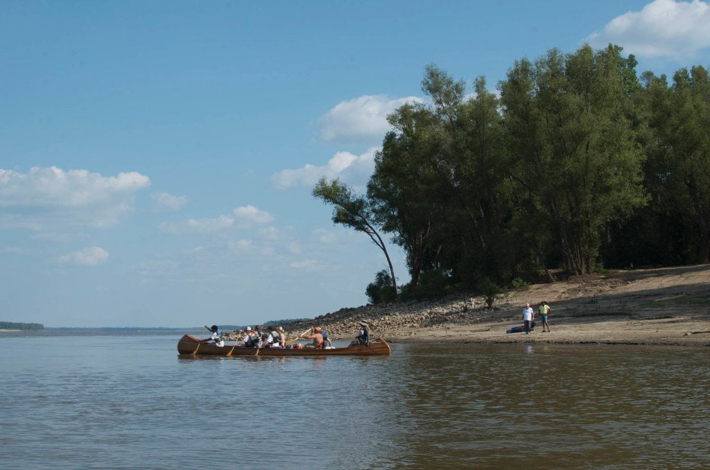
After exiting the Missouri Bootheel and bouncing along the Chickasaw Bluffs past Memphis, the Mighty Mississippi flows southwesterly in giant meandering loops into the verdant and fantastically fertile Mississippi Delta.  This is the land that gave birth to the Delta Blues, and was once the cotton kingdom of the world.  Its forest was America’s Amazon, millions of acres of deep woods now removed for farmland.  Leaving Tennessee and entering Mississippi the paddler is welcomed by a long line of casinos that rivals Atlantic City, but which you’ll see little evidence of as you paddle behind long chains of islands in the same area, although you should stop for a visit to the Tunica Riverpark Museum. The river carves elegant S-curves through deep woods as it meanders through Commerce Bend, Mhoon Bend and Walnut Bend, and then wanders down through a floodplain fifteen miles wide to the mouth of the St. Francis River.  The big river engulfs mind-boggling swaths of muddy landscapes as it is forced southerly by the strange geophysical anomaly Crowley’s Ridge, which parallels the Mississippi out of Missouri.  Buck Island invites exploration, picnicking or camping, and Helena, Arkansas commands the base of Crowley’s Ridge, and is the only population in between Memphis and Vicksburg (300 miles) that sits right on the main channel as result.  Visit the Delta Cultural Center, or coordinate your adventure with one of the world’s greatest celebrations of music, the King Biscuit Blues Festival (October).  Canoeists, SUPs and kayakers will find provisions, maps, gear, and paddling tips at Quapaw Canoe Company – Helena, as well as water and Wi-Fi.

CLICK HERE for the next section

Leave A Comment

SECTION MILE ACCESS CITY
Middle Mississippi & Bluegrass Hills / Bootheel 195-0, 954-850 ST. LOUIS TO CARUTHERSVILLE
Chickasaw Bluffs 850 – 737 CARUTHERSVILLE TO MEMPHIS
Upper Delta 737 – 663 MEMPHIS TO HELENA
Introduction  
Memphis to Tunica
736 LBD Memphis, Tennessee, Mud Island Harbor
Buoys and Docks  
Floating Underneath a Bridge  
734.7 Lower Bridges/Engineer’s Bar
734.7 The Frisco Bridge
734.7 The Harahan Bridge
734.7 The Ghost Bunker
734.7 The Old Bridge (Memphis & Arkansas Bridge)
733 President’s Island
Fleeted Barges  
732 LBD Hole in the Wall ##2
727.3 TVA Transmission Lines
727.3 RBD The Wreck of the Raft
Tennessee Valley Authority  
725.5 LBD Entrance to McKellar Lake
7 Miles Up harbor Riverside Park Marina On McKellar Lake  
724 T.E. Maxon Wastewater Treatement Facility
Paddler’s Routes Below Memphis  
727 – 712 Dismal Point/Ensley Bar/Cow Island Bend Area
726 – 717 Armstrong/Dismal Point/Ensley Bar
720 Josie Harry Bar
718 – 713 Cow Island Bend
Goodbye Tennessee, Hullo Mississippi  
The Yazoo-Mississippi Delta and the Blues  
711 – 705 Cat Island No.50
710.8 LBD Starr Landing
712 – 695 Paddler’s Routes Around Cat Island and the Casinos
Pickett Dikes Back Channel  
639.8 RBD Tunica Riverpark Museum Boat Ramp
Tunica Riverpark Museum  
Basket Bar Dikes/Porter lake Dikes  
693.8 RBD Lost Lake Pass
703 Buck Island (No. 53)
701 Gold Strike Casino
700 Fitzgerald’s Casino
Tunica to Helena
700 Basket Bar
Paddler’s Routes Through Commerce and Mhoon Bends  
695 – 690 Commerce Bend
692.5 RBD Peter’s Boat Ramp
690 Rabbit Island
Switching to thhe Helena Gage  
Dikes and Water Levels  
687.5 Mhoon Landing
689 – 685 Mhoon Bar
690 – 683 Mhoon Bend
682 – 679 Whiskey Chute/Walnut Bend
680 Whitehall Crevasse
Paddler’s Routes Below Walnut Bend  
Stumpy Island, Shoo Fly Bar and Tunica Lake  
Main Channel  
677.4 LBD Tunica Runout
Behind Shoo Fly Bar  
Stumpy Island  
Walnut Bend Boat Ramp  
Tunica Lake Boat Ramp  
679 RBD Walnut Bend Boat Ramp
679 – 677 Hardin Cut-Off
677.4 LBD Pass Into Tunica Lake
677 – 676 Shoo Fly Bar
677 – 674 Stumpy Island
674.5 Harbert Point
672 RBD Mouth of the St. Francis River
Primitive Landing at the Mouth of the St. Francis Rive – Conditions  
RBD 3 Miles up St. Francis River Three Mile Ramp
Daytrip: St. Francis to Helena  
St. Francis to Helena: Paddler’s Descriptions  
For Intermedite Paddlers: Right Bank Route  
For Expert Paddlers: Left Bank Route  
St. Francis River  
671 – 673 LBD St. Francis Bar
669 LBD Flower Lake Dikes
668 RBD (A View of) Crowley’s Ridge D
668-663 RBD Buck Island (Prairie Point Towhead)
665.5 LBD Trotter’s Pass
663 RBD Helena Harbor
Helena Boat Ramps  
663 RBD Helena-West Helena
Quapaw Canoe Company – Helena Outpost  
Helena’s “Low Road” Into St. Francis National Forest  
King Biscuit Blues Festival (2nd Week of October)  
Helena to Friars
661.6 Helena Bridge (Hernando De Soto Bridge – US HWY 49)
663 RBD Leaving Helena Harbor
Fleeted Barges  
Small Towns in Harbors  
Buoys and Other Stationary Objects  
Highlights of Civilization  
Pollution Within the Helena Industrial Reach  
661.6 Helena Bridge (Hernando De Soto Bridge – US HWY 49)
657 LBD  
How to Get Into the Old Entrance of the Yazoo Pass  
LBD: Alternate Route to Vicksburg: Yazoo Pass  
Yazoo Pass Milage  
Rivers & Robert Johnson  
656 LBD East Montezuma Bar
657 – 654 RBD Montezuma Towhead
654.7 LBD Montezuma Landing
Shuttle Route Montezuma to Clarksdale  
652 LBD Friars Point
652.2 LBD Friars Point Landing (Unimproved)
What’s to Come Further Downstream  
Appendix  
Middle Delta 663 – 537 HELENA TO GREENVILLE
Lower Delta 537 – 437 GREENVILLE TO VICKSBURG
Loess Bluffs 437 – 225 VICKSBURG TO BATON ROUGE
Atchafalaya River 159 – 0 SIMMESPORT TO MORGAN CITY
Louisiana Delta 229 – 10 BATON ROUGE TO VENICE
Birdsfoot Delta 10 – 0 VENICE TO GULF OF MEXICO