The Lower Mississippi River Water Trail
677-676 Shoo Fly Bar
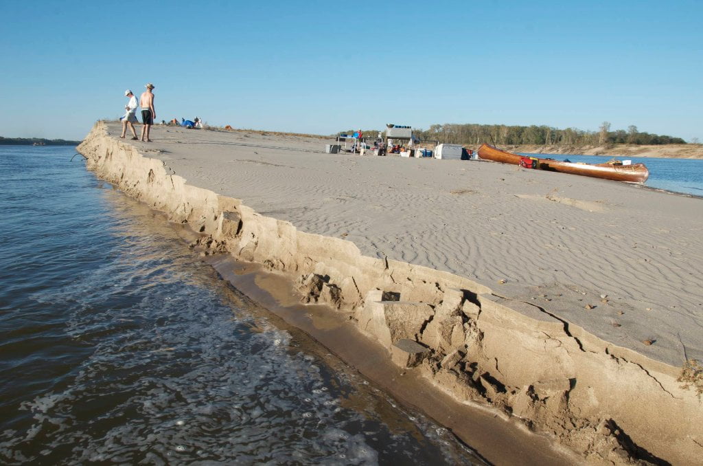
Shoo Fly is what paddlers have come to name a dynamic low-lying open bar that forms below the Tunica Runout and is only visible in low water conditions, and goes completely under around 20HG. Paddlers should avoid camping here except in the most perfect of conditions. To be caught in the wind or an oncoming storm here would be like being caught out in the middle of the ocean. Good rest stop or picnic place. Back channel flowing even in the lowest of water. I have found plenty of flowing water as low as -5HG, enough for canoes, kayaks, SUPs or other shallow draft vessels. Shoo Fly is the last remnant of land leftover from the Hardin Cut-Off which created Tunica Lake in 1942. Local river expert Rick Howe: “This bar was not present prior to about 1995 or so – I used to go the River from Lake through runout and back on stages down to 1 or 2MG. About 1993 or 1995, major flood pushed/translated a huge sand bar in front of the runout and it actually damned up the runout and held Tunica Lake/Cut-Off at about 6MG for a couple of years. Then the next year, it disappeared…moved on down the River pushed by the River currents. Haven’t seen big bar there in years. You mentioned current behind the bar….I suppose this is at very low levels (below 5HG, or so)? Haven’t been there at such low levels….(We are now seeing -7MG or about -1 or -2HG…) I actually always thought “Shoo Fly Bar” was the historic name of the natural bar on the pre-Cutoff inside bend of the River at what is now the Runout chute… However, Shoo Fly Bar is not a bad/inappropriate name for a big sand bar that forms up at this location in the present River…”
677-674 Stumpy Island
Three mile long island (at low water) topped with a young willow/cottonwood/sycamore forest with beautiful camping all around. In high water levels best camping is found top end above the trees, and there is ample water flowing through the back channel. (Cutoff resident Rick Howe recalled catching over 100 bass in one outing 20 years ago, and has not caught another single bass there since!) As the water drops sandbars emerge on all sides and the back channel dries. By low water, around 15HG there is no flow in the back channel and generous sandbars are found on all sides, especially above the island and along main channel. Only when the river bottoms out below zero on the Helena Gauge is the full three-mile length of this island revealed, now attached to the mainland woods along the right bank.
674.5 Harbert Point
Swift currents past the point will carry the downstream paddler quickly into the final approach to the mouth of the St. Francis River. You can stay left bank and duck behind the St. Francis Bar. Or you can stay main channel and enjoy a quick view upstream the St. Francis into the heart of Crowley’s Ridge. Take a moment, if you have the time, and eddy out at the mouth of the St. Francis, and enjoy the change in water color, the narrow mouth of the river (several hundred yards) and the common wildlife and river rat sightings. Bald eagles frequent this area, and fishermen, both attesting to the prolific fishery.


Leave A Comment
You must be logged in to post a comment.