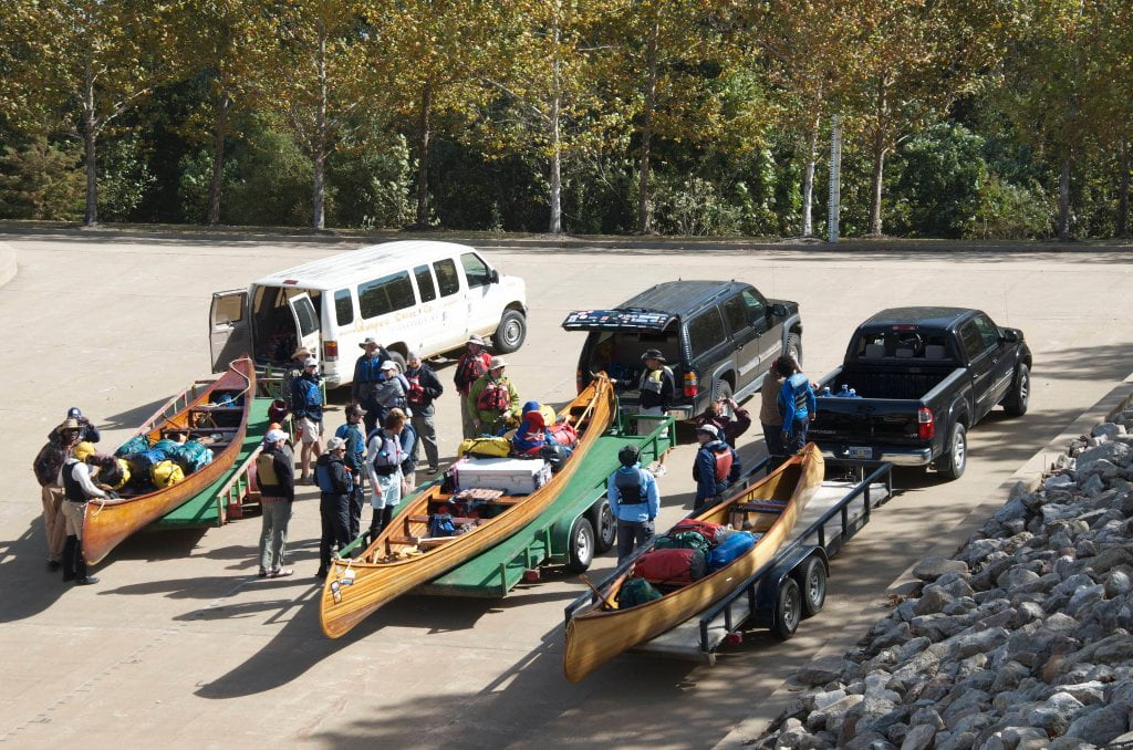
The Lower Mississippi River Water Trail

695-690 Commerce Bend

Right angle bend running westward and then south slightly eastward around Rabbit Island.  Commerce Bend is as good as any in demonstrating the dynamic and irascible nature of the big muddy river in a big muddy landscape.  


Commerce, Mississippi, had a hopeful beginning and was a thriving little river town in the 1830’s, but by 1841 it was engauged in a losing battle with the Lower Mississippi, and it soon lost most of its waterfront buildings and houses.  In 1874 the Mississippi jumped across a neck of land just below Commerce and cut about ten miles off its channel. Local people reported that a steamboat passed through the new cutoff just two days after the river changed its course, and that it was 800 yards wide by the third day.  The

river continued making changes around Commerce, causing all kinds of trouble for the little town and doing a lot of damage to property in the area. It finally settled itself comfortably in a new bed known as Mhoon Bend, where it still remains today- restrained from further movement by a long revetment on the east bank of the bend.  The steamboat landing at Commerce was still in occasional use as late as 1888, when a boat called the Kate Adams caught fire and burned at the landing. The big side-wheel boat was one of the first steamers on the Lower Mississippi to be completely equipped with a modern invention known as the electric light. The popular boat was also noted for the beauty of its cabin accommodations. The staterooms were paneled in solid walnut, cherry, and ash. The town of Commerce was still hanging on in 1915, and still had a post office and steamboat landing, but the river had built up a big sandbar in front of it. As the steamboat trade on the river dwindled away, the community gradually disappeared.  (Adopted from Bragg’s Historic Names & Places)


But fortune has many twists and turns along its convoluted route.  Today Commerce has been rejuvenated by a cluster of casinos just over the levee from the old town site, which is now occupied by a MicroHotel, a Quality Inn, and an Exxon gas station at the corner of Casino Strip Resort Blvd and Perry Rd.  There is no present connection to the river save for a short revetment above Rabbit Island called Commerce Revetment.   This history would be worthy of another Robert Johnson blues, had he lived long enough to pen more songs.  He is reported to have resided for a year at the nearby Abbey & Leatherman Plantation.


RBD 692.5 Peter’s Boat Ramp

Narrow rugged revetment ramp laid over the rip rap.  Usable at all water levels, but long overland drive for access to any conveniences, at least 20 miles to Marianna.  For resupply keep going to Helena, 29 miles downstream.  

Leave A Comment

SECTION MILE ACCESS CITY
Middle Mississippi & Bluegrass Hills / Bootheel 195-0, 954-850 ST. LOUIS TO CARUTHERSVILLE
Chickasaw Bluffs 850 – 737 CARUTHERSVILLE TO MEMPHIS
Upper Delta 737 – 663 MEMPHIS TO HELENA
Introduction  
Memphis to Tunica
736 LBD Memphis, Tennessee, Mud Island Harbor
Buoys and Docks  
Floating Underneath a Bridge  
734.7 Lower Bridges/Engineer’s Bar
734.7 The Frisco Bridge
734.7 The Harahan Bridge
734.7 The Ghost Bunker
734.7 The Old Bridge (Memphis & Arkansas Bridge)
733 President’s Island
Fleeted Barges  
732 LBD Hole in the Wall ##2
727.3 TVA Transmission Lines
727.3 RBD The Wreck of the Raft
Tennessee Valley Authority  
725.5 LBD Entrance to McKellar Lake
7 Miles Up harbor Riverside Park Marina On McKellar Lake  
724 T.E. Maxon Wastewater Treatement Facility
Paddler’s Routes Below Memphis  
727 – 712 Dismal Point/Ensley Bar/Cow Island Bend Area
726 – 717 Armstrong/Dismal Point/Ensley Bar
720 Josie Harry Bar
718 – 713 Cow Island Bend
Goodbye Tennessee, Hullo Mississippi  
The Yazoo-Mississippi Delta and the Blues  
711 – 705 Cat Island No.50
710.8 LBD Starr Landing
712 – 695 Paddler’s Routes Around Cat Island and the Casinos
Pickett Dikes Back Channel  
639.8 RBD Tunica Riverpark Museum Boat Ramp
Tunica Riverpark Museum  
Basket Bar Dikes/Porter lake Dikes  
693.8 RBD Lost Lake Pass
703 Buck Island (No. 53)
701 Gold Strike Casino
700 Fitzgerald’s Casino
Tunica to Helena
700 Basket Bar
Paddler’s Routes Through Commerce and Mhoon Bends  
695 – 690 Commerce Bend
692.5 RBD Peter’s Boat Ramp
690 Rabbit Island
Switching to thhe Helena Gage  
Dikes and Water Levels  
687.5 Mhoon Landing
689 – 685 Mhoon Bar
690 – 683 Mhoon Bend
682 – 679 Whiskey Chute/Walnut Bend
680 Whitehall Crevasse
Paddler’s Routes Below Walnut Bend  
Stumpy Island, Shoo Fly Bar and Tunica Lake  
Main Channel  
677.4 LBD Tunica Runout
Behind Shoo Fly Bar  
Stumpy Island  
Walnut Bend Boat Ramp  
Tunica Lake Boat Ramp  
679 RBD Walnut Bend Boat Ramp
679 – 677 Hardin Cut-Off
677.4 LBD Pass Into Tunica Lake
677 – 676 Shoo Fly Bar
677 – 674 Stumpy Island
674.5 Harbert Point
672 RBD Mouth of the St. Francis River
Primitive Landing at the Mouth of the St. Francis Rive – Conditions  
RBD 3 Miles up St. Francis River Three Mile Ramp
Daytrip: St. Francis to Helena  
St. Francis to Helena: Paddler’s Descriptions  
For Intermedite Paddlers: Right Bank Route  
For Expert Paddlers: Left Bank Route  
St. Francis River  
671 – 673 LBD St. Francis Bar
669 LBD Flower Lake Dikes
668 RBD (A View of) Crowley’s Ridge D
668-663 RBD Buck Island (Prairie Point Towhead)
665.5 LBD Trotter’s Pass
663 RBD Helena Harbor
Helena Boat Ramps  
663 RBD Helena-West Helena
Quapaw Canoe Company – Helena Outpost  
Helena’s “Low Road” Into St. Francis National Forest  
King Biscuit Blues Festival (2nd Week of October)  
Helena to Friars
661.6 Helena Bridge (Hernando De Soto Bridge – US HWY 49)
663 RBD Leaving Helena Harbor
Fleeted Barges  
Small Towns in Harbors  
Buoys and Other Stationary Objects  
Highlights of Civilization  
Pollution Within the Helena Industrial Reach  
661.6 Helena Bridge (Hernando De Soto Bridge – US HWY 49)
657 LBD  
How to Get Into the Old Entrance of the Yazoo Pass  
LBD: Alternate Route to Vicksburg: Yazoo Pass  
Yazoo Pass Milage  
Rivers & Robert Johnson  
656 LBD East Montezuma Bar
657 – 654 RBD Montezuma Towhead
654.7 LBD Montezuma Landing
Shuttle Route Montezuma to Clarksdale  
652 LBD Friars Point
652.2 LBD Friars Point Landing (Unimproved)
What’s to Come Further Downstream  
Appendix  
Middle Delta 663 – 537 HELENA TO GREENVILLE
Lower Delta 537 – 437 GREENVILLE TO VICKSBURG
Loess Bluffs 437 – 225 VICKSBURG TO BATON ROUGE
Atchafalaya River 159 – 0 SIMMESPORT TO MORGAN CITY
Louisiana Delta 229 – 10 BATON ROUGE TO VENICE
Birdsfoot Delta 10 – 0 VENICE TO GULF OF MEXICO