The Lower Mississippi River Water Trail

LBD 740.6 Wolf River

Known as Riviere du Loup amongst French explorers the 105-mile long Wolf River is the last of the Tennessee Rivers you’ll pass continuing on downstream into the Delta.   Nonconnah Creek enters McKeller Lake Harbor, which empties into the Mississippi fifteen miles downstream.  And then there are no tributaries on this side of the river for 300 miles!  We’ll continue this discussion in the next section of the Rivergator, from Memphis to Helena.


Like the Hatchie, the Wolf River springs out of the North Mississippi Hills and runs first north into Tennessee, and then follows a predominantly westerly course to join its mother river, the Mighty Mississippi.  It is home to deer, river otter, mink, bobcat, fox, coyote, turkey, and many waterfowl, reptiles and amphibians.  Tennessee state champion trees along the wolf include a Tupelo Gum that is 17 feet in diameter.  Other hardwoods found in its extensive wetlands include green ash, red maple, swamp chestnut oak, blackgum and Louisiana bald cypress, and native flowers such as cardinal flower, ironweed, swamp iris, false loosestrife, spatterdock, swamp rose, blue phlox and spring cress.  Twenty-five species of freshwater mussels have been documented in its upper reaches which is a testament to good water quality.


The Wolf River is protected by the very active Wolf River Conservancy, which was founded in 1985 and has protected much of its drainage including the exceptionally beautiful and magical Ghost River section.  Memphis’ good tasting water comes from a pure underground aquifer beneath the Wolf River Basin, and a micro-brewery uses it for their fine beers by the name. The Wolf’s fragile wetlands hold water long enough for it to be absorbed into the ground and serve as natural filters to cleanse polluted waters before they reach the aquifer. The Wolf originally ran alongside downtown Memphis, but because of its foul smell in the pre Clean Water Act of 1972 dark ages of industrial and agricultural pollution, a new channel to the river was carved out and lined with rip-rap, and the wolf was made to enter the Mississippi here, while its old channel was dredged and enlarged to create the downtown harbor. 


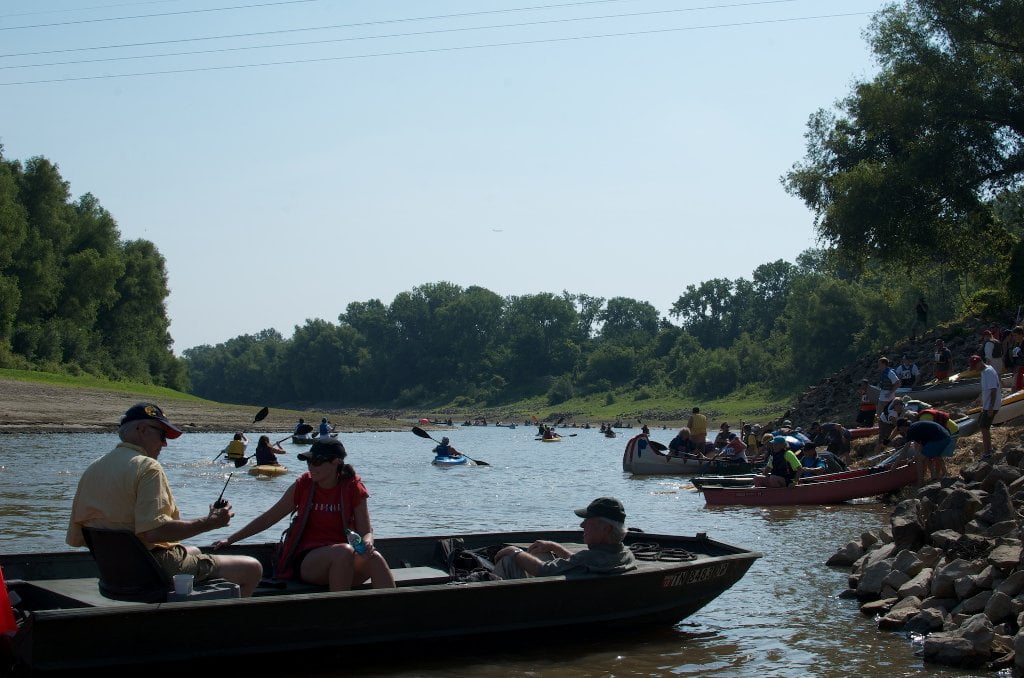
The mouth of the Wolf is the start line for the annual Outdoors Inc. Canoe and Kayak Race, a 3 mile dash under the bridge and into the harbor, and the largest such gathering of paddlers anywhere in the Southeast.


LBD 738.4 Mud Island Upper Boat Ramp

Concrete boat ramp bottoms out around -0-MG.  Foul smelly water here due to unfortunate placement of the Memphis Wastewater Treatment Plant one mile upstream.  You will not want to get in the water.  You may not even want to put your boat in the water here due to the slightly tangy, slightly nauseating effluent aroma!  But it’s okay.  There is no harm in stepping in it, or putting your boat in it.  But seriously, no swimming or eating fish from this place.   Put in here makes for a quick 1/2 hour run to the bottom of Mud Island.

Leave A Comment

SECTION MILE ACCESS CITY
Middle Mississippi & Bluegrass Hills / Bootheel 195-0, 954-850 ST. LOUIS TO CARUTHERSVILLE
Chickasaw Bluffs 850 – 737 CARUTHERSVILLE TO MEMPHIS
Introduction  
Caruthersville to Osceola
850 – 737 LBD Options for Paddlers in the Caruthersville Stretch
Above Caruthersville  
Below Caruthersville  
850 RBD Caruthersville Harbor Boat Ramp (1/2 Mile Up Harbor)
849 RBD Mouth of the Carutherville Harbor
849 RBD Trinity Barge Fabrication Plant
847 RBD Blaker Towhead
846.5 Caruthersville
846 RBD Isle of Capri/Lady Luck Casino and Casino Inn Suites
845 – 840 LBD Caruthersville – Linwood Bend
850 RBD – 840 LBD Day Trip: Caruthersville to Booth’s Point
840 LBD Linwood Bend Boat Ramp
839 Caruthersville Bridge
Bridges and Mud: How Deep is the Mississippi Mud  
Several Routes Around Islands 18, 20 and 21  
838 – 835 LBD Island 18 Towhead
829 – 832 RBD Island 20 Dikes and Towhead
823 – 829 LBD Island 21
Routes for the Paddler Around Tamm/Barfield Bends  
820 – 815 RBD Wright’s Point – Tamm Bend
819.3 LBD Mouth of the Obion River
Moss Island WMA  
817.7 LBD Tamm’s Landing and Ed Jones Boat Ramp
817.7 – 801.8 LBD Chickasaw National Wildlife Refuge
No Levee?  
814 LBD Nebraska Landing
815 – 805 LBD Barfield Bend
809.3 RBD Barfield Boat Ramp
806 RBD Tomato Arkansas
805 – 801 RBD Island 25
Paddler’s Options in the Island 30 – Osceola Area  
800 – 796.5 RBD Island 26 and Forked Deer Island 27
803 – 787 RBD Ashport-Keyes Gold Dust
796 – 791 RBD Ashport Gold Dust Dikes
797 LBD Shoaf Landing
797 LBD Lower Forked Deer River
796 LBD Ashport-Keyes Boat Ramp
793 – 785 RBD Island 30
796 LBD Ashport-Keyes Boat Ramp
Neark (Jacksonville) Landing  
786.5 LBD Back Channel Island 30
785 RBD Osceola Arkansas
783.5 RBD Sans Souci Boat Ramp
Osceola to Shelby Forest
785 RBD Osceola Arkansas
783.5 RBD Sans Souci Boat Ramp
782 LBD Driver Island
779.8 LBD Old Mouth of the Forked Deer
779 – 778 LBD First Chickasaw Bluff
Alternate Paddler’s Route Around Hatchie River & 2nd Chickasaw Bluff  
778 – 773 RBD Sunrise Towhead – Island 34
777 – 773.5 LBD Hatchie Towhead
773.5 LBD Mouth of the Hatchie River
773.5 LBD Lower Hatchie National Wildlife Refugee
771 – 772 LBD Angelo Towhead
771 LBD Randolph Landing
771 – 769 LBD The Second Chickasaw Bluff (Richardson Bluff)
768.9 LBD Richardson’s Landing
768 LBD Randolph’s Landing/Duvall’s Boat Ramp
766 – 763 LBD Below Richardson’s Landing Dikes and Bar
Dyess Arkansas, Birthplace of Johnny Cash’s Five Feet High and Rising  
Five Feet High and Rising  
767.6 – 761.5 RBD Island 35
767 RBD Island 35 Boat Ramp
Back Channels of Island 35  
767.6 RBD Entrance
761.5 RBD Exit Behind Dean Isand
Memphis Gage  
Dikes and Water Levels  
Reading Google Maps  
761.5 – 757 RBD Dean Isand
761.5 – 757 RBD Back Channel of Dean Isand
Third Chickasaw Bluff  
758 – 754 LBD Denseford Bar and Dikes/Hen and Chicks
752.7 LBD Shelby Forest Boat Ramp
Shelby Forest to Memphis
Memphis Gage  
Dikes and Water Levels  
752.7 LBD Shelby Forest Boat Ramp
Hen & Chicks Round Trip  
754 – 745 LBD Meeman Shelby Forest State Park
754 – 747.5 RBD Back Channel of Brandywine Island
Buoys and Dikes  
Paddling Into Memphis: Three Distinct Routes  
749 – 742 LBD Hickman Bar
Picknicking and Camping on Hickman  
746 LBD Upper Hickman
745 LBD Middle Hickman
744 LBD Lower Hickman
743 LBD Below Lower Hickman
740.6 LBD Loosahatchie River
743.5 – 740 LBD Redman Point Bar
Memphis Upper Waswater Treatment Plant  
M.C. Stiles Waterwater Treatment Facility  
739 LBD Conoco Lucy-Woodstock Memphis Chemical Terminal Dock
740.6 LBD Wolf River
738.4 LBD Mud Island Upper Boat Ramp
740 – 737.5 Loosahatchie Bar
737.5 Ferry Crossing to Memphis From the Bottom of Loosahatchie Bar
737 Memphis “M” Bridge (Hernando De Soto Bridge)
736 LBD 4th Chickasaw Bluff: Memphis
736 LBD Memphis Mud Island Harbor
Mud Island Riverpark & Museum  
Memphis Yatch Club Marina & Boat Ramp  
Coast Guard Boat Ramp  
Memphis Conveniences Useful to Paddlers  
Several Challenging Round-trips From Memphis  
The Lossahatchie Redman Figure-Eight  
The Loosahatchie Roundtrip  
Hickman Bar Roundtrip  
Upper Delta 737 – 663 MEMPHIS TO HELENA
Middle Delta 663 – 537 HELENA TO GREENVILLE
Lower Delta 537 – 437 GREENVILLE TO VICKSBURG
Loess Bluffs 437 – 225 VICKSBURG TO BATON ROUGE
Atchafalaya River 159 – 0 SIMMESPORT TO MORGAN CITY
Louisiana Delta 229 – 10 BATON ROUGE TO VENICE
Birdsfoot Delta 10 – 0 VENICE TO GULF OF MEXICO