The Lower Mississippi River Water Trail

Several Challenging Round-Trips from Memphis:

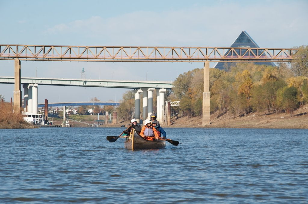
Memphis is the largest population on the last 1,000 miles of river, and yet in only an hour of hard paddling from downtown you can disappear into a big river wilderness with nothing but big skies, big forests, big sandbars and big river all around you!  Keep reading below for three samples of the best offerings.  Warning: Expert Routes.  For advanced paddlers only!


Everyone has their limits.  If you reach yours on one of these round trips, just turn around.  That’s the beauty of going upstream first.  It’s like climbing the mountain, except the return trip is (under normal conditions) easier than the climb.  If you push yourself beyond your capabilities you might be asking for trouble.  Possible dangers include heat exhaustion, hypothermia, and dehydration.   As any seasoned athlete or expedition member knows, it’s much better to enjoy the journey and turn around and survive than make it to the top of the mountain and not return!  On the Mississippi there are old paddlers, and there are bold paddlers.  But there are no old bold paddlers!


The Loosahatchie Redman Figure-Eight

12.8 miles (from Mud Island Upper)

https://maps.google.com/maps/ms?msid=217859314001592865582.0004e42b1a166efc02718&msa=0&ll=
35.186576,-90.06918&spn=0.086703,0.112696

http://goo.gl/maps/RQIg6


For expert paddlers only!   Must be well trained in self-rescue.  Also, the river must be above 15 on the Memphis Gauge to make all of the crossings over back channel dikes.  Wear wetsuit in cold water (Nov – April) and stash phone and emergency gear in dry bag or dry box.  Difficult at medium water, extremely difficult at high water.  Do not attempt at flood stage.


Park your vehicle at Mud Island Upper, set your GPS, strap your gear down and tighten your life jacket.  You’re in for an adventure!  (And it will all take place within five miles of downtown Memphis!) 


This figure-eight route will take you twelve to thirteen miles around two big islands with lots of fast water, strainers, snags, sawyers, flooded forests, roaring shoals, violent eddies, powerful boils, strong whirlpools, towboats, pleasure boats, docks, buoys, and other hazards.  You will need to make 3 ferry crossings, 17 dike crossings, and 2 long upstream crawls to complete this loop.


Check for traffic and grab the eddy at the mouth of the Wolf River to sling you out across the main channel to the Loosahatchie Bar. Hug Loosahatchie Bar to topsides and then ferry over to Redman, crawl up backsides using eddies and slow water wherever possible.  Cross over strong channel full of snags topsides into slow water at base of willow forest.  Follow willows through hole in the wall (at medium water) and blast you way through boil line back into main channel.  Enjoy downstream flow along outer Redman and dive back into Loosahatchie Back Channel to bottom of island, cut hard across island base and crawl your way back up outside Loosahatchie until you are even with the mouth of the Wolf.  Carefully check for traffic then make hard ferry crossing back to Mud Island.

Leave A Comment

SECTION MILE ACCESS CITY
Middle Mississippi & Bluegrass Hills / Bootheel 195-0, 954-850 ST. LOUIS TO CARUTHERSVILLE
Chickasaw Bluffs 850 – 737 CARUTHERSVILLE TO MEMPHIS
Introduction  
Caruthersville to Osceola
850 – 737 LBD Options for Paddlers in the Caruthersville Stretch
Above Caruthersville  
Below Caruthersville  
850 RBD Caruthersville Harbor Boat Ramp (1/2 Mile Up Harbor)
849 RBD Mouth of the Carutherville Harbor
849 RBD Trinity Barge Fabrication Plant
847 RBD Blaker Towhead
846.5 Caruthersville
846 RBD Isle of Capri/Lady Luck Casino and Casino Inn Suites
845 – 840 LBD Caruthersville – Linwood Bend
850 RBD – 840 LBD Day Trip: Caruthersville to Booth’s Point
840 LBD Linwood Bend Boat Ramp
839 Caruthersville Bridge
Bridges and Mud: How Deep is the Mississippi Mud  
Several Routes Around Islands 18, 20 and 21  
838 – 835 LBD Island 18 Towhead
829 – 832 RBD Island 20 Dikes and Towhead
823 – 829 LBD Island 21
Routes for the Paddler Around Tamm/Barfield Bends  
820 – 815 RBD Wright’s Point – Tamm Bend
819.3 LBD Mouth of the Obion River
Moss Island WMA  
817.7 LBD Tamm’s Landing and Ed Jones Boat Ramp
817.7 – 801.8 LBD Chickasaw National Wildlife Refuge
No Levee?  
814 LBD Nebraska Landing
815 – 805 LBD Barfield Bend
809.3 RBD Barfield Boat Ramp
806 RBD Tomato Arkansas
805 – 801 RBD Island 25
Paddler’s Options in the Island 30 – Osceola Area  
800 – 796.5 RBD Island 26 and Forked Deer Island 27
803 – 787 RBD Ashport-Keyes Gold Dust
796 – 791 RBD Ashport Gold Dust Dikes
797 LBD Shoaf Landing
797 LBD Lower Forked Deer River
796 LBD Ashport-Keyes Boat Ramp
793 – 785 RBD Island 30
796 LBD Ashport-Keyes Boat Ramp
Neark (Jacksonville) Landing  
786.5 LBD Back Channel Island 30
785 RBD Osceola Arkansas
783.5 RBD Sans Souci Boat Ramp
Osceola to Shelby Forest
785 RBD Osceola Arkansas
783.5 RBD Sans Souci Boat Ramp
782 LBD Driver Island
779.8 LBD Old Mouth of the Forked Deer
779 – 778 LBD First Chickasaw Bluff
Alternate Paddler’s Route Around Hatchie River & 2nd Chickasaw Bluff  
778 – 773 RBD Sunrise Towhead – Island 34
777 – 773.5 LBD Hatchie Towhead
773.5 LBD Mouth of the Hatchie River
773.5 LBD Lower Hatchie National Wildlife Refugee
771 – 772 LBD Angelo Towhead
771 LBD Randolph Landing
771 – 769 LBD The Second Chickasaw Bluff (Richardson Bluff)
768.9 LBD Richardson’s Landing
768 LBD Randolph’s Landing/Duvall’s Boat Ramp
766 – 763 LBD Below Richardson’s Landing Dikes and Bar
Dyess Arkansas, Birthplace of Johnny Cash’s Five Feet High and Rising  
Five Feet High and Rising  
767.6 – 761.5 RBD Island 35
767 RBD Island 35 Boat Ramp
Back Channels of Island 35  
767.6 RBD Entrance
761.5 RBD Exit Behind Dean Isand
Memphis Gage  
Dikes and Water Levels  
Reading Google Maps  
761.5 – 757 RBD Dean Isand
761.5 – 757 RBD Back Channel of Dean Isand
Third Chickasaw Bluff  
758 – 754 LBD Denseford Bar and Dikes/Hen and Chicks
752.7 LBD Shelby Forest Boat Ramp
Shelby Forest to Memphis
Memphis Gage  
Dikes and Water Levels  
752.7 LBD Shelby Forest Boat Ramp
Hen & Chicks Round Trip  
754 – 745 LBD Meeman Shelby Forest State Park
754 – 747.5 RBD Back Channel of Brandywine Island
Buoys and Dikes  
Paddling Into Memphis: Three Distinct Routes  
749 – 742 LBD Hickman Bar
Picknicking and Camping on Hickman  
746 LBD Upper Hickman
745 LBD Middle Hickman
744 LBD Lower Hickman
743 LBD Below Lower Hickman
740.6 LBD Loosahatchie River
743.5 – 740 LBD Redman Point Bar
Memphis Upper Waswater Treatment Plant  
M.C. Stiles Waterwater Treatment Facility  
739 LBD Conoco Lucy-Woodstock Memphis Chemical Terminal Dock
740.6 LBD Wolf River
738.4 LBD Mud Island Upper Boat Ramp
740 – 737.5 Loosahatchie Bar
737.5 Ferry Crossing to Memphis From the Bottom of Loosahatchie Bar
737 Memphis “M” Bridge (Hernando De Soto Bridge)
736 LBD 4th Chickasaw Bluff: Memphis
736 LBD Memphis Mud Island Harbor
Mud Island Riverpark & Museum  
Memphis Yatch Club Marina & Boat Ramp  
Coast Guard Boat Ramp  
Memphis Conveniences Useful to Paddlers  
Several Challenging Round-trips From Memphis  
The Lossahatchie Redman Figure-Eight  
The Loosahatchie Roundtrip  
Hickman Bar Roundtrip  
Upper Delta 737 – 663 MEMPHIS TO HELENA
Middle Delta 663 – 537 HELENA TO GREENVILLE
Lower Delta 537 – 437 GREENVILLE TO VICKSBURG
Loess Bluffs 437 – 225 VICKSBURG TO BATON ROUGE
Atchafalaya River 159 – 0 SIMMESPORT TO MORGAN CITY
Louisiana Delta 229 – 10 BATON ROUGE TO VENICE
Birdsfoot Delta 10 – 0 VENICE TO GULF OF MEXICO