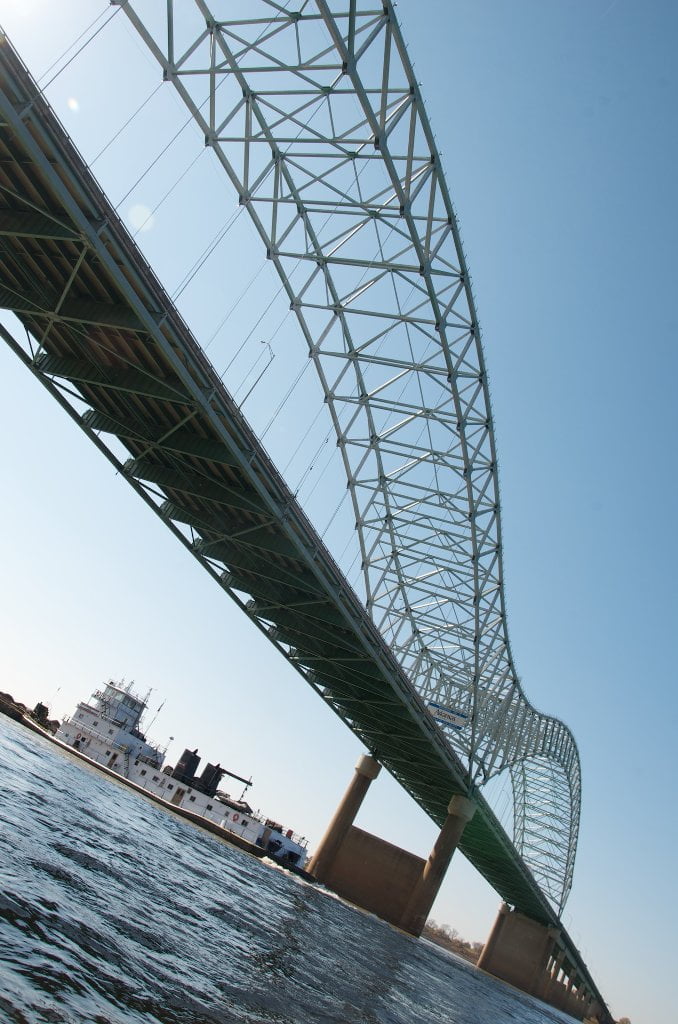
The Lower Mississippi River Water Trail

There is a large eddy several hundreds yards-wide at the Mud Island Harbor entrance.  As mentioned above the harbor opens up just past a sometimes muddy, sometimes grassy, and sometimes sandy spit that marks the end of Mud Island.  Ride the eddy out and use it to your advantage to swirl to gain the slackwater beyond.  If you are taking out or resupplying in Memphis you have three choices for public landings, 1) the Memphis Yacht Club Marina, which is about a half mile up the Harbor on the left, 2) the Coast Guard Boat Ramp which is about a mile up on the right.  Both described in greater detail below.   The first is friendlier, but a longer walk into town.  The second is closer to conveniences, but not a safe place to leave your canoe or kayak unattended.  Or 3) pull up anywhere along the long cobblestone riverfront below downtown, where all the steamboats used to dock in the glory days of the Steamboatin’ era.  All of downtown’s attractions and businesses of importance to a long-distance paddler can be reached with a quick walk, including the downtown library, the downtown post office, restaurants markets, hotels, museums, and of course all of Memphis music clubs, notably Beale Street.


You will be greeted into the harbor by a long slice of a building shaped like the mouth of a smiling whale with gleaming rows of tall panes of glass for teeth and a maroon curly-cue gangplank leading to a maroon dock.  This dock, called Beale St. Landing, is the home base of the American Queen Steamboat, biggest and most powerful steamboat ever on the Mississippi River.  Further up the harbor along the cobblestone you might see the Island Queen, the Memphis Queen, and above them the Autozone headquarters, The University of Memphis School of Law (Old Customs Building), and others further back like the famous Peabody Hotel, Metro 67, Madison Hotel, Comfort Inn, Memphis Business Journal, Up Building, and others.


Mud Island Riverpark & Museum

1/4 mile up Harbor on left

You can relive your expedition walking a scale model of the Mississippi River at Mud Island Riverpark Museum.  While you’re there visit interpretive exhibits about the history and culture of the river, and the establishment of Memphis on the 4th Chickasaw Bluff.  Changing exhibits throughout year.  Live music summers in open air amphitheater.  Gift Shop and restaurant.  Monorail over harbor into downtown.  Open 10-5 Tuesday thru Sunday, April through October.  901-576-7241 or 800-507-6507.


Harbor left beyond the seven flags a replica keelboat is on display above the rip-rap, signed with the name Angela’s Ark.  She arrived in Memphis several years ago bearing a rag-tag group of re-enactors re-tracing Meriwether Lewis’ final journey, which was a downstream expedition to Memphis from St. Louis.  From Memphis the depressed leader of the Lewis & Clark Expedition went by horseback to the Natchez Trace toting all of his uncompleted journals, and either committed suicide or was murdered at a tavern along the Trace in October of 1809.  Fortunately for history, the journals were saved and later assembled for publication.

Leave A Comment

SECTIONMILEACCESS CITY
Middle Mississippi & Bluegrass Hills / Bootheel195-0, 954-850ST. LOUIS TO CARUTHERSVILLE
Chickasaw Bluffs850 – 737CARUTHERSVILLE TO MEMPHIS
Introduction 
Caruthersville to Osceola
850 – 737 LBDOptions for Paddlers in the Caruthersville Stretch
Above Caruthersville 
Below Caruthersville 
850 RBDCaruthersville Harbor Boat Ramp (1/2 Mile Up Harbor)
849 RBDMouth of the Carutherville Harbor
849 RBDTrinity Barge Fabrication Plant
847 RBDBlaker Towhead
846.5Caruthersville
846 RBDIsle of Capri/Lady Luck Casino and Casino Inn Suites
845 – 840 LBDCaruthersville – Linwood Bend
850 RBD – 840 LBDDay Trip: Caruthersville to Booth’s Point
840 LBDLinwood Bend Boat Ramp
839Caruthersville Bridge
Bridges and Mud: How Deep is the Mississippi Mud 
Several Routes Around Islands 18, 20 and 21 
838 – 835 LBDIsland 18 Towhead
829 – 832 RBDIsland 20 Dikes and Towhead
823 – 829 LBDIsland 21
Routes for the Paddler Around Tamm/Barfield Bends 
820 – 815 RBDWright’s Point – Tamm Bend
819.3 LBDMouth of the Obion River
Moss Island WMA 
817.7 LBDTamm’s Landing and Ed Jones Boat Ramp
817.7 – 801.8 LBDChickasaw National Wildlife Refuge
No Levee? 
814 LBDNebraska Landing
815 – 805 LBDBarfield Bend
809.3 RBDBarfield Boat Ramp
806 RBDTomato Arkansas
805 – 801 RBDIsland 25
Paddler’s Options in the Island 30 – Osceola Area 
800 – 796.5 RBDIsland 26 and Forked Deer Island 27
803 – 787 RBDAshport-Keyes Gold Dust
796 – 791 RBDAshport Gold Dust Dikes
797 LBDShoaf Landing
797 LBDLower Forked Deer River
796 LBDAshport-Keyes Boat Ramp
793 – 785 RBDIsland 30
796 LBDAshport-Keyes Boat Ramp
Neark (Jacksonville) Landing 
786.5 LBDBack Channel Island 30
785 RBDOsceola Arkansas
783.5 RBDSans Souci Boat Ramp
Osceola to Shelby Forest
785 RBDOsceola Arkansas
783.5 RBDSans Souci Boat Ramp
782 LBDDriver Island
779.8 LBDOld Mouth of the Forked Deer
779 – 778 LBDFirst Chickasaw Bluff
Alternate Paddler’s Route Around Hatchie River & 2nd Chickasaw Bluff 
778 – 773 RBDSunrise Towhead – Island 34
777 – 773.5 LBDHatchie Towhead
773.5 LBDMouth of the Hatchie River
773.5 LBDLower Hatchie National Wildlife Refugee
771 – 772 LBDAngelo Towhead
771 LBDRandolph Landing
771 – 769 LBDThe Second Chickasaw Bluff (Richardson Bluff)
768.9 LBDRichardson’s Landing
768 LBDRandolph’s Landing/Duvall’s Boat Ramp
766 – 763 LBDBelow Richardson’s Landing Dikes and Bar
Dyess Arkansas, Birthplace of Johnny Cash’s Five Feet High and Rising 
Five Feet High and Rising 
767.6 – 761.5 RBDIsland 35
767 RBDIsland 35 Boat Ramp
Back Channels of Island 35 
767.6 RBDEntrance
761.5 RBDExit Behind Dean Isand
Memphis Gage 
Dikes and Water Levels 
Reading Google Maps 
761.5 – 757 RBDDean Isand
761.5 – 757 RBDBack Channel of Dean Isand
Third Chickasaw Bluff 
758 – 754 LBDDenseford Bar and Dikes/Hen and Chicks
752.7 LBDShelby Forest Boat Ramp
Shelby Forest to Memphis
Memphis Gage 
Dikes and Water Levels 
752.7 LBDShelby Forest Boat Ramp
Hen & Chicks Round Trip 
754 – 745 LBDMeeman Shelby Forest State Park
754 – 747.5 RBDBack Channel of Brandywine Island
Buoys and Dikes 
Paddling Into Memphis: Three Distinct Routes 
749 – 742 LBDHickman Bar
Picknicking and Camping on Hickman 
746 LBDUpper Hickman
745 LBDMiddle Hickman
744 LBDLower Hickman
743 LBDBelow Lower Hickman
740.6 LBDLoosahatchie River
743.5 – 740 LBDRedman Point Bar
Memphis Upper Waswater Treatment Plant 
M.C. Stiles Waterwater Treatment Facility 
739 LBDConoco Lucy-Woodstock Memphis Chemical Terminal Dock
740.6 LBDWolf River
738.4 LBDMud Island Upper Boat Ramp
740 – 737.5Loosahatchie Bar
737.5Ferry Crossing to Memphis From the Bottom of Loosahatchie Bar
737Memphis “M” Bridge (Hernando De Soto Bridge)
736 LBD4th Chickasaw Bluff: Memphis
736 LBDMemphis Mud Island Harbor
Mud Island Riverpark & Museum 
Memphis Yatch Club Marina & Boat Ramp 
Coast Guard Boat Ramp 
Memphis Conveniences Useful to Paddlers 
Several Challenging Round-trips From Memphis 
The Lossahatchie Redman Figure-Eight 
The Loosahatchie Roundtrip 
Hickman Bar Roundtrip 
Upper Delta737 – 663MEMPHIS TO HELENA
Middle Delta663 – 537HELENA TO GREENVILLE
Lower Delta537 – 437GREENVILLE TO VICKSBURG
Loess Bluffs437 – 225VICKSBURG TO BATON ROUGE
Atchafalaya River159 – 0SIMMESPORT TO MORGAN CITY
Louisiana Delta229 – 10BATON ROUGE TO VENICE
Birdsfoot Delta10 – 0VENICE TO GULF OF MEXICO