The Lower Mississippi River Water Trail
The largest, wildest & tallest sandbars on Buck Island are located on its top end, the upstream side facing north, sitting above the northernmost stands of trees. At low water these sandbars extend almost a full mile above the northernmost trees, and near the water’s edge are mostly gravel. These gravel bars were once the favorite haunts of noted Helena archeologist Injun Joe Madonia. If Joe’s spirit is found anywhere since his passing in 2011, it will be found here. If you make landing look out for unusual rocks, fossils and petrified bones, many of which have been washed hundreds and sometimes thousands of miles down the Mississippi River out of all past epochs of geologic history of North America. And watch out for Injun Joe’s playful spirit & twinkling eyes, which are surely peeking down on us from across the heavens!
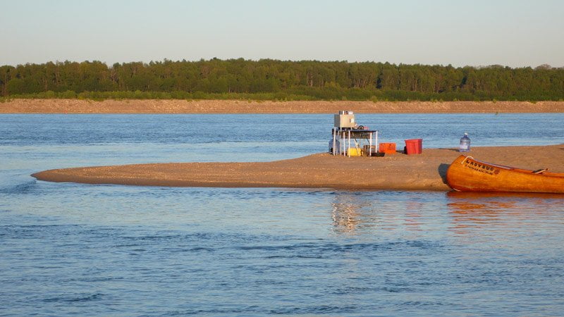
Due to its very gentle slope the top end sandbar of Buck Island goes underwater quickly as the river rises. One foot of river rise might mean hundreds of feet of sand going underwater, so choose your campsites carefully and be aware of the river forecast [CLICK HERE: Forecasting & Monitoring River Levels].
Several years ago two adventurers made a campsite stop on Buck island after a long hard-days of paddling. The exhausted pair pulled their canoe up the shore, ate some supper, and then unloaded their sleeping bags and went to sleep, leaving most of their gear still in the canoe. The next morning they awoke to find their canoe and all their gear had disappeared in the night. The reason — the rising waters had crept up the shallow bar and floated the canoe away. Always pull your canoe up and tie it down! If there aren’t any trees nearby drive one of your paddles deep into the sand or mud for an anchor point. This shows how the river will sometimes surprise even the most experienced paddlers. Never assume you know everything about the river! [Add Citation]. I once had to chase down my canoe as a strong north wind blew it out towards the open main channel. Saving it required a long swim. Not saving it would have meant an even longer swim! Another time I had carelessly laid camp at dark without carefully inspecting the location and not forecasting the river. I awoke in the wee-wee hours of early morning with water entering the bottom of my sleeping bag!
In the heat of the Summer an open bar camp can be a decided advantage as you lay sweltering your tent in thick swarms of mosquitoes. Wide open bars like Buck island are subject to the best breezes. If there are no oncoming storms and the sun is low enough to comfortably set camp without getting burned, you might locate camp far from the trees on an open beach. The mosquitoes live in the trees, and don’t usually come out until after dark. The slightest breeze will help keep them down and keep you cool as the roasting sand off vents from the heat of the day. [CLICK HERE: for more hints about how to live with mosquitoes].
On the other hand, open bars become broiling pans in the direct light of the sun, and as noted are subject to the whims of the weather. Perhaps the best combination to look for is the place where a thin line of trees extends across a dune extending out of the forest outwards towards the shoreline of any island, or similar attribute of the island that creates a thin line of trees. It might be at the end of an island which is collapsing into the river. There you will find protection if you need it, shade from the sun, shelter from the wind, but also the ability to easily set your tent on top of a ridge or dune for the best breezes when they are blowing gently. Another possibility to keep in mind here is the hammock. Strung between two medium sized or larger trees atop a dune you will feel like you have landed in the Yucatan Peninsula and will sleep like a baby in the gentle breezes blowing off the waters. The rustling of cottonwood leaves or the gentle swaying of the fragrant willow completes this scene of paradise in the middle of America!
There are two small isolated splinter islands on the top end of Buck Island at Mile 668 that have formed around the dikes RBD that paddlers in the area have named The Fawns. Around its Eastern circumference (at Mile 666 — opposite Trotter’s) a larger splinter island named Doe Island is found with a medium sized channel separating it from Buck. This mid-island channel is closed off until the river rises above 17 HG. Above 35 HG Doe goes completely underwater. Located at the bottom end of Doe is a favorite campsite on a prominent peninsula with an inlet behind that local paddlers refer to as Tip-o-Doe!
At low water the sandbars of Buck Island extend completely around its outside edge, broken here and there by a mudbar or an isolated inlet. As the water rises the bars quickly go under, first from its bottom end and in the back channel, then the sides and finally the entire top end. At 35 HG there is no more sand to be found anywhere around Buck Island, but the woods are still dry. In the winter, when the snakes are hibernating and the mosquitoes are gone, you can find good campsites within the forests of Buck Island — that is until the river rises above flood stage (44HG). However in the warmer months be ready for clouds of voracious mosquitoes, thick poison ivy, and a healthy snake population.


Leave A Comment
You must be logged in to post a comment.