The Lower Mississippi River Water Trail
209 LBD Plaquemine Point
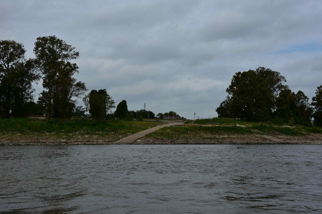
Paddlers will find high dry bluffs of sand at Plaquemine Point, dry up to bank full 30 BR. Unfortunately a nearby dirt removal operation just downstream of the point ruins the wild effect. You might be considered trespassers stopping here. The City of Plaquemine is directly across the river, and Plaquemine Island one mile upstream. Your best bet for camping is Plaquemine Island, or if stopping in the City of Plaquemine, go for the landing at the mouth of Bayou Plaquemine, on river side, directly over the levee from the old Lock & Dam.
208.4 LBD Plaquemine Point Shipyard, Repair Wharf
208.0 LBD Banta Mile 208 Fleet
208.5 RBD Plaquemine Boat Ramp
Steep Concrete Ramp leading into river at downstream angle. Good ramp at all water levels. Questionable overnight parking. Access over levee from Court Street. Round trip access from here to reach Plaquemine Island. Best camping near town would be several hundred yards upstream at Plaquemine Beach.
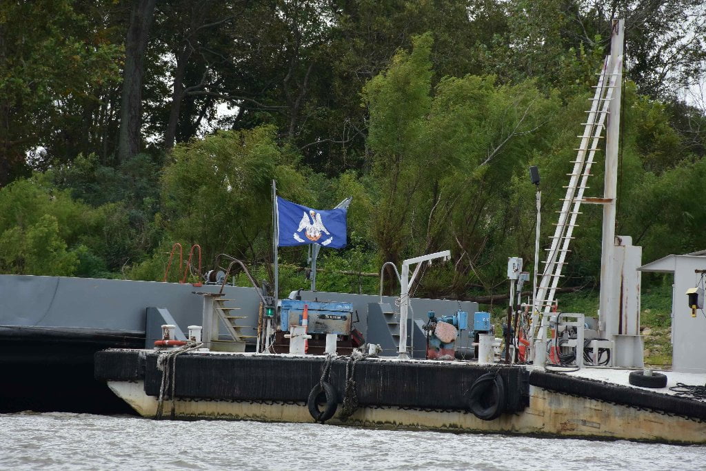
208 RBD – 207.5 LBD Plaquemine Ferry
Watch for Plaquemine Ferry going back and forth across the main channel after as you come around Plaquemine Bend. Crosses from the eastern side of Iberville Parish and East Baton Rouge Parish for vehicles and pedestrians, and used by both workers getting to their jobs and tourists. The Plaquemine Ferry is operated by the Louisiana Department of Transportation and Development Ferry Location: End of La. Hwy 75 (Belleview Drive) and Mississippi River intersection in Plaquemine (29 miles from I-10-Mississippi River Bridge). Ferry Schedule: Monday-Friday: 4:00 am to 8:45 pm; Saturday-Sunday: 5:00 am – 8:45 pm – 7 days a week (subject to closure during inclement weather). Leaves every hour and half hour from the west bank side; no toll fee when entering on the west bank side. Ferry Hotline Number: 1-888-613-3779.
Ferry Landing is closest access to grocery stores in Plaquemine: 1) Butcher Boy Grocery at 58045 Belleview Drive, or 2) LeBlanc Foods a little further up at the Bellview Shopping Center, 58440 Belleview Dr.
206 RBD – Reveilletown
An accident at the Georgia Gulf PVC plant filled the air of the surrounding area with toxic fumes. Plumes of vinyl chloride seeped into the residential community of Reveilletown, which was located less than 1,000 feet from the plant. Residents filed suit against Georgia Gulf after traces of vinyl chloride were found in local children’s blood. Georgia Gulf settled with the residents of Reveilletown, who either received a cash payment for their homes or were moved to a small suburban cul-de-sac several miles upriver. (Paul Orr)
205.5 LBD Axiall (formerly Georgia Gulf)
204.8 LBD Shintec Louisiana Plaquemine PVC Plant
These two large facilities produce chlorvinyl chemicals, primarily for the manufacture of PVC, with Shintech Corp having the dubious distinction of being the world’s largest producer of PVC. Along with the Dow Chemical and other Shintech facilities in the area, a large amount of the nation’s chlorovinyls and PVC are manufactured in this area. Together these PVC powerhouses boasted toxic air releases of 528,129 pounds in 2013, while Axial alone sent 144,402 pounds of toxic gunk into the water towards the freshwater intakes of every community downstream. (Paul Orr)
205.2 RBD Small Dune
There is a small dune located West Bank in between the Georgia Gulf and Ashland Chemical docking facilities. Possible emergency camp in lower water levels, but best for a low/med water picnic site. Too noisy and busy for campsite. Nearby Shintech Corp is one of the world’s largest producer of PVC, and features a tall cone-shaped pile of raw sulphur that seems to glow with a blazing Day-Glo green. If possible, keep going downstream to Point Pleasant or Bayou Goula Island.
206-204 RBD Sunshine Wetlands
There is a two-mile long wetlands a half mile wide found along the East bank main channel between 206 and 204 LBD with medium high sandy shelves topped with thick willow forests. Behind the willow thickets is a vibrant wetlands composed of ridges, channels, lowlands, marshes, borrow pits and other forms of wetlands. Campsites and picnic sites could be found any number of places along this stretch of river, but there is a dirt removal operation towards the bottom end, around mile 206.
206 RBD – 203 LBD Granada Crossing
Freighters and all big commercial traffic make a channel crossing here from West Bank to East Bank. Smaller vessels can go just about anywhere during medium or higher river levels, but at low water most will follow this traditional route for making a safe crossign to deep water. Paddlers can continue on whatever routes suits you best. To avoid traffic stay bank right (West Bank) and make a close turn around Point Pleasant. If you stray into the channel for faster waters stay vigilant for oncoming fast-moving freighters. If you have a VHF marine radio monitor channel 67.
204.8 RBD Ashland Chemical Co., Plaquemine Plant Wharf.
203.8 RBD LBC PetroUnited Terminals, Sunshine Terminal Wharf
203.8 LBD – LBC Sunshine Terminal
LBC Sunshine terminal is a bulk liquid terminal with 40 tanks, a storage capacity of 118,020,000 gallons, and handles chemicals, petroleum products, and oils.
203.3 RBD SNF Flopam
SNF Flopam manufactures acrylamide monomer and polyacrylamide powders packaged in bags or supersacks within the Dow complex. SNF Flopam Toxic Releases (TRI) for 2013 in pounds: Air: 317,435.
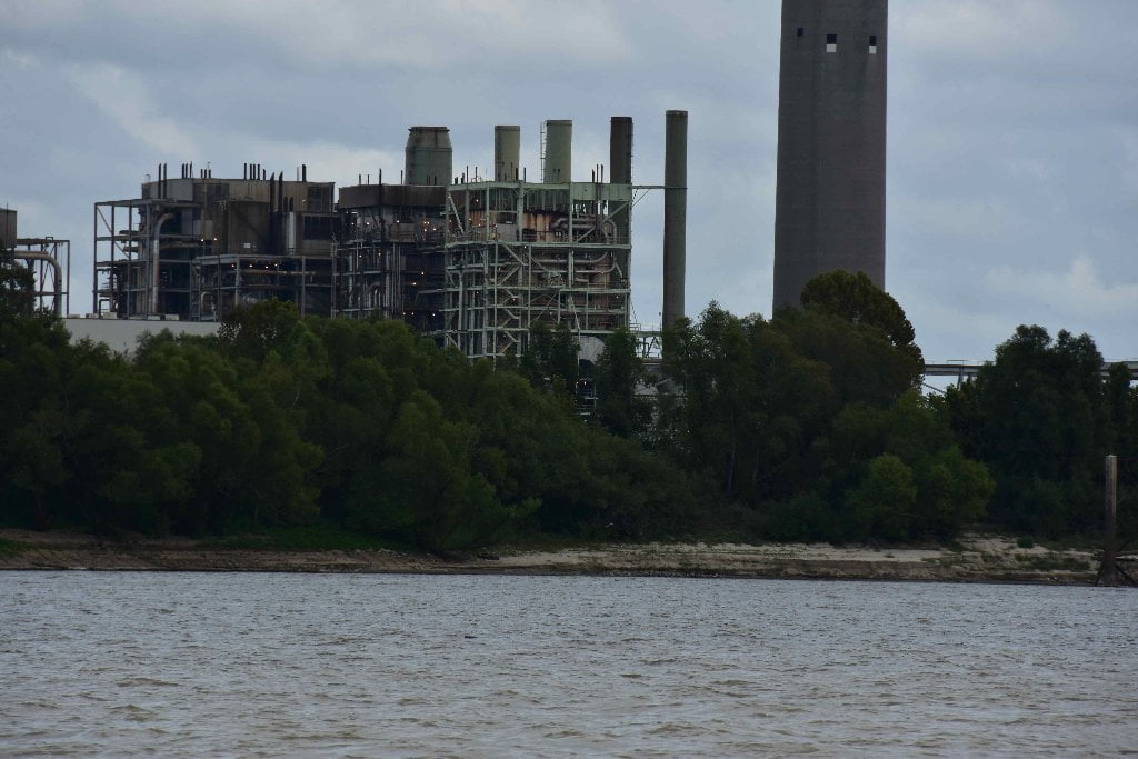
201.6 LBD Willow Glen Power Plant
Entergy’s Willow Glen Power Plant is a natural gas and fuel oil fired power plant used to provide variable levels of energy and/or capacity to the area when needed. Unfortunately located in this otherwise wild stretch of river, Willow Glen is the first power plant that you will encounter on this stretch of your paddle. (Paul Orr)


Leave A Comment
You must be logged in to post a comment.