The Lower Mississippi River Water Trail

111.8 LBD Small Sand Dune

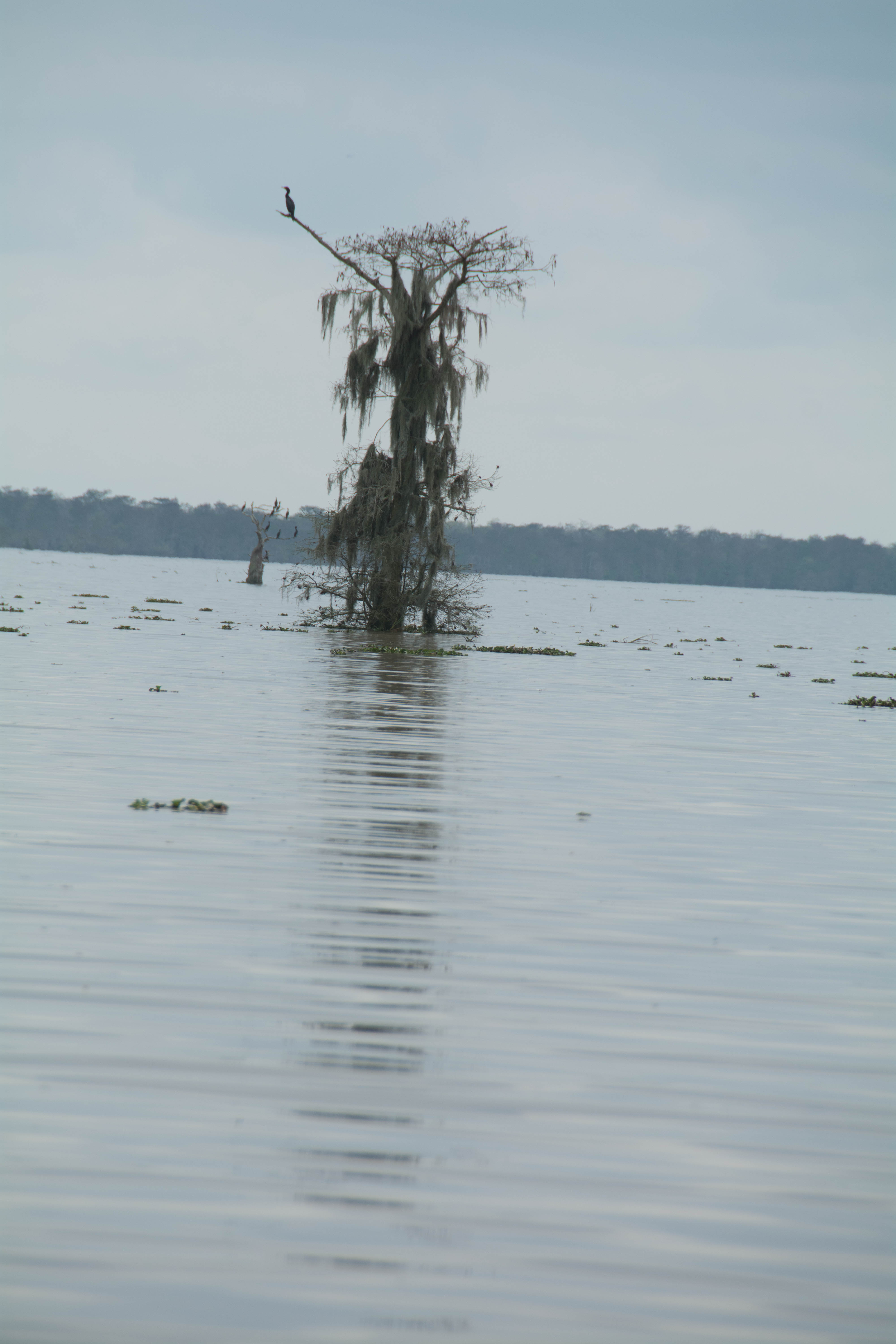
There is a small sand dune with soft landing that forms in low water, and would make for good camping or picnicking at any water levels below 8NO. Good protection from levee by thick brushy woods.

112.1 East Jefferson Parish Discharge

A low water sandbar is found downstream of the East Jefferson Parish Discharge, but this is a place you will definitely want to avoid except in emergency situations. Black water releases are common. As with similar sized communities across America, East Jefferson Parish communities are having difficulty keeping storm water separate from waste water, and street dumpings of motor oil, paints, and other unwanted liquids are all too frequent.

Jefferson is a long, narrow Parish (County) in Louisiana, adjacent to the city of New Orleans, reaching from Lake Pontchartrain on the north, about 55 miles south to Grand Isle, on the shores of the Gulf of Mexico. The northern 14 miles of Jefferson is split by the winding Mississippi River into an East and West Bank and this portion of the Parish is considered urbanized, and part of the New Orleans Metropolitan Area. In addition, the Parish is further bounded by estuarine systems of the Gulf of Mexico, at tide level. Most of the population of Jefferson (nearly ½ Million) is in this urbanized metropolitan area, which has relatively flat topography with ground elevations varying from slightly above to about five (5) feet below sea level. Flood control is provided by a system of levees, floodwalls, canals and drainage pump stations. All storm water runoff is conveyed by gravity through a system of subsurface drainage lines and canals into the suction bays of various pump stations then pumped into surrounding bodies of water outside of the flood protection system. The Department of Drainage is responsible for the administration, direction, coordination and implementation of major drainage and flood control programs and direct operation, construction and maintenance of: 340 miles of drainage canals, drainage ditches, 1465 miles of street subsurface drainage systems, and the operation and maintenance of 53 drainage pump stations. The Drainage Department also schedules and monitors pump station screen cleaning operations, canals and waterways trash pickup and grass cutting. The Department plans and coordinates construction of capital improvements and special projects. It maintains and manages the Parish wide Drainage and Flood Control System, Supervisory Control and Data Acquisition (SCADA) flood gauges and associated structures. (Jefferson Parish Drainage District)

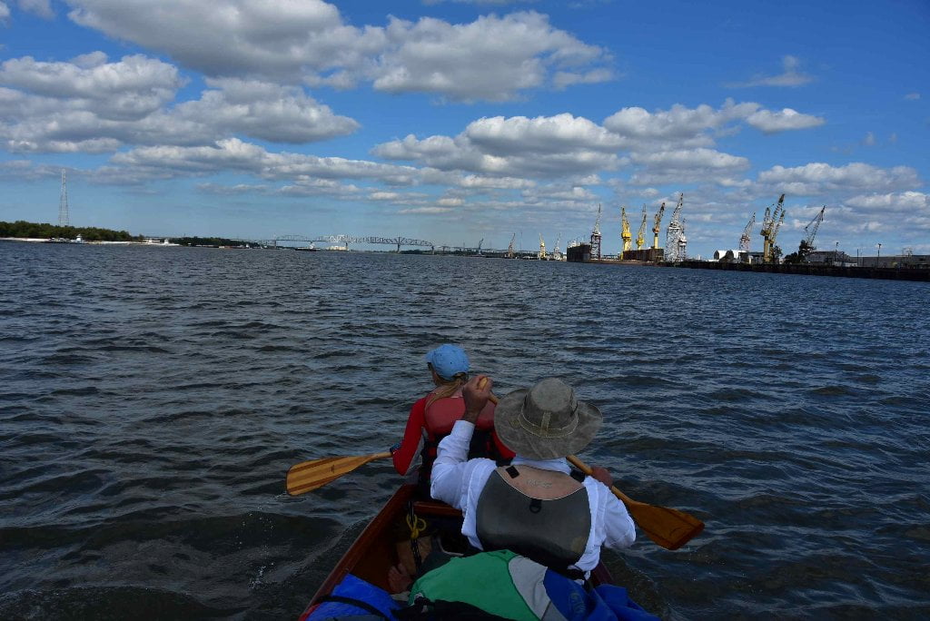
111 – 108 Avondale Bend/the “River Illusion”

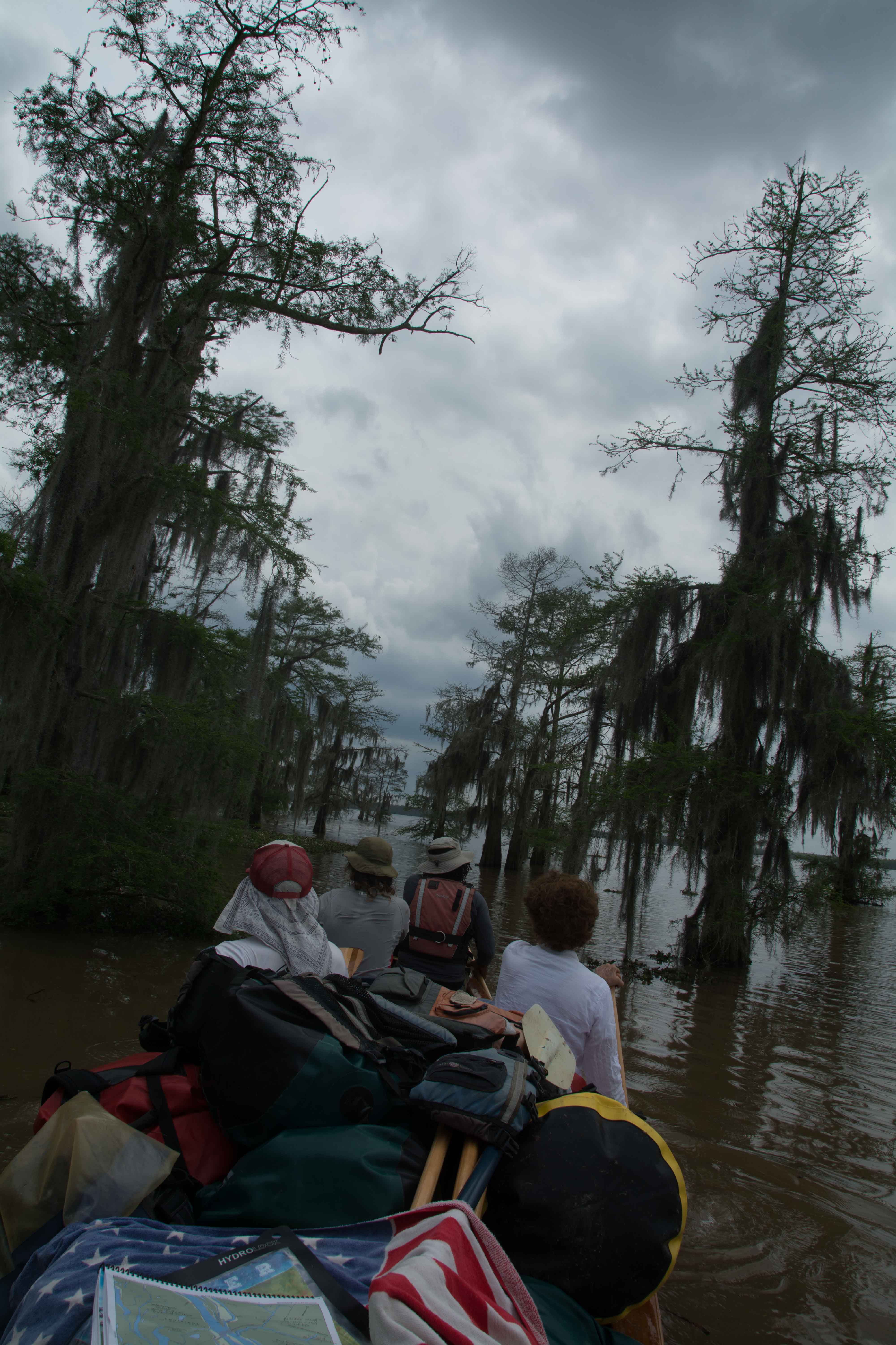
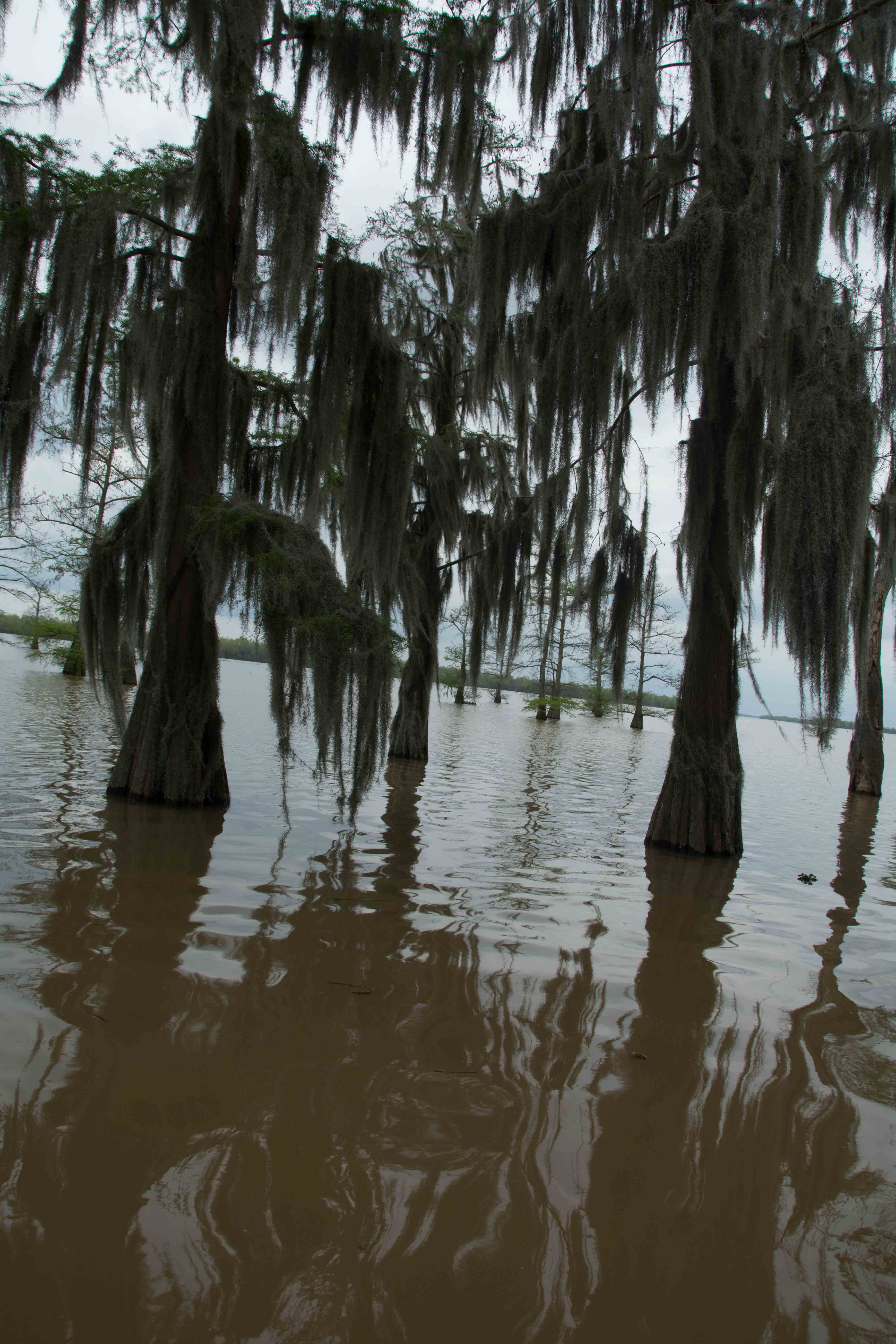
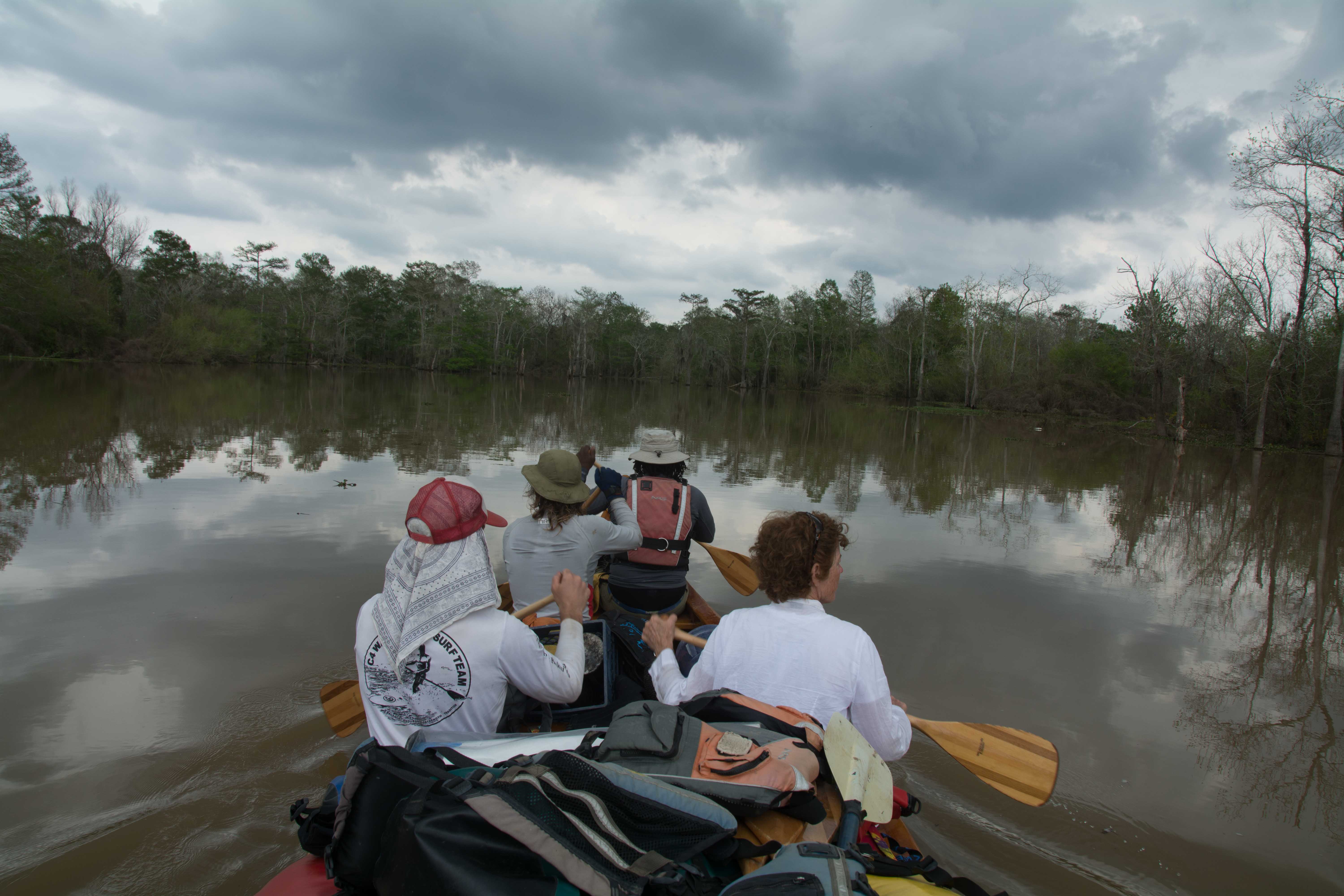
As you paddle into Avondale Bend the busy industrial Kenner reach fades away and some quietness returns along with long lines of trees on both sides of the river, giving the illusion of paddling through a wild wooded place. We call this the “river illusion.” The “river illusion” is found on rivers big and small all over the interior of America. I’ve felt it on the Missouri, the Pearl, the Sunflower, the Yazoo, and many others. Enjoy this illusion while it lasts! Industry awaits just around the corner where Chemical Corridor resumes is methodic march of giant refineries, graineries and scrap steel units.

Click here for more reading about the “River Illusion” [Insert Link]

112 – 109 LBD Twelve Mile Point Greenspace

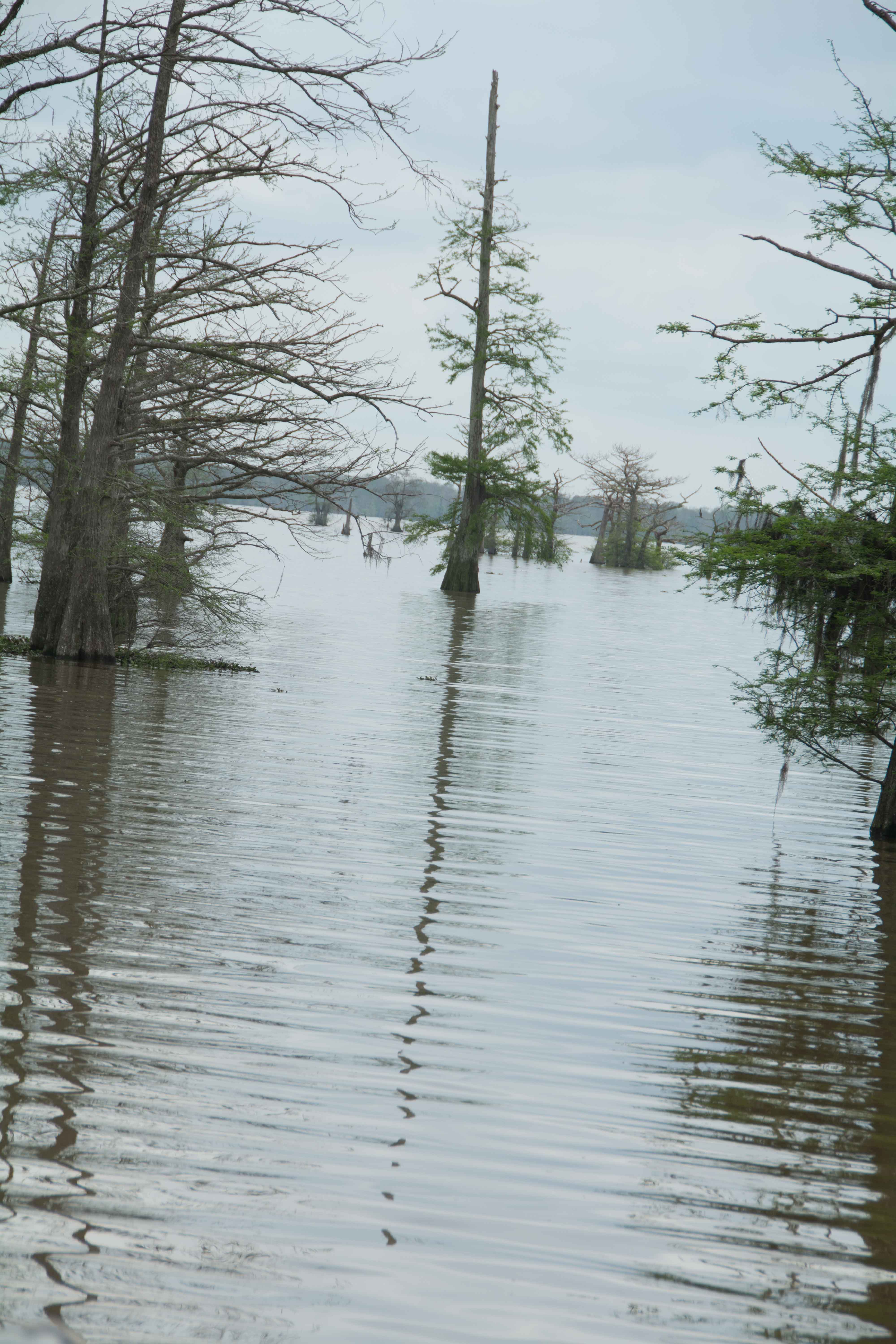
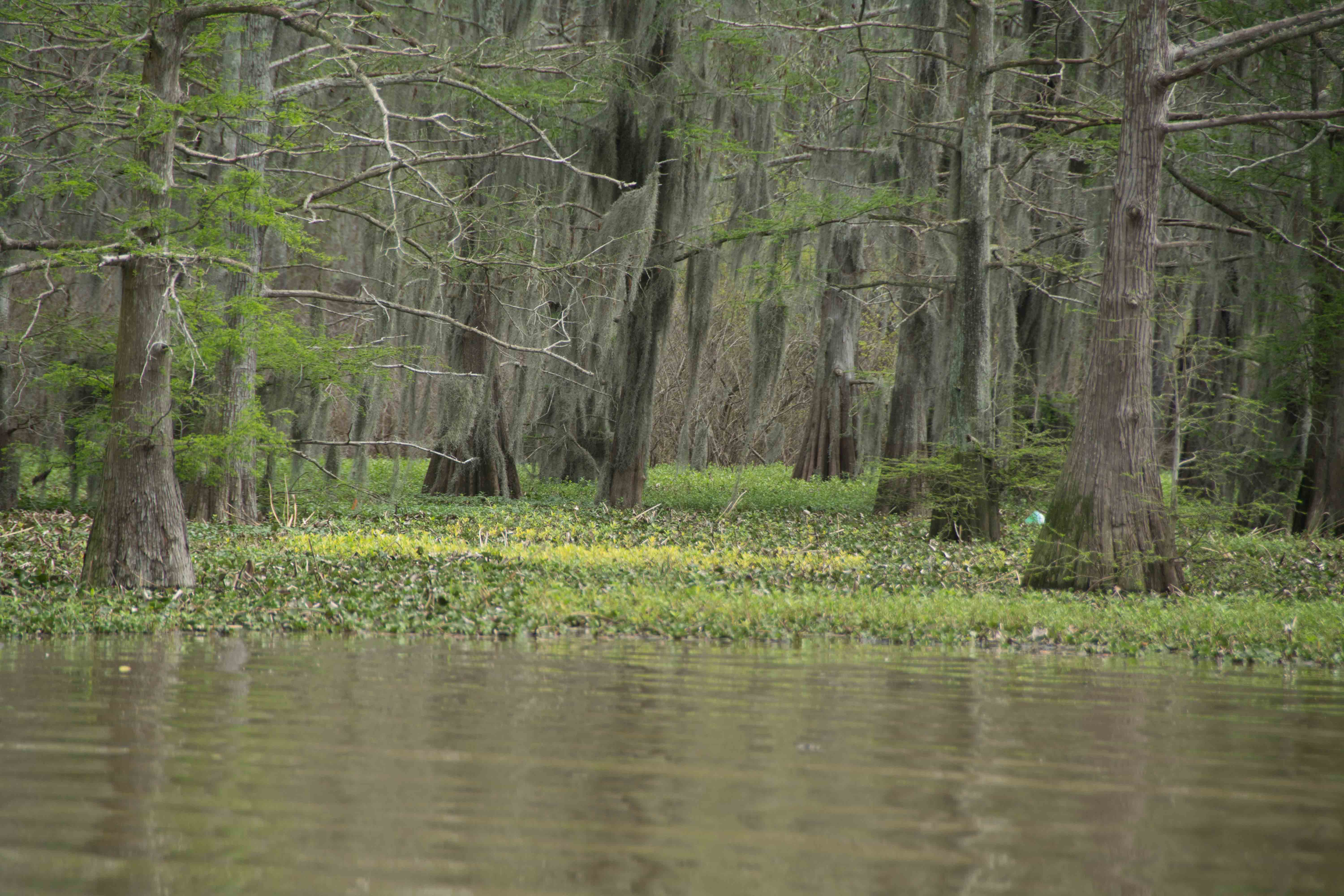
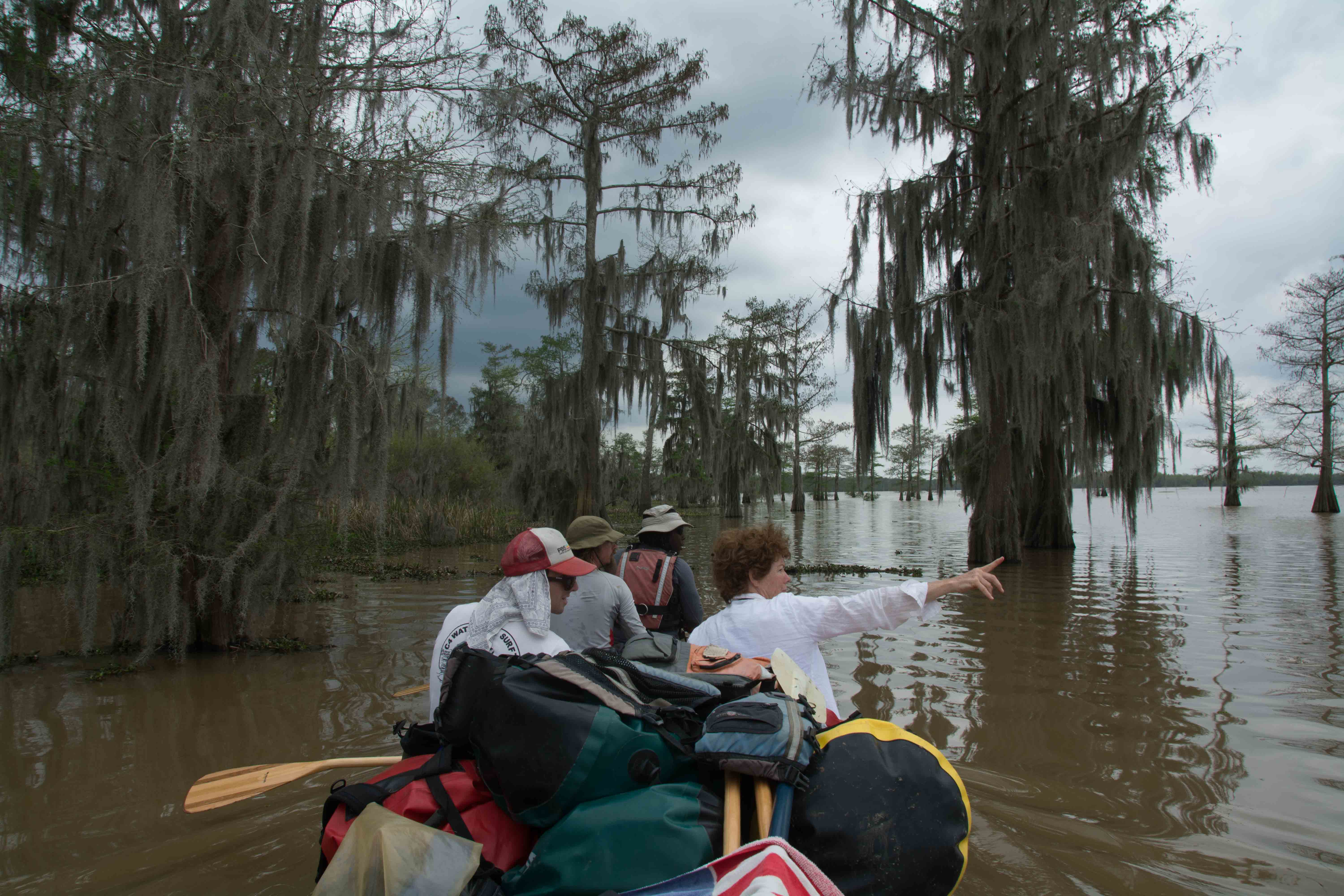
This Chem Corridor Greenspace is the thinnest yet encountered on the Lower Mississippi, but provides all of the buffer necessary to achieve the “river illusion,” that peaceful sensation that only a paddler can enjoy. Even though this Greenspace is a thin slice of batture woods only a 100 feet wide (or less), the downstream canoeist or kayaker (or paddleboarder) feels all of the peace and harmony achieved in the wildest of river places. Most of the greenery is found along the East Bank (LBD) below the sand dune at 111.8 LBD. Good picnicking or camping up to 10NO can be located along the way, especially at 110LBD, but also at 12 Mile Point 109 LBD.

110 – 109 LBD Twelve Mile Point

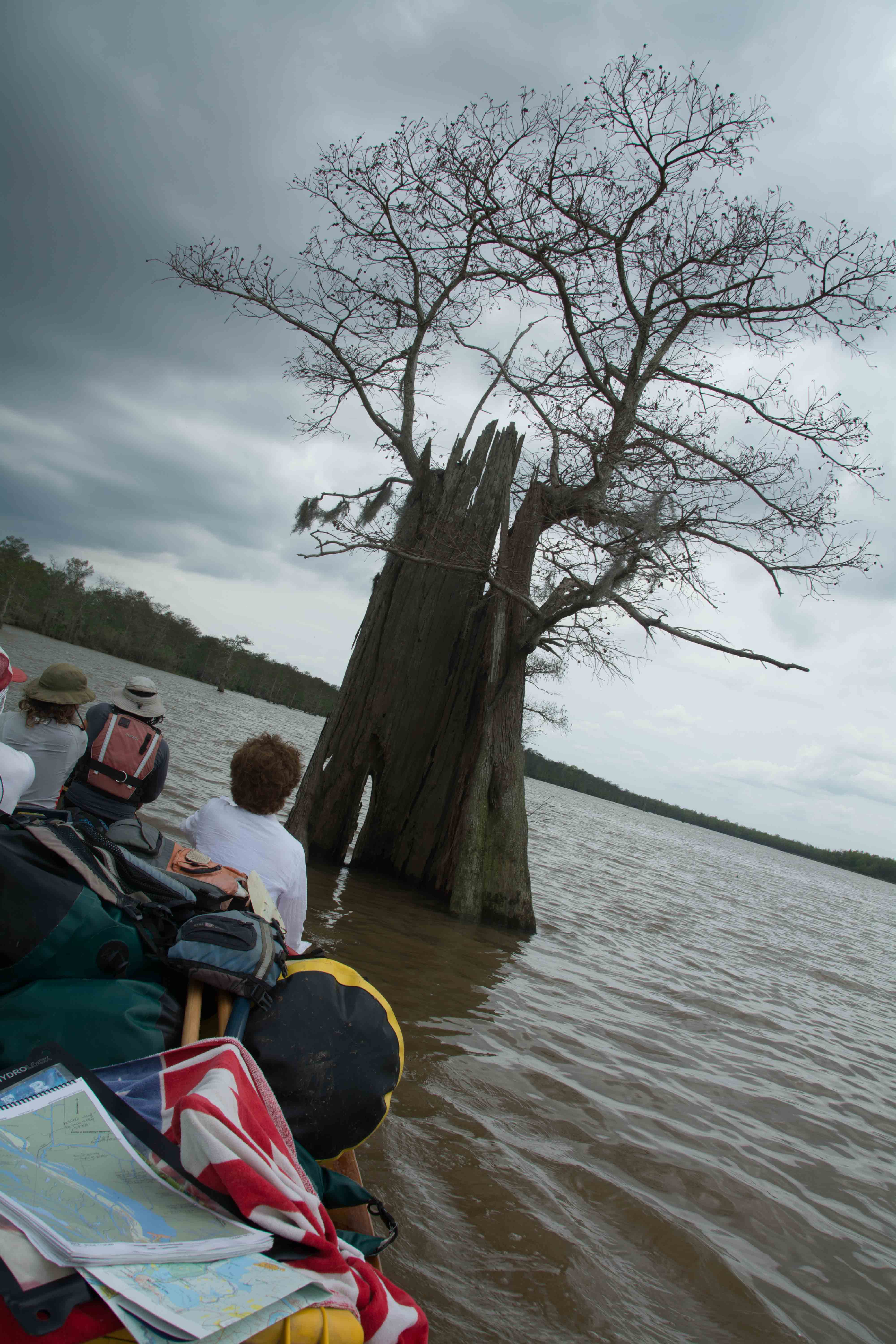
Last remote camping/picnicking above New Orleans, but only in low/med water levels. As you round Avondale Bend in low or medium water levels, you will notice several small skinny dunes East Bank — hung along the inside of the bend at Twelve Mile Point. These narrow shelves are the last remote camping/picnicking above New Orleans (in low/med water levels). But you will probably have to make landing on rip-rap for access, unless you hit it at exactly the right water level (around 8NO gage). If you stop here, lift or slide your vessel completely out of the water and onto the sandy shelf (or risk capsize in waves from fast-passing ships!). In higher water levels you could find shelter in the woods above. Several possible campsites or picnic sites will be found along high bank, with the levee not too far through the woods behind. You won’t find any possible landings below the point (at 108.5 LBD) where a long line of fleeted barges begins.

Elmwood/Bridge City/Jefferson Industrial Reach

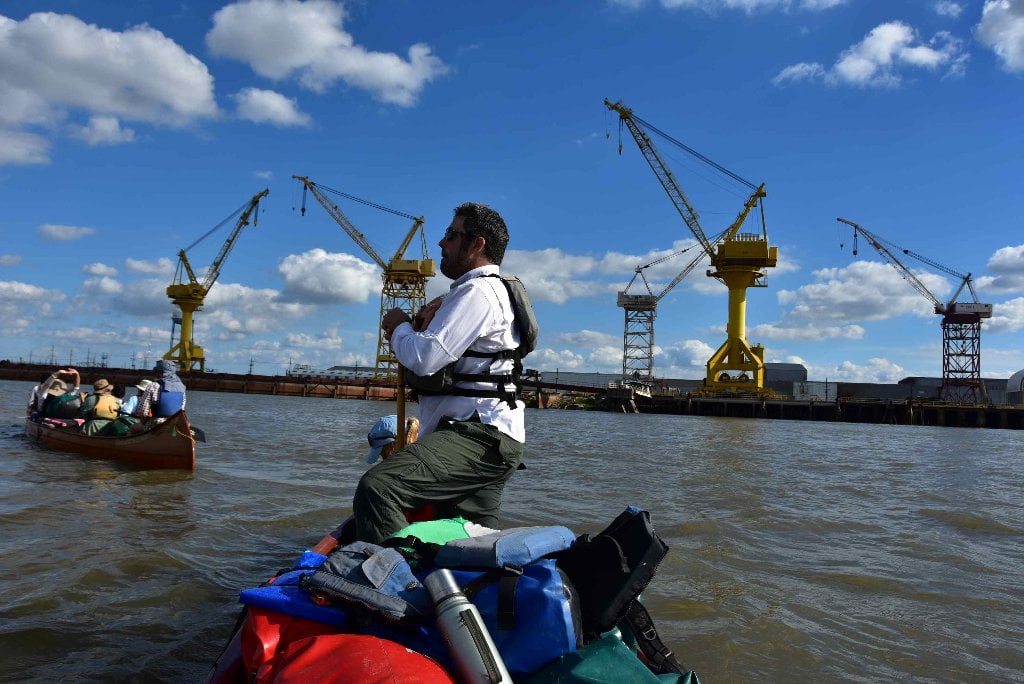
As you come around 12-Mile Point and approach the Huey P. Long US 90 Bridge the momentary quiet preceding the Avondale Bend ends and paddlers will again be squeezed into the middle of the channel by bank-to-bank activity on both sides of the river, including wharves, cranes, stevedoring, fleeting, graineries and anchorages, especially busy around the Litton Industries Docks No’s 1, 2, 3 and 4 which are all strung along this right bank descending from 107.6 – 106.6 RBD just above the Huey P. Long Bridge. Watch carefully for freighter traffic as you come around Nine-Mile Point, a particularly tight bend of the river.

108.4 RBD Wood Resources Corp., Avondale Wharf


108.3 RBD International – Matex Tank Terminals, Ltd., Avondale Dock No’s 1, 2 & 3


108.2 RBD – International Matex Tank Terminals (IMTT) Avondale

IMTT Avondale is a 100 acre bulk liquid terminal with 82 tanks for 1.1 million barrels of total capacity. Tanks range in size from 3,000 to 80,000 barrels. The terminal handles vegetable and other natural oils, specialty chemicals, and non-flammable petroleum products.

107.8 RBD Litton/Avondale Industries, Inc., Main Plant Wet Dock No. 1


107.7 RBD – Avondale Ship Yard

As you come around 12-Mile Point and the Huey P. Long Bridge appears downstream, paddlers will be amazed by the largest drydock yet seen on the Lower Mississippi River. If it seems as long as an ocean-going freighter, guess what: it is! This mega-drydock (anchored West Bank) is what remains of the legendary Avondale Shipyards.

Avondale Shipyards was founded in 1938 as Avondale Marine Ways. Initially the yard built barges and a few tugs but when the war effort started, it expanded to build large tugs and small cargo ships for the U.S. Maritime Commission. After the war, it expanded to its present site and also to a repair yard on the Harvey Canal. In May 1959, the original owners sold it to Ogden Corporation for $14 million and it became Avondale Shipyards Inc. as of July 1st, 1960. It was the site of the modernization of the USS Iowa in the early 1980s and built US Navy and US Coast Guard ships. At one time, it was the largest employer in the state of Louisiana with about 26,000 employees. It was later acquired by Litton Industries, then by Northrop Grumman Corporation, and most recently acquired by Huntington Ingalls Industries. In June of 2015 Huntington Ingalls stated it’s intention to sell the facility, which now sits idle. (Paul Orr)

Leave A Comment

SECTION MILE ACCESS CITY
Middle Mississippi & Bluegrass Hills / Bootheel 195-0, 954-850 ST. LOUIS TO CARUTHERSVILLE
Chickasaw Bluffs 850 – 737 CARUTHERSVILLE TO MEMPHIS
Upper Delta 736 – 663 MEMPHIS TO HELENA
Middle Delta 663 – 537 HELENA TO GREENVILLE
Lower Delta 537 – 437 GREENVILLE TO VICKSBURG
Loess Bluffs 437 – 225 VICKSBURG TO BATON ROUGE
Atchafalaya River 159 – 0 SIMMESPORT TO MORGAN CITY
Louisiana Delta 229 – 10 BATON ROUGE TO VENICE
Introduction  
Baton Rouge to New Orleans
Baton Rouge Gauge (BR)  
230 LBD Welcome to Baton Rouge: Downtown Riverfront
Baton Rouge Sites and Services of interest to Paddlers  
Food  
229.6 – 228.6 RBD Port Of Baton Rouge
The I-10 (New) Bridge  
229 LBD Glass Beach
Directions to Glass Beach  
Daytrips from Baton Rouge  
229 LBD Old Municipal Dock
229 – 228.5 Lower Baton Rouge Anchorage
229.1 RBD Baton Rouge City Wharf: Community Coffee
SoLa Coffee Companies  
How to Brew a Great-Tasting Pot of River-Rat Coffee:  
228.9 RBD Cargill Greater Baton Rouge Port Commission Grain Wharf
Port Allen/West Baton  
229 – 228.5 LBD Lower Baton Rouge Anchorage
228.5 LBD Economy Boat Store Wharf
228.4 RBD Mouth of ICWW
228.4 RBD Intracoastal Waterway (Morgan City Port Allen Route)
Resupply from Intercostal Waterway Boat Ramp (Under Hwy 1)  
228.4 – 226 RBD Cargo Carriers Port Allen Fleet West Bank Mooring
What are Fleeted Barges?  
Paddling out of the Baton Rouge Industrial Reach  
228 RBD LSU Tigers Stadium
227.4 LBD LSU
Highlights of Industry  
Toxic Release Inventory (TRI)  
Chem Corridor Superlatives  
High-Tech Materials Used by Paddlers  
What about Terreprene?  
Green Spaces  
Wild Miles  
225.3 – 223.9 RBD Western Towing Company West Bank Fleet
225-223 Red Eye Crossing
224-221 LBD Missouri Bend Pointway
223-222 LBD Missouri Island
RBD 221.8 Dow Chemical Missouri U.S.A., Plaquemine Dock No. 2. Hydrocarbon Wharf
222 and 210 RBD Dow Chemical Company Louisiana Operations, Dexco, and Shintech Addis
Duncan Point/Manchac Point/Plaquemine Island/Sunshine Green Space  
LBD 221-220 Duncan Point
219 RBD Lowlands Opposite Duncan Point
220 RBD Sardine Point
220 RBD – 218 LBD Sardine Crossing
219 RBD Comeaux Landing
216.5 RBD Australia Landing
216.5 LBD L’Auberge Casino
216.2 LBD Longwood Plantation
214.5 RBD Manchac Point
215 LBD Bayou Manchac
212.8 LBD Small Dune
213 LBD – 211 RBD Medora Crossing
211.5 RBD The Medora Site
211 – 209.5 LBD Plaquemine Island
210.5 RBD Morrisonville
210.4 RBD Morrisonville Landing
210 RBD Dow Chemical Company Louisiana Operations
210 RBD Dow Chemical Wastewater Outfall
208.5 RBD Dow Chemical Plaquemine Point Shipyard, Cleaning Wharf
209 RBD Myrtle Grove Trailer Park
208.7 RBD Plaquemine Beach
City of Plaquemine  
Bayou Plaquemine: Alternate Route to Gulf via Atchafalaya Basin  
209 LBD Plaquemine Point
208.5 RBD Plaquemine Boat Ramp
208 RBD – 207.5 LBD Plaquemine Ferry
206 RBD Reveilletown
204.8 LBD Shintec Louisiana Plaquemine PVC Plant
205.2 RBD Small Dune
206-204 RBD Sunshine Wetlands
206 RBD – 203 Granada Crossing
203.8 LBD LBC Sunshine Terminal
203.3 RBD SNF Flopam
201.6 LBD Willow Glen Power Plant
201 – 199 RBD Point Pleasant
200 LBD – 197 RBD Bayou Goula Crossing
200.1 LBD Industrial Complex including Taminco Inc., Syngenta, and Olin Chlor Alkali
Point Pleasant/Bayou Goula Island/Point Claire Green Space  
195.6 RBD Bayou Goula Landing
196 – 194.5 LBD Bayou Goula Island
Bayou Goula  
194.8 RBD Nottaway Plantation
194 LBD Point Clair
193.5 RBD White Castle
192.7 RBD Cane Sugar Refinery (Cora Texas Manufacturing Co)
191.5 RBD – 191 LBD White Castle-Carville Ferry
Carville  
191 LBD Carville Landing
190.8 LBD Carville Boat Ramp
191 – 190 LBD White Castle Anchorage
Geismar Industrial Reach  
188-184 RBD Claiborne Island
Nurdles: What Are Nurdles?  
187.9 LBD Total Petrochemicals and Refining and Caravelle Energy Center
186.8 LBD Industrial Complex including PCS Nitrogen, Honeywell, and Williams Olefins
185.3 LBD Methanex
185 LBD Industrial Complex including Borden Chemicals, Westlake Chemicals, and Momentive Specialty Chemicals
185 LBD Geismar
184.6 LBD Rubicon and Lion Copolymer
183.9 IMTT Geismar and BASF
183.2 LBD Shell Chemical and OxyChem
183.2 LBD Sandbar below Shell Geismar
182.8 – 182 LBD Carline’s Geismar Fleeting
182 LBD Old Inger Oil Refinery Superfund Site
Philadelphia Point/ Eighty-One Mile Point Greenspace  
181 – 179 RBD Philadelphia Point
180.3 – 178.8 LBD L & L Dry Bulk Transfer & Mooring
177.3 – 175.2 LBD L & L Fleeting and Mooring
Big Foot  
178 LBD Eighty-One Mile Point
Donaldsonville Industrial Reach  
177.9 RBD Smoke Bend Sand Dune
177 RBD – 174 LBD Smoke Bend Crossing
175.4 RBD Bayou Lafourche Water Intake
175.2 Donaldsonville Boat Ramp
175 RBD Donaldsonville
173.5 RBD CF Industries
173.7 LBD Private House and Boat Ramp
Bringier Point/Houmas Point Greenspace  
173 LBD Bringier Point
172 RBD Point Houmas
170.7 LBD Houmas House Plantation and Gardens
170 LBD Burnside Terminal and Burnside Alumina Refinery
169.2 LBD Chemours
168.3 LBD Motiva Convent Refinery
167.5 Sunshine Bridge
167 -165 LBD Sunshine Anchorage
Bonfires on the Levee  
167 RBD Mosaic Faustina and American Styrenics
163.8 LBD Zen-Noh Grain
165 LBD Shell Beach
164.5 LBD Zen-Noh Point
163 LBD Nucor Steel
162 LBD Romeville Dune
161 LBD – 158 RBD Rich Bend Crossing
161.5 LBD Occidental Chemical Convent
160.9 LBD SunCoke Energy Convent Marine Terminal
160.7 RBD thru 158 RBD St James Petroleum Terminals
160.4 Mosaic Uncle Sam
159.5 RBD Burton Lane
160 RBD Chatman Town
156 LBD College Point Beach & Greenspace
Manresa On The Mississippi  
156 RBD – 152 LBD Belmont Crossing
Oak Alley Plantation  
150.4 LBD ADM Growmark St. Elmo
150.5 LBD St. Elmo Terminal Grain Elevator Wharf
149.3 LBD Paulina – Poche Park
148.1 LBD Grandview Beach
Switching To The New Orleans Gage (NO)  
Water levels according to the New Orleans Gage (NO)  
149 – 147 LBD Upper Grandview Anchorage
147 Gramercy
146.2 LBD Louisiana Sugar Refining (LSR)
145.6 LBD Rain CII Gramercy Calciner
145.4 LBD Noranda Alumina Gramercy
145.9 Gramercy Bridge (Veteran’s Memorial Bridge)
145.4 Kaiser Bauxite
Blind River  
Maurepas Swamp Wildlife Management Area  
Manchac Wildlife Management Area  
144 RBD Angelina Landing
143.6 LBD Nalco Garyville And Evonik Stockhausen
Angelina/Willow Bend Greenspace  
143.4 LBD MARQUEZ
142.4 LBD Forty-Eight Mile Point/ Belle Point
142.3 RBD Wego
142 RBD Willow Bend
141 RBD – 139 LBD Willow Bend Crossing
141.7 LBD Garyville
139.75 LBD Lions
140.6 – 140.0 LBD Marathon Ashland Petroleum, Louisiana Refining Docks 1, 2, 3 & 4
140.5 LBD Marathon Garyville Refinery, Pinnacle Polymers, And Air Products And Chemicals
139.8 LBD Cargill, Inc. – NAGOC Reserve Oilseed Wharf
139.4 LBD Cargill
139.2 LBD ADM/Growmark, Reserve Elevator Wharf
138.7 LBD Port Of South Louisiana, Globalplex Bulk Commodities Wharves
138 RBD Reserve
138 RBD – 137.6 LBD Reserve Ferry
137.8 – 135 RBD Cargo Carriers Fleeting & Mooring
135.4 – 134.7 LBD La Place Anchorage
136.7 LBD Elmwood Marine Services Repair Wharf And Capital Marine Supply, Triangle Fleet Moorings
135.7 LBD DuPont Pontchartrain Works
Bonnet Carre/Thirty-Five Mile Point Green Space  
133 RBD Bonnet Carre Point
132.9 LBD Bonnet Carre Crevasse
132.4 LBD ArcelorMittal (Bayou Steel)
132 – 131.5 RBD BONNET CARRE ISLAND
131.5 RBD Hymelia Crevasse
131 RBD HYMELIA BEACH
130 RBD Killona Landing
130 LBD THIRTY-FIVE MILE POINT
Taft/Hahnville/Norco Industrial Reach  
129.8 RBD Entergy Louisiana, Waterford Steam Electric Plants 1 & 2 Wharf
129.5 RBD Waterford 3
129.5 LBD Entergy Louisiana, Inc., Little Gypsy Power Plant
128.9 RBD Occidental Chemical Koch Industries, Taft Plant Dock
128.8 LBD False Boat Ramp
128.8 – 127.3 LBD BONNET CARRE SPILLWAY
128.8 – 127.3 LBD Bonnet Carre Anchorage
127.3 LBD SPILLWAY BOAT RAMP
128.8 – 127.3 Kugler And Kenner Cemeteries
128.4 RBD Air Products, Air Liquide, Praxair, Galata, Koch Nitrogen
128.1 – 127.8 RBD Dow Chemical Company (Union Carbide Corp)
127.8 RBD Taft
127 RBD Upper St. Rose Repair Wharf And Fleet Mooring
127 RBD Upper St. Rose Repair & Fleeting
127 LBD Shell Chemical Norco Plant
126.1 LBD Diamond And Norco
126.9 LBD Shell Norco Chemical Plant West Site And Momentive Specialty Chemicals
126 LBD Motiva Enterprises, Norco Refining Dock 1, 2, 3 & 4
126 LBD Bayou Trepagnier
125.5 LBD Shell, Motiva, Valero, Union Carbide, And Rain CII
125 LBD Valero Refining Corp., Norco Refinery Dock No.1, 2, 3, 4, And 5
124.6 LBD New Sarpy
124.4 RBD T.T. Barge Mile 125 Barge Launch And Repair Wharf
123.7 LBD 26-Mile False Point
122.7 LBD Twenty-Six Mile Point (And Greenspace)
122.5 LBD Ormand Landing And Plantation
123 RBD Dufresne
122 RBD Small Dune At Luling
121.6 RBD Hale Boggs – Luling Bridge
121 LBD Old Pan American Southern Oil Refinery
120.8 RBD Old Luling Ferry Ramp (Defunct)
Luling/Destrehan/St. Rose/Ama Industrial Reach  
120.5 LBD ADM/Growmark Destrehan Elevator Wharf
120.5 LBD Bunge Corp North America, Destrehan Elevator Wharf
120 RBD Monsanto Luling Docks No’s 2, 3, And 4
120 RBD Monsanto, OxyChem, And Air Products
Roundup  
118.8 LBD International Matex, St. Rose Terminal, Berths Nos. 2, 3, 4, 6, 7, 8, 9, 10, 11, 12, 13 14, And 15
118.6 LBD International Matex Tank Terminals (IMTT) And Shell
118.7 RBD Davis Crevasse
118 RBD – 115 LBD Fairview Crossing
117.6 RBD ADM/Growmark, Ama Grain Elevator Dock
117.5 LBD St. Rose Landing
116 – 113 RBD Kenner Bend Anchorage
114.5 RBD Fortier Manufacturing Complex
Louis Armstrong International Airport  
114.7 City Of Kenner Landing (Upper)
113 LBD City of Kenner Landing
113 LBD Kenner, LA
111-109 Wood Resources Fleeting
111 RBD Channel Shipyard Wharf
111 RBD ARTCO New Orleans Shipyard Slip
111.8 LBD Small Sand Dune
112.1 East Jefferson Parish Discharge
111 – 108 Avondale Bend/The “River Illusion”
112 – 109 LBD Twelve Mile Point Greenspace
110 – 109 LBD Twelve Mile Point
Elmwood/Bridge City/Jefferson Industrial Reach  
108.2 RBD International Matex Tank Terminals (IMTT) Avondale
107.7 RBD Avondale Ship Yard
107.6 RBD Litton Industries
106.1 Huey P. Long Bridge
106.1 RBD Fort Banks
105 LBD Camp Parapet & Parapet Line
104.8 RBD T.T. Barge Coatings, Inc
104.2 LBD Ochsner Medical Center
104.3 LBD Batture Houses
Mahalia Jackson  
104 RBD Nine-Mile Point
103.8 RBD Entergy Louisiana Nine-Mile Point Steam Electric Station
104.1 LBD New Orleans Raw Water Intake
103.8 LBD Carrolton Bend Beach
We All Live Downstream  
104 – 103 LBD Carrolton Bend
Gert Town  
103.1 – 103 RBD Cargill Westwego Grain Transfer
Smaller Tows From Here On Downstream  
102.8 USACE Boat Ramp (Restricted)
102.7 U.S. Army Corps Of Engineers, New Orleans District
Flood Control  
Americas Largest Port  
Protecting And Restoring Louisiana’s Coast  
102.3 – 102.2 RBD Low Water Sand Dunes
102 RBD Kinder Morgan Seven Oaks Terminal
101.7 LBD Audubon Park Excursion Boat Landing
102 – 101 LBD “The Fly” — Audubon Park — Audubon Zoo
Some Music Venues Of Note Within Walking Distance  
Health Food/Gourmet Food Resupply  
New Orleans / Westwego / Gretna / Algiers Industrial Stretch  
New Orleans Steamboats And Ferries  
101.9 RBD National Gypsum Co., Westwego Plant Wharf
101.7 RBD City Of Westwego Landing
101.4 RBD ST Services, LLC, Westwego Terminal Wharf
101.4 RBD Blackwater Midstream Westwego
101.4 LBD Six-Mile Point
101.1 LBD Henry Clay Avenue Wharf
100.8 LBD Nashville Avenue Wharf A, B, And C
100 LBD New Orleans Container Terminal
99.5 LBD Napoleon Avenue Container Terminal
98.2 RBD Harvey Lock – Entrance To The Harvey Canal
97.1 RBD – 97.1 LBD Gretna Ferry
97.1 LBD East Bank (New Orleans Side) Gretna Ferry
97 LBD Gretna
96.7 RBD Gretna Water Intake
96.3 LBD Old New Orleans Power Plant
95.6 Crescent City Connection – Greater New Orleans Bridge
July 2008 Oil Spill  
95.4 LBD New Orleans Convention Center
95.4 RBD Algiers Water Intake
95.4 – 94.0 LBD Welcome to New Orleans: The Riverwalk
94.9 LBD – 94.8 RBD Algiers – Canal Street Ferry
94.7 Audubon Aquarium Of The Americas
94.7 LBD Bienville St. (Aquarium Landing) Wharf
94.6 LBD Moonwalk, French Quarter
New Orleans to Venice
94.5 RBD Algiers Point
94.4 RBD Algiers Sandbar & Beach
LBD 94-93 Algiers Bend
93.9 Crescent Park
Tidal Effect Below New Orleans  
Estimate Your Camp Height  
Press Park, Gordon Plaza, And Liberty Terrace  
92.5 LBD Industrial Canal (Intercoastal Waterway East)
MRGO  
91.7 LBD Jackson Barracks
90.9 LBD Domino Sugar Factory (American Sugar Refinery)
90.6 LBD Arabi Terminal Aka Chalmette Slip No. 1 And No. 2
90.5 LBD Chalmette Primitive Landing
90.2 LBD Chalmette Battlefield & Chalmette National Cemetery
Versailles  
Chalmette / Meraux / Violet Industrial Stretch  
89.6 LBD Former Kaiser Aluminum Site
89.2 – 88.3 LBD Chalmette Refining
89.1 LBD Rain CII Chalmette Calciner
88.6 LBD – 88.6 RBD Lower Algiers Ferry
88.2 RBD Algiers Lock: Gulf Intercoastal Waterway
87.6 LBD Meraux Water Intake
87.5 LBD East Chalmette
87.0 LBD Murphy Oil USA, Meraux Refinery
Poydras Bend/English Turn Bend Green Space  
84.6 RBD Docville Farms
84.5 RBD Poydras Wetlands
84.4 RBD Poydras Lower
84.3 RBD Audubon Wilderness Park
83.9 LBD The Violet Canal
83.8 LBD Violet Dock Port, Inc., Berthing Facility No’s 1, 2, 3, 4, And 5
83.6 RBD A Studio In The Woods
82.6 – 81.6 Poydras Crevasse
81.4 LBD Caernarvon Crevasse
81.4 LBD Caernarvon Fresh Water Diversion Structure
81 RBD TWELVE MILE POINT
79.7 LBD Stolthaven New Orleans LLC, Berth No’s 3 & 4, Braithwaite
79.7 LBD Stolthaven Boat Ramp (Private)
78 LBD Shingle Point
79 – 77 English Turn Bend
“You Are On The Wrong River!”  
78.1 RBD Fort St. Leon
78.1 LBD Fort St. Marie
78 RBD Plaquemines Parish Public Boat Ramp (Shingle Park)
Belle Chasse Industrial Stretch  
76.6 – 76.4 LBD AMAX Metals Recovery
76 RBD – 75.7 LBD Belle Chasse Ferry
75.6 LBD Scarsdale Ferry Landing
72.3 RBD Chevron Oronite, Oak Point Plant Wharf
70.25 RBD Oakville
69 – 67 Jesuit Bend
Will’s Point/Jesuit Bend/Live Oak Green Space  
68 LBD Will’s Point
Over The Edge Of The Earth  
Carlisle / Phoenix / Davant Industrial Stretch  
The Last Bottleneck Of Big Industry?  
64.4 LBD 2 Tiny Refuges
63.2 – 62 RBD Conoco Phillips 66 Alliance Refinery
61.8 RBD Cenex Harvest States Cooperatives, Myrtle Grove Terminal Wharf
60 LBD Poverty Point
Camping at the Mouth of the Passes and Other Gulf Outlets Below Pverty Point  
59.4 LBD Fort Iberville / Fort De La Boulaye
57 – 56.6 RBD International Marine Terminals Shiploader Wharf
55 RBD Junior Crevasse
55.4 – 55.2 LBD TECO Davant United Bulk Terminal
51.6 LBD Plaquemines Parish Lock-Up
51.5 RBD Point Celeste
49 RBD Plaquemines Parish Water Treatment Intake
48.6 LBD – 48.6 RBD Pointe A La Hache Ferry
48.6 Ferry Landing/The Town Of Pointe A La Hache
44.5 LBD Pointe A La Hache
44.4 LBD Bohemia Beach
44 LBD Mardi Gras Pass
How Did Mardi Gras Pass Get Its Name?  
43.1 RBD Happy Jack
43 RBD Happy Jack Primitive Boat Ramp: Final Resupply?
42.8 LBD Huling Low Water Harbor
39.4 – 38.8 RBD Freeport-McMoran Sulphur Company
39.7 LBD Nestor Canal
39 RBD Freeport Sulphur Company
35.2 LBD Pointe A La Hache Relief Outlet
35.2 LBD Bass Enterprises
33 RBD Sixty Mile Point
Rising Oceans And Disappearing Landscapes  
33.2 LBD Bayou LaMoques/Balandock Canal
32 – 28 Tropical Bend
28 – 31 LBD Point Pleasant
29.1 RBD Daybrook Fisheries
29 RBD Empire Locks
Increasing Fisherman Traffic  
27.5 – 24.7 LBD Chevron Company (Oil & Butane)
26.7 LBD Chevron Pipeline Company Empire Terminal
25.2 LBD Ostrica Pass
25.2 RBD Buras Landing Boat Ramp
24.6 RBD Abandoned Mooring
24.5 RBD Motto’s Basin
24.4 – 23 RBD Ostrica Anchorage
24-23 LBD Neptune Pass
22 LBD Bolivar Point
21.4 RBD Protected Industrial Harbor
20.9 RBD Lagoons Above Fort Jackson
20.9 RBD Fort Jackson Boat Ramp
20.8 RBD Marine Spill Response Corp
Protecting New Orleans  
20.1 LBD Fort St. Philip
20 RBD Fort Jackson
19.9 LBD Harvey Pass
19.6 LBD St. Phillip’s Bend Pass
Plaquemines Bend/Fort Jackson Point  
19.5 – 18.5 RBD Fort Jackson Beach
18.5 – 12.2 Boothville Anchorage
18 LBD St. Anne’s Pass
16 LBD Olga Pass
15.5 LBD Un-Named Pass
14.5 LBD Un-Named Pass
12.5 LBD Un-Named Pass
11.9 RBD Bar Pilot’s Association
History Of The Bar Pilots  
11.5 LBD Sandbar At Mouth Of Baptiste Collette Bayou
11.5 LBD Baptiste Collette Bayou
-1.9 RBD Emeline Pass
-2.5 RBD Fimbel Pass
-6 To -8 Baptiste Collette Jetty
10.5 RBD Venice, LA, The End Of The Road
Directions To The Marinas In Tiger Pass:  
Cypress Cove Marina  
Venice Marina  
Birdsfoot Delta 10 – 0 VENICE TO GULF OF MEXICO