The Lower Mississippi River Water Trail
84.4 RBD Poydras Lower
Low shelf of sand on water’s edge, maybe good to 6 NO gage. Good for picnicking, but keep on downstream to Twelve Mile Point, Shingle Point or Will’s Point for better choices.
84.3 RBD Audubon WIlderness Park
Located in Lower Coast Algiers, at 14001 River Rd, Audubon Wilderness Park is a natural and secluded green space filled with trees and plants that support a wide variety of native Louisiana birds. The Wilderness Park is open seasonally in the spring and fall. On weekdays the Park is open to the general public free of charge; on weekends groups are invited to experience educational programs for a fee. One of the weekend educational programs will include an introduction to bird-watching to highlight the native and migratory birds that use the Park as home or a resting place before continuing their travels.
83.9 LBD The Violet Canal
Located several hundred yards above the docked Navy Ships, the Violet Canal is a pre-Industrial Canal connection to the MRGO: the Mississippi River Gulf Outlet, hence to the Gulf of Mexico. A seven-mile channel called the Lake Borgne Canal begins at Violet, Louisiana, and was formerly much used by light-draft vessels because it cut about 60 miles off the trip from the Gulf to the Port of New Orleans. The Violet Canal is today cut off by the levee from the Mississippi, but there is talk of a re-opening to help reduce land loss through muddy water sedimentation. Today the old canal is used only by fishermen, and only those who are already docked on that side of the levee. Note: Following Katrina the MRGO has been permanently disconnected from Breton Sound with a rock dike just beyond Bayou La Loutre; it is not passable with a boat and would require portaging over rocks for canoes, kayaks or paddleboards.
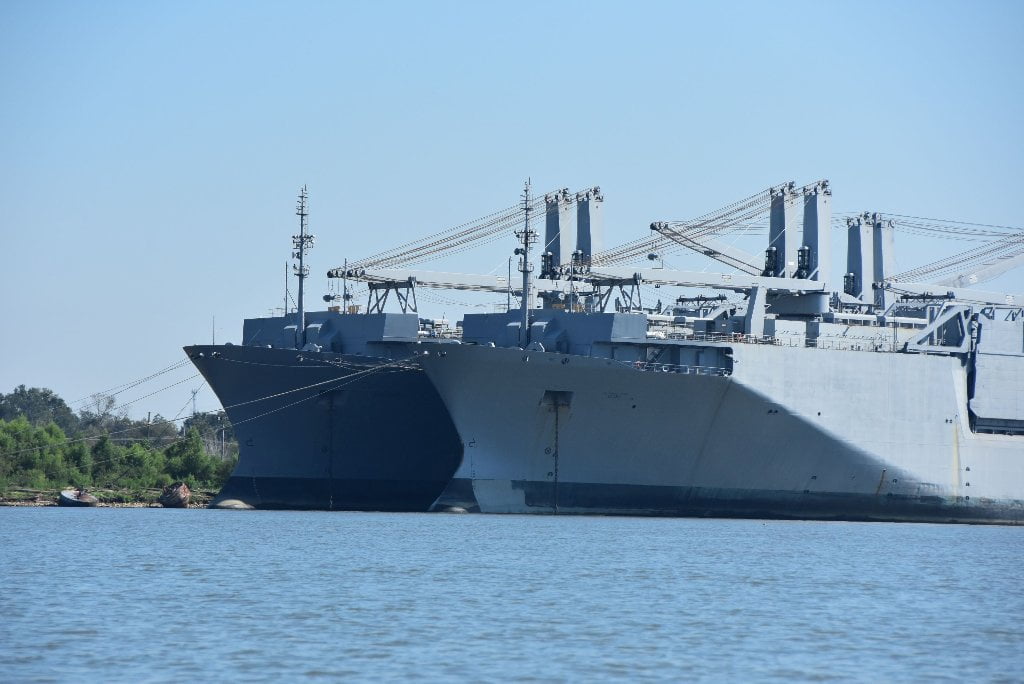
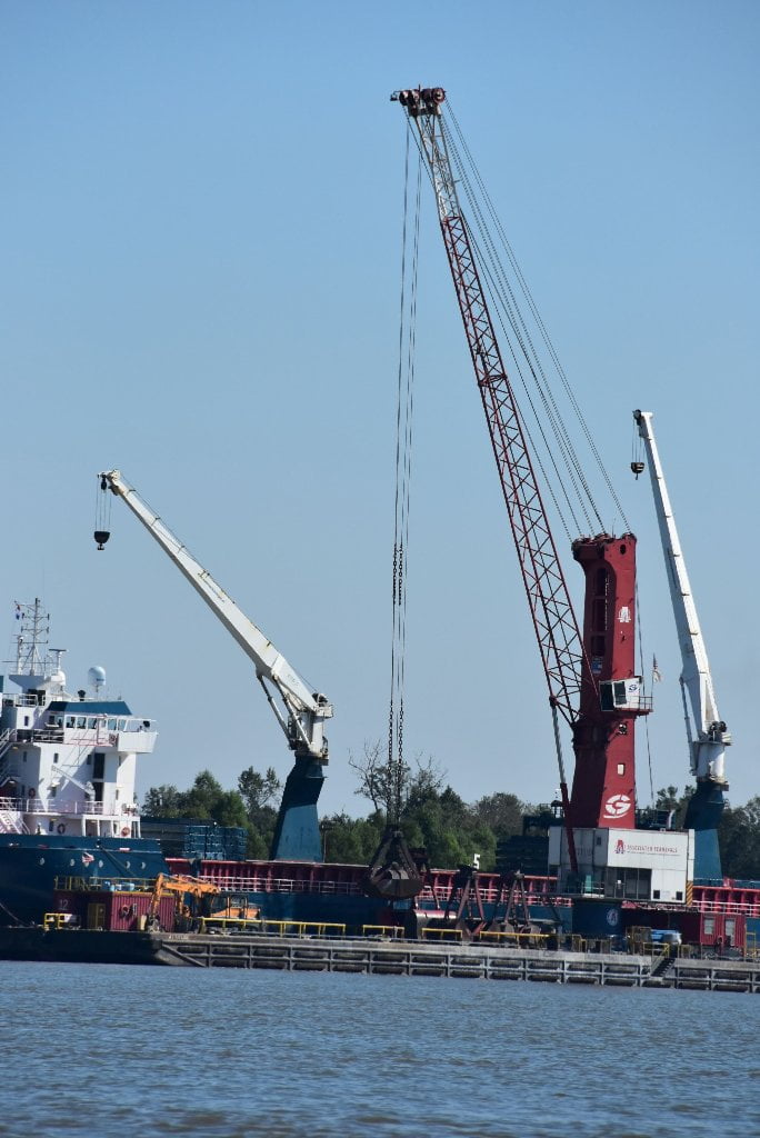
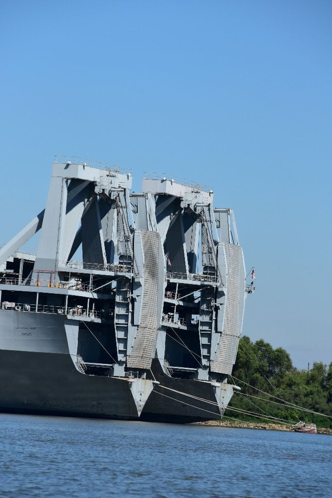
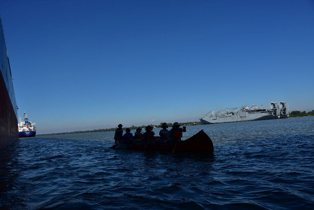
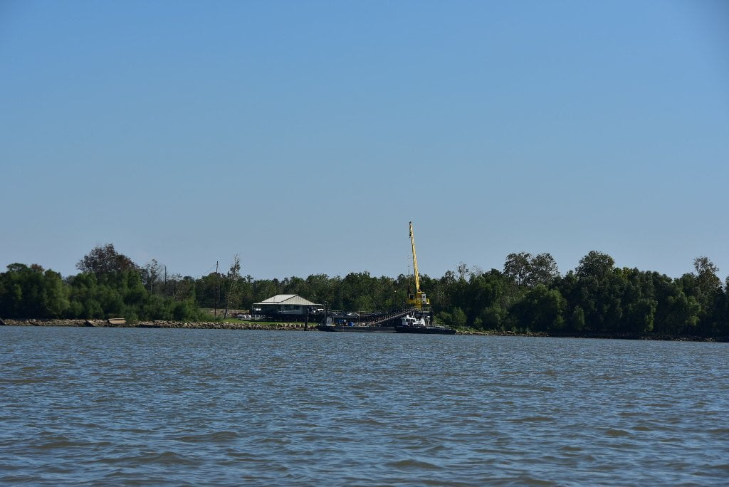
83.8 LBD Violet Dock Port, Inc., Berthing Facility No’s 1, 2, 3, 4, and 5
Two large Navy Bulk Container vessels seem to be permanently docked at the 9-Mile Anchorage. I have seen them here on every expedition that has brought me by this location since 2009. This is the home for two U.S. Navy Military Sealift Command cargo ships when they are not at sea. The 950-foot long Large, Medium-Speed, Roll-on/roll-off ships, called LMSRs, are some of the largest ships in the Navy inventory. Capable of carrying more than 300,000 square feet of oversized, heavy military cargo.
83.8 RBD Port Ship Services, Inc., 9-Mile Anchorage West Bank Landing
83.6 RBD A Studio in the Woods
Infused with art, love and a profound respect for nature, A Studio in the Woods has grown with the forest as organically as it grew into a nonprofit artist retreat and learning center, built sustainably with salvaged goods long before green building became fashionable. In 1968, Joe and Lucianne Carmichael purchased the site and sought to preserve the 7.66 acres of endangered forest for its great value as wetlands and as a powerful source of creative inspiration and education. They began the process of building their home and studios to early standards of sustainability and exploring ways the site could offer opportunities for others to learn about and gain inspiration from this natural treasure. In June 2002, with the encouragement and consultation of artists, environmentalists, and wider community members, Friends of A Studio in the Woods was formed with the mission to protect and preserve the Mississippi River bottomland hardwood forest and to provide a tranquil haven where artists can reconnect with universal creative energy and work uninterrupted within this natural sanctuary. Located in a unique wooded setting within the city of New Orleans, A Studio in the Woods has an established record of pairing land preservation with intimate artist residencies centered on environmental challenges and connecting artists to the local community. A Studio in the Woods: visits by appointment only: info@astudiointhewoods.org or call 504-392-4460, 13401 Patterson Rd, New Orleans, LA 70131.
82.9 LBD Shell Intake
82.6 – 81.6 Poydras Crevasse
Map aficionados will notice an unusual wide spot in the batture is found at Poydras, East Bank between 82.6 and 81.6, where the levee veers away from the river for a mile, and then returns back again. The levee broke here in the flood of 1922, and the hydraulic scouring here left blue holes and lowlands that cannot support the weight of a levee. As result a small but vibrant wetlands was created by this anomaly. The rip-rap is unbroken along Poydras Crevasse, but paddlers seeking wind or storm protection from the south or southeast would find good low-water camping along this mile-long stretch of woods. In higher waters you can follow a narrow channel of water that flows along the levee behind the woods & wetlands following the perimeter of the crevasse, to re-enter the big river a mile downstream.
The Poydras community was on the western boundary of the area that early settlers called “Terre aux Boeufs,” where about 1,500 Canary Islanders settled under Spanish rule in 1778 and 1779. The small farmers were given supplies and tools and implements by the Spanish government. They used oxen to pull their plows and wagons, and the French phrase “Terre aux Boeufs” meant “Land of Oxen.” All of the Canary Islanders spoke Spanish, and were called “Islenos” by the French settlers of Louisiana. The community of Poydras was virtually wiped out in 1922 by a crevasse in the levee that local interests had constructed. Less than half an hour before the levee collapsed, an inspector had examined the levee and said that it was in excellent condition. The break at Poydras relieved a critical situation at New Orleans, causing the river stage there to fall .2 of a foot in the next 24 hours. The crevasse water spread rapidly over the small farms and citrus groves on the east bank of the river below Poydras. In New Orleans, the crevasse that had possibly saved the city from disaster, was the object of much curiosity and interest. Thousands of people travelled by automobile to Poydras to see the great crevasse. At Violet, Louisiana, cars were stopped and a donation of $1 was collected from each of the sightseers, to be used for flood relief. The steamboat Capitol was sent down from the city to assist in flood relief work. Refugees were taken from the levees and other high spots as far down as Pointe a la Hache. (Braggs)
82.5 LBD Port Ship Services, Inc., Poydras Landing
81.4 LBD Caernarvon Crevasse
Caernarvon Crevasse has always been a controversial location. In its history is both the “Trapper’s War,” and the often criticized freshwater diversion canal. But most famously, it is the exact location where the levee was exploded to save New Orleans from the rising waters of the Great Flood of 1927. As John Barry so eloquently details in his book by the same title, the “levees only” policy of the USACE was simultaneously blown sky high.
In 1927, the Lower Mississippi Valley was experiencing the worst flood ever recorded in the river’s history. By mid-April, the river was so swollen at New Orleans that levees around the city were in real danger of being overtopped. After long conferences between State and city authorities and the Army Corps of Engineers, it was agreed that the situation at New Orleans was desperate enough to call for drastic remedial measures. It was decided that an artificial crevasse would be made at Caernarvon plantation, in the hope that this would reduce the flood height at New Orleans and save the city. On April 25, 1927, a large crowd of engineers, government officials, reporters, and spectators gathered at Caernarvon to watch the blowing up of the levee. There was some embarrassment when the first charge of dynamite failed to do more than open up a small gap, through which the water trickled very, very slowly. Again and again, divers slid into the muddy water and carefully placed additional charges of dynamite, but the river refused to cooperate. After several days, successive charges opened a wide gap in the levee and the crevasse quickly enlarged until it was about 2,600 feet wide. At New Orleans, the river began to fall. Many of the people who had lived behind the Caernarvon levee were small farmers, trappers, and fishermen. Not all of them were willing to sacrifice their own homes and fields for the sake of New Orleans. “Let nature take its course and choose her own victims,” they grumbled. Residents of New Orleans promised to reimburse the small farmers for their losses. For a while, it had been feared that the farmers and fishermen might oppose the levee crevasse with violence, and the Governor of Louisiana had ordered a small contingent of national guardsmen to Caernarvon, but they were not needed. The Islenos had bowed to the inevitable and were jamming the road to New Orleans with their ox carts and wagons, carrying all their worldly goods with them as they evacuated their homes. Small farmers in the Caernarvon area still raise cattle and vegetables today. St. Bernard Parish, in which the community is located, has ground elevations ranging from 11 feet above mean sea level to below sea level. Many shallow lakes, bays, bayous, and canals make the parish attractive to both commercial and sport fishermen. There is some oil and gas production in the parish, as well as several refineries. The population of the area is increasing rapidly, as people spillover from the New Orleans area. (Braggs)
Leave A Comment
You must be logged in to post a comment.