The Lower Mississippi River Water Trail
97.1 RBD – 97.1 LBD Gretna Ferry
Possible rest stop/campsite below West Bank (Gretna side) Ferry Landing. Paddlers are forever expanding the limits of what makes for good camping. Source-to-Sea paddlers including Jake Takvoli reported that they camped at this location in November 2015. Wrote Jake: “If it’s dry out there are plenty of places to pitch a tent. We went underneath the cement structure to hide from the rain. There were a handful of dry spots. The area immediately next to it is used for concerts and events which would make camping there almost impossible if something was going on. There were porta potties there and there’s a bar right over the levee for food and water. I felt safe leaving our things there. The ferry was closed when we were there. The lights were on but I don’t think it’s operational anymore.”
97.1 LBD East Bank (New Orleans side) Gretna Ferry
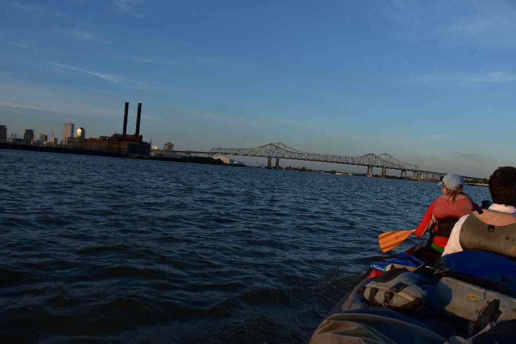
An East Bank landing here might be the only place to make an emergency stop if needed along the miles of docks and wharfing above the French Quarter, but it will require great concentration and some deft paddling. Avoid if it looks tricky. Walmart Super Center on the other side of Tchoupitoulas Street. Better option would be to cross over to the opposite shore, where could even set up camp if the water level was low enough, and there wasn’t a concert in the nearby Gretna waterfront park.
97 LBD Gretna
Paddlers could make landing alongside the public park located in downtown Gretna. See above for Ferry Landing. Paddler friendly town and city government.
96.8 RBD John. W. Stone Oil Distributor, Gretna Dock No’s 1, 2, 3, 4, 5, 6, 7, & 8
96.7 RBD Gretna Water Intake
Gretna residents draw their drinking water directly from the Mississippi River, as do all communities and water districts downstream of Baton Rouge. This only reinforces the admonishment to be careful about what you dump in the Mississippi River and its tributaries. The saying “We all live downstream” applies big time down here because everything is upstream! 44% of America drains past Gretna, all springs, creeks, streams and rivers from the Northern Rockies to the Alleghenies, and from the Sangre De Cristo range of the Southern Rockies of New Mexico to Appalachia.
96.6 RBD Gretna Harbor Traffic Control
96.6 LBD Celeste Street Wharf
96.3 LBD Market Street Wharf
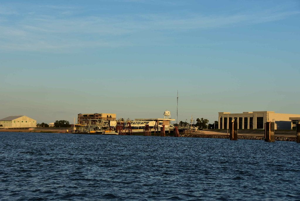
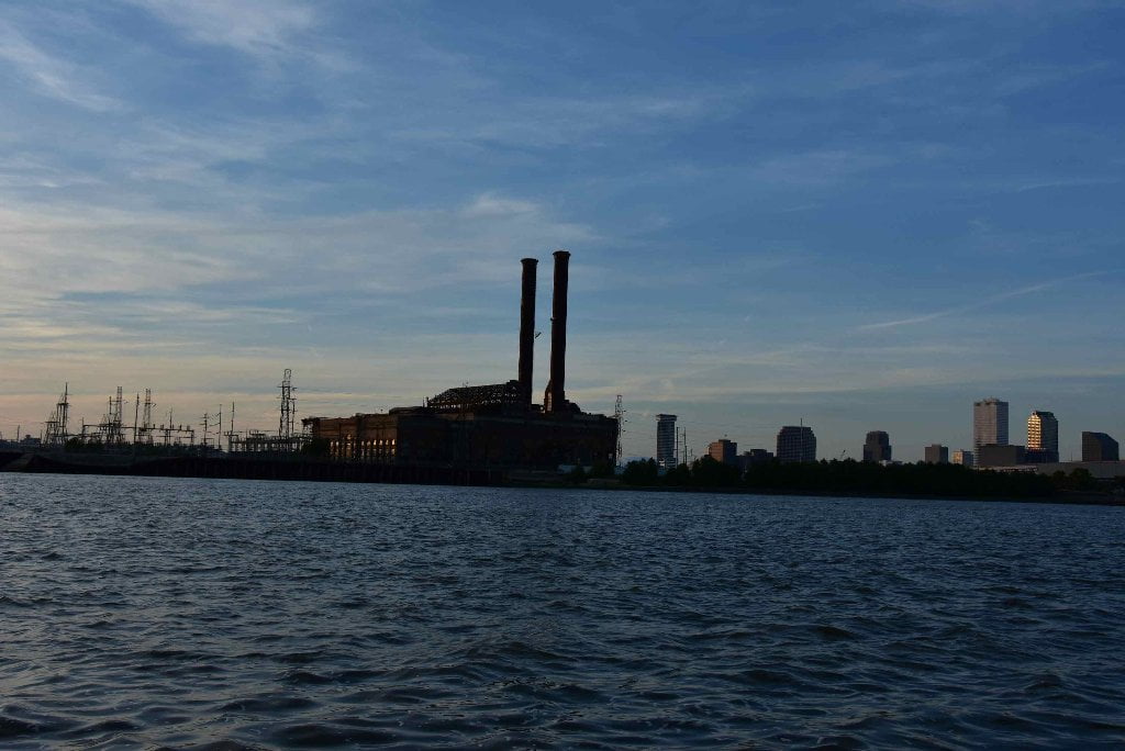
96.3 LBD Old New Orleans Power Plant
Due to neglect, a remarkable green space has been created below the Old New Orleans Power Plant, with a sandy landing and willows behind you. This very skinny bar (10-50 feet wide depending on water level) appears at all water levels below flood stage in a protected place below the old power house on the East Bank near mile 97. Look for the two tall smokestacks in rusty old remnant of a power plant that looks something like a classic Mississippi River steamboat plowing down the river silhouetted by darkness. Was this designed to look like a steamboat? It appears to be so by its bulky shape and double smokestacks.
Open only to the water, this sandbar & tiny greenspace is protected from behind by train tracks and the power plant. The power plant is protected from surrounding neighborhoods by a tall chain link fence with concertina wire. This bar would make a great camp, safe and separate from any intruders, at least for the time being. However plans may be afoot to convert this old relic into the next urban renewal project. Good camping now (2015/2016). But future paddlers might find the scene to be much different in upcoming years.
96.3 LBD Orange Street Wharf
96.2 LBD Robin Street Wharf
96.2 LBD Mardi Gras World
95.8 LBD Perry Street Wharf
95.7 LBD Thalia Street Wharf
95.6 LBD Erato Street Wharf


Leave A Comment
You must be logged in to post a comment.