The Lower Mississippi River Water Trail
223-222 LBD Missouri Island
Low island, but no protection. Good picnic place below 10BR.
Missouri Island emerges out of the muddy river like a golden slice of sandy beauty when the river drops below 10BR, sometimes adorned with logs, driftwood, and an array of human trash. Not recommended for camping until 5 BR or lower. Waves from passing work boats, tugs and freighters could wash over any low places, especially within inlets or at the edge of shallows (where the wave heights tend to multiply frighteningly).
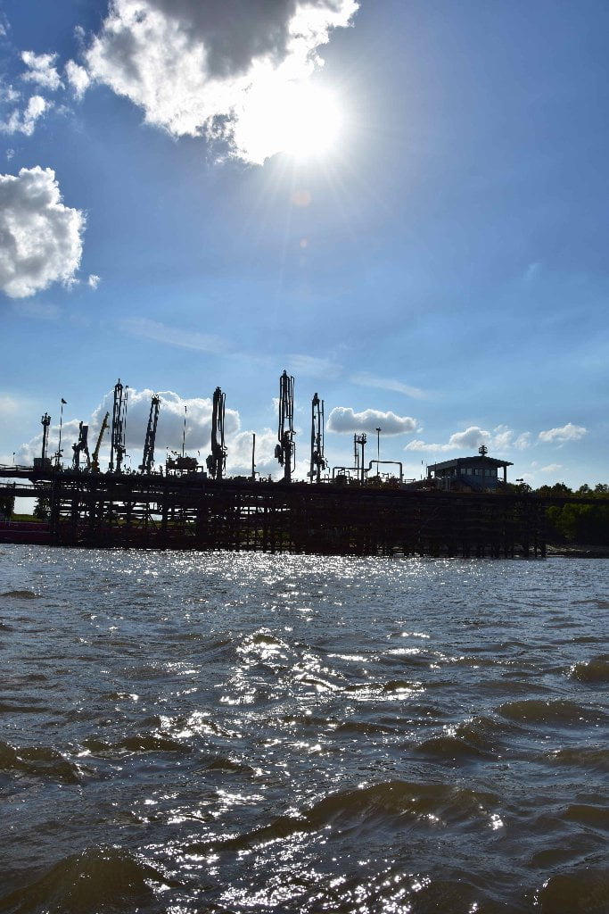
RBD 221.8 Dow Chemical Missouri U.S.A., Plaquemine Dock No. 2. Hydrocarbon Wharf
This modest oil docking facility belies the sprawling petrochemical operations it services, indeed one of the largest such facilities found along the Gulf Coast. Keep readin below for more details.
222 and 210 RBD Dow Chemical Company Louisiana Operations, Dexco, and Shintech Addis
With the purchase of four plantations in Iberville and West Baton Rouge parishes, Dow established it’s Louisiana Operations in 1956. Today, the 1,500-acre integrated manufacturing facility is one of Louisiana’s largest petrochemical facilities. It straddles the base of Manchac Point and can be seen from both sides. Louisiana Operations has 23 production units manufacturing more than 50 different intermediate and specialty chemical products, such as chlorine and polyethylene, that are used to produce cosmetics, detergents, solvents, pharmaceuticals, adhesives, plastics for a variety of packaging, automotive parts, electronics components, and more. Dexco Polymers manufactures styrenic block copolymers at a plant within the Dow complex. Formed in 1988 as a 50/50 joint venture of Dow Chemical and ExxonMobil, Dexco was acquired by TSRC corporation of Taiwan on April 1, 2011. Shintech’s Addis plant manufactures PVC right across Hwy. 1 from Dow. These two large facilities produce chlorvinyl chemicals, primarily for the manufacture of PVC. Shintech Corp. is the worlds largest producer of PVC. Along with the Dow Chemical and other Shintech facilities in the area, a large amount of the nations chlorovinyls and PVC are manufactured in this area.
Toxic Releases (TRI) for 2013 in pounds: Dow: Air: 1,863,204; Water: 522,233. Dexco: Air: 442,550. Shintech Addis: Air: 68,742.
Duncan Point/Manchac Point/Plaquemine Island/Sunshine Green Space
Duncan Point, Manchac Point and Plaquemine Island are mostly wooded and wild, and taken together the threesome represents a significant acreage for potential future protection. Thousands of acres of forests, floodplain fields, wetlands and sandbars are created by the giant meanders of the Mississippi around Manchac and Plaquemine Points, and is punctuated by one of the best campsites below Baton Rouge, Plaquemine Island. If you are anywhere near Plaquemine Island at “that time of day” you ought to stop and make camp. (If not, Manchac Point and Bayou Goula Island are also both excellent campsites). The experience from the river is the pleasurable feeling of endless trees and free-flowing river. Of course from space the picture is less picturesque. This tender sliver of green is being invaded from all sides by industry, logging, land removal, and agriculture. But paddler’s can enjoy the “River Illusion” while it lasts as the muddy Mississippi churns between the tall banks and even taller trees, harkening back to a not too long ago era when steamboats ruled the waters, and then not far before that when it was only canoes! You are likely to encounter bald eagles fishing these waters, less visible are the fish they pursue. Maybe you’ll see dead fish washed ashore, or maybe catch a glimpse of a buffalo fish or catfish emerge from the murky depths, or maybe a bowfin (skipjack) make a series of leaps before dark or after sunrise. Typical trees are willows, cottonwoods and sycamores in lower elevations close to the river, and oaks, sweetgums, hackberry, and others typical to the bottomland hardwood forests of the Lower Mississippi River.
LBD 221-220 Duncan Point
Duncan Point stands tall above the main channel with mature willows, and seems to grin like a baleen whale its mouth full of krill. At low water this is a steep sandy bank, at medium water less so, and at high water you can step right out of your canoe or kayak and onto level ground. Best camping between 20 and 25 Baton Rouge gage. Warning: active logging during fall 2015. Also, site for perennial dirt removal. Duncan Point is topped by a thick wall of tall willows. These willows sway in the wind, but open up below into cool protected hallways of willow trunks, vines and scattered willow leaves. A heavenly place if you hit it at the right water levels.
219 RBD Lowlands Opposite Duncan Point
There is a low point in the bank at the outside of Missouri Bend RBD 219 where the water spills over the rip-rap in flood season and has created a dynamic landscape of rolling sandbars and vegetation. After getting flooded the water and sand return back out into the river, creating one of those neat places of ebb and flow. This could be an excellent campsite in certain conditions, but be prepared for noise & noxious smells (from nearby Dow Chemical) and possible 4WD visitation. Has been used in past years as a dirt removal operation.
220 RBD Sardine Point
Paddling around Missouri Bend and past Sardine Point will bring you out of the industry of Baton Rouge and into the relative calm of the Mississippi River you’re used to: long sweeping stretches of flowing muddy water and the sky, with nothing but a long line of trees in between! Watch for deer, beaver, river otters, turtles, snakes and other creatures along the steep muddy banks overflowing with vegetation, and the sky for pelicans, anhingas, cormorants, and songbirds in their season.
220 RBD – 218 LBD Sardine Crossing
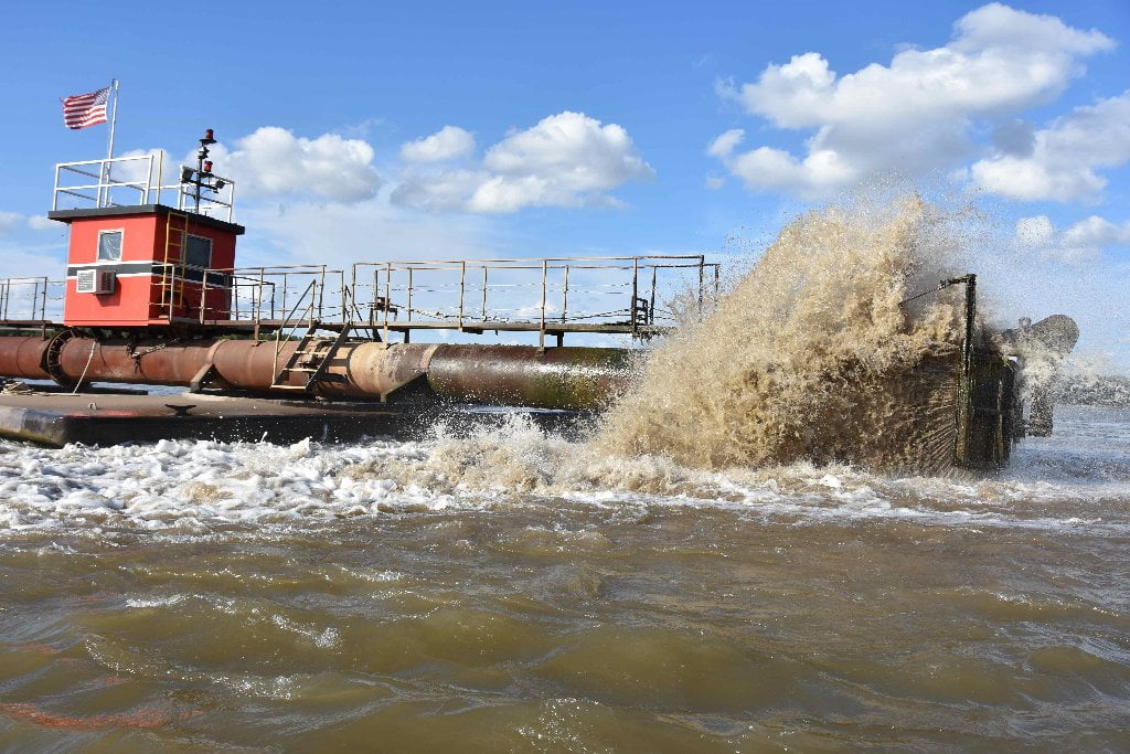
Commercial traffic tends to roll off the West Bank around Sardine Light and make a 2-mile crossing over the East Bank in this vicinity. Paddlers, however may continue to stay RBD towards the East Bank to shave off a few miles, especially if intending to make landing at the best sandbars in the area, which are found at Manchac Point. An dredging operation was in service here in Oct, 2015.
219 RBD Comeaux Landing
A small but very protected sand dune is located within an alcove cut into the bankside here. This would make an possible camp in the threat of oncoming south or south-westerly storms, or if you had to make camp in strong south winds. You’ll find sand here up to 20BR, and in emergency maybe a little higher. But use only as last resort in the most dire circumstances. Beware 4WD roads and nearby hunting camp (in woods several hundred feet behind landing). You can see the rustic hunting camp from the woods as you paddle by.
216.5 RBD Australia Landing
216.5 LBD L’Auberge Casino
As you come around Duncan Point, you might have to rub your eyes for the fantastic vision that has entered the scene. Downstream is a gleaming yellow building with mirror glass windows and four tall palm trees growing on top. Like Don Quixote riding his faithful Rozinante, you might be tempted to charge it at full throttle and spear it with your paddle. But as you float downstream you realize this is not a hallucination, it’s a shiny new casino. And it sits in what otherwise used to be one of the most isolated bends in the area. Rising above the willows and the levee, in fact rising above everything else around it, L’Auberge Casino is located just above the outfall of the Baton Rouge Wastewater Treatment Plant.
216.2 LBD Longwood Plantation
Former Landing, now removed from the river by borrow pits. Plantation taken over by Pinnacle Entertainment, who oversees the L’Auberge Casino.


Leave A Comment
You must be logged in to post a comment.