The Lower Mississippi River Water Trail
118.8 LBD International Matex, St. Rose Terminal, Berths Nos. 2, 3, 4, 6, 7, 8, 9, 10, 11, 12, 13 14, and 15
International Matex oversees 15 freighter berths between 118.8 and 118.5 LBD for the purpose of bulk chemical storage and transfer. Bloomberg.com reports that International-Matex Tank Terminals, Inc. owns and operates bulk liquid storage terminal facilities for petroleum, chemical, consumer products, utilities, and commodity industries in North America. It stores and handles petroleum products, vegetable and tropical oils, renewable fuels, and various chemicals. The company was founded in 1939 and is headquartered in New Orleans, Louisiana. It has terminal locations in Bayonne, New Jersey; St. Rose, Avondale, Gretna, and Geismar, Louisiana; Chesapeake and Richmond, Virginia; Lemont and Joliet, Illinois; and Richmond, California. International-Matex Tank Terminals, Inc. operates as a subsidiary of Macquarie Infrastructure Company LLC. In 2014 Australia based Macquarie Infrastructure Co., agreed to buy the 50 percent of International-Matex Tank Terminals it doesn’t already own for $1.03 billion in cash and stock. (from Bloomberg.com)
118.6 LBD – International Matex Tank Terminals (IMTT) and Shell
IMTT St. Rose is a 1,000 acre bulk liquid (primarily petroleum product) terminal. IMTT has 207 Tanks with 14,750,000 barrels total capacity. Tanks range in size from 40,000 gallons to 500,000 barrels. There are 5 deepwater tanker berths, 13 barge berths, as well as truck and railcar loading/unloading facilities. Shell jointly operates (with IMTT) an asphalt plant on the northeast side of the IMTT facility. Strong odors from the asphalt plant plagued nearby residents in St. Rose in 2014. The Louisiana Department of Environmental Quality said that the odors resulted from the use of crude oil that contained high levels of sulfur compounds and the failure of equipment designed to prevent such odors. Even so, reported Toxic Releases (TRI) for Shell St. Rose in 2013 was only 7,905 pounds.
118.7 RBD Davis Crevasse
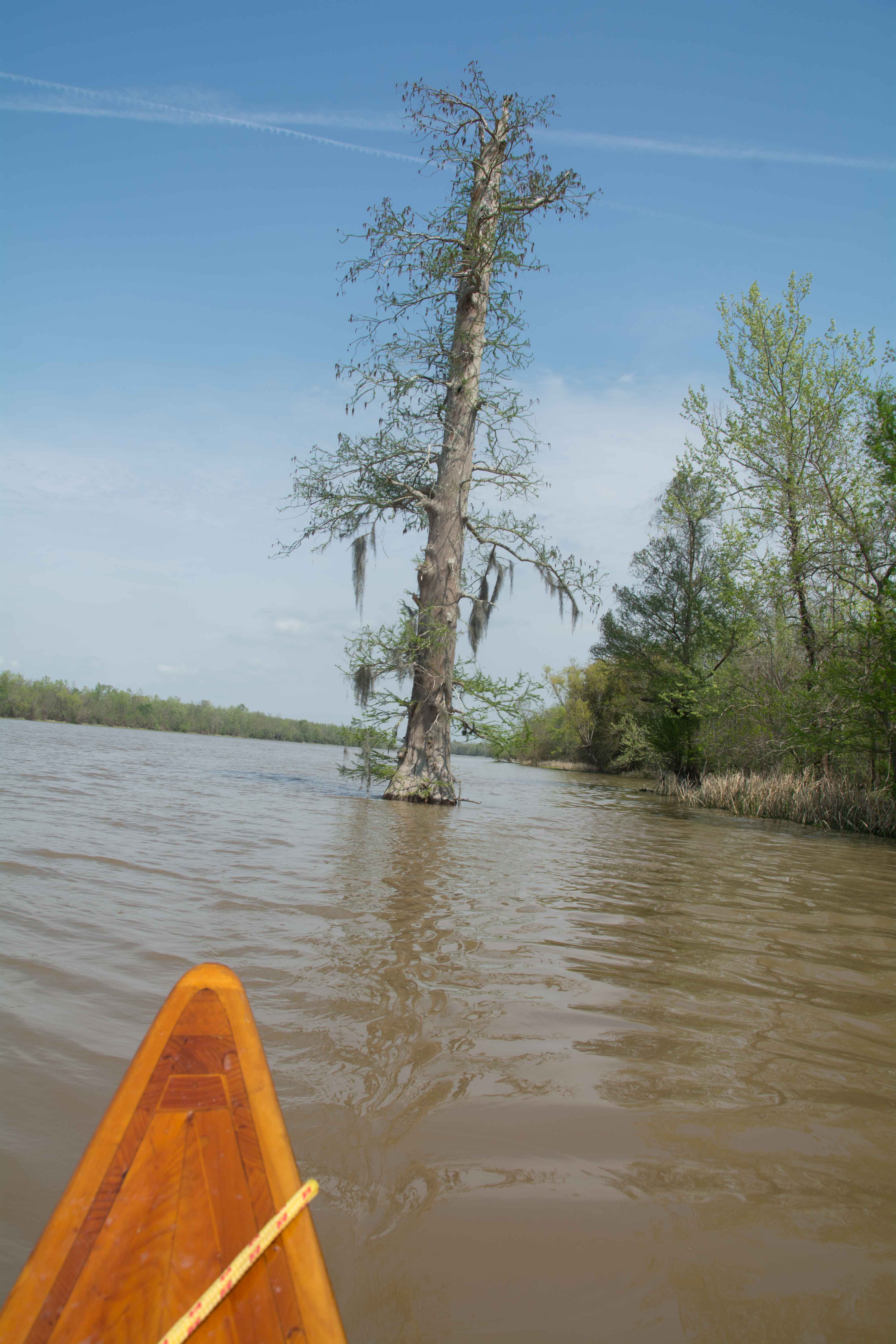
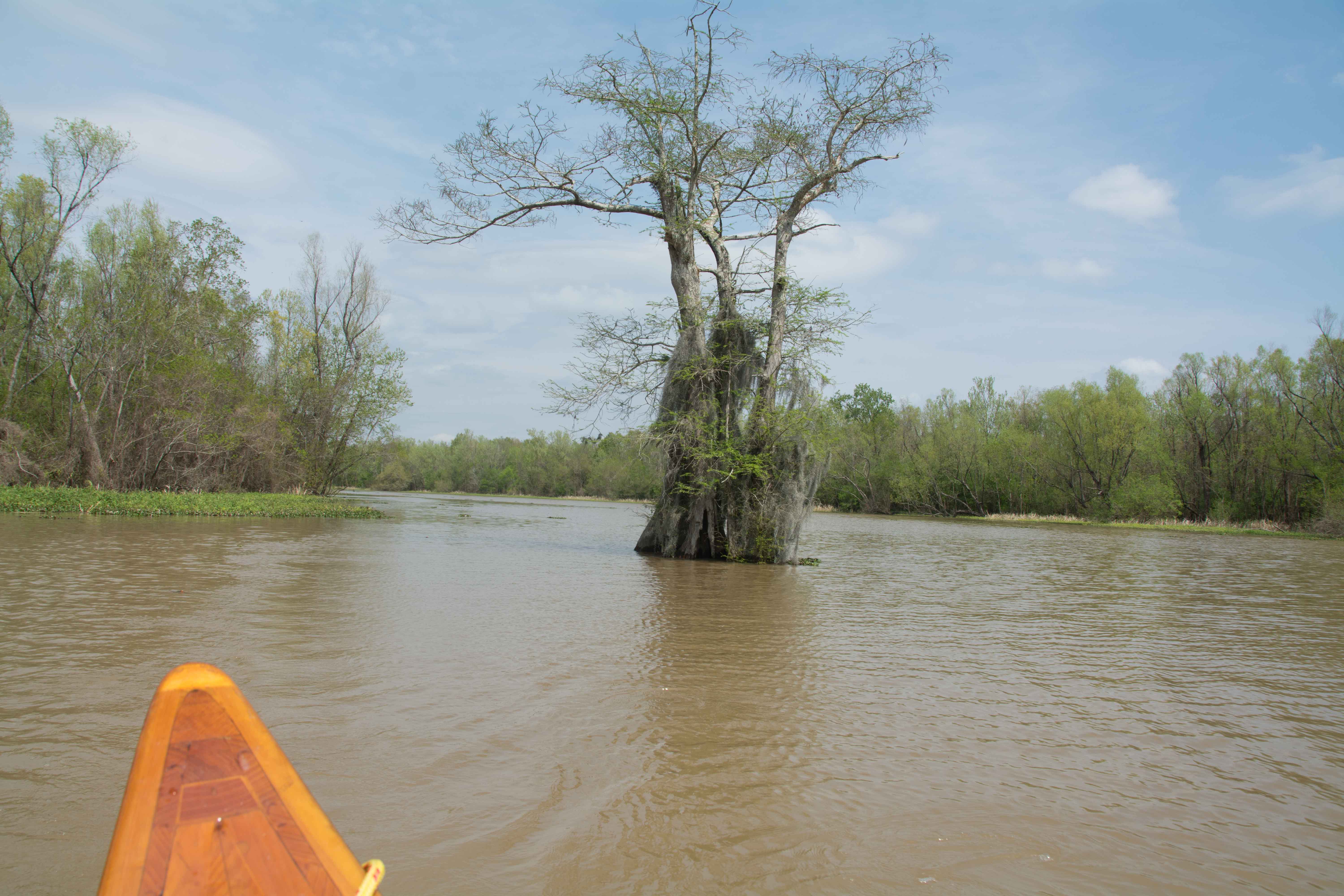
Paddlers in need of seeking shelter from oncoming storms or high winds would find refuge in the rectangular peaceful harbor carved into the West Bank at 118.7RBD. The banks are soft mud lined with rip-rap, but you could make a landing also within this protected harbor, and stretch your legs, and picnic, and possibly make a decent campsite. Best location for camp would be at the mouth of the harbor, downstream side, where a broad field is found.
Rice was introduced in Louisiana very early in its colonial history, and by 1726 was being exported to Europe in small quantities. Today most of Louisiana’s rice production is carried out on irrigated lands in the southwestern part of the State, but some of the early rice plantations were located along the banks of the Mississippi. Rice planters built flumes in the levee system to conduct the river water into the rice fields, and the flumes were a constant source of worry to levee boards that tried to maintain adequate protection from the frequent floods that struck the Lower Mississippi Valley. Louisiana law dictated specifications for the construction of all rice flumes that pierced the levee system, but the law was not always obeyed. The State Board of Engineers advocated the use of siphons instead of flumes, but siphons were not very popular with the rice planters, who found the flumes easy to build and less costly to operate. By 1884 the State laws were very strict, and rice planters were required to remove all below-standard or unlicensed flumes. Cutting the levee for new rice flumes was expressly prohibited. At Davis plantation, an old rice flume had been filled, apparently not very expertly, and on March 8,1884, at 1:00o’clock in the morning, the loose earth began to ooze out of the levee. Soon a 1,000-foot-wide crevasse opened up, and the flood waters poured into two Louisiana parishes. A railroad company whose rail line was affected by the crevasse expended a lot of money, time, and labor on an attempt to close the crevasse, but the effort failed. With the emergency repairs washed away, the railroad abandoned the crevasse on March 20, and it flowed unimpeded over the country below until the flood subsided. (Braggs)
118 RBD – 115 LBD Fairview Crossing
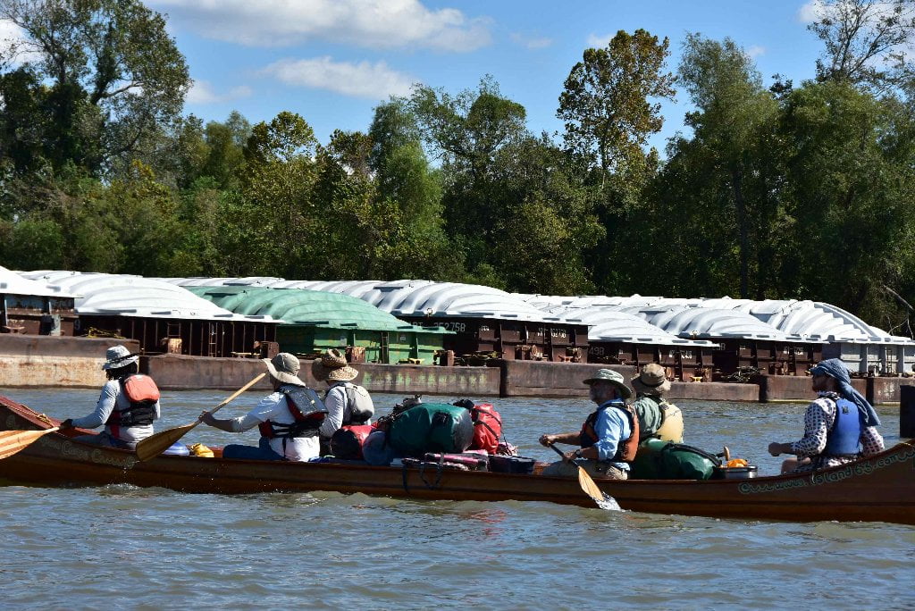
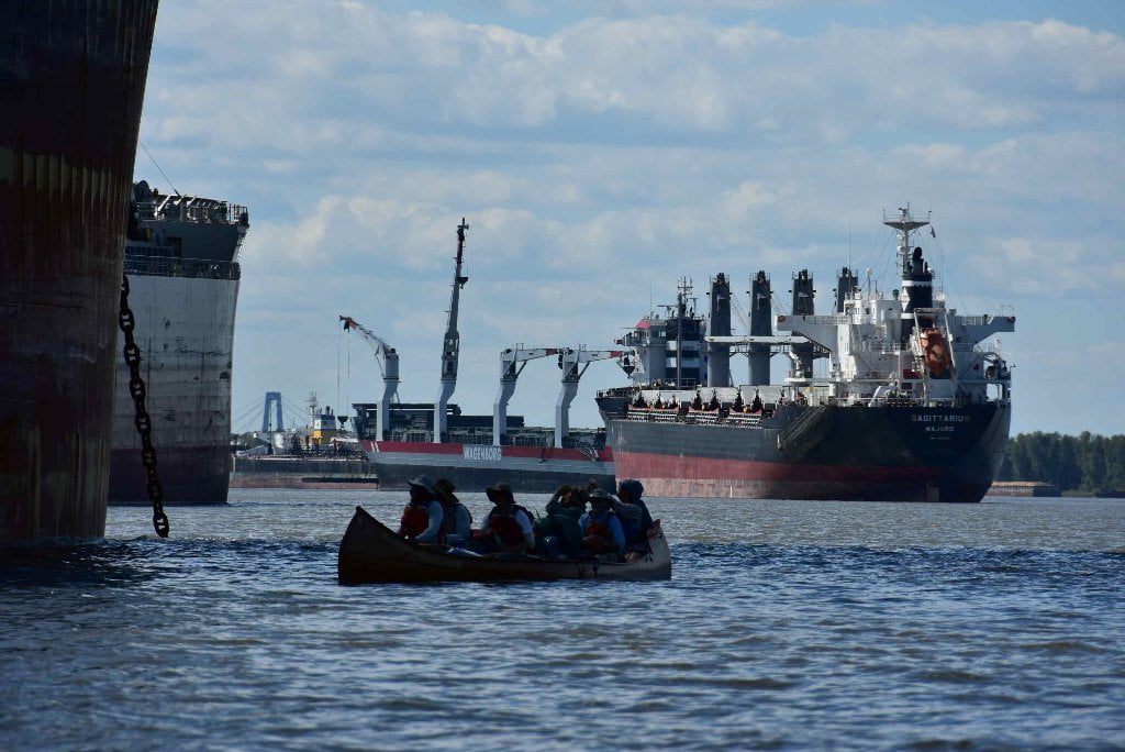
Paddlers can follow this crossing once safely underneath and past the Luling Bridge, if the coast is clear. Otherwise maintain a line of travel in between main channel and the Kenner Anchorages. Watch for off-channel traffic between anchored freighters and fleeted barges tight against West Bank. Smaller tows (1-6 barges) tend to cut the corner and current here along the Kenner Bend by running in between the big parked ships and the fleeted barges. As you watch the river for oncoming traffic you will also start seeing traffic of another kind, for you also more friendly: that is big commercial jets flying in and out of the Louis Armstrong International Airport, which is located just downstream behind Kenner.
117.6 RBD ADM/Growmark, Ama Grain Elevator Dock
Archer Daniels Midland grain terminal with 4 loading spouts and a 5,500,000 bushel capacity. In 1902, George A. Archer and John W. Daniels began a linseed crushing business. In 1923, Archer-Daniels Linseed Company acquired Midland Linseed Products Company, and the Archer-Daniels-Midland Company was formed. Every decade since our corporate inception, ADM has added a major profit center to our agribusiness: milling, processing, specialty feed ingredients, specialty food ingredients, nutrition and more. With a worldwide transportation network and more than 265 locations, ADM continues to partner with farmers and agriculture to create markets for their products around the globe. (From ADM.com)
117.5 LBD St. Rose Landing
A narrow low slung bar forms here behind sometimes long lines of fleeted barges, and might make for good landings and camping/picnicking in low water levels, but marked “Restricted Access” with large white sign planted in middle of sandbar.
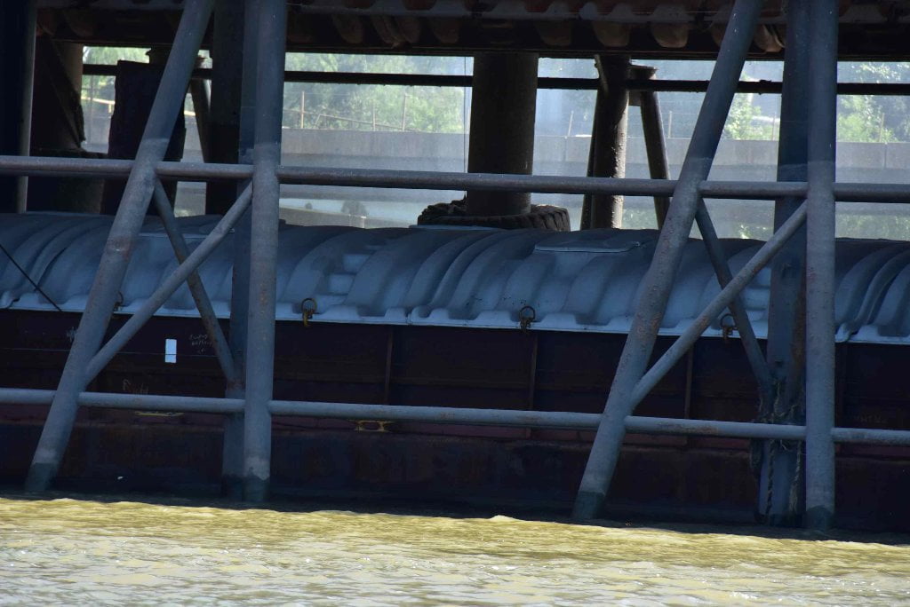
117.3 – 115.5 Ama Anchorage
116 – 113 RBD Kenner Bend Anchorage
As noted above, watch for off-channel traffic in between anchored freighters and fleeted barges tight here within the Kenner Bend Anchorage and Lower Kenner Bend Anchorage. Smaller tows (1-6 barges) tend to cut the corner and current here along the Kenner Bend by running in between the big parked ships and the fleeted barges.
115.8 RBD ARTCO Tulane Fleeting, Barge Cleaning Wharf and Lower Kenner Bend Fleet Moorings
115.2 LBD Crescent Ship Service, Ama Landing
115.1 LBD Lower River Ship Services, Ama Landing
115.1 LBD Belle Chasse Marine Transportation, Inc., Ama Launch Mooring
114.5 Cytec Industries, Inc, Fortier Plant Docks


Leave A Comment
You must be logged in to post a comment.