The Lower Mississippi River Water Trail
94.4 LBD Mandeville Street Wharf
94.2 LBD Press Street Wharf
93.9 RBD LASH Marine Services, Inc.
93.8 LBD Louisa Street Open Wharf
93.7 LBD Piety Street Wharf
93.6 RBD Crescent Towing Co., Inc., Algiers Mooring
93.4 LBD Pauline Street Wharf.
93.2 RBD Navy Support Activity Launch Dock
93.1 LBD Poland Avenue Wharf Berths Nos. 4 and 5
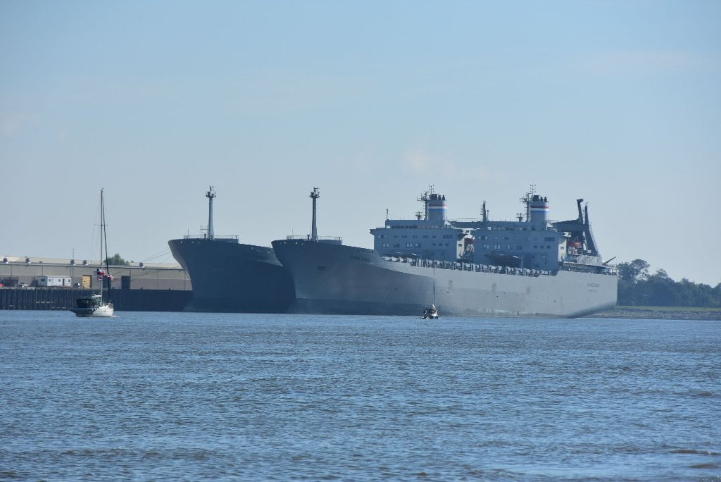
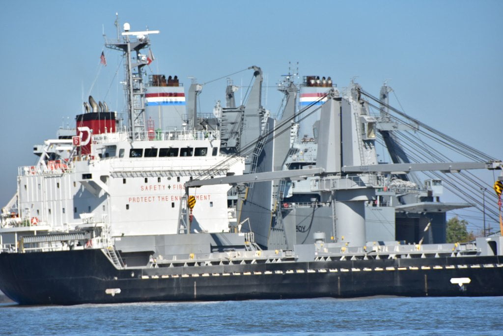
93.0 RBD Navy Support Activity – Military Sealift Command
93.0 – 92.9 RBD Navy Support Activity Lower Dock
Press Park, Gordon Plaza, and Liberty Terrace
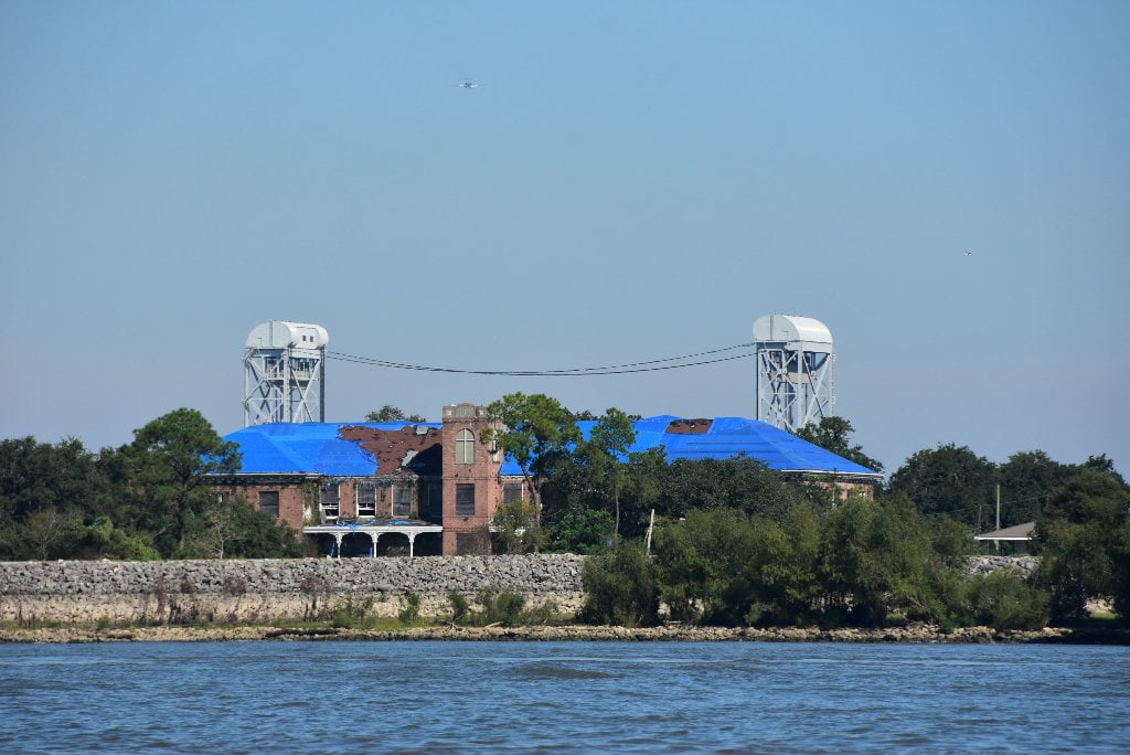
The town home development Press Park, the neighborhood Gordon Plaza and the apartment complex Liberty Terrace were built in 1978 as part of a redevelopment project, championed by local politicians, aimed at helping to give low income African-American residents of New Orleans a piece of the American Dream. By 1986 residents began to complain of trash popping up through the soil in their yards and health problems. The developments had been built on the old Agriculture Street Landfill, a primary landfill for the City of New Orleans from 1909 to 1952 and was used again to dispose of waste from Hurricane Betsy in 1965 and 1966. In 1994 the area was put on the Superfund list by the EPA and a cleanup was conducted; removing contaminated soil, installing fabric barriers and placing new soil but the residents remained in place. Hurricane Katrina devastated the area and the flooding is thought to have allowed contamination to seep to the surface. The town homes and apartment complex (which was being used as a retirement home) remain abandoned but most of the single family homes are currently occupied. (Paul Orr)
92.5 LBD Industrial Canal (Intracoastal Waterway East)
Paddlers can exit the Mississippi here and access Lake Ponchartrain or or the Intracoastal Waterway heading east towards Florida.
You can lock into the Industrial Canal here to gain entrance to Lake Ponchartrain, or follow the Intracoastal Waterway East towards Bay St. Louis, Gulfport, Biloxi, Pascagoula, Mobile, Pensacola and points East. Coahoma County (Mississippi) resident Jimmie Vickers makes an anuual Fall pilgrimage down the Sunflower, Yazoo and Mississippi Rivers to New New Orleans, where he follows this route to his winter hibernation headquarters in Mobile Bay. Summertimes he can be found in a cane and bamboo lodge propped underneath the Hopson Bridge, along the banks of the Sunflower River near the Shack Up Inn.
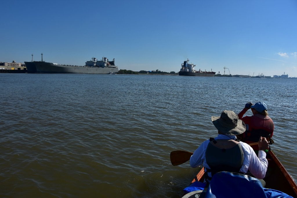
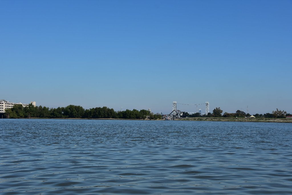
New Orleans’ opportune maritime situation is visible through this gray area of the Industrial Canal. Connecting to the canal is crucial water access for NASA at its Michoud complex, which is currently building the most powerful rocket launcher in the history of the world for the SLS system, as well as hardware for the Orion mission to Mars. It’s one of the world’s largest indoor manufacturing complexes, (43 acres under “one” roof!!), where 136 fuel tanks for various space missions were assembled and transported (via the Intracoastal Waterway) to Kennedy Space Center in Florida.
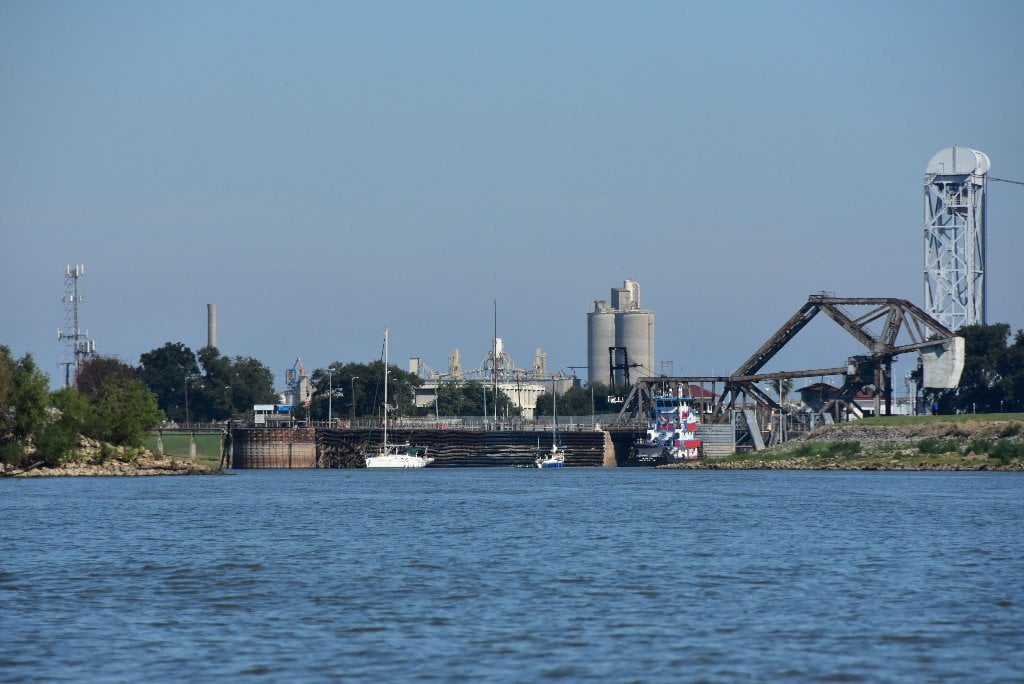
The Inner Harbor Navigation Lock and Canal belong to the State of Louisiana and have been in use for more than half a century. The Corps of Engineers operates the lock and part of the canal, and the Board of Commissioners of ths Port of New Orleans operate the remainder. The lock is 640 feet long, 75 feet wide, and has a depth of 31.5 feet. The canal provides access to both the Intracoastal Waterway east of New Orleans, and to Lake Ponchartrain. A new ship lock and connected channel from the Mississippi River to the Mississippi River-Gulf Outlet waterway were built, but then blocked off after Katrina devastated low lying places in the city. A vast amount of iron, steel, grain, shells, chemicals, and petroleum products go through the Inner Harbor Navigation Lock and Canal.
Industry within the Inner Harbor includes Packard Pipe Terminals Inc. Dock, Circle Inc. Dock, Kostmayer Construction Co. Dock, Redneb Services Dock, NREC Power Systems Inc. Dock, Canal Barge Co. Mooring, Delta Coatings Inc. Wharf, Louisiana Machinery Power Systems Dock, Coastal Equipment Co. Wharf, General Marine Leasing Inc. Wharf, Sunland Contruction Inc. Wharf, Harbour Construction Co. Dock John W. Stone Fueling Dock, H.B.H., Inc. Fabrication, United Tugs Inc. Wharf Superior Diving co. Wharf, B & I Industries Inc. Dock, Hugh Eymard Towing Co. Dock Bay Ltd. Offshore South Dock, Dixie Offshore Transportation Inc., Elmwood Drydock and Repair, Oil Field Barges Inc., M-I Drilling Fluids Terminal Dock, Boomtown Casino Boat Basin, Otto candies Mooring Basin, Evans Industries South Yard Wharf, River Construction Co., Petrex Inc., Total Marine Services, Total Services, Dixie Carriers, Reagan Equipment Co., Rathborne Land Co. Harvey Canal Wharf and Kody Marine Wharf
Note: Possible emergency Camping spots during high water in the Holy Cross: Advantages: elevated; separated by the surrounding neighborhood by fences Disadvantages: The fences have holes in them. The piers have holes in them, and the port next door is bustling.
MRGO
The Industrial Canal connects the Mississippi to the New Orleans “Inner Harbor” as well as the notorious Mississippi River Gulf Outlet (MRGO) Canal, a culprit in the disastrous effects of 2005 Hurricane Katrina. MRGO created a open passage for the Katrina storm surge into the city neighborhoods, notably the Ninth Ward. Recently the MRGO was MRGO has been permanently disconnected from Breton Sound with a rock dike just beyond Bayou La Loutre. Meanwhile marshlands are disappearing around the MRGO at an alarming rate, one football field every hour, and it is now doubtful how effective any small closure will be when the entire buffer zone of coastal marshes are going underwater. The state of Louisiana and the Federal government are in court, disputing responsibility for the restoration of wetlands adjacent to the MRGO.
Each hour, Louisiana loses about a football field’s worth of land. Each day, the state loses nearly the accumulated acreage of every football stadium in the N.F.L. Were this rate of land loss applied to New York, Central Park would disappear in a month. Manhattan would vanish within a year and a half. The last of Brooklyn would dissolve four years later. New Yorkers would notice this kind of land loss. The world would notice this kind of land loss. But the hemorrhaging of Louisiana’s coastal wetlands has gone largely unremarked upon beyond state borders. MRGO has been permanently disconnected from Breton Sound with a rock dike just beyond Bayou La Loutre; it is not passable with a boat and would require portaging over rocks for canoes, kayaks or paddleboards. Where MRGO and ICWW come together and go into the New Orleans inner harbor on the west end of Lake Borgne the Corps has built a massive wall called the Lake Borgne Surge Barrier. The navigable opening is at the north end in the ICWW. It remains open all the time except when a large storm surge is expected. (Paul Orr)
92.3 RBD Litton/Avondale Industries, Inc., Algiers Facility, Merrill Avenue Wharf
92.2 RBD Litton/Avondale Industries, Inc., Algiers Facility, Hines Lane Wharf
92.1 LBD Andry Street Wharf
91.9 LBD Alabo Street Wharf
Leave A Comment
You must be logged in to post a comment.