The Lower Mississippi River Water Trail
78 RBD Plaquemines Parish Public Boat Ramp (Shingle Park)
Plaquemines Parish Public Boat Ramp is located in Shingle Park on the West Bank inside English Turn Bend RBD near mile 78. From land it’s directly behind the Plaquemines Parish Health Department, 3706 Main St, Belle Chasse, LA 70037. This wide boat ramp is made of revetment, bordered by jumbles of big rocks and rip-rap, and falls at the typical steep angle into the water. Appears to be a good ramp at all water levels, even above flood stage (when you could put in right off the levee here. There is a big parking lot above ramp, with plenty of room for maneuvering trailers. Some nearby piles of sand, gravel, rocks, probably aggregate for the Plaquemines Parish road crew. But this is also a typically rough looking place for long-term parking. Do not leave your vehicle here overnight — or suffer consequences!
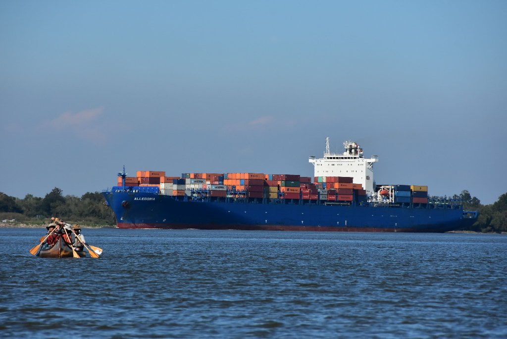
Belle Chasse Industrial Stretch
While fighter jets scream in and out of the speed of sound, big industry re-emerges in Plaquemines Parish. One of the last flare-ups of intensive industry, the Belle Chasse reach features AMAX, Alpine Mud, and another big refinery, Chevron Oronite. Underneath the river are seven petrol pipes laid by Enbridge Pipeline, Southern Natural Gas, and Shell. Try not to camp anywhere within this ten mile stretch between English Turn Bend and Jesuit Bend.
76.6 – 76.4 LBD AMAX Metals Recovery
This was a metals recycling plant that converted spent petroleum catalysts into four commercial products: molybdenum sulfide, alumina trihydrate, vanadium pentoxide and a nickel-cobalt concentrate. In 1989, the facility was expanded to recycle a chromium-aluminum hazardous waste material generated by aluminum finishing operations. The facility is now closed.
76 RBD – 75.7 LBD Belle Chasse Ferry
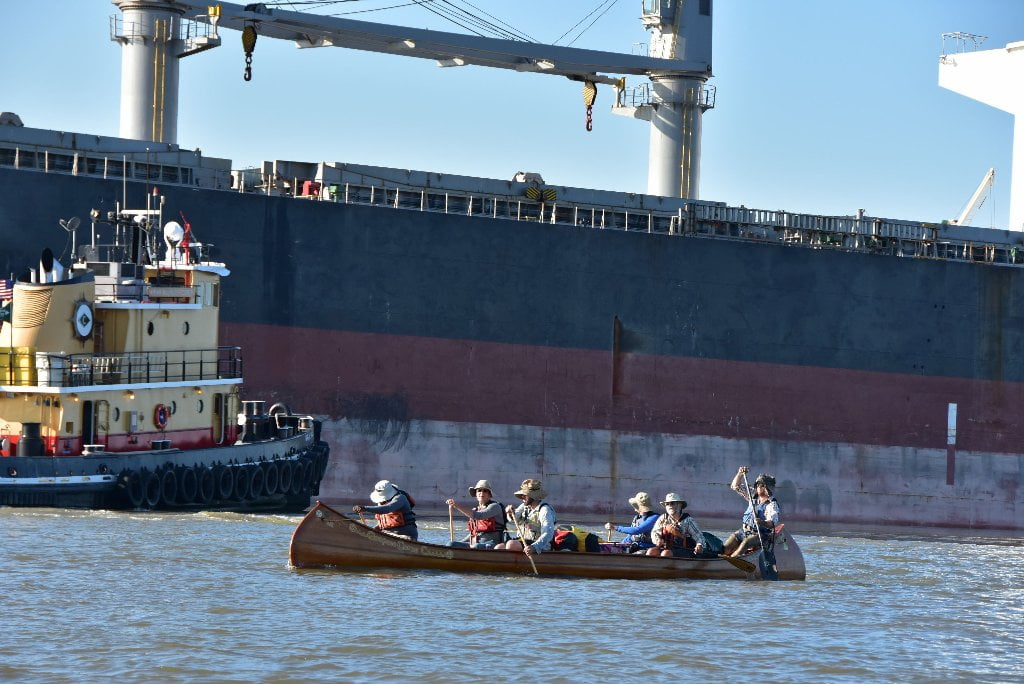
While the Air Force jets are screaming overhead the Belle Chasse Ferry moves back and forth across the main channel here below English Turn Bend. Paddlers will want to be extra vigilant for possible traffic challenges with fast-moving freighters and the methodical ferry, working at right angles of each other.
75.6 LBD Scarsdale Ferry Landing
You can find water, ice, beer, and other refreshments at a convenience store called the Ferry Stop, across the LA highway 39 from the Scarsdale Ferry Landing. Pull your vessel completely out of water if you do stop, or risk capsize! You best pull-out would be 100 feet downstream below Ferry Landing at a rip-rap landing. No ramp here, so you will have to lift your vessel over the rip-rap at low water, but will easily access soft landings above in high water.
75.6 RBD Belle Chasse Marine Transportation Belle Chasse Landing
75.8 RBD Plaquemines Port Authority Dock
75.7 RBD Alpine Mud Products Wharf
75.2 – 73.1 RBD Belle Chasse Anchorage
72.8 RBD Port Ship Services, Belle Chasse Landing
72.3 RBD Chevron Oronite, Oak Point Plant Wharf
Oronite’s first and largest manufacturing site, it was originally designed to produce diesel engine additives during World War II. The facility makes performance-enhancing additives for lubricating oils and fuels. Toxic Releases (TRI) for 2013 in pounds: Chevron Oronite Oak Point: Air: 18,098; and Water: 3,332.
71.1 – 69.9 RBD Cedar Grove Anchorage
70.25 RBD – Oakville
Oakville, a small African-American community founded by slaves newly freed from area plantations, lies on the Mississippi River in Plaquemines Parish. in the 1980s the Industrial Pipe landfill was opened adjacent to the community to dispose of construction debris. Over time the landfill obtained permits to accept municipal solid waste and to reduce its buffer zone. Residents of Oakville who share a property line with the landfill now have a soil-covered hill of waste that starts almost immediately at their fence and is multiple stories tall. Residents have complained of health problems, noxious odors and decreased property values for many years but have gotten little assistance from Government agencies. (Paul Orr)
69 – 67 Jesuit Bend
The river makes a gentle curve around Will’s Point at Jesuit Bend (just a bump in the road compared to the radical bends upstream — less than 90 degrees). This bump creates a series of possible campsites/picnic sites along its inside edge from 68.5 to 67.5 LBD. This little bump here results in a thin sliver of greenery amongst the some of the last pockets of intense industry on the Lower Miss. While not more than a mile wide levee to levee, it is plenty wide and deep for paddler to find their lovely “river illusion,” that is the feeling that you are alone with nothing but wilderness around you!
The Society ofJesus is a religious order of the Roman Catholic Church. and the Jesuits took an active part in the early settlement and development of the Lower Mississippi Valley. A Jesuit priest accompanied Iberville and Bienville. and other Jesuits established small missions on the Mississippi. enduring all kinds of incredible hardships and laboring incessantly to convert the Indian tribes to Christianity. Some were murdered for their efforts. but the Jesuits continued their work in Louisiana until they were expelled in 1763 because of European opposition to the Order. They helped introduce indigo, oranges, figs, and sugar cane to the colony, and established missions and educational institutions. In 1837 the Jesuits were allowed to come back to Louisiana, and they acquired land below New Orleans and operated plantations to support the educational institutions they established in New Orleans and elsewhere. River pilots called this great bend of the river Jesuits Bend, because some of the land belonging to the order was located in the area. (Braggs)
Will’s Point/Jesuit Bend/Live Oak Green Space
Above New Orleans you enjoyed brief periods of forested banks and wild spaces in between the industry. The same continues downstream with more and more wild places. The Green Spaces get larger and larger the closer you get to the Gulf, as the land gets lower and lower. Also, the extensive river wetlands become even bigger and broader coastal wetlands, through which the river flows in its many passes and canals. Much of this Gren Space is protected by state and national wildlife management areas and refuges.
Will’s Point/Jesuit Bend/Live Oak Green Space creates a thin sliver of greenery amongst the some of the last pockets of intense industry on the Lower Miss, not more than a mile wide levee to levee, but just wide enough, dear paddler, to afford you a great picnic spot, or a good night’s rest.
68 LBD Will’s Point
Good camping on wooded ridge in low/med water, best between 0 and 8 NO Gage.
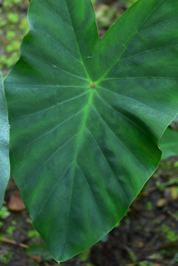
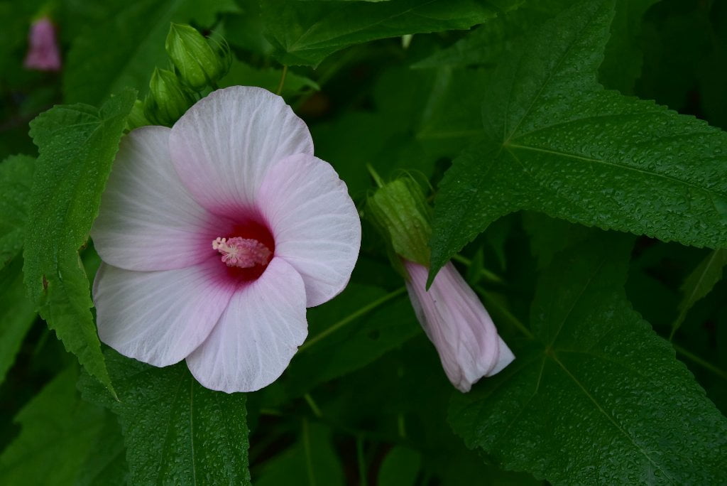
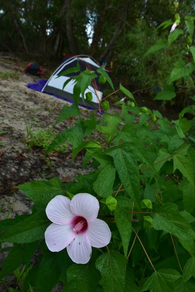
Will’s Point is one of the few natural places in this long stretch of river where you can stop (at low/med water) and stretch your legs, or make camp. (underwater in high water above 12NO). There is a long narrow stretch of dry bank composed of alternating layers of mud and sand with a willow forest behind. This is one of the beauties of the river here: you don’t have to go far to find the shade of the trees at any of the beaches. On the other hand, you can’t get away from the voracious mosquitoes which sometimes swarm in thick clouds here! Sun shade/mosquitoes: just another example of your yin-yang existence as a paddler on the Lower Mississippi River. Stay bank left as you enter the bend. Just past the Will’s Point mile marker tower (a big red diamond 68) you will start seeing dry bank emerging at a steep angle from the trees, with enticing landings beckoning. Pick your spot and pull in. A long hallway of open spots is found beneath the willows, with higher ground behind replete with sycamores and hackberry. A wetlands is found behind camp, over a narrow ridge running parallel to the river. This wetlands is connected to the river and ringed by more willows and punctuated with wild hibiscus, horse tail, elephant ears, and many varieties of fungi. This might be the first tidal inlet on the Lower Miss. You will experience up to a 6 inch tide here, and higher in storm surges. As the tide breathes in and out the water cycles in response through a narrow meandering channel at the downstream end of the Will’s Point. As result of this dynamic layout, Will’s Point wetlands is rich in amphibians and birds. I turned on my headlamp one night while walking along the edge and was amazed by the dozens of red alligator eyes looking back at me. The next morning I found roseate spoonbills in this same wetlands grazing the muddy water for plankton alongside egrets and herons. This area is ATV accessible, but probably only used during hunting season.
There is a high dry bank in low water (below 8NO) along the length of Will’s Point, with wild primitive landings on either mud or sand. There are no completely sandy places here, everything seems to be composed of layers of mud and sand, so in rainy seasons it will be gooey, and you will most likely have a muddy landing. But once you pull your vessels up in this beautiful place, and establish a dry camp above the high tide line, who cares? This area is tidal influenced, so check tide charts before choosing camp, and make sure you are 3 feet above high tide. Passing ships can make big waves. The shoreline is lacerated with a series of inlets reaching into some rich wetlands behind. As mentioned above, Will’s Point is a haven for shorebirds, waders, and amphibians like turtles and alligators.


Leave A Comment
You must be logged in to post a comment.