The Lower Mississippi River Water Trail
107.6 RBD Litton Industries
The Litton Industries Docks No 1, 2, 3 and 4 are all strung along this right bank descending for the next mile from 107.6 – 106.6 RBD, the idled remains of Avondale Shipyards.
107.4 RBD T.T. Barge Cleaning Inc. East Bank Wharf.
106.4 LBD National Maintenance and Repair of Louisiana, Inc., Mooring
105.2 LBD Zito Fleeting. LLC/Intercoastal Marine Repairs, Inc., Mooring
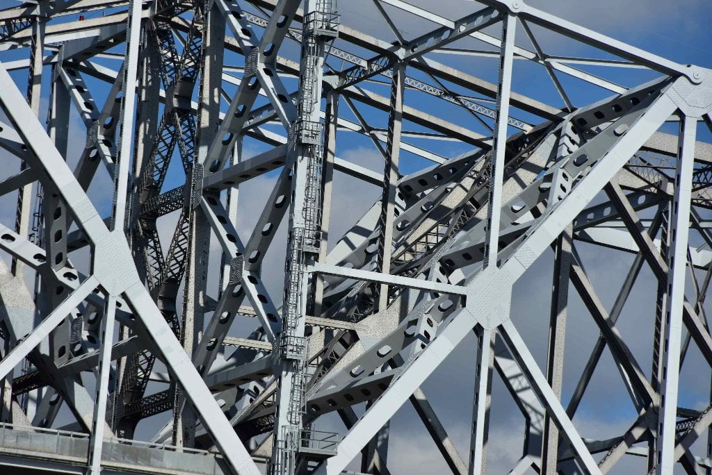
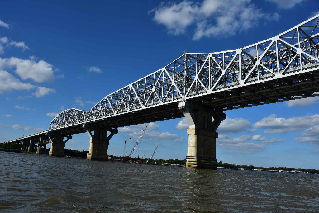
106.1 Huey P. Long Bridge
The Huey P. Long Bridge carries both autos and trains, and it is the second to last bridge on the entire Mississippi River system. Named after the infamous Louisiana governor Huey P. Long “Kingfish” whose populist rule lasted between 1928 and 1932. He served in the Senate until his assassination in 1935. His policies led directly to the development of Chemical Corridor in the century following.
The Huey P. Long Bridge in New Orleans is one scary tall narrow bridge. The high volume of traffic doesn’t help things, nor do the tight turns and steep grades on the approach ramps. It is hard to grasp how big this metal monster really is. The deck is flat to accommodate rail traffic, whereas high bridges like this normally have a hump shape. As a result, the highway ramps go up-hill at a rather strong grade, while the railroad approaches are much more gradual, and extend miles to each side of the river crossing. The piers are equally massive, but much of that structure is below water. Given that New Orleans is built on silt, bedrock doesn’t begin until you dig down over 1,000 feet below the riverbed. That makes it impractical to use bedrock for the base of the bridge pier foundations. Instead, the piers depend on their size and mass to stay in place. The Huey P. Long Bridge has been rated as ‘unacceptable’ and has been high on the priority list for replacement for many years. A project to rebuild the bridge in place was started in 2005. The plan was to first build the existing piers wider to support a wider bridge. Then the traffic decks was removed, and new truss structures was built parallel to the existing truss structure supported by the newly widened piers. These new trusses are now carrying 3 lanes of traffic. New approach roads were built to carry the wider highway to the new truss spans. The entire project was completed in 2013. Note that there are two bridges over the Mississippi River in Louisiana that are named after Huey P. Long, longtime governor of that state. The other Huey P. Long Bridge is a very similarly configured structure carrying US-190 over the river at Baton Rouge. (John Weeks)
106.1 RBD – Fort Banks
Fort Banks (1861-1865), first established in 1861 as an unnamed Confederate fort on the orders of MG Mansfield Lovell for 90 men and six 32 pounders. Captured by Adm. David Farragut’s Union naval forces in April 1862 and made a part of the Union fortifications surrounding New Orleans. Abandoned in 1865 at the close of the U.S. Civil War. Nothing remains.
105 LBD – Camp Parapet & Parapet Line
The Parapet Line (1861 – 1862), Confederate earthworks built in the Metairie area along present-day Causeway Boulevard, with Camp Parapet at the southern terminus. The 1.5 mile long works were unfinished when the Union captured the city in April 1862. Camp Parapet was rebuilt and renamed Fort John M. Morgan by the Union in 1862. At the north-end of the line the Union built a ten-pointed Star Fort. An earth-covered brick powder magazine still remains at the east end of Arlington Ave. two blocks from the levee.
104.8 RBD T.T. Barge Coatings, Inc
One of the nastiest smelling locations along the Lower Mississippi. The overspray from this facility might cause you to gag and give you headaches if you pass too closely. Give wide berth, especially in south, southeast or east wind.
104.2 LBD Ochsner Medical Center
As you round Avondale Bend five miles upstream you will be met by a glorious view of the Huey P. Long Bridge and the Ochsner Medical Center just downstream beyond. Poison Ivy got out of control? Feeling a fever you can’t get rid of? Are those infections from red ant bites getting out of hand? Here is your one chance on the Lower Mississippi to easily access medical care from your canoe or kayak! Ochsner Medical Center, Ochsner Hospital, 1516 Jefferson Hwy, New Orleans, LA 70121, www.ochsner.org, 504-842-3483.
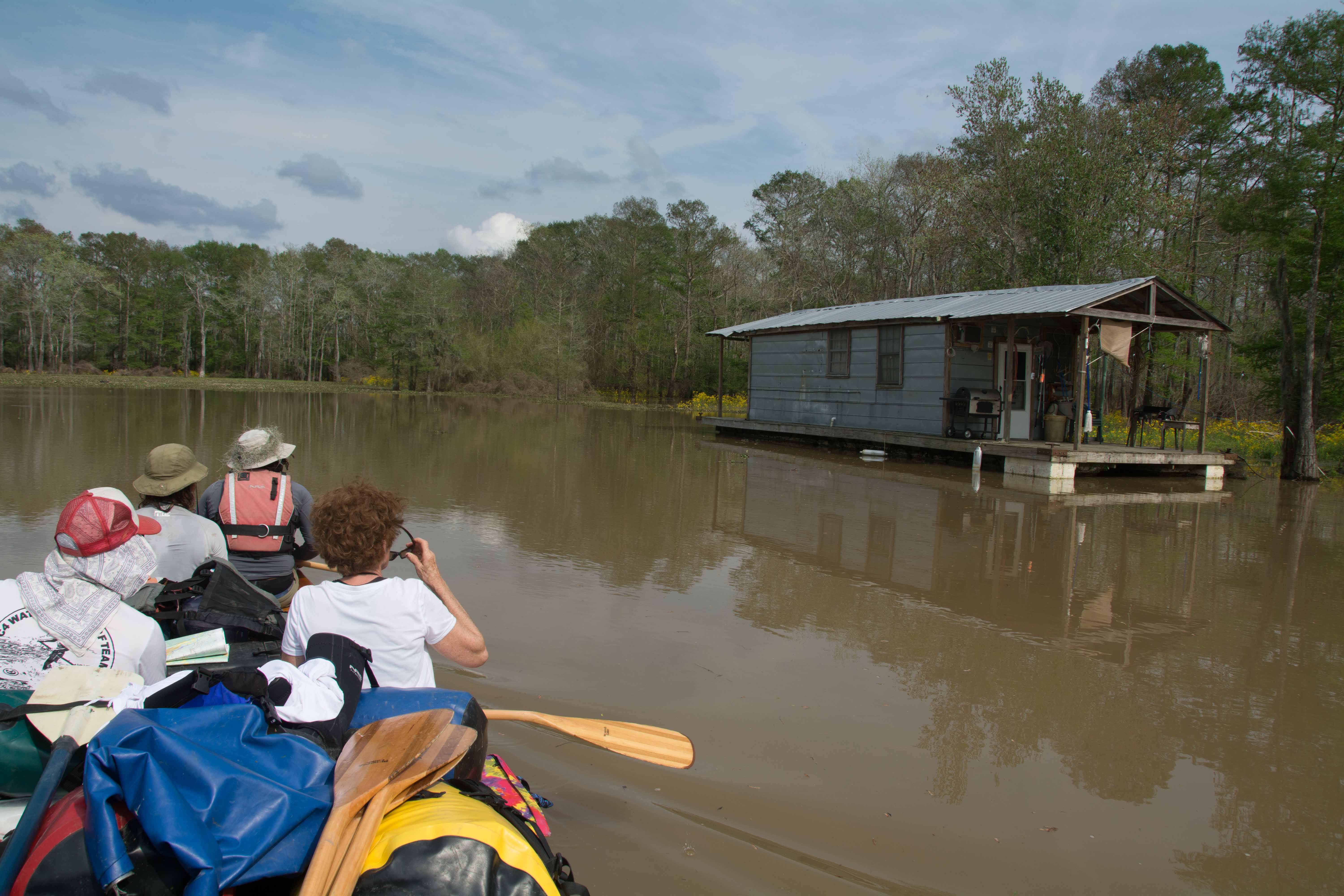
104.3 LBD Batture Houses
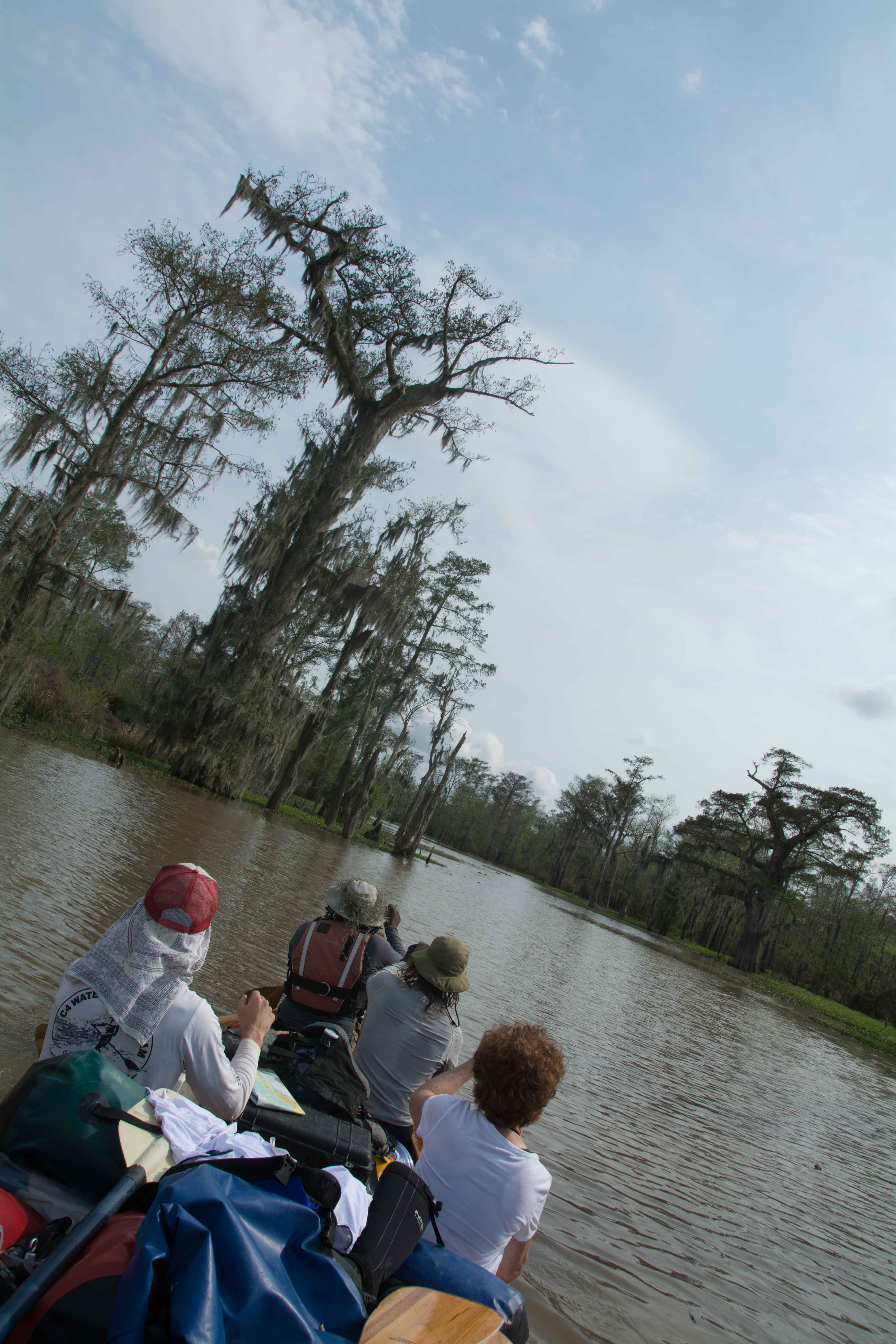
The Batture Houses are a string of thirteen houses on the riverside of the levee. They are the last homes on the batture between Baton Rouge and the Gulf of Mexico (according to historian Oliver Houck). Before the 1950’s, the east bank batture was lined with squatter houses like these, for four miles, all the way to Audubon Park. During the Great Depression, down and out New Orleanians took refuge in this linear village along the river. “The structures were made of driftwood that came down the river. Hobos fished out the scrap and lashed it into shelters. It grew by accretion, a monument of ingenuity, a chaos of rafts and skiffs that lined the river,” according to author Rich Cohen. These river people scoured the banks for wood (especially ash, which burns longest and hottest), ran trotlines for catfish, made willow furniture, and salvaged whatever they could find to sell in the city. In 1950, with the the Corps of Engineers aiming to lift levees, the residents of the Batture houses were ordered to the other side of the levee. They fought, but they lost, and some were removed by force. Some houses were demolished, and others were moved. The thirteen homes that you see huddled under the sycamore trees managed to survive by technicality – because years before, Jefferson Parish had lifted their own levees. For decades, they have survived the dangers of yearly river floods, as well as the poaching of local businessmen who claim title to that land. (Wolf E. Staudinger)
Mahalia Jackson
As you drift beneath the powerlines and past the US Army Corps of Engineers complex, listen closely. Mahalia Jackson, the Queen of Gospel, was born in the kitchen of a batture house in 1911. As a child, she split her time between the river and Mount Moriah Baptist Church (still open, just across the levee on Millaudon Street). She writes in her autobiography, “The river levee was high and grassy, and it was our playground. We used to sit out there and sing songs with ukuleles and bake sweet potatoes in fires made from driftwood and catch all the fish and the crabs we wanted.” She collected driftwood and pried apart old barges to feed her family’s wood stove. She stuffed mattresses with Spanish moss and corn husks. “We often had baby alligator for breakfast,” she wrote, “When you saw one sunning himself in the swamp or on the riverbank, you’d get a stick and creep up real quiet until you got close enough to crack him on the head so hard he never knew what it was that hit him. You ate the tail baked like smothered chicken with onions and garlic and herbs.” When she was fourteen, she was baptized in the Mississippi River, at a calm place just upstream from Audubon Park. She was dressed in a light white cotton dress and a white veil trimmed with white lace roses. By the time she died in 1972, she’d recorded more than 30 albums, sang for heads of state, and been called, “the single most powerful black woman in the United States.” She sang at the 1963 Civil Rights March on Washington, just before Martin Luther King took the podium. When he died, she sang at his funeral. She is buried in Providence Memorial Park, a mile from the river in Kenner (112LBD). (Wolf E. Staudinger)
104 LBD Equilon Enterprise, LLC, Wharf
104 RBD Nine-Mile Point
A throbbing Entergy power plant dominates 9-Mile Point, but you can find camping there on a low sandbar that emerges below 8 NO gage. There is a another possible stopping place (that would be a good picnic site, and possible campsite) across the river created in a small shelf of sand that also emerges around 8 NO, located below the New Orleans Water Intake. See below for more detail.


Leave A Comment
You must be logged in to post a comment.