The Lower Mississippi River Water Trail
212.8 LBD Small Dune
A small sandy dune is found left bank descending just before the Medora Crossing that would make good protection in southerly storms or winds. Even though this pace is 4WD accessible, it is portected from the land and levee by a long borrow pit that parallels the river, and has formed a wetlands teeming with wildlife.
213 LBD – 211 RBD Medora Crossing
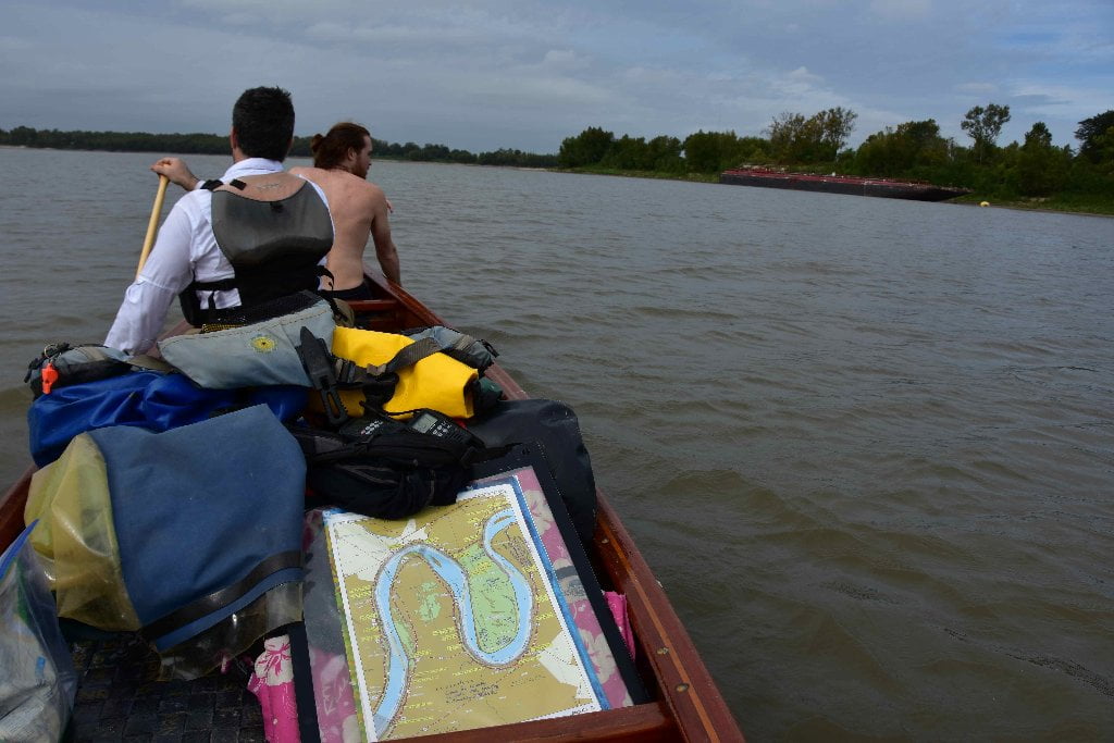
Medora is an easy 2-mile crossing between Manchac and Plaquemine Island, with good visibility uostream and down. Paddlers can follow the main channel through Medora Crossing if intending to make a landing at the City of Plaquemines. Or you can stay left bank descending and go behind Plaquemines Island, or make landing there. Medora Dikes push water away from back channel, and become a nuisance below 5BR.
211.5 RBD – The Medora Site
The Medora Site (16WBR1) is a Native American archaeological site that is a type site for the prehistoric Plaquemine culture period. The name for the culture is taken from the proximity of Medora to the town of Plaquemine, Louisiana. The site is in West Baton Rouge Parish, Louisiana, and was inhabited from approximately 1300 to 1600 CE. It consisted of two mounds separated by a plaza. In the winter of 1939-40 excavation of this site was undertaken by the Louisiana State Archaeological Survey, a joint project of Louisiana State University and the Work Projects Administration. It was directed by Dr. James A. Ford, and George I. Quimby. The excavations of the site were instrumental in defining the characteristics of the Plaquemine period and culture.
211 – 209.5 LBD Plaquemine Island
Beautiful camping and picnicking at all water levels and in all types of weather conditions and wind directions. Plaquemine Island is one of the last three islands on the Lower Miss below Baton Rouge.
Plaquemine Island is one of the last three islands on the Lower Mississippi, Bayou (Goula and Bonnet Carre further downstream being the last two). If its that time of day you should stop here for excellent picnicking or camping. Bayou Goula Island is another 15 miles downstream, so if you want to go further you have that one awaiting you (and its bigger and wilder, less surrounding commotion). 10 miles downstream, Point Pleasant is a low or medium water option also. Highest point is in the woods at top end, and stays dry up to flood stage 35 BR, but possible campsites surround island, choose your place according to wind and weather conditions. Noise and light pollution from Dow Chemical on main channel. Shallow wetlands in depression top center of island. Navigable inlets form in low water levels between big sandbar and main island.
Similar in proportion to both Shreve’s Bar and Bayou Goula Island, Plaquemine Island features an extensive shallow sandbar which extends upriver above its forested towhead in lower water levels. This sandbar is the best camping in calm conditions in low/medium water. Best approach is paddling into the protected inlets which form between sandbar and forest ridge on either side of island. Deepest inlet on main channel side. If you paddle directly into the sandy flats you might find yourself bottoming out in shallow waters. This shallow sandy expanse highly sensitive to river rises and falls, so be careful where you set up camp! On windy days, or fast rising river, it would be best to seek the shelter of the forested mainland of the island, a narrow ridge which runs 1750 feet from top to bottom
In higher water levels, find suitable location along forested bulk of the island. There is good camping all around, but because pof the sprawling Dow Chemical opposite island on main channel, it is considerably quieter making camp somewhere along the back channel. The very bottom of the island is preferable in east winds, and feels especially good on cold winter days. There are several layers of sandy flats tucked into the willow woods at bottom end, where you can always find good shelter from winds and storms (up to bank full 30BR). Barges are sometimes anchored along the inside channel of the bottom end, in fact you can see one on Google Earth. Top end is best in strong west winds and stay dry up to flood stage 35BR. Stay main channel in high winds out of the south, and back channel in strong northerly winds.
Plaquemine Island is dominated by willows, but top end features some big cottonwoods and sycamores which bald eagles like to perch on for best fishing view. The island is favored by beavers, river otters, and many species of turtles and snakes.
If you intend to make a landing at the city of Plaquemine go West bank below Plaquemine Island and make landing at 209 RBD on Plaquemine Beach (low water) or the grassy levee incline above (med or high water). This will easy to do if you stay main channel around the island. But if you take the back channel behind Plaquemine Island you will have to look and listen carefully for any apporaching traffic and then make an expedient crossing below the bottom of the island. See Rivergator entry below for more description about the city of Plaquemine.
210.5 RBD Morrisonville
Founded on Manchac Point, a spit of swampy land surrounded by the Mississippi River, by slaves newly freed from plantations near Plaquemine, Louisiana. Following catastrophic flooding on the Mississippi River the residents moved in 1931, a few miles west and just inside the new Federal flood levees, onto land adjacent to the Mayflower Plantation. Dow Chemical Company bought the plantation land next to Morrisonville in 1958 and built a chemical plant to produce vinyl chloride and other chemicals. Dow’s facility encroached on Morrsionville more and more as the facility grew. It was said that the residents could hear announcements over Dow’s loudspeakers in their homes. In the 1980’s extensive vinyl chloride contamination of the groundwater was found under the Dow facility and Morrisonville. Dow bought out the residents, many of whom moved to two new subdivisions named in honor of the old town. (Paul Orr)
210.4 RBD Morrisonville Landing
Primitive gravel and rip-rap landing found off La Hwy 988 where it cuts north around Dow Chemical. Follow Davis Road several hundred feet off Hwy 988 and over levee. Rough place. Good place for a take-out below Baton Rouge. You could make an ideal daytrip putting in at Glass Beach, below the I-10 Bridge, and paddling the approx 25 miles to take out at this landing. But not recommended for camping or overnight parking.


Leave A Comment
You must be logged in to post a comment.