The Lower Mississippi River Water Trail
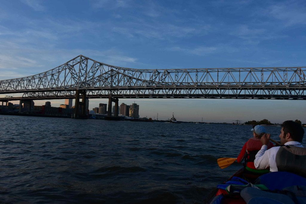
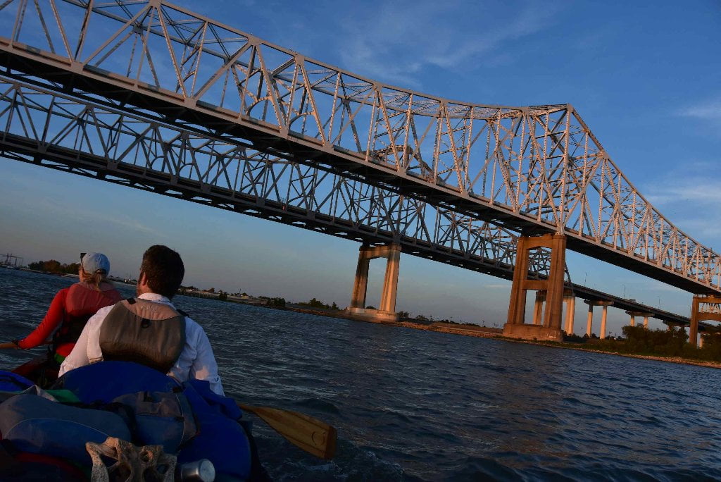
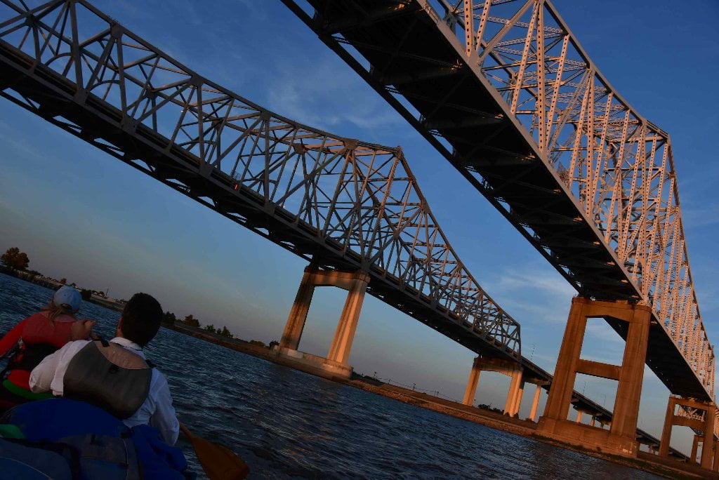
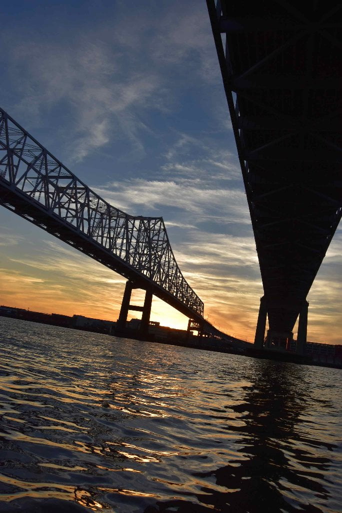
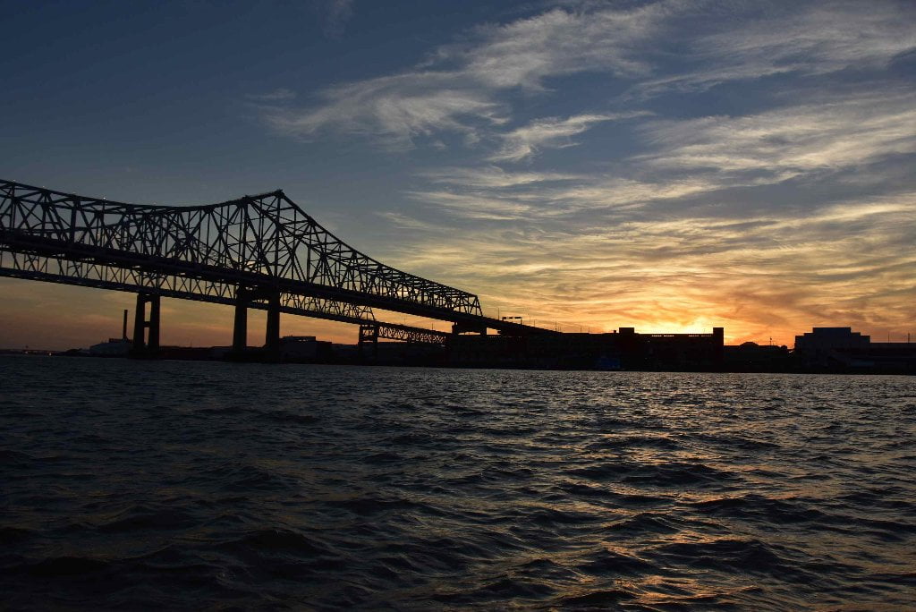
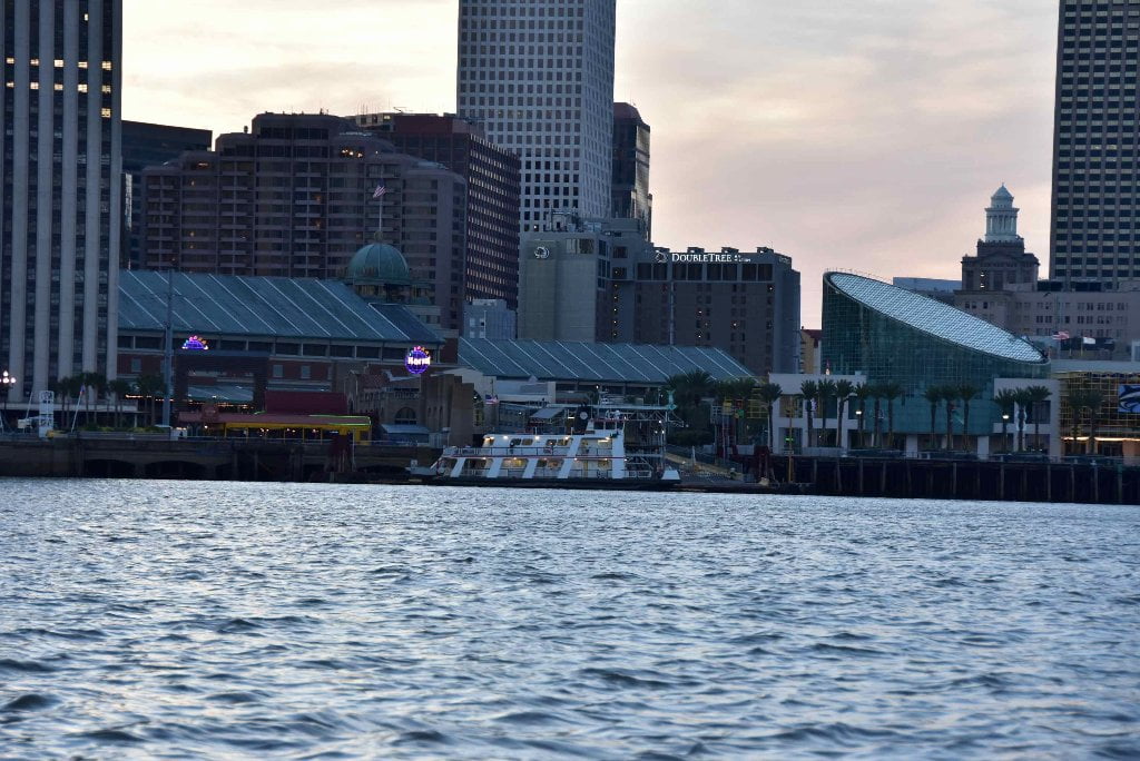
95.6 Crescent City Connection – Greater New Orleans Bridge
The Crescent City Connection (Greater New Orleans Bridge) is a milestone for long distance paddlers: this is the very last bridge on the entire Mississippi River system. Congratulations paddler! After paddling under your first bridge below Lake Itasca (the 1st 3 bridges are actually footbridges — very appropriate), and then under Minnesota Clearwater County 112, you have paddled under 100s of others in between from covered bridges to swing bridges, from concrete slab to steel truss, from cable-stay to suspension. The bridges of the Mississippi River could be an architectural study in of itself. You’ve seen them all, and paddled under them all. 100s of bridges in 2,000 miles to reach your last bridge, and here it is, within sight of the the St. Louis Cathedral and Jax Brewery rising out of the French Quarter. There is no safe landing anywhere underneath. Watch for river traffic, as it gets concentrated here to pass under one of the two open spans, with endless dredge work seemingly going on just downstream of the bridge along the East Bank.
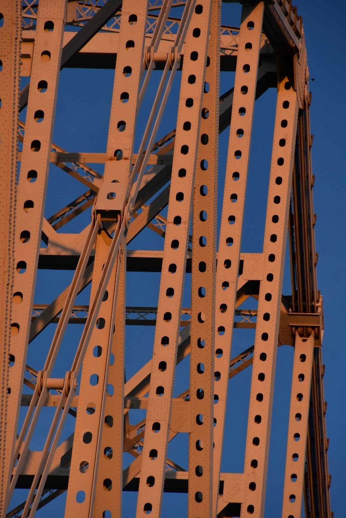
The Crescent City Connection is a classic Continuous Steel Truss Bridge that supports 8 lanes of auto/truck traffic, plus 2 reversible HOV lanes. Not surprisingly, it is one of the busiest bridges on the Lower Miss, with a daily traffic count of 64,612 (2003). There are two different bridges built 29 years apart. The southbound span was built first, and the northbound span was added three decades later just downstream of the older structure. While the two spans are the same length, and look similar, closer inspection shows significant differences. Some of these differences include the new span being wider, T shaped piers on the newer span, a truss deck section on the older span, and more welding (in place of bolting) on the newer span. The older span was the longest continuous truss bridge in the world when it opened. The 3,019 foot long truss superstructure and 1,575 foot long main span still rate as some of largest continuous truss bridges on the planet. (John Weeks)
A dark chapter for the Crescent City Connection bridges happened during the Hurricane Katrina disaster. Gretna Police Chief Arthur Lawson blocked the south end of these bridges to prevent the thirsty, starving, and dying people of New Orleans from sharing the stockpiles of supplies that were located in Gretna. Chief Lawson even fired machines guns at the crowd and turned dogs loose on people who had no food or water for days. Nearly 2,000 people died in the disaster, many less than 2,000 feet from safety. Since most of the citizens in distress were African-American, and Chief Lawson is white, many have accused Lawson of being a racist. (John Weeks)
July 2008 Oil Spill
in July 2008 a 600-foot tanker the Tintomara collided with the towboat a tugboat the Mel Oliver pulling an oil-laden barge underneath the Crescent City Connection, and broke the barge in half, spilling 282,000 gallons of No. 6 heavy oil into the river. The Mel Oliver tuboat was to blame. The captain was away from the helm, 1,000 miles away in fact, and the apprentice had fallen asleep at the wheel. Literally. If this sounds preposterous, it’s not. It’s plain stupid. Mark Twain was turning over in his grave with vehement rage when he heard about it. The story would surely be included in Life on the Mississippi if Twain ever wrote an update, but unfortunately it was no laughing matter. The thick industrial fuel pouring from the barge could be smelled for miles in city neighborhoods up and down the river, even as hundreds of cleanup workers struggled to contain the hundreds of thousands of gallons. A oil sludge coated the Mississippi River for nearly 100 miles from the center of the city to the Gulf of Mexico. There were reports of fish and bird kills in sensitive marsh areas downstream. This shut down the river to commercial traffic, and took place frighteningly near the City of Algiers Water Intake. It was the worst oil spill ever on the Mississippi. The circumstances leading to the catastrophe are frustratingly lame. The captain of the Mel Oliver tugboat -– an employee of DRD Towing — had driven to Illinois to check on a rumor that his girlfriend was unfaithful, leaving an apprentice without a full master’s license at the helm. The apprentice had previously been fired twice by DRD Towing for sleeping on the job. Immediately after the crash, a crew member found him slumped over the steering gear and unresponsive, according to court records. His license didn’t allow him to steer without supervision from a captain. The Liberian-flagged Tintomara was cleared of any fault. The judge wrote that the Tintomara, which had the right-of-way on the river that day, shouldn’t be held responsible because its last-minute maneuvers to avoid the crash failed.
95.4 LBD New Orleans Convention Center
This is the site of the crown jewel/dud of the now-infamous 1984 Louisiana World’s Fair. A $10 million gondola was strung across the Mississippi river, bank to bank, from a pair of 320-foot towers. When Archbishop of New Orleans Philip Hannan went to bless the Gondola in the inaugural ride, his gondola car got stuck dangling above the river, 200 feet up in the sky. The gondola, which was supposed to have operated indefinitely as a famous attraction, lasted less than four months after the Fair. The Fair went on to lose more than $100 million, but New Orleanians remember it fondly. (Wolf E. Staudinger)
95.4 RBD Algiers Water Intake
The muddy Mississippi River, which flows past New Orleans at an average rate of 300 billion gallons per day, is the city’s most reliable source of raw water. On a normal day, the city uses approximately 150 million gallons of water for vital health, industrial and fire-fighting purposes. In periods of emergency, such as prolonged freezes, water consumption in Orleans Parish has approached the system’s capacity of 250 million gallons per day. Raw water is taken from the river through intakes in both Algiers and the East Bank plants. After being drawn from the river, raw water flows through underground pipelines into the Carrollton and the Algiers purification plants. The city’s purification plants employ modern processes, which remove suspended matter, and destroy disease- causing substances. Those processes produce drinking water exceeding all federal and state standards. There are two separate intake stations, which can continuously pump Mississippi River water to the East Bank’s Carrollton Water Purification Plant. One station draws water from below the river’s surface through two 48-inch diameter pipelines and a 72-inch pipeline over the levee, with four electrically driven pumps. The other station draws water from below the river’s surface with three electrically driven pumps, which have a combined capacity of 210 million gallons per day. There are two intake stations serving the West Bank’s Algiers Water Purification Plant. Intake Station #1 draws water from below the river’s surface with three electrically driven pumps whose combined capacity is 45 million gallons per day. Intake #2 draws water from below the river’s surface with two electrically driven pumps whose combined capacity is 10 million gallons per day. The purification process at the Algiers Plant is similar to that of Carrollton, utilizing a complex system of chemicals. Two of the three up-flow treatment units in Algiers have a capacity of 12 Million Gallons per Day (MGD) each with the third capable of 8 MGD. The Carrollton Water Purification Plant normally yields about 139 million gallons per day of finished water for the east bank of Orleans Parish. The Algiers Plant, which serves the predominately residential west bank portion of the parish, purifies about 11 million gallons per day of water. Combined, the two plants treat approximately 55 billion gallons of water per year, removing about 20,000 tons of solid material from the raw river water.
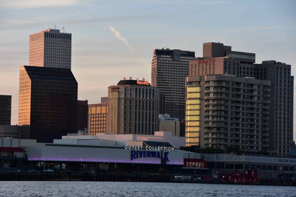
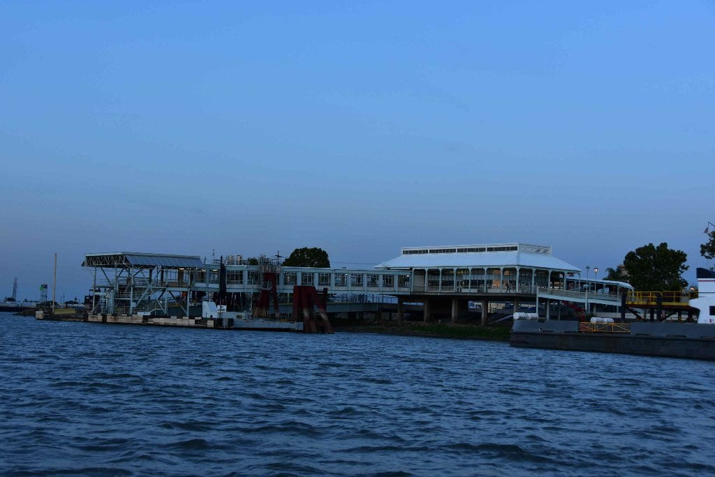
95.4 – 94.0 LBD Welcome to New Orleans: The Riverwalk
This is a big mall – the kind that you’ve probably been trying to escape with your trip down the river. It was originally a venue for the World’s Fair. On December 14, 1994, a 700-foot ocean-going freighter, loaded with grain, ran askew and slammed into the side of this mall, crowded with holiday shoppers. Luckily no one died. 66 people were injured, and everyone involved was terrorized by the experience. People reportedly jumped into the river in the panic of the accident. Damages along the riverbank reached $15 million. The ship’s damage totaled $1.8 million. The cause of the accident was a poorly-maintained oil filter, which caused the engines to fail and the boat to drift with the force of the river into the mall. The name of the ill-fated freighter was the MV Bright Field. As of May 2010, it sails under the Chinese flag, with the name Yong Xu Hai. Look out! Be careful around those boats!!
The skyline of the city, especially if you’ve arrived at the sundown twilight, is beautiful, backlit, and pulsing with life. You might hear horns blowing towards you from the streets of the French Quarter, and you probably see people feeling the breezes along the riverbanks along the Moonwalk. This scene was not always this way! This scene was a hard-fought fight between residents of the French Quarter, business people, and even the Vatican, and it dates all the way back to the 1700’s, when the streets of the Quarter were lined with open sewers, and the 1800’s, when factories belched coal dust into peoples’ bedrooms, which were shared with eight or nine people, coughing, etc. The French city planners intentionally left the riverfront open. They kept wharves away from the urban riverfront, so that the breezes could blow across the water and cool and refresh the muggy, polluted city. People went to the riverfront to breathe fresh air, to promenade, to flirt, to dig up river sand for their gardens or the construction of the new city.
All of that changed when a New Yorker named Edward Livingston came down and made claims to property along the riverside. People were pissed! They mobbed a construction company that intended to build along this stretch of the river. But eventually, Livingston won, and for over a century, New Orleanians had to travel Uptown or Downtown (upriver or downriver) to even see the Mississippi. The whole scene you see before you was blocked by wharves. It almost got worse in the sixties. By this point, a lot of the marine infrastructure that Livingston scammed into the riverside had been abandoned. All of the supposedly advanced American cities were turning their gloomy riverbanks over to the new, shiny automobile. Boston, New York, Philly all had built riverside expressways. New Orleans lagged behind, as it is prone to doing. But plans eventually came along create an elevated expressway, six lanes-wide, forty feet up in the air, all along the riverfront – from Elysian Fields, past Jackson Square, all the way Uptown. Enter the river. Geologists realized that the river’s churning, at its deepest point here was threatening to undercut the wharves and the levees along the French Quarter. Their immediate solution was to demolish the derelict wharves along Jackson Square and the upper French Quarter. For the first time in over a century, New Orleanians saw, smelt, felt the blessings of the river. And they liked it.
When they got wind of the riverside expressway, they revolted. The Archbishop of New Orleans, Philip Hannan, mobilized his well-connected parishioners, calling it the “right thing do to,” and, even though Lindon B. Johnson signed an appropriation for the” Vieux Carré Expressway” into law, Nixon came along and cancelled it. When you think about it in the larger scheme, New Orleans was so far behind other cities that it eventually came out ahead: many other riverfront cities are still struggling to remove the layers of concrete that separate the river from the people who need it to stay sane. Imagine the insanity of New Orleans without this access…. On a darker note… while the French Quarter has counted its blessings in the wake of the interstate controversy, another equal and opposite result is playing out less than a mile away. Walk down any of the streets that shoot from the river (Ursulines, Orleans, Toulouse…), and come to The Tremé. Its the neighborhood where Free People of Color and Creoles created an African American equivalent of the French Quarter. Its Jackson Square is Congo Square (visit: corner of Rampart and Toulouse), where slaves gathered on Sunday to sing, dance, party, flirt, and promenade. And up until the 40’s, the life of the community pulsated along Claiborne Avenue, where live oak trees, as big as the ones along wealthy St. Charles Avenue, shaded parade-watchers, chess games, family reunions, shoppers, picnics…. But go there now and see what you see. Five-foot-diameter concrete pillars support a forty-foot high, six-lane expressway like some dystopian cathedral. The results to the community have been devastating. (Wolf E. Staudinger)


Leave A Comment
You must be logged in to post a comment.